Chicago Storm
-
Posts
18,587 -
Joined
-
Last visited
Content Type
Profiles
Blogs
Forums
American Weather
Media Demo
Store
Gallery
Everything posted by Chicago Storm
-
Crazy amount of TSSN in Central/East-Central Illinois.
-
Peak wind gusts across downstate IL... 72MPH MTO 69MPH CMI 67MPH DEC
-
There’s already widespread TSSN in Central and East-Central Illinois. .
-
Seeing some very high wind gusts just north of the peaking SLP. 66MPH at DEC and 63MPH at SET.
-
18z NAM will be SE, so there’s that. .
-
ya’ll are overusing the “lock of the week” meme. .
-
.
-
.
-
-
-
i can do so when they hit.
-
update: back to miss south stank.
-

-

Chicago Weather Records Tracking
Chicago Storm replied to Chicago Storm's topic in Lakes/Ohio Valley
Winter 2022/23 finished as the 14th warmest and 15th wettest on record. -
Chicago Weather Records Tracking
Chicago Storm replied to Chicago Storm's topic in Lakes/Ohio Valley
February 2023 finished as the 8th wettest February on record. Top 10 Wettest February’s: 1. 5.56” - 1997 2. 5.10” - 1887 3. 4.74” - 1883 4. 4.64” - 2018 5. 4.28” - 1881 6. 3.90” - 1876 7. 3.84” - 1909 8. 3.83” - 2023 9. 3.72” - 1908 10. 3.53” - 2008 -
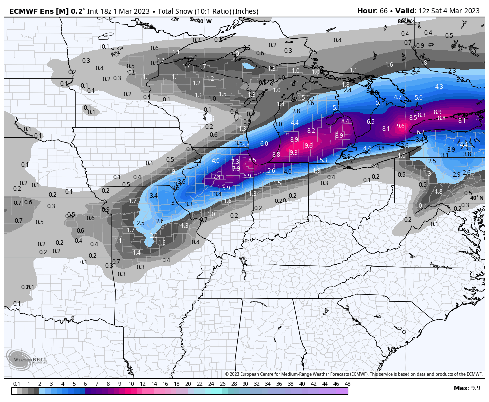
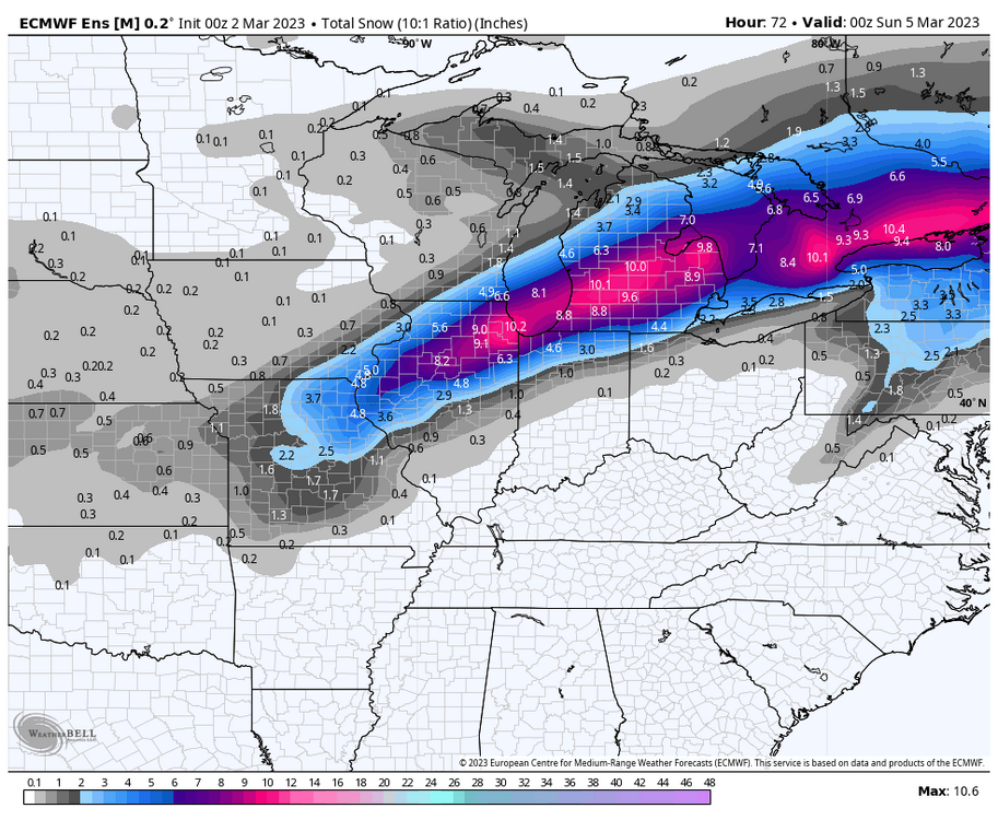
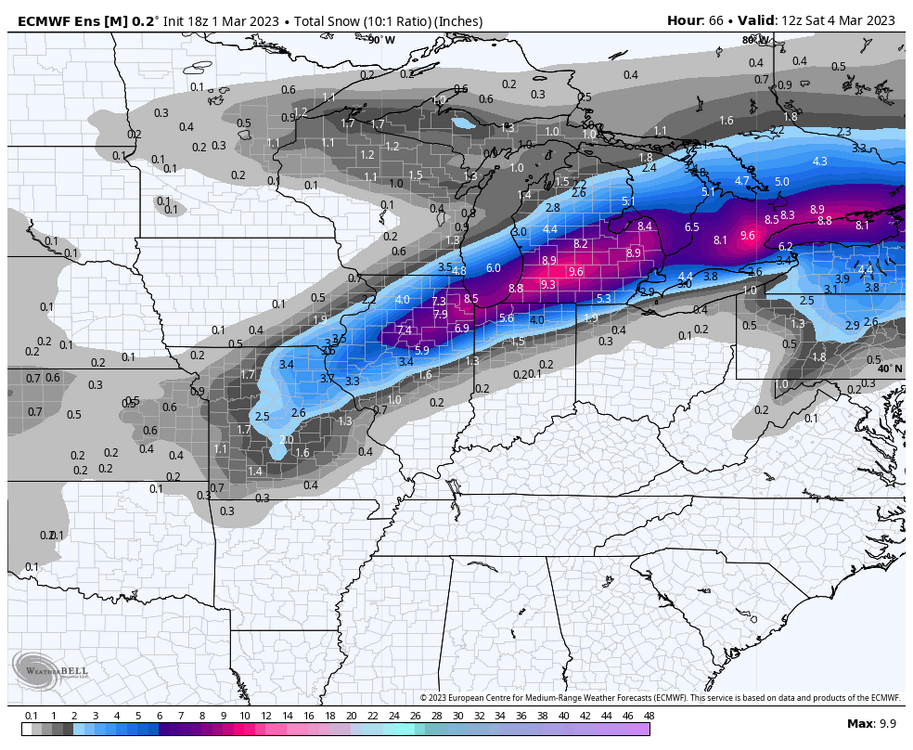
As much as I personally dislike the snow depth change maps, as they can be often times too low, this will be one of the times that they are closer to reality…maybe with a mix of kuchera in there a bit too.
-
the best kind of snow there is. .
-
have you inquired about his status here?
-
people should have never gotten invested several days out from a thread the needle potential in a not so great pattern in the first place.
-
didn't you used to have contact with dll years ago?
-
need this to trend nw for more severe t'storm opportunity. .
-
2023 Short/Medium Range Severe Weather Discussion
Chicago Storm replied to Chicago Storm's topic in Lakes/Ohio Valley
Both Chicago metro area tornadoes (Naperville & Plainfield/Joliet) from this morning have been confirmed as EF-0's. -
Final rainfall totals in the area from the storm system today… ORD - 1.01" MDW - 0.85" RFD - 1.54"
-
2023 Short/Medium Range Severe Weather Discussion
Chicago Storm replied to Chicago Storm's topic in Lakes/Ohio Valley
Since moving down here in November 2020, this will be the 4th tornado within 15 minutes of home. -
2023 Short/Medium Range Severe Weather Discussion
Chicago Storm replied to Chicago Storm's topic in Lakes/Ohio Valley
A brief clip of the circulation as it passed within my view off of my balcony.