

Chicago Storm
-
Posts
18,587 -
Joined
-
Last visited
Content Type
Profiles
Blogs
Forums
American Weather
Media Demo
Store
Gallery
Everything posted by Chicago Storm
-

May 13-19 Severe/Heavy Rain threats
Chicago Storm replied to Tim from Springfield (IL)'s topic in Lakes/Ohio Valley
Worst and most significant/widespread flooding I have experienced here is ongoing. Most roads are several blocks in which they are partially to fully underwater, many with feet of standing or flowing water...with many closed. The nearby creek flooded a large park complex, which has backed up onto a nearby road. There is one stretch of a nearby road where several blocks are under feet of water, with cars submerged to above their windows and water is entering homes. Up until now the period of tropical remnants of Sept 2008 featured the worst flooding I had seen around here, but this has now topped that. In that case it was 10"+ of rain over a longer span of time, where this was 4"+ of rain in the past 24hrs...and nearly 2"/hr at one point tonight. -
May 13-19 Severe/Heavy Rain threats
Chicago Storm replied to Tim from Springfield (IL)'s topic in Lakes/Ohio Valley
~2" of rain at ORD in the past hour. -
May 13-19 Severe/Heavy Rain threats
Chicago Storm replied to Tim from Springfield (IL)'s topic in Lakes/Ohio Valley
Still one well pronounced couplet as it is about to enter Kane Co. Looks like on the current track, it will come about 15min driving distance from here. If it holds on a bit longer, might have to take a drive. -
May 13-19 Severe/Heavy Rain threats
Chicago Storm replied to Tim from Springfield (IL)'s topic in Lakes/Ohio Valley
New tor warning with it, as there are still two couplets as it moves across DeKalb Co. -
May 13-19 Severe/Heavy Rain threats
Chicago Storm replied to Tim from Springfield (IL)'s topic in Lakes/Ohio Valley
There it is... tor warned. -
May 13-19 Severe/Heavy Rain threats
Chicago Storm replied to Tim from Springfield (IL)'s topic in Lakes/Ohio Valley
Storm needs a tor warning. Two couplets in Lee Co currently, and becoming better defined with closer approach to radar. -
May 13-19 Severe/Heavy Rain threats
Chicago Storm replied to Tim from Springfield (IL)'s topic in Lakes/Ohio Valley
There has been a significant meso with the storm moving across Lee Co, with associated WAA wing extending eastward into the Chicago metro. -
May 13-19 Severe/Heavy Rain threats
Chicago Storm replied to Tim from Springfield (IL)'s topic in Lakes/Ohio Valley
FFW for Chicago... ~1" of rain in 10min at MDW COOP. -
May 13-19 Severe/Heavy Rain threats
Chicago Storm replied to Tim from Springfield (IL)'s topic in Lakes/Ohio Valley
Best looking radar around here in ages. -
May 13-19 Severe/Heavy Rain threats
Chicago Storm replied to Tim from Springfield (IL)'s topic in Lakes/Ohio Valley
Might have said this too soon...We'll see. -
May 13-19 Severe/Heavy Rain threats
Chicago Storm replied to Tim from Springfield (IL)'s topic in Lakes/Ohio Valley
Main issue is no surface flow. Probably would have produced otherwise. -
May 13-19 Severe/Heavy Rain threats
Chicago Storm replied to Tim from Springfield (IL)'s topic in Lakes/Ohio Valley
Can probably toss this now for the most part. Looks like any training with excessive totals will now be more isolated/localized...instead of more widespread as it looked earlier. -
May 13-19 Severe/Heavy Rain threats
Chicago Storm replied to Tim from Springfield (IL)'s topic in Lakes/Ohio Valley
The whole area has the same kind of threat...No matter if you're in ORD, IKK or GBG. -
May 13-19 Severe/Heavy Rain threats
Chicago Storm replied to Tim from Springfield (IL)'s topic in Lakes/Ohio Valley
While there is a still a SLGT worthy severe risk for the area (even if SPC did trim it, they have been meh), the flood threat looks to steal the show overall. Upwards of 1.00-2.50" of rain fell across a corridor within N Illinois last night/this morning. It looks like a good portion of that corridor will overlap with the heaviest for this afternoon/tonight, with upwards of another 2-5" of rain possible. Could be seeing final totals in that overlap region in excess of 6"...if things line up correctly. -
May 13-19 Severe/Heavy Rain threats
Chicago Storm replied to Tim from Springfield (IL)'s topic in Lakes/Ohio Valley
Quality storms this morning around here. 1.28” rain at ORD this morning and 2.04” here. . -
It is definitely much better, as madwx pointed out. Not just for our region either...It has done well in the Plains as well. A recent example was when it nailed the 5/7 event from 1+ day out.
-
It is. Previous high was <180.
-
May 2020 cold snap; record cold, possible snow?
Chicago Storm replied to michsnowfreak's topic in Lakes/Ohio Valley
This period at ORD... As mentioned before no records were broken, and it probably was not as significant as it could have been, but still fairly unusual.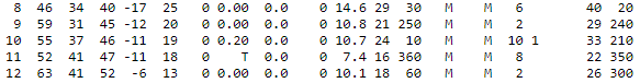
-
Tomorrow definitely holds potential, but all hinges on tonight/tomorrow mornings activity. SGT risk looks good for now, but could need upgrade to ENH in the morning once everything becomes clear.
-
May 2020 cold snap; record cold, possible snow?
Chicago Storm replied to michsnowfreak's topic in Lakes/Ohio Valley
It's the same temperature. -
Local threat possible on Thursday.
-
But also had the highest test count as well, around 30k.
-
May 2020 cold snap; record cold, possible snow?
Chicago Storm replied to michsnowfreak's topic in Lakes/Ohio Valley
No records at ORD or RFD during this period. So while highly anomalous and unusual/rare, it wasn't record breaking at official sites in the area. -
May 2020 cold snap; record cold, possible snow?
Chicago Storm replied to michsnowfreak's topic in Lakes/Ohio Valley
Had snow flurries here earlier this morning. -
May 2020 cold snap; record cold, possible snow?
Chicago Storm replied to michsnowfreak's topic in Lakes/Ohio Valley
ORD didn't report any snow, yet everywhere else surrounding did. Chalk up another observer fail.


