Blue Ridge
-
Posts
1,565 -
Joined
-
Last visited
Content Type
Profiles
Blogs
Forums
American Weather
Media Demo
Store
Gallery
Everything posted by Blue Ridge
-
This one?
-
Considering he just said “oh I forgot about the mesovorts dude,” I’m going with “not much.”
-
The current jog west is really concerning for TLH (and even more concerning for the NHC truthers). I can’t tell if the center is actually doing a NNW jog, but the western eye wall most certainly has veered in that direction.
-
The Nate Silver approach to polling data (read the top lines; toss it in the averages) is practical for so many data sets.
-
Other than one or two degens betting the house on TPA >CAT 4 +10000 - but those who have been around a minute know to tune them out.
-
Interesting clip: https://x.com/wcyb_davidboyd/status/1691443672775061504?s=46&t=-jk574F48wGboFVZ_ROoOQ IIRC, this would line up close to the CC drop.
-
Sandhills and portions of the Triad broke the bust. Let’s see if the blob entering Chatham can hold it together and give greater Raleigh a show. .
-
Doozy of a training situation in Southern Wake this morning. Wild light show along with the heaviest rain since Ian.
-

Historic Christmas Cold & maybe snow?! Dec 23rd-30th
Blue Ridge replied to Wurbus's topic in Tennessee Valley
This is what happened during the 2015 cold snap. The coldest day IMBY (Erwin at the time) was 8° with ice crystals falling nearly all day. Unlike anything I’d seen before or have seen since. -
Historic Christmas Cold & maybe snow?! Dec 23rd-30th
Blue Ridge replied to Wurbus's topic in Tennessee Valley
Tapatalk double post, disregard -
0/10 composition and editing, but after watching at 8x speed I have no doubt this was it. I wish I’d saved radar data - this meso initially developed ahead (to the NE) of the line and just crawled along US 1 until merging with the line. This is from roughly when the merger was occurring; the warning came ~20 mins later.
-
I saw what appeared to be a rotating wall cloud from Holly Springs as that cell moved to my north (at least 20 minutes prior to the warning). Unfortunately I was juggling my kid and cloud watching, so the best I have is crappy video from my iPhone propped in the window.
-
RTP tornado was an EF-1
-
Per Durham EMS on Twitter, it’s a Pfizer facility on Shiloh Glenn Dr at the 40/540 cloverleaf. A few pictures of damage here.
-
Following I-540 for a couple of scans. Holy hell. That’s usually a parking lot by 4:45 or so.
-
It did the thing
-
This cell is giving it a go. Don’t think it will quite get there. Bears watching though.
-
If there’s a cell (or two) that will do the thing in the Triangle, it will likely be from this cluster west of Sanford.
-
New warning for Warren Co just north of Norlina
-
The cell east of Fayetteville looks ominous on SRV. CC dipped for a scan too, but looks like it may have just been noise.
-
Gatlinburg-Pigeon Forge (KGKT) went from 41 at 8:15 am to 82 by 1:35 pm. 41° in a touch over five hours is absolutely wild.
-
Sadly, this sub doesn’t really get up for severe weather. The TN Valley and Western subs both generally have more active discussion threads, particularly during MS/AL threats.
-
Mid to Long Range Discussion ~ 2022
Blue Ridge replied to buckeyefan1's topic in Southeastern States
I don’t blame him one bit. Dude fields questions all day long generated by pages like “Real OFFICIAL Lizard Lick Wx Page” sharing the GFS 384 hr total accumulation as though it’s gospel. People eat that up and then whine that meteorologists can’t forecast worth a crap when, shocker, it doesn’t come true. It’s a great way to illustrate that model sharing does not equate to forecasting or meteorology in any way. This ain’t smug. -
Mid to Long Range Discussion ~ 2022
Blue Ridge replied to buckeyefan1's topic in Southeastern States
You mean to tell me we can’t will the atmosphere into producing snow with good vibes? -
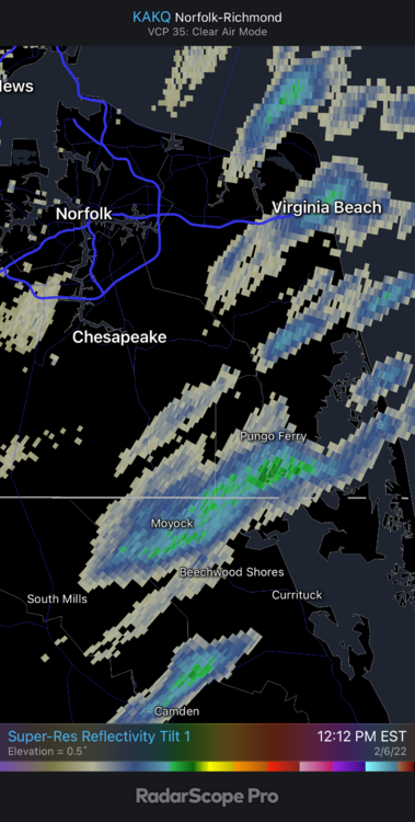
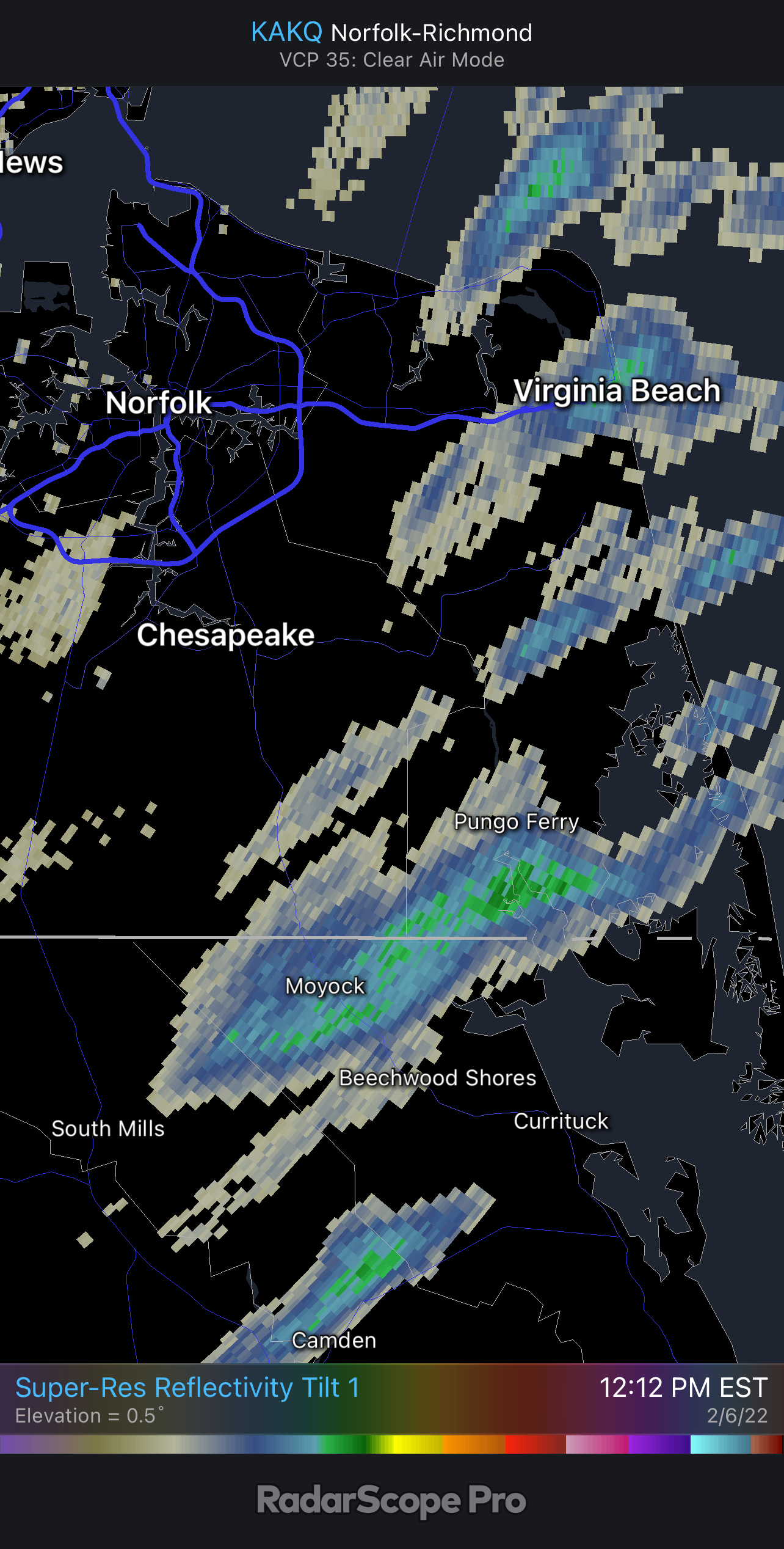
Looks like our friends in the Yock may have something reaching the ground!