

NJwx85
-
Posts
19,238 -
Joined
-
Last visited
Content Type
Profiles
Blogs
Forums
American Weather
Media Demo
Store
Gallery
Everything posted by NJwx85
-
Small supercell has popped up ahead of the line in Western Atlantic County. Some broad rotation on radar, with decent environment to work with.
-
South Jersey about to got rocked, looking meh for areas North of Philly. About ready to put a fork in this one for our area, although a marginal threat exists with the activity near Wilkes-Barre.
-
We would really be in business if some SBCAPE managed to work into the area. Right now, surging up into PA.
-
That doesn't include O&R customers. O&R is owned by Con Ed.
-
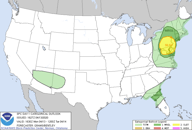
Update, slight risk extended East to about the Hudson river.
-
One lone lightning strike just showed up near Allamuchy State Park.
-
Think the cells developing near Martinsburg are the ones to watch. Just went warned.
-
Damage from Cape May
-
Hoping things pick up again soon. In a bit of a lull currently with light rain and breezy conditions.
-
URGENT - IMMEDIATE BROADCAST REQUESTED Tornado Watch Number 119 NWS Storm Prediction Center Norman OK 1130 AM EDT Mon Apr 13 2020 The NWS Storm Prediction Center has issued a * Tornado Watch for portions of District Of Columbia Delaware Maryland New Jersey Central and eastern Pennsylvania Northern Virginia Eastern West Virginia Panhandle Coastal Waters * Effective this Monday morning and evening from 1130 AM until 600 PM EDT. * Primary threats include... A couple tornadoes possible Scattered damaging wind gusts to 70 mph likely Isolated large hail event
-
From @earthlight
-
It’s coming
-
The old SPC WRF is signaling a good amount of 2-5km updraft helicity (rotation) crossing the area with convection between 18 and 22z which would correlate with the strongest instability.
-
Right on the edge here of the 5% tor threat and slight risk zones.
-
You can have the wind, we’ll take the tornado threat.
-
12z NAM with a convective damaging wind threat here tomorrow after steady rain moves out early afternoon. Not sure if we get enough clearing for Northern areas with warm front hung up around I-87.
-
-
Excited about this threat, not sure if it beats March 2010 locally. Had almost 5” of rain here and numerous gusts >50mph.
-
No dice here, just pedestrian moderate rain.
-
Severe Thunderstorm Watch just posted until 4pm.
-
Coming up on the 10th anniversary of my favorite March storm of all time.
-
Beautiful day out there today. Went for a walk on my lunch hour. Thermometer said 55 but felt warmer in the sun.
