NJwx85
-
Posts
19,676 -
Joined
-
Last visited
Content Type
Profiles
Blogs
Forums
American Weather
Media Demo
Store
Gallery
Everything posted by NJwx85
-
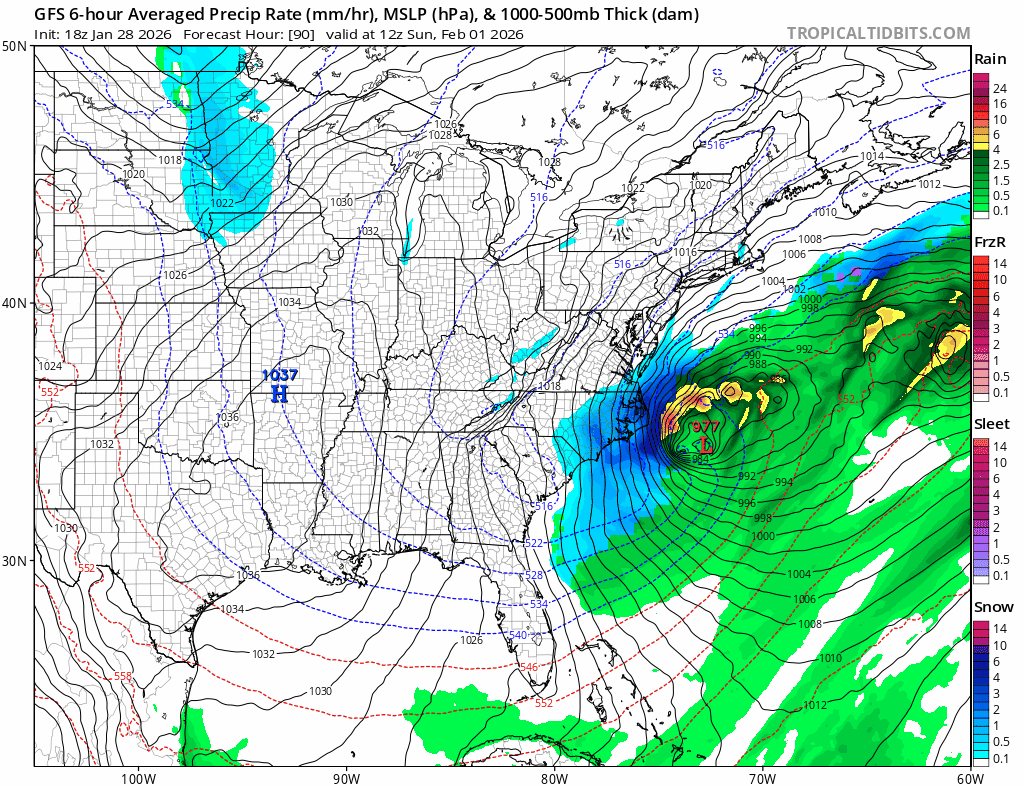
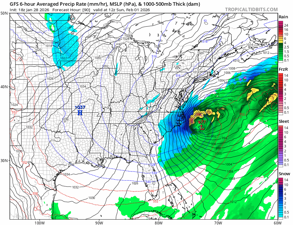
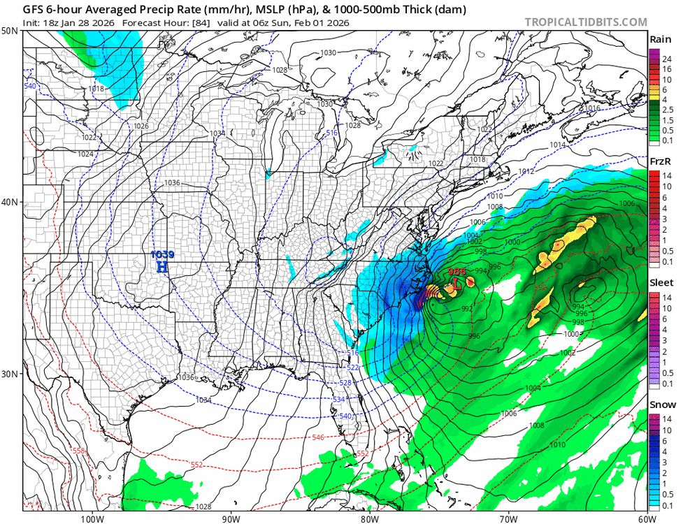
The SLP that’s near the NC coast actually gets absorbed by the one further offshore on the GFS.
-
Better but still at least two lows
-
Back to 12z
-
Early on GFS is slightly better.
-
I would be more optimistic if I lived out on the island. For those of us in the NW crew, this one is over and I’m fine with it. I had 20” on Sunday and 4 or 5 plowable snowfalls before that. Also my roof is happier.
-
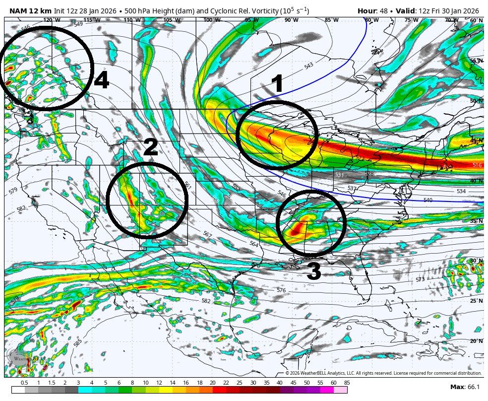
#3 is the initial problem, #4 is the final nail in the coffin.

-
This has so many issues now. It’s close to beyond fixable. The trough closes off too early and way too far South. You would want it over VA or WV. You have poor wave spacing and you end up with a ton of junk at 500mb which spawns 2 or 3 different surface lows. And then the final nail is that kicker coming into the Northern plains on Saturday.
-
So far East it missed everyone except Eastern NC and extreme SE VA.
-
It’s still a positive tilted trough and it’s actually further East than 12z.
-
I really hate Miller A’s. Feast or famon and more often than not, the latter.
-
Sorry, you’re not getting snow back to Eastern PA with a surface low 200 miles South of the benchmark.
-
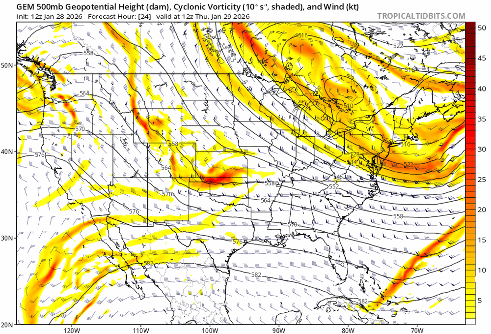
This is what the 12z Canadian did. 500mb is a mess with a ton of vortices. I’m not sure if the models are focusing on the right pieces. Each run and model seems to be different.
-
The trough orientation is neutral on the Canadian and actually does go negative at the last minute. I think it would have ended up better if not for the double barreled low.
-
I’m not throwing in the towel but I’m being realistic based on what I see, the trends and my experience.
-
Yeah, but it makes sense. This vort that swings through creates the first low.
-

-
It’s still a miss except for LI.
-
The Canadian is going to end up better.
-
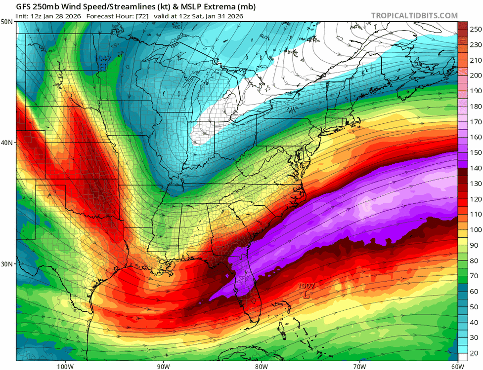
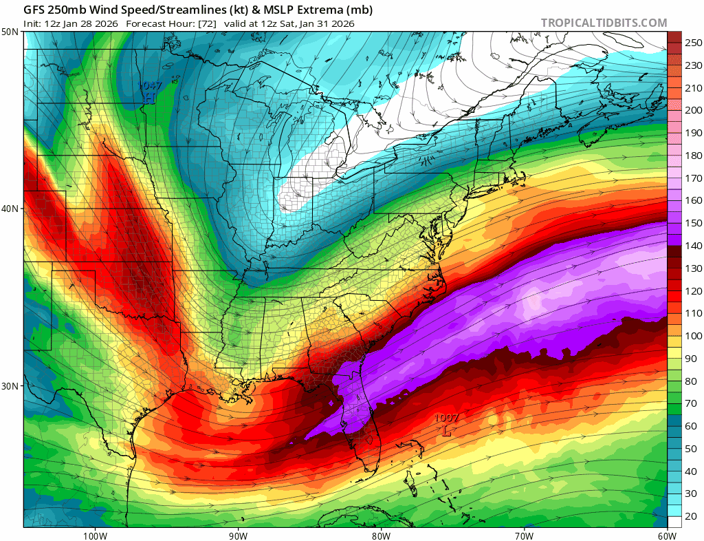
No, I just showed you the 250mb winds. The trough orientation is wrong.
-
Early on the Canadian looks better.
-
You can’t get a storm to turn the corner with a big positively tilted trough, especially when it starts that far South.
-
There was a bit more precip on the NW side but it was a setup back in the upper levels.
-
Bye, bye

-
No chance with upper level winds like this