

NJwx85
-
Posts
19,238 -
Joined
-
Last visited
Content Type
Profiles
Blogs
Forums
American Weather
Media Demo
Store
Gallery
Everything posted by NJwx85
-
That storm was child's play compared to this one...
- 511 replies
-
- 1
-

-
- heavy rain
- tropical gusts
- (and 1 more)
-
Too much model hugging and not even meteorology.
- 511 replies
-
- 3
-
-
- heavy rain
- tropical gusts
- (and 1 more)
-
Been on and off torrential rain here all day so far. Some areas will have seen 2-3" before the main show happens which will easily drop an additional 4-6" areawide.
-
Almost all of Southern PA is currently under a flash flood warning and the heaviest convection hasn't even fired yet.
-
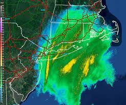
Fairly certain that's the cell that came off the coast near Toms River earlier.
- 511 replies
-
- 1
-
-
- heavy rain
- tropical gusts
- (and 1 more)
-
This is the first time I can recall people on here complaining about not getting the most rain.
- 511 replies
-
- 4
-

-
-
- heavy rain
- tropical gusts
- (and 1 more)
-
Someone within 50 miles of NYC could see 10" of rain in a 12 hour period or less. The bust calls are annoying and clog up the thread. Thanks in advance to the moderators working hard to keep things on topic.
- 511 replies
-
- 2
-
-
- heavy rain
- tropical gusts
- (and 1 more)
-
4-6" for everyone. Some will get a little less and some will get a little more. It's really not hard. The problem is most of it will fall in a very short period of time and it will be widespread.
- 511 replies
-
- 3
-
-
-
- heavy rain
- tropical gusts
- (and 1 more)
-
New HRRR. Locally up to 10" over NNJ and SE NY. We need less location specific posts. The NYC metro is larger than your backyard.
- 511 replies
-
- 2
-
-
- heavy rain
- tropical gusts
- (and 1 more)
-
You're making it sound like this storm is going to Buffalo. Long Island was never forecasted to receive the highest totals and it was always a close call for NYC proper. With that being said, the further North the warm front makes it the greater the severe threat.
- 511 replies
-
- 1
-
-
- heavy rain
- tropical gusts
- (and 1 more)
-
This was always supposed to play out like this. Have to get some clearing for awhile if we're going to destabilize enough to support the convection.
- 511 replies
-
- 1
-

-
- heavy rain
- tropical gusts
- (and 1 more)
-
We always knew it wasn't going to rain all day. The question is, when the convection comes in later, will it be focused more over Central, Northern NJ or will it be more of a North Jersey, Hudson Valley focus.
-
New SPC outlook is out. The 10% tornado threat has been expanded Northward to about Staten Island. https://www.spc.noaa.gov/products/outlook/day1otlk.html
-
That supercell to the West of Toms River blew up fast.
- 511 replies
-
- 1
-
-
- heavy rain
- tropical gusts
- (and 1 more)
-
The latest HRRR shifted slightly North again with heaviest totals over extreme NNJ and the LHV. I don't buy that scenario. I think it's already too far North with the precipitation shield and way underdone in the I-80 corridor.
-
It’s been the same for 3 days. It’s happening so might as well embrace it.
- 511 replies
-
- 3
-
-
- heavy rain
- tropical gusts
- (and 1 more)
-
All these years later and you still don’t know what the NYC metro is.
- 511 replies
-
- 10
-
-
-
- heavy rain
- tropical gusts
- (and 1 more)
-
Quite a big shift North on the RGEM. Coming into a consensus now. I suspect it might not be finished correcting. The trough has been trending more amplified.
-
12z WRF-ARW High res. Pockets of 6"+
-
Most of the rain falls in short order but it's not necessarily in and out in 6-8 hours. For example the 12z 3K NAM brings rain into the area late tonight before the main convective precipitation even forms. Either way it looks like light to moderate rain at times well out ahead of the main show.
