hlcater
-
Posts
2,670 -
Joined
-
Last visited
1 Follower

About hlcater

Recent Profile Visitors
11,159 profile views


-
DVN was considering headlines last night but ended up deferring. 12z guidance so far showing a bit more eastward extension of accumulating snow than previous guidance cycles have. Think even 1-3" results in a high impact event when coupled with gusts of 55-60mph for several hours. Think WWA is the best fit currently but wouldn't be shocked with a game time blizzard warning if the 12z guidance is a bit closer to reality. Curious to see what they end up doing. Doubly true when you consider that an increase in precip/snow rates will more effectively mix down that monster LLJ.
-
Live look at this storm, and the season as a whole
-
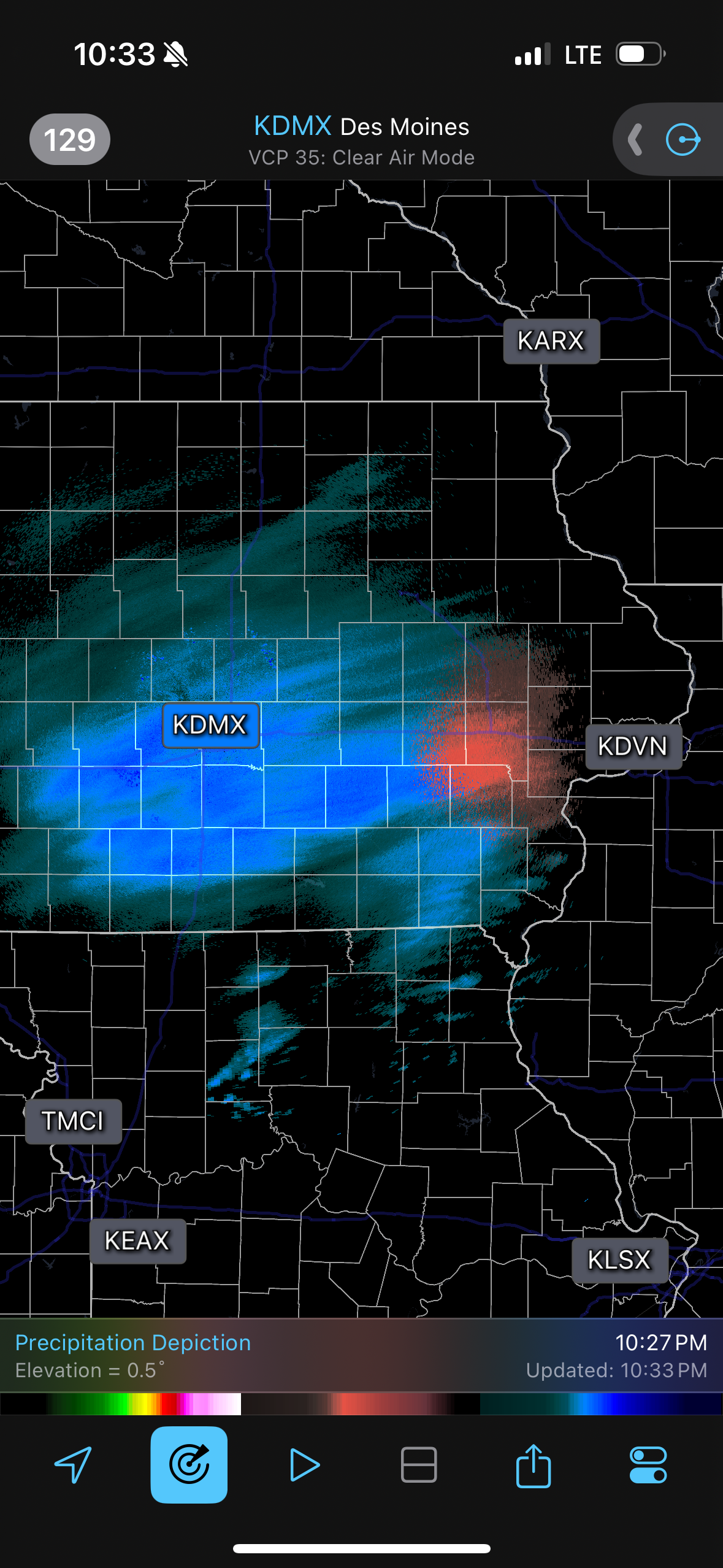
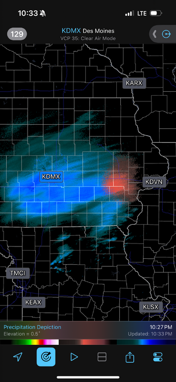
Most of it is virga
-
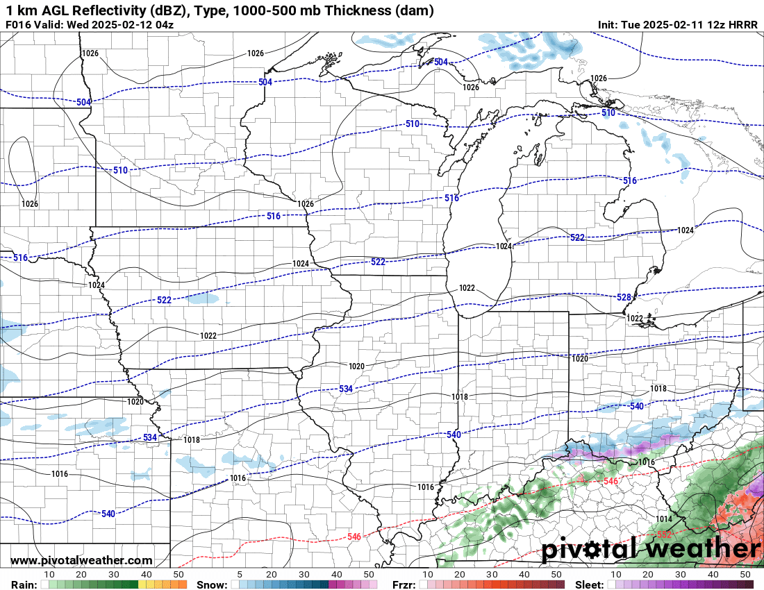
No idea what to expect between the two waves out here. Range basically from nothing at all to 6"+ depending on which model you look at. No real trend one direction vs the other either
-
7.3" for the final total in IC
-
Sounds like dendrites/ratios where a big problem for a lot of people outside the primary axis of snowfall but out here we had good flakes for the majority of the day. I'll take measurements in a bit as snow continues to taper but I'd estimate at least 7-8" in Iowa City. The axis of heavier snowfall was a lot narrower than forecast of which the dry slot in IL is probably partly to blame, but elsewhere I gotta wonder if just poor lift/dry air in the DGZ causing ratios to not pan out the reason for underperforming.
-
Snow has already begun in IC. Almost 6 hours ahead of schedule
-
DVN saying 7-10" out here on the point and click. With temps in the teens, winds gusting to 25, and a mid day storm, you really cant draw up a better winter storm
-
Finally.
-

Winter 2024-25 Medium/Long Range Discussion
hlcater replied to michsnowfreak's topic in Lakes/Ohio Valley
Real chance we go into february here with under 5" of seasonal snowfall and BA temp anomalies... -
3" on the nose today. More than tripling my season total coming into today in Iowa City
-
NAM at 84 tends to be north so not putting a ton of stock in that. As others have said, not really gonna put money in this coming north until there's a marked trend of this system doing so.
-
Winter 2024-25 Medium/Long Range Discussion
hlcater replied to michsnowfreak's topic in Lakes/Ohio Valley
I’m here to promote high quality discussion with fellow winter weather enthusiasts like me!!!!! -
Winter 2024-25 Medium/Long Range Discussion
hlcater replied to michsnowfreak's topic in Lakes/Ohio Valley
I just want to get pasted with the white stuff -
Yea that system tuesday could drop some cement out here if things trend right. NAM/Euro anecdotally have seemed to handle these setups pretty well in the past and they're the ones showing snow this time so I guess we'll see.