hlcater
-
Posts
2,670 -
Joined
-
Last visited
Content Type
Profiles
Blogs
Forums
American Weather
Media Demo
Store
Gallery
Everything posted by hlcater
-

2022 Short/Medium Range Severe Weather Discussion
hlcater replied to Chicago Storm's topic in Lakes/Ohio Valley
Yesterday was hard. Storms were moving 45-50mph at a 45 degree angle to the grid, so keeping up was exceptionally challenging. Needless to say, I didn't really have time to take many good pictures, and the tornadoes I saw weren't especially photogenic from my vantage points anyway. I traded pictures for keeping up and only stopped 2-3 times the entire chase. Despite the few good pictures, I absolutely cannot complain about seeing tornadoes and a great cyclic supercell on March 5th, in Iowa. The first tornado was near corning which I have zero pictures of as it lasted 30-40 seconds and I was driving. The second tornado lasted about 2 minutes and was near Creston. It had a much more pronounced debris cloud before I was able to get a picture. The 3rd tornado was a rain wrapped wedge that tracked from Winterset to Newton and produced EF2-3 damage near winterset from what I could tell. This was near colfax, and the tornado had shrunk markedly to a cone here. And finally, the 4th tornado was an amorphous bowl near Kellogg. It had multiple subvortices beneath it and seemed pretty weak. Immediately prior to the winterset tornado. Storm was a very high contrast sculpted beauty.- 850 replies
-
- 13
-

-
February Snow Bonanzas - the new norm in SE MI?
hlcater replied to michsnowfreak's topic in Lakes/Ohio Valley
yea I'm not aware of any snow bonanza -
Much needed after this year's slow winter. Just shy of 3" in IC.
-
This must be what they call share the wealth poverty
-
Mother of god
-
beautiful image
-
Pretty impressive squall. Vis dropped to a half mile at times and roads became snow covered rapidly. Some heavy gusts maybe to 50mph. This isn't the worst of the band either
-
KCID and MPING reports seemingly suggest the band has transitioned nearly entirely to snow in the CR/IC corridor.
-
That should track all the way down here throughout the day. Could be an interesting hour or two this evening.
-
Lol
-
I dont see much, if any, reason to be considering the GFS seriously at this stage. Seen this time and time again.
-
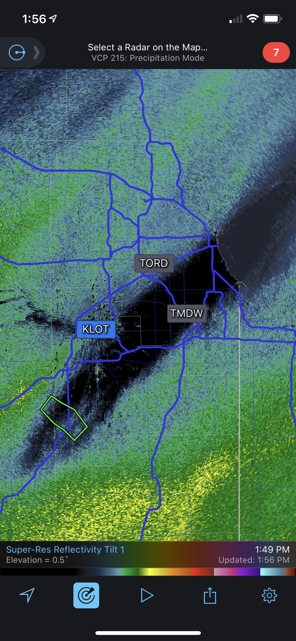
Interesting to see that LOT graphic basically mimic the GFS in terms of heavy snow spread. Must think the rest of guidance is out to lunch. Wonder if we can get some insight on that decision? Seems bold to go with a model that is objectively the outlier.
-
Now for the GFS to come south
-
I've always kind of been a closet UKMET truther. It's kinda been blowing chunks this year though
-
Canadian and UKMET remain south. A hair north on the UKMET and a fairly substantial jump north from the Canadian. Still well south of the GFS. As much as I'd like to believe, I don't really see a scenario where the GFS is correct and everything caves towards it.
-
Holy shit the GFS. What do I need to do to make that happen
-
UK and Canadian still south of the GFS.
-
Bet against the amped system
-
I dont know how this compares with the 00z but the 12z EPS mean is substantially further north than the operational. Especially with eastward extent.
-
-
12z euro is stronger and perhaps a touch NW.
-
There's still 108 hours left on this one. Plenty of time for things to change for better or worse.
-
Reeling in the D4
-
Winter 2021-22 Short/Medium Range Discussion
hlcater replied to Chicago Storm's topic in Lakes/Ohio Valley
Why did you start a threat at the behest of someone named “solidice”. Do you know what you’ve done? -
Also the low coming out is much more organized at the surface-700mb layer than the last system. Should yield a higher probability of heavier rates for someone.