hlcater
-
Posts
2,670 -
Joined
-
Last visited
Content Type
Profiles
Blogs
Forums
American Weather
Media Demo
Store
Gallery
Everything posted by hlcater
-
Yea, rather impressive wake low/MCV this morning. Not to mention this series of MCSs is doing wonders for our dry stretch.
-
Levi changed the way the maps load to make them load slower to reduce server load. Now instead of loading all the frames at once, it only loads the current and then a few on either side.
-
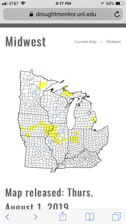
Surprised they introduced D1, it’s been fairly wet here recently, or at least enough to green things up a bit.
-

2019 Short/Medium Range Severe Weather Thread
hlcater replied to snowlover2's topic in Lakes/Ohio Valley
I didn’t see it, but I know a few people that did.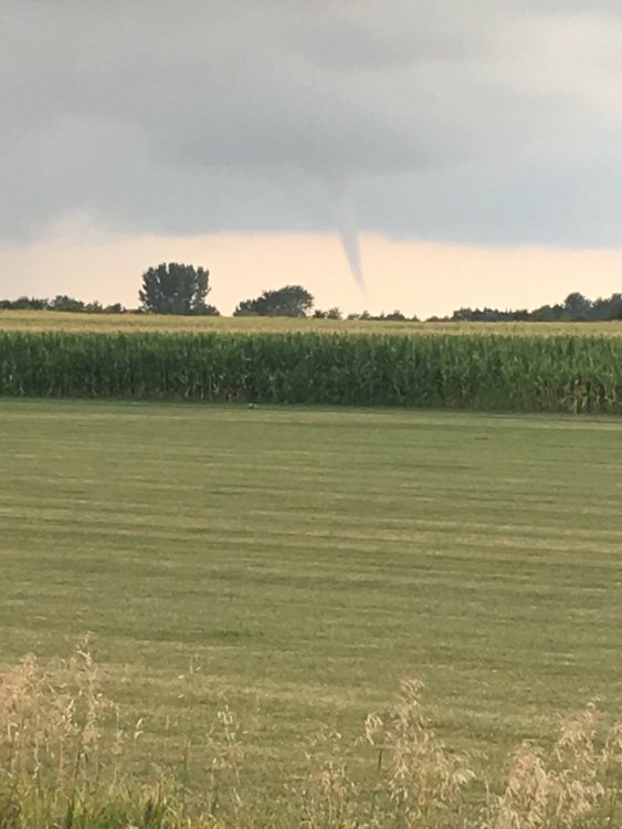
-
2019 Short/Medium Range Severe Weather Thread
hlcater replied to snowlover2's topic in Lakes/Ohio Valley
Looking like there’s pretty solid chances for a strong/severe MCS somewhere across E IA and W IL come Monday. Might be a shot for an isolated tornado early given rather impressive parameters in place, but seems more liable to go upscale sooner rather than later. -
I dont think this will intensify much more. Radar from taiwan is indicative of an EWRC/imperfect core. Passed through at 130kts though, so nothing to scoff at.
-
Yes, actually, gotta keep the place tidy
-
We couldnt use the short/medium severe thread for a slight risk?
-
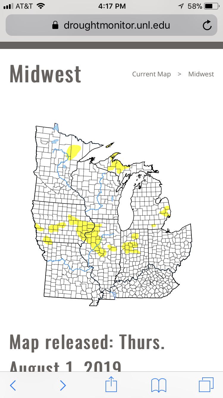
This pattern we’ve been in for the past month is insufferable. Unsurprisingly, D0 has begun to show up like a rash across portions of the sub.
-
Really starting to get concerned with drought prospects around here after our dry July and likely dry start to August. Probably going to see a rather rapid expansion of D0 and maybe introduction of D1 for some.
-
supercell structure immediately south of St. Cloud organizing.
-
Super outflow dominant, looks exactly how I expected it would. 0 tornado threat with that storm. The one to the east however, is working on becoming surface based. It could produce, but strength/longevity of any tornado may be precluded by more linear convection developing to the south and west.
-
Funnel cloud on a storm with no 0-3km CAPE, no surface based parcels and that's outflow dominant? I understand covering your bases and being safe but I'd probably call BS on a funnel report, even from a trained spotter, in the environment that storm is in unless I had a picture.
-
No idea why, those storms are almost certainly at least somewhat elevated.
-
Those supercells are well elevated at this time. I'd watch for more development on the front down by Benson where there is currently a patch of agitated cumulus. I do think storms up by Little Falls do eventually become surface based, but probably not within the next hour.
-
2019 Short/Medium Range Severe Weather Thread
hlcater replied to snowlover2's topic in Lakes/Ohio Valley
HRRR and other CAMs are still pretty gung ho on supercells this evening across central and E IA, however CAMs are doing a terrible job handling the MCS in NW IA right now, so I’m highly doubting these solutions. -
Fine with me. I hate heat.
-
Sounds rough but lucky injuries weren’t worse. An injury you can recover from, no matter how long it takes, is better than something that’s permenant. Wishing you best.
-
Yuck at the upcoming pattern. Hot and dry is my least favorite weather. If models are correct, interestingly some spots might be starting to look at drought concerns in 10 days or so. The GFSs have backed off on precip thru D10 as well. I dont know how I posted that in the OH thread, but I did, but now its here.
-
2019 Atlantic Hurricane Season
hlcater replied to AfewUniversesBelowNormal's topic in Tropical Headquarters
Random question here, does anyone know if the FV3 is ocean coupled? -
Models this morning have relaxed the ridge just a little bit allowing a few thunderstorm chances to creep in over the next 7 days along the periphery of the ridge while areas immediately to our south and west continue to dry out.
-
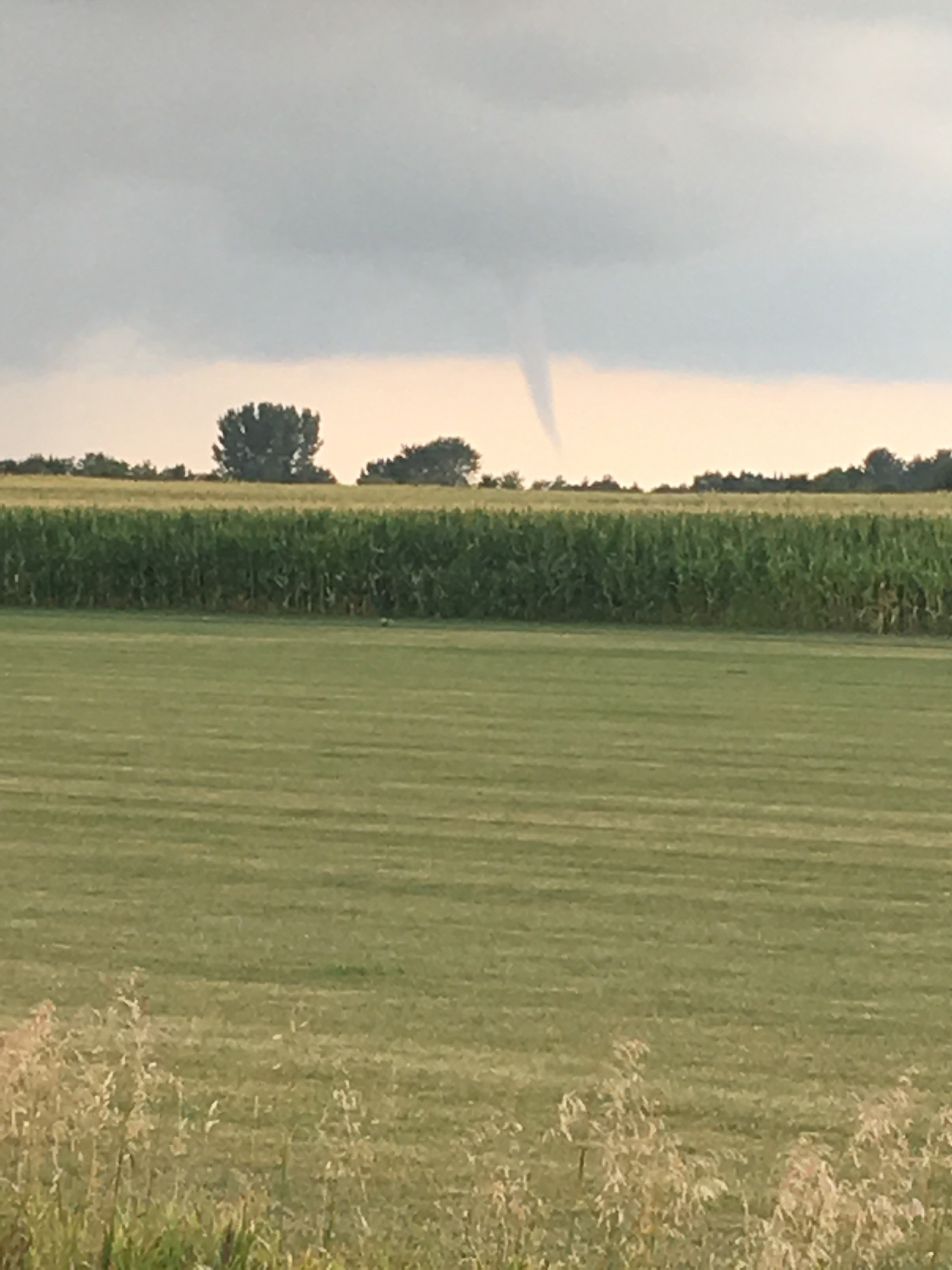
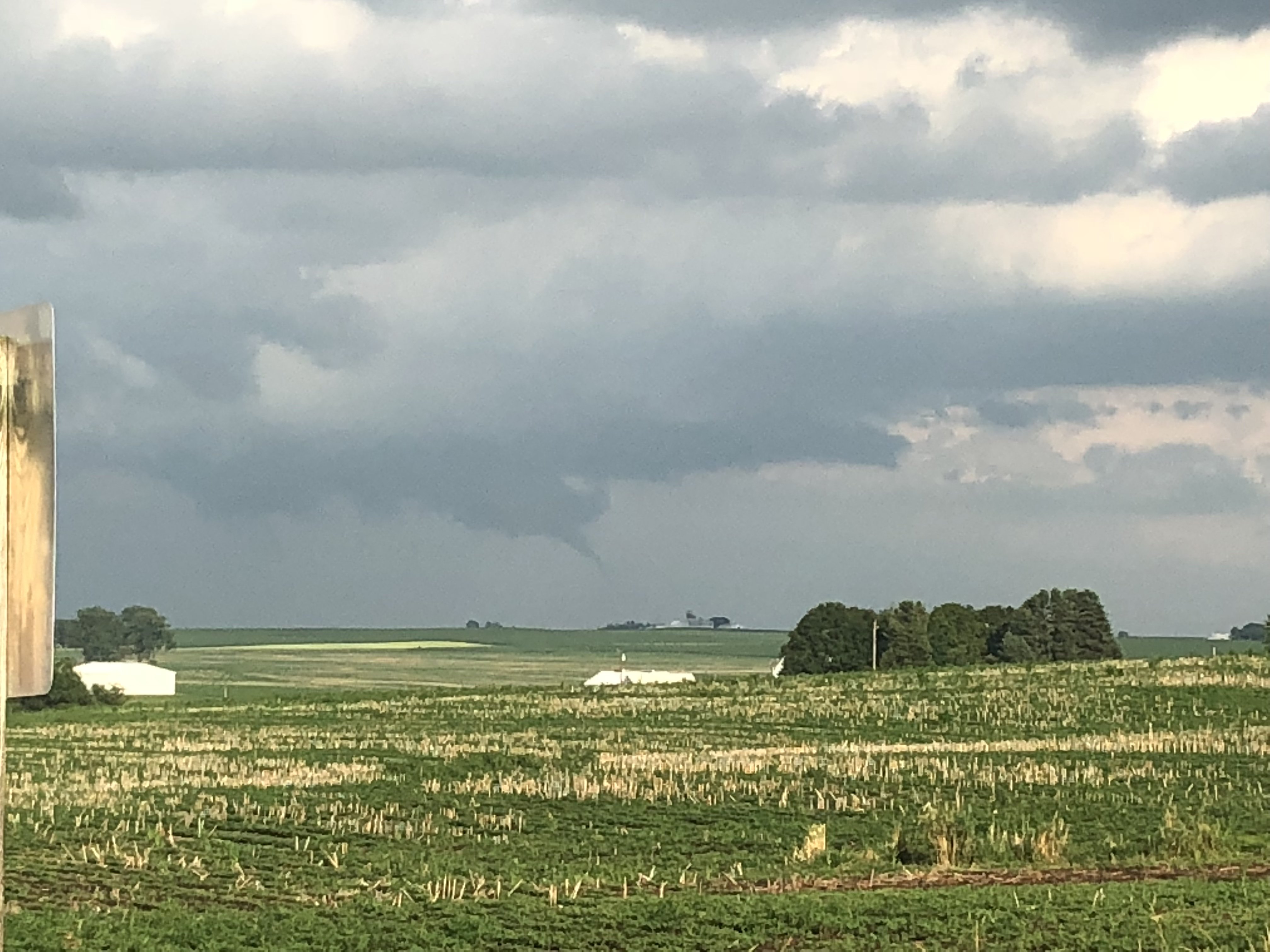
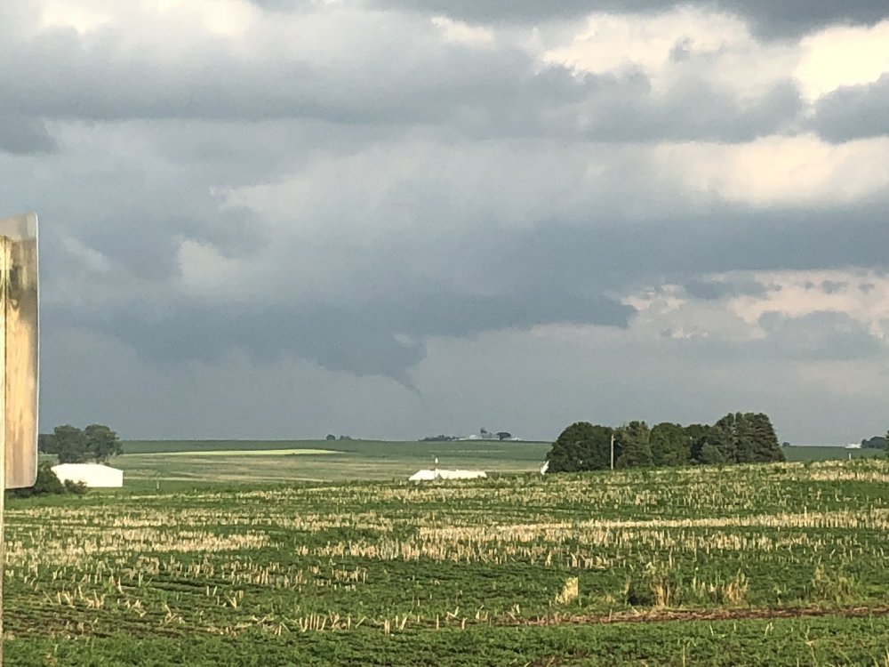
I too had a really solid funnel yesterday, not totally sure if it was down, but assume it was at least briefly as there were times when it was 1/2 to 2/3rds the way down. DVN knows about it so I presume they’ll probably try and find some damage if it was really down.
-
Cicadas are gross.
-
2019 Short/Medium Range Severe Weather Thread
hlcater replied to snowlover2's topic in Lakes/Ohio Valley
Nice little MCS here in CR. Had numerous 50-60mph wind gusts as the gust front passed through. -
This MCS has an impressively dense canopy and combined with a cold pool that’s still well in place, we might struggle to reach posted highs 88-90. It’s still only 68 at noon.