hlcater
-
Posts
2,670 -
Joined
-
Last visited
Content Type
Profiles
Blogs
Forums
American Weather
Media Demo
Store
Gallery
Everything posted by hlcater
-
And that is fine with me given the thermos it was going to have. Miss. Me. With. That.
-
you're not the only one that's mentioned the tendency for anomalous high lat blocking to sit around for many weeks/months. I've seen that elsewhere too. Those same people also think the current pattern evolution resembles that of 09-10 and 10-11 closely. One can only hope as the thing that the current pattern needs most is a little more cold air to work with.
-
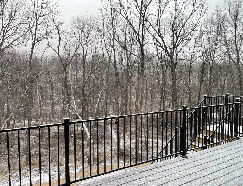
Had some light freezing rain earlier that has since switched to snow. Pretty picturesque out there. Hoping for an inch.
-
I wouldn’t be so quick to toss a map like that. Especially over areas that see snow on Tuesday. Lot of WAA aloft here... could spell trouble for someone.
-
Another potential big system, another surface low tracking through Iowa. The Dakotas have been on an absolute tear the past several years.
-
In the 40s dews!
-
Dakotas special if that lead system doesn’t show up and suppress.
-
Loop it and check other ensembles.
-
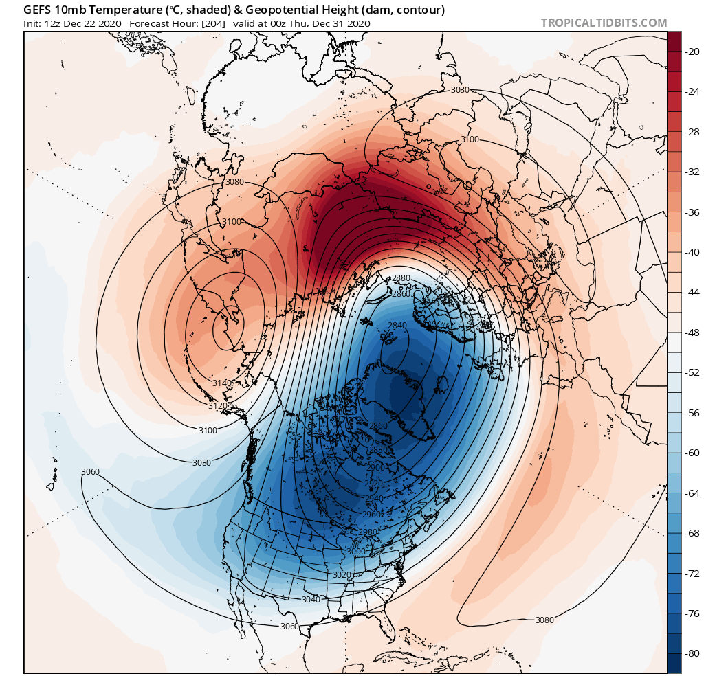
Some whisperings of an SSW over Siberia to open the new year??

-
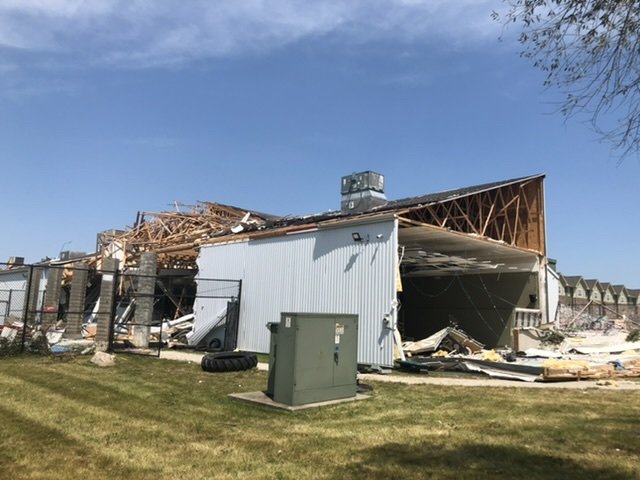
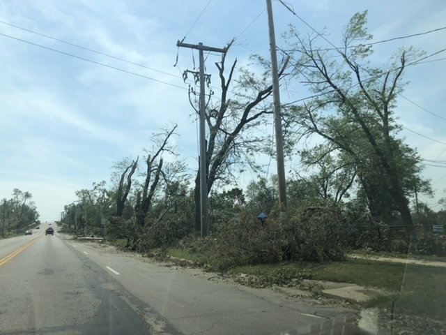
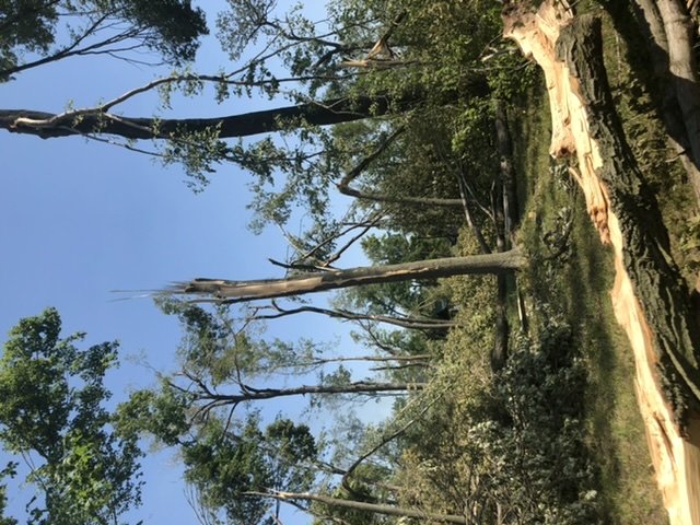
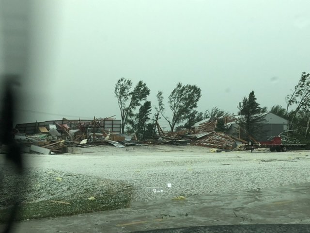
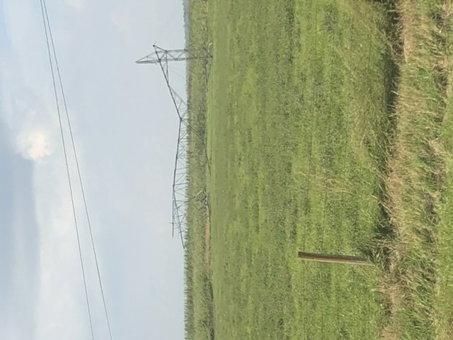
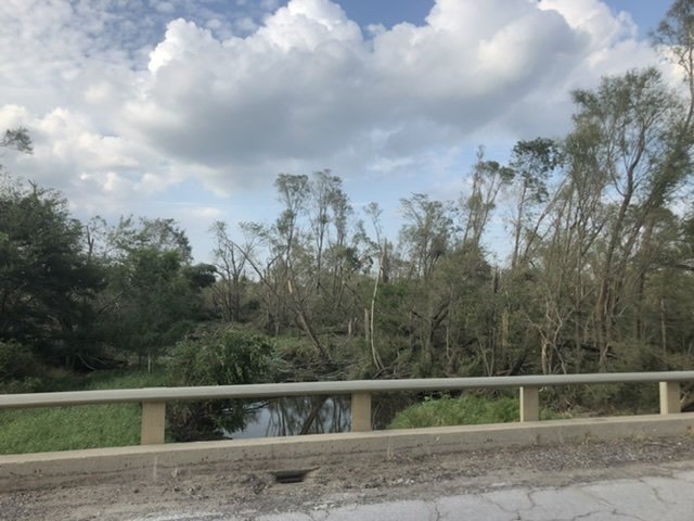
Nothing will top the derecho, not for a long time at least. At my location near Fairfax/Atkins. I had multiple gusts over 100 and one that probably approached/exceeded 120. In hindsight, lucky I didn’t lose glass in my car. Then we were without power for 3 days, and we were amongst the first to get it back. Even now, local forests are quite eerie with fallen snow atop large swaths of blown down forest. I’ll have to get some pics the next time it snows. The AON estimate is up to 9 billion in damage, which is just incredible. Perhaps(probably) it’s because I’m a huge weenie, but I feel like the spatial extent of the 100/120mph winds from the survey are underdone with south and especially westward extent(ie I’m confident I saw 120 3 S Atkins) and Nick Stewart was pretty confident he had 130-140 near Van Horne. For such a historic event, I really do feel like DVN dropped the ball in the survey department. Had 2” hail back in April, but that doesn’t hold a candle. Other than those two, only saw 2 tornadoes, each from a distance. So my noteworthy events list from this year is quite small. I’ll leave this by reposting some of the more impressive damage pics.
-
5.5" from 0.4 QPF in the past hour is leading to ratios ~14:1 at Binghamton.
-
One time, I got 1" in only an hour.
-
How was the dry slot?
-
Whew the long range is not looking particularly impressive at all. It is highly progressive which is nice, but it's flooded with a ton of mild air. Gonna have to hope that the storm signal Dec 23-24th materializes and is snow for most.
-

December 11th-12th Potential Winter Storm
hlcater replied to Thundersnow12's topic in Lakes/Ohio Valley
Measured 3.5" in downtown IC. Assuming that's compacted some, we probably saw 4" overnight. Pleasantly surprised. Family measured 3.7" in Hiawatha earlier this morning -
December 11th-12th Potential Winter Storm
hlcater replied to Thundersnow12's topic in Lakes/Ohio Valley
Snowing in Iowa City. Temp 35.2 -
December 11th-12th Potential Winter Storm
hlcater replied to Thundersnow12's topic in Lakes/Ohio Valley
Going with 1.5” in IC. -
December 11th-12th Potential Winter Storm
hlcater replied to Thundersnow12's topic in Lakes/Ohio Valley
I was being sarcastic. I think that poster mixed up MSP and MSN. -
December 11th-12th Potential Winter Storm
hlcater replied to Thundersnow12's topic in Lakes/Ohio Valley
damn they're killing it up there! Considering driving up for this one. -
And the euro comes in with a blizzard. lol.
-
zzzzzzzzzzzzzzzzzzzzzzzzzzzzzzzzzzzzzzzzzzzzzzz
-
There are always weenie maps, if there's one thing in life I am certain of, it's fantasy range triple phasers that always disappoint.
-
Haven’t had a real December in like a decade
-
Looking like a slow start to winter.
-
nice