hlcater
-
Posts
2,670 -
Joined
-
Last visited
Content Type
Profiles
Blogs
Forums
American Weather
Media Demo
Store
Gallery
Everything posted by hlcater
-
I have no idea why that matters. Column temp/omega/saturation is what you want to pay attention to. Matters little where that is coming from. The airmass on the cold side of the baroclinic zone absolutely favors higher end ratios and as such kuchera is probably the better reflection here.
-
Euro was close to a bomb but couldnt quite get there. Sad!
-
its 4th and 14 with the game on the line for NYC rn
-
dw the northern stream is gonna ensure that does not happen
-
This system is gonna be a tough one to predict. Euro for example has 3 separate pieces of energy along a steep baroclinic zone with a 1045mb high pressing down from Canada. Add in the fact that how this baroclinic zone behaves depends on a shortwave traversing the US/CA border and a predictability disaster unfolds. Anything from a wound up bomb to suppressed/overrunning trash is realistically on the table.
-

Winter 2021-22 Short/Medium Range Discussion
hlcater replied to Chicago Storm's topic in Lakes/Ohio Valley
Lol -
Models are underdoing a band of mostly rain in NW IA where temps are in the 40s. Models suggest any precip that does fall here tonight will likely be rain, but with that being said and given the current extent/intensity of precip near the area of low pressure, I wonder if we end up with snow here instead. Soundings prior to precip arrival appear pretty ripe for evap cooling. 2nd sounding should support snow or graupel. Expecting a DAB- even if it does snow. I'm mostly just interested in p-type.
-
McHenry buried
-
6.4" will be my final total.
-
never forget the 16" in Cedar Rapids on the last storm!
-
this thread is the biggest train wreck I have ever seen
-
Spot on!
-
So climo for those west of the lakes?! Its ass isn’t it!
-
UK/CMC/Euro all have a similar system at FH126. GFS has a clipper in the UP.
-
Wasn't sure where to put this and there isn't really a place for it, but seeing as Stewart has been around since 1999 and is well known by those who read the discussions, I figured it was newsworthy enough to warrant its own (albeit small) thread. https://www.nhc.noaa.gov/pdf/stewart_retirement_010122.pdf
-
Winter 2021-22 Short/Medium Range Discussion
hlcater replied to Chicago Storm's topic in Lakes/Ohio Valley
please dont encourage them, they're better off in quarantine -
Pattern after about day 7 or so looking mighty mediocre. Looks like a seasonably stagnant pattern dominated by pacific air.
-
Final total of 6.4"
-
I busted low! Somehow. Not really sure how. looking at 6” outside rn
-
I will say I cant really remember a time where the dry air on the north side of a system was overmodeled. Big dry slot coming in and eating at the southern side of snow band sure. But even early this morning higher res guidance had the dry air holding on far longer than it actually did.
-
Yea haven't seen many others from the CR area so far so figured I'd throw mine in for once.
-
Just measured 5.5". Talk about a weenie band right up against the northward cut off of snow totals.
-
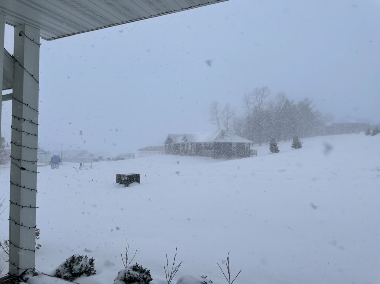
Just dumping. Maybe even 2”/hr right now. Visibility subjectively 1/8mi.


- 837 replies
-
- 11
-

-
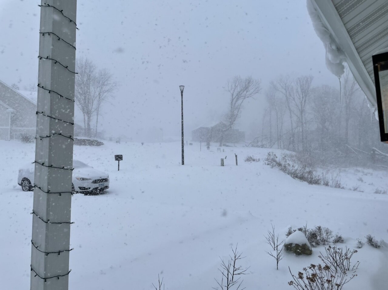
Parachutes right now in Hiawatha. Probably 1-1.5”/hr. getting extremely lucky with the placement of the northward edge of snow and this weenie band that’s been over Linn County basically all day.