ma blizzard
-
Posts
2,832 -
Joined
-
Last visited
Content Type
Profiles
Blogs
Forums
American Weather
Media Demo
Store
Gallery
Everything posted by ma blizzard
-
Potential Major Noreaster 10-26 through 10-27
ma blizzard replied to ineedsnow's topic in New England
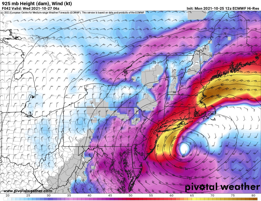
75-80+ kt at 925 .. impressive
-
Potential Major Noreaster 10-26 through 10-27
ma blizzard replied to ineedsnow's topic in New England
kinda surprised there isn't more of an inversion .. should be fun on the coast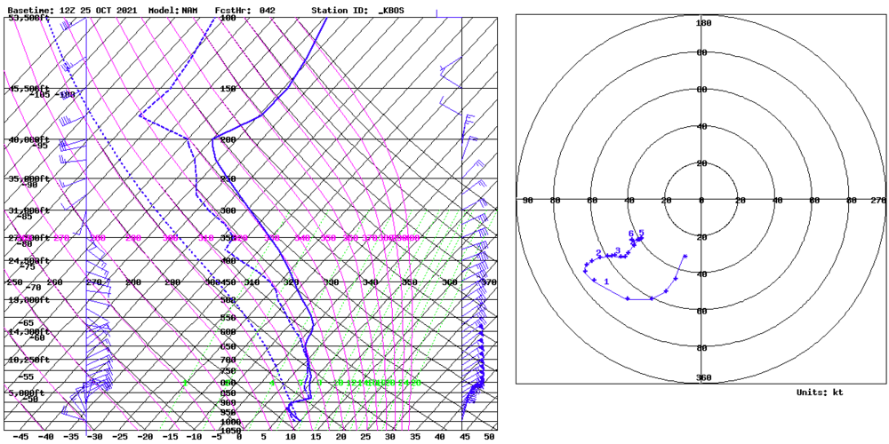
-
October Discussion: Bring the Frost-Hold the Snow
ma blizzard replied to 40/70 Benchmark's topic in New England
For KBOS past 30ish years: 10/10/2018 86 10/9/2011 87 10/10/2011 85 10/4/2007 86 10/2/2002 85 10/6/1990 86 10/7/1990 85 90 after 10/1: 10/7/1963 (3 days 85+, including 86 on 10/27 - latest 85+ on record) 10/12/1954 (4 days 85+ this month) 10/1/1881 -
October Discussion: Bring the Frost-Hold the Snow
ma blizzard replied to 40/70 Benchmark's topic in New England
riveting discussion -
same snow cover stats for ORH?
-
September Discussion Thread: Bring the frost; kill the bugs.
ma blizzard replied to moneypitmike's topic in New England
3"-4" of slop in Somerville while like 8 mi away saw 18" infuriating -
September Discussion Thread: Bring the frost; kill the bugs.
ma blizzard replied to moneypitmike's topic in New England
some seasonable and dry weather would be nice as the crop finishes up -
September Discussion Thread: Bring the frost; kill the bugs.
ma blizzard replied to moneypitmike's topic in New England
nah I think their name was Will .. IIRC lives in a big spot now in the upper peninsula of Michigan far away from civilization -
yup 15 years on Eastern / here for me
-
September Discussion Thread: Bring the frost; kill the bugs.
ma blizzard replied to moneypitmike's topic in New England
if october snow is bad, september snow is worse? -
gonna be a close call
-
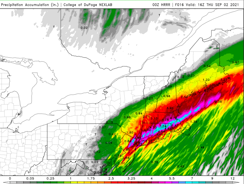
def believable .. convection along the south coast gets lifted to that axis where the crazy totals are depicted.. trains east as the blob by NYC moves ENE along that same axis .. gonna be wild
-
-
-
holy sh!t
-
September Discussion Thread: Bring the frost; kill the bugs.
ma blizzard replied to moneypitmike's topic in New England
3"-6" with locally up to 8"? -
August Disco 2021. Do record dews continue?
ma blizzard replied to Damage In Tolland's topic in New England
KBOS pulled a 81 for a low last night .. temps will drop below this evening but still impressive 88/66 at 9 am -
August Disco 2021. Do record dews continue?
ma blizzard replied to Damage In Tolland's topic in New England
-
August Disco 2021. Do record dews continue?
ma blizzard replied to Damage In Tolland's topic in New England
return of the smoke from out west? https://rapidrefresh.noaa.gov/hrrr/HRRRsmoke/jsloopLocalDiskDateDomainZipTZA.cgi?dsKeys=hrrr_ncep_smoke_jet:&runTime=2021082412&plotName=trc1_int&fcstInc=60&numFcsts=49&model=hrrr&ptitle=HRRR-Smoke Graphics&maxFcstLen=48&fcstStrLen=-1&resizePlot=1&domain=full looks like NNE right in the crosshairs this week .. already can see the smoke that will move in this afternoon: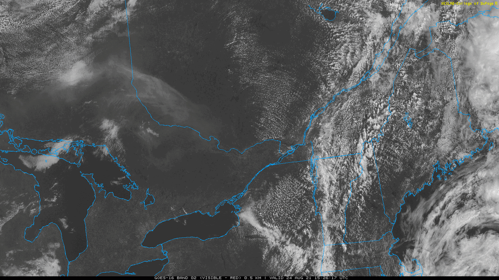
-
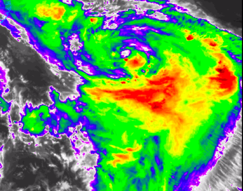
convection starting to fire on the S/E side as recon gets close .. should be interesting
-
new convection blowing up where it seems the S/SE eyewall is
-
caveats apply ... but the 18z NAM further east / much slower if anything that's a different look
-
If Henri is going to intensify, convection will have to start firing up soon near the center .. otherwise it is what it is at this point
-
Def improvement since midday! Shear prob has maxed and slowly declining. CDO looks more symmetrical, outflow improving although still getting squashed on the N/NE sides. Any idea when the next recon flight is scheduled?