PowellVolz
-
Posts
3,819 -
Joined
-
Last visited
Content Type
Profiles
Blogs
Forums
American Weather
Media Demo
Store
Gallery
Everything posted by PowellVolz
-
Yes… I believe around 1 pm I seen a report of 4” on the SW side of the city.
-
Going by ground reports and the radar, seems as though the snow isn’t taking long to reach the ground.
-
So not much verga?
-
The Jan 2024 event I specifically remember the NMB showing higher amounts than other models and I was confident they would go with that because they always do. lol…. The literally said in an AFD before it started, they were going with the SREF. That mod(s) was the lightest one and MRX was off by about 1/2 lol…
-
-

-
We are pretty much now casting anyway. What we have is what we have at this point.
-
I honestly don’t know. The HRRR and other CAMS are designed for severe thunderstorms, not snow. I only use the HRRR as a validation tool for the other mods.
-
If those temps are at the surface, there shouldn’t be a difference in PType with those areas. If the warm layer is elevated, neither location would be snow. If the snow totals are different, then we could have downsloping issues drying up the qpf.
-
Because there’s some WAA with this system, it’s possible that the high temp happens at 12:01am and continues to cool throughout the day
-
You might have broken this website with that comeback….. I’m still crying
-
And their snow is starting 30 minutes earlier.
-
That’s so true and so depressing. Lol
-
so what you are saying is we are guaranteed to get double what the mods are saying……

-
Really hoping the mods are over doing the downsloping into the valley. It would really help me if the flow was more W to E. That would give my area a little more time to allow lift to kick back in. NW to SE is a killer for my area.
-
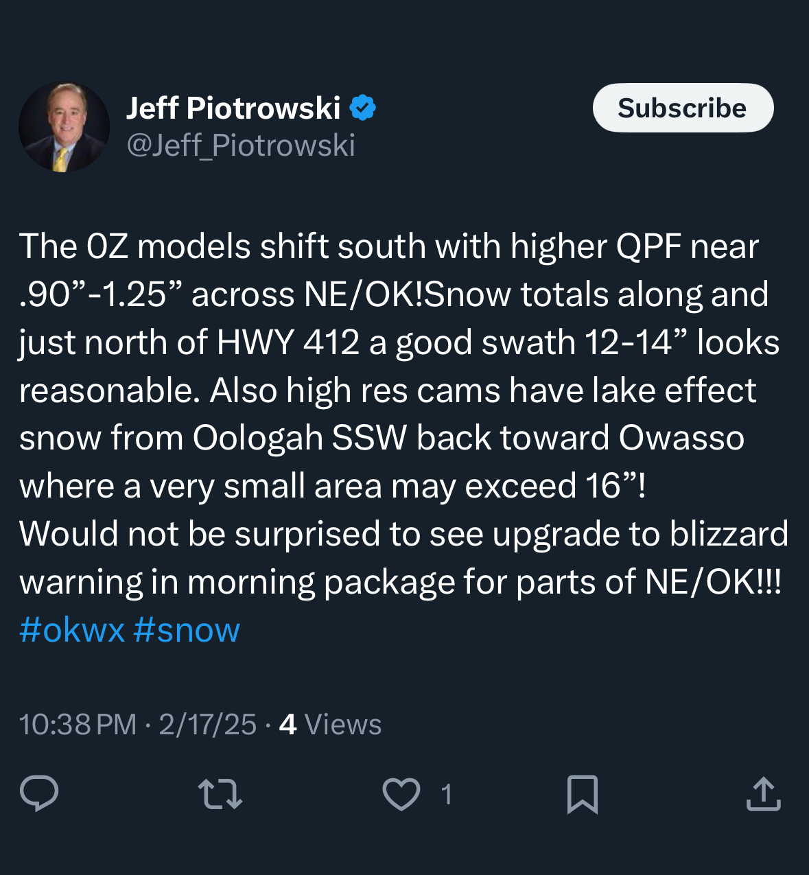
16z HRRR is starting to show more snow accumulation further south into Mississippi.
-
The 3k NAM and most of the CAMs we look at have actually gotten some better today.
-
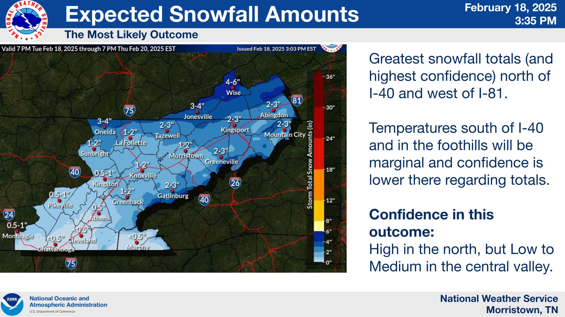
I’m just having a hard time seeing what’s going on out west, knowing temps are not an issue, at least for 40 and north, seeing we have ok saturation throughout the column and trying to believe this system is only gonna spit out .10 to .20 at the most? I know the system about a month ago was generally a 2”-4” snow in the valley but how often do you see a decent slider with a backside wave with potential high ratios and we only get an inch or two? Outside of NW flow events, how often do we see 1” of snow in the valley? Typically it’s all or nothing here, a flizzard or 6”. Ok… soapbox over.
-
What I mean is the link will get you to the page. My issue is the full tweet isn’t showing up on this board like normal. All I see is the URL.
-
@Carvers Gapi still can’t get tweets to work for me. What part of that address do I need to change? I took X out and put Twitter in.
-
To me it smells like a heated up dryer sheet.
-
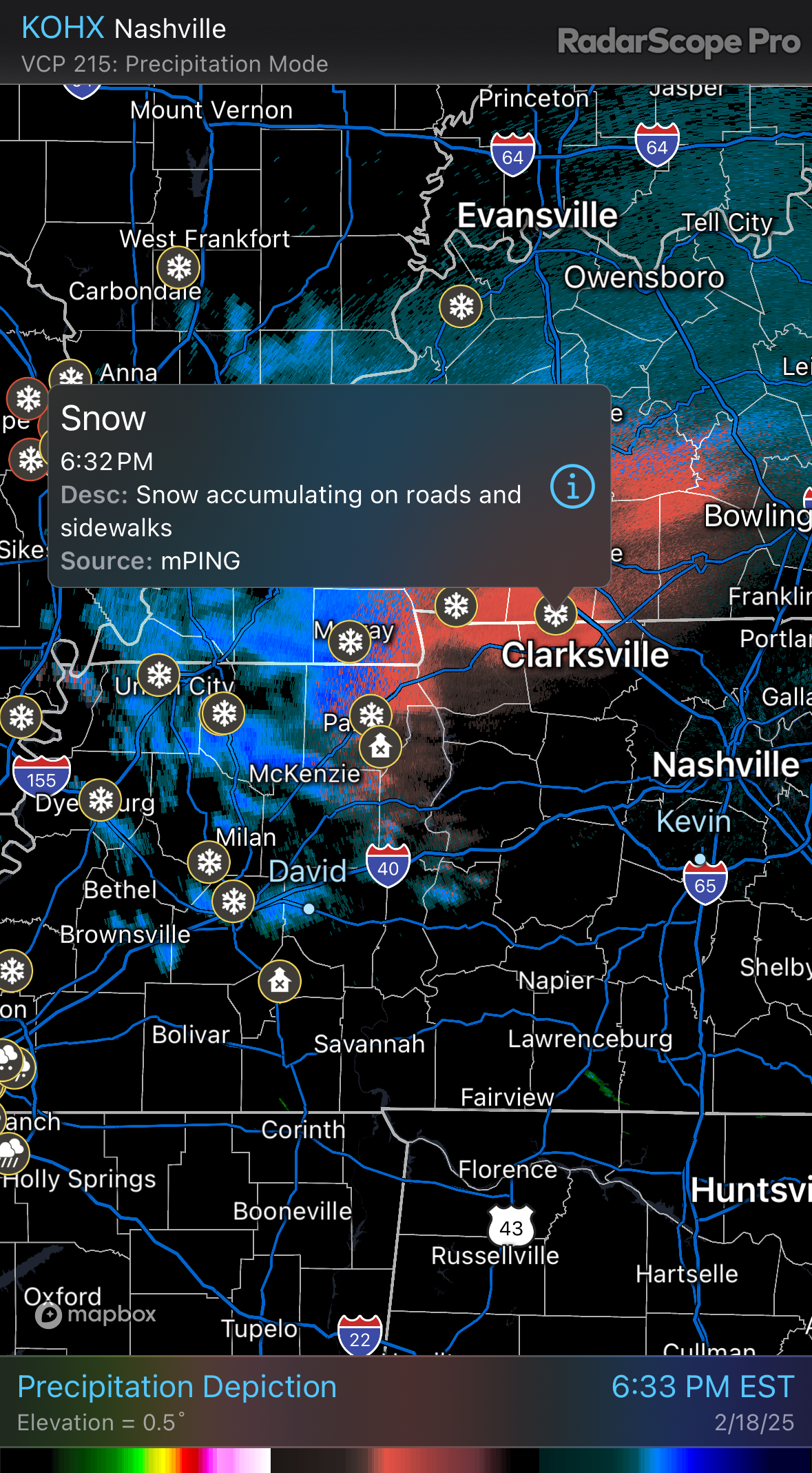
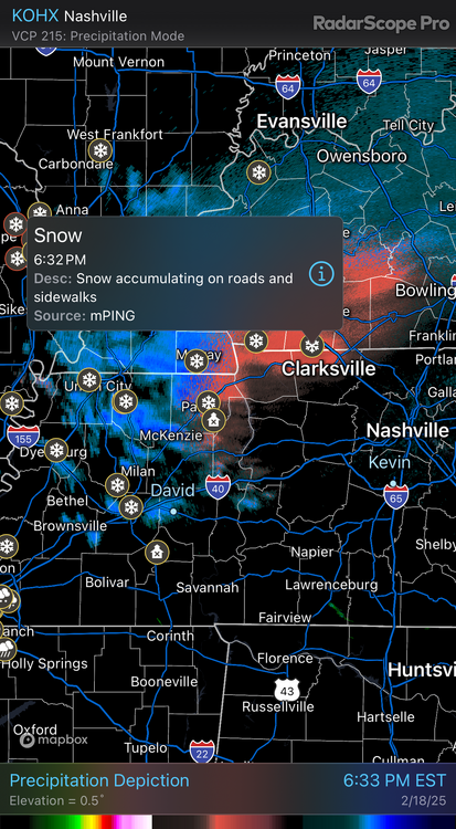
@Holston_River_Rambler here’s the GRAF. Something i didn’t notice is how fast this system is moving. Looks like about 10 to 12 hours of precipitation for Knox…. https://twitter.com/scweather_wx/status/1891797000464613444?s=46&t=LVg8BRWCh1zZb6F_t95EVg
-
The air this morning has that smell to it.
-
That gotta be ahead of schedule
-
So we are starting to adjust to the low qpf bias for middle to late February?