PowellVolz
-
Posts
3,819 -
Joined
-
Last visited
Content Type
Profiles
Blogs
Forums
American Weather
Media Demo
Store
Gallery
Everything posted by PowellVolz
-
It’s so hit or miss but 75% a miss. Most of the time we get down slopped bad unless the flow has a little more W to E direction in it. When the DGZ is lower, the problem is still there but not as bad.
-
I wasn’t trying to correct you. I’m not one of those.
-
If the DGZ is saturated and below 850, that will help the valley. A low and saturated DGZ tends to bank up against the mountains and backup into the valley but it takes a little time for this to happen. It basically acts like fog in the valley caused by an inversion. It can’t can’t go anywhere. A low DGZ also helps the down slope issues off the northern plateau into the valley. Getting interested now lol
-
what site is that? Link?
-
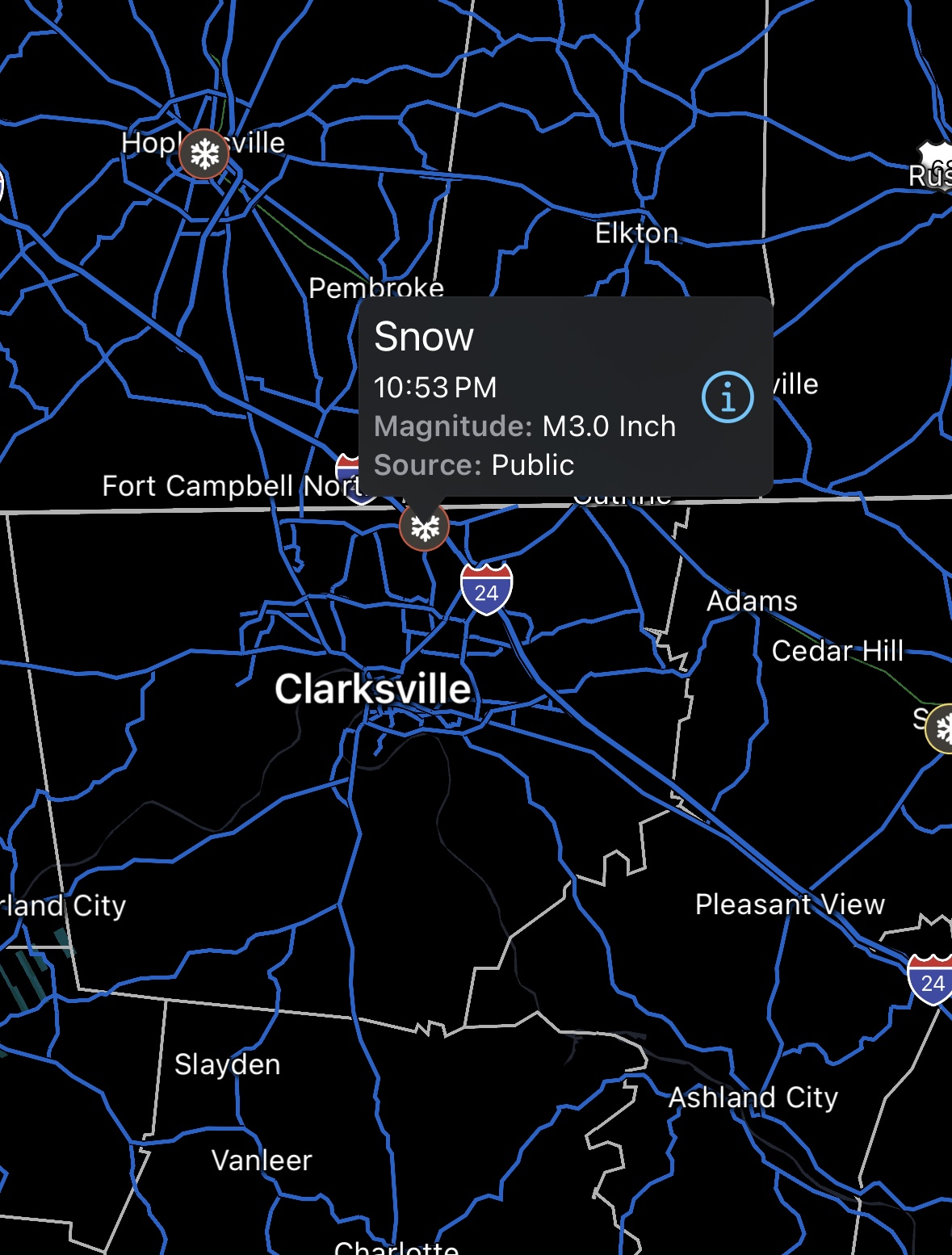
Looking at state wide totals and assuming qpf was the same, I don’t believe we had down sloping issues in the valley. Pretty much 2” state wide other than the Clarksville area. I haven’t seen anything from @John1122 Its possible he had 4 or 5 inches.
-
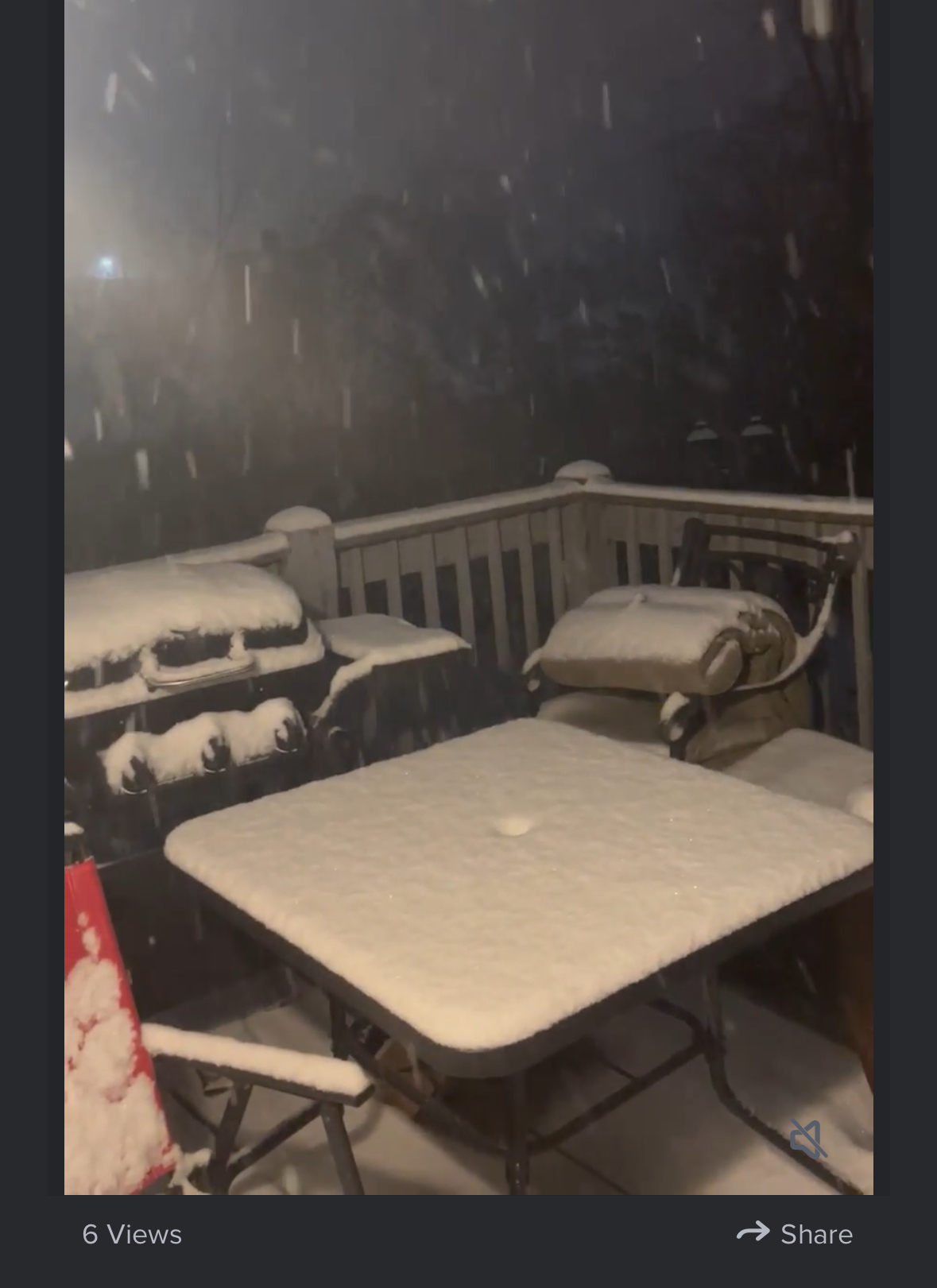
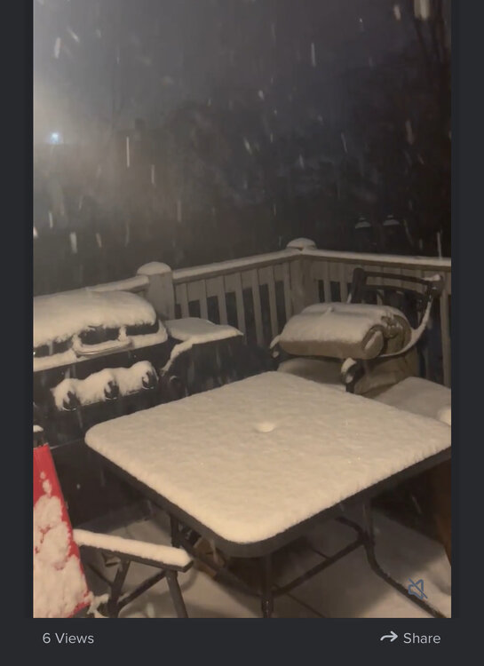
I’ve got right at 2” this morning on elevated surfaces.
-
It’s not really a ULL (upper level low), it’s more of a short wave on the upper level trough that will swing though tonight. It’s not really a benefit to the valley, more in the foothills, plateau and mountains.
-
In a way… the flow on the radar kinda reminds me of the overrunning event from Jan 24.
-
Yep… some of the mods are showing that belt on both sides of 40 now. It matches up with the radar.
-
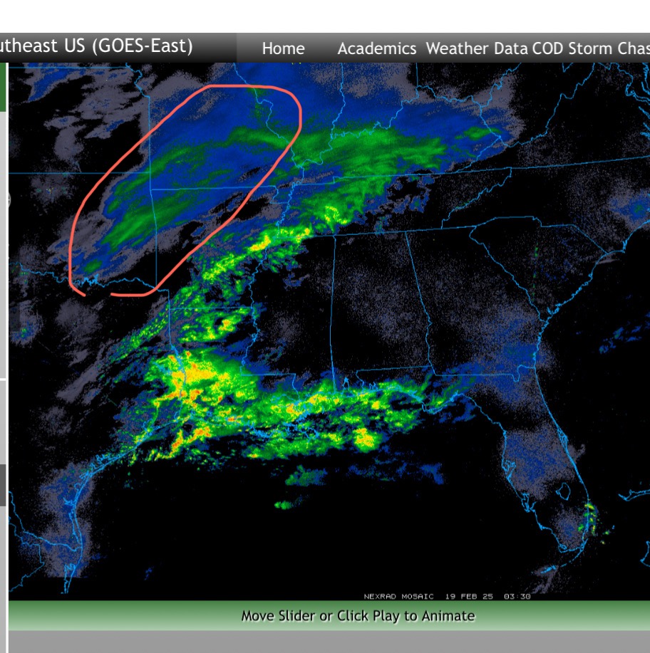
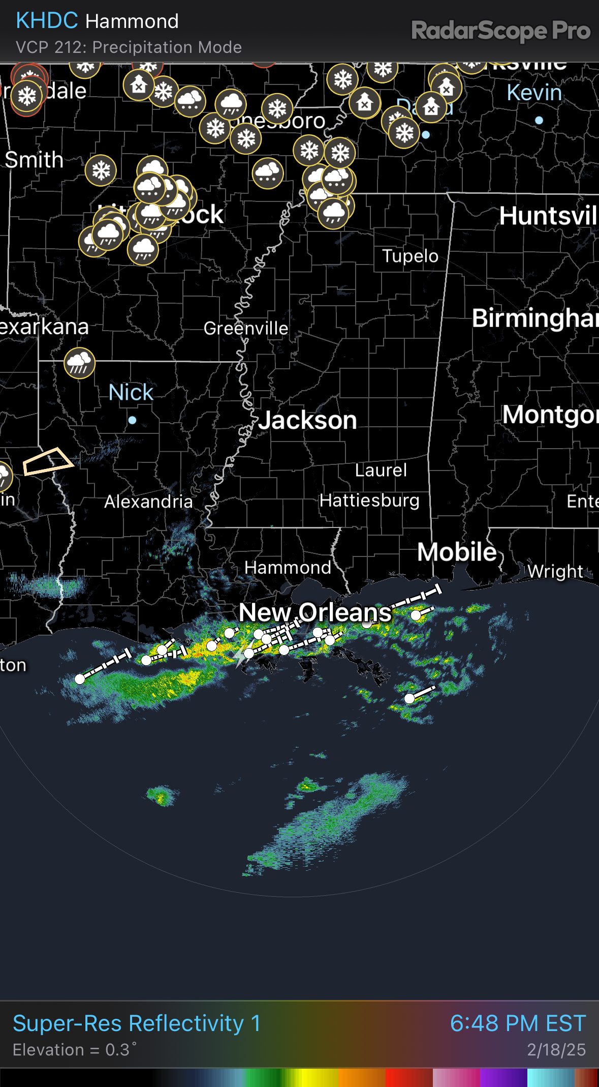
I’m starting to believe by looking at the radar that the belt of heavier snow is further south than the mods said. I’ve only seen one, 3” report in Kentucky. Would be real nice if that belt of snow holds together that’s tracking right on 40 towards ETn.
-
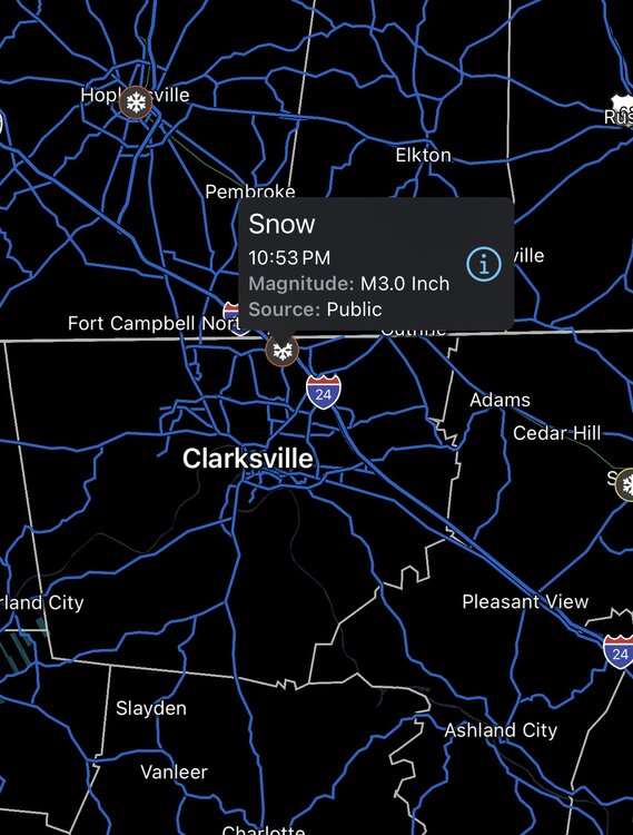
Ping report in Clarksville with 3”.
-
The air is dry but not as much as I expected. A couple PWS in my area showing humidity in the mid 70’s. 33/27
-
-
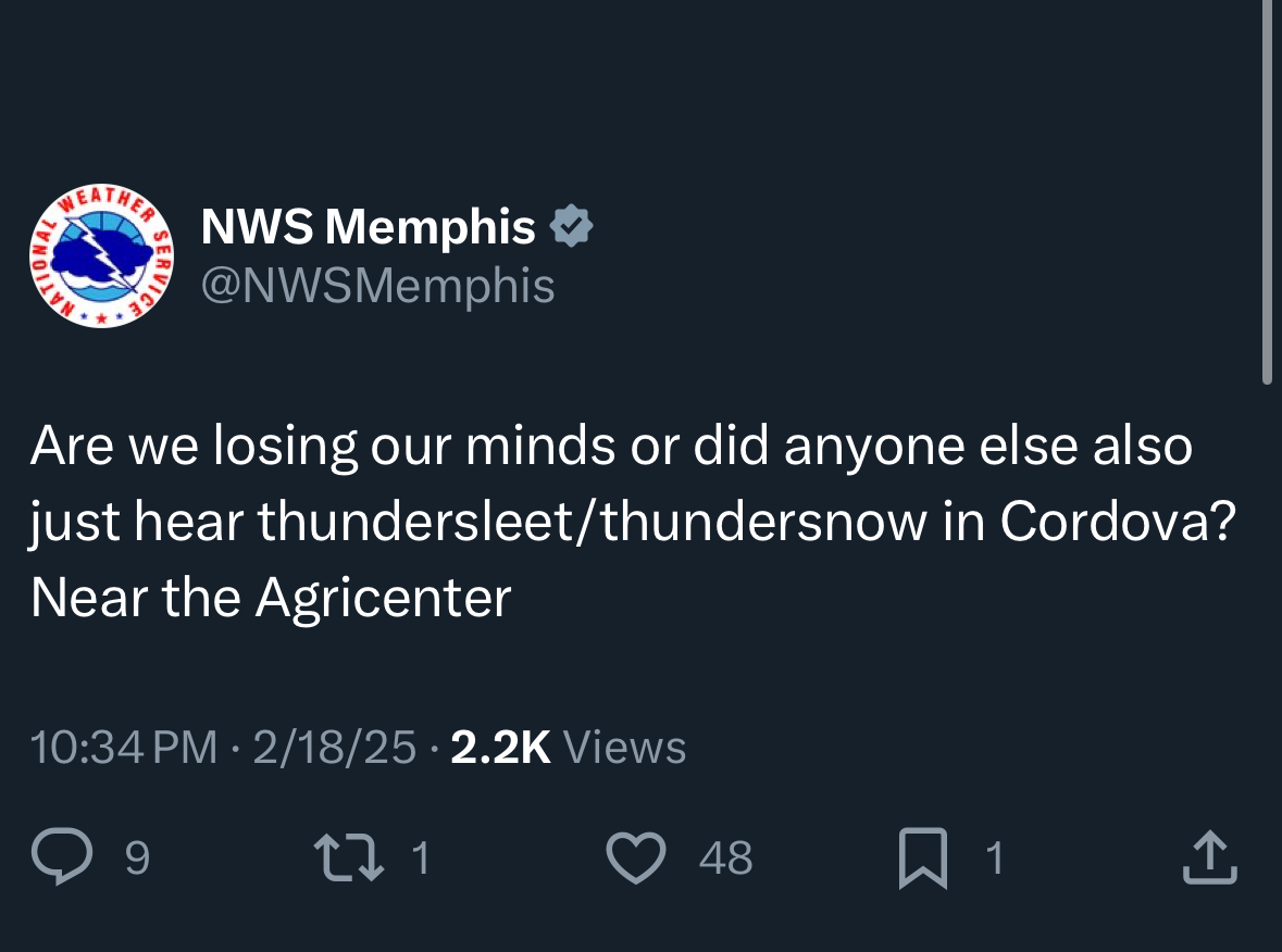
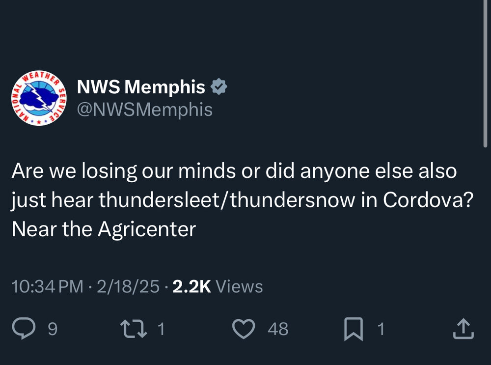
NWS in Memphis just tweeted they believe they just had thundersnow
-
Is this the upper level trough catching up? I don’t know how to make a gif but it’s definitely catching the back end.

-
I’m still pessimistic here but there’s a nice firehose set up from the Arklatex region moving into N Miss and W Tenn that’s on a track for ETn if it holds.
-
Starting to see some reflections on the plateau which probably means it’s reaching the ground considering how bad the radars are in that area, especially for snow.
-
I feel like we have done well over the last 4-5 years with the higher end storms. I’ve had at least 4, 8”+ since the Christmas Eve Eve snow. I’ve also had a handful of 2”-4” snows. But I’m greedy so any chance of snow that doesn’t work out is a face palm.
-

Historic Tennessee Valley Cold, Snow, and Ice Events
PowellVolz replied to Carvers Gap's topic in Tennessee Valley
We have a lot of historical snows in the ETn valley but the majority of our history is watching other people get snow. Lol -
Hope the GOM gets in the game soon or the Euro might be right.

-
Hope no one gets hungry. lol.. just kidding
-
After seeing the SERF QPF average of .4” liquid, 2”-4” is definitely in play if that’s right.
-
Interesting from the SREF Plumes…. BNA 2,75” average, .3” qpf TYS just a hair below 3” but the qpf is .4” 75% snow, 25% liquid. if Knox area gets .4” qpf, I feel pretty good about 2” or so, obviously assuming it’s right.
-
-
oof……