bl5585
-
Posts
58 -
Joined
-
Last visited


-
12z is 10 mb weaker at 06z.
-
They did also leave off the Indiana counties.
-
Seems like they are using this data for their afternoon forecast. Earlier it looked closer to the 12:20PM version.
-
I've been having issues with it on RadarScope. I ended up switching to MDW and ILX to view my area.
-
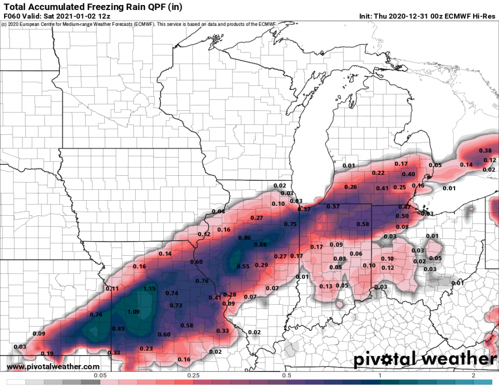
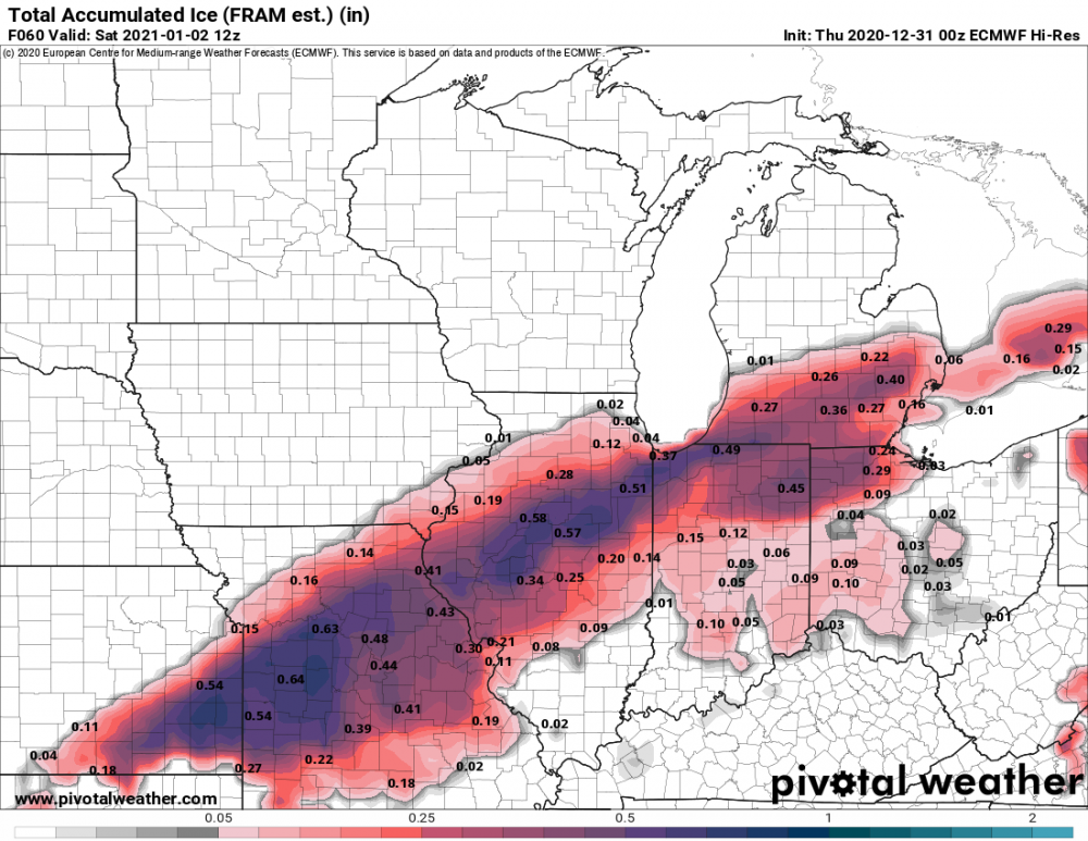
Seems like they were pretty bullish with my area this afternoon afternoon as well. They have me at >0.15 ice accumulation which seems to be a bit excessive.
-
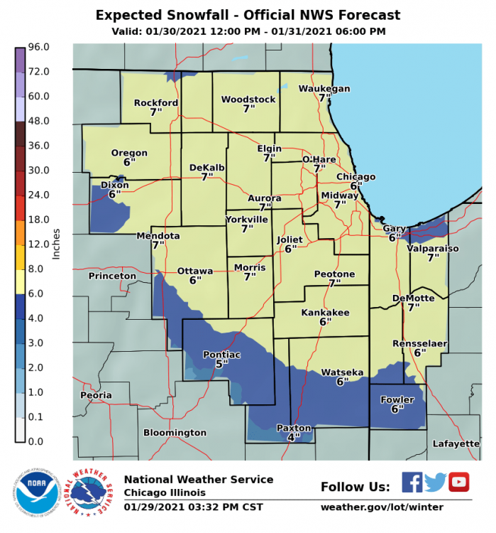
LOT just put up a WSW for every county along/north of I-80 with the exception of Porter in Indiana.
-
Pretty decent shift south over the day today.
-
I was really hoping for around 6" or a little more even if we weren't in the main band but it does seem like that's becoming more unlikely. I know this is setting the bar really low but with how the last few years have gone, it would be nice to at least get the grass covered and get a wintery look which appears to be reasonable to expect at this point.
-
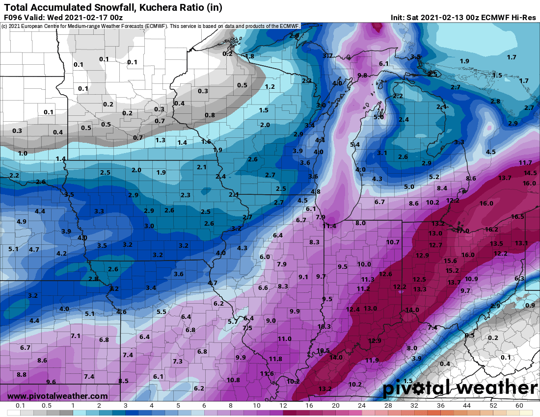
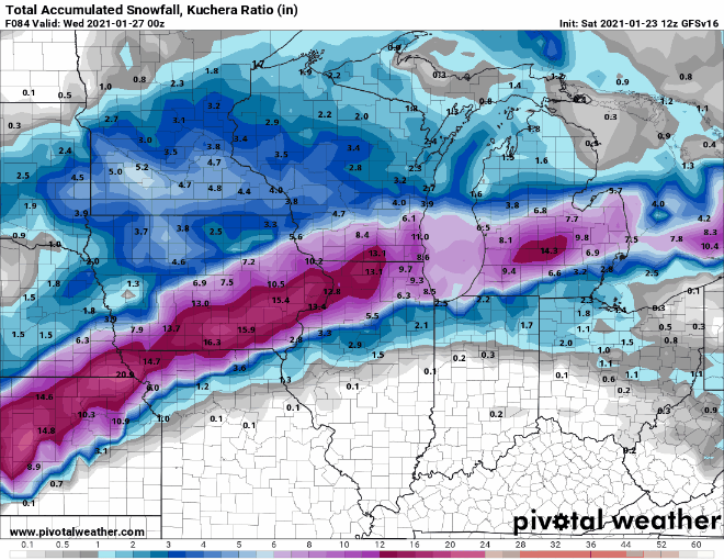
That map is a mess since it includes both events. This isn't perfect but it at least gives a better rough idea of this event. There is still a bit more going in Ohio but the placement is right.
-
As someone south of I-80 how concerned should the general area be about the ice amounts if solutions like those verify? I know it doesn't take much to cause problems.
-
I'm just hoping we can get in the main band with minimal/no mixing. I know it's still entirely possible but I'm at least feeling a bit better about it than I did last night.
-
Starting to feel a bit more hopeful about those of us in and south of the 80 corridor in LOT. It's been a while since we've gotten a solid hit of snow.
-
-