KeenerWx
-
Posts
869 -
Joined
-
Last visited
About KeenerWx

Recent Profile Visitors
6,762 profile views


-
Heavy storm for sure. Looks like we’ll have some thundery rain for quite some time.
-
Dang destructive tag w/100 mph winds on that warning in Lake County. Coming this way…
-
Yeah solid thunder here already. We’ll see how things hold together.
-
To my dusty cobwebbed eyes, it looks like the threat may have modulated downward for much of LOT CWA. Window for recovery is fairly brief after morning to early afternoon convection.
-
Maybe can score a short “chase” again.
-
Nice. D2 Moderate.
-
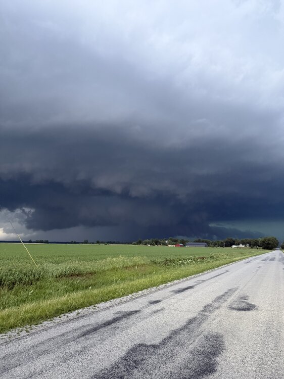
Video - Certainly could have gotten closer for better shots, but didn’t care to. Was a beautiful storm to watch.
-
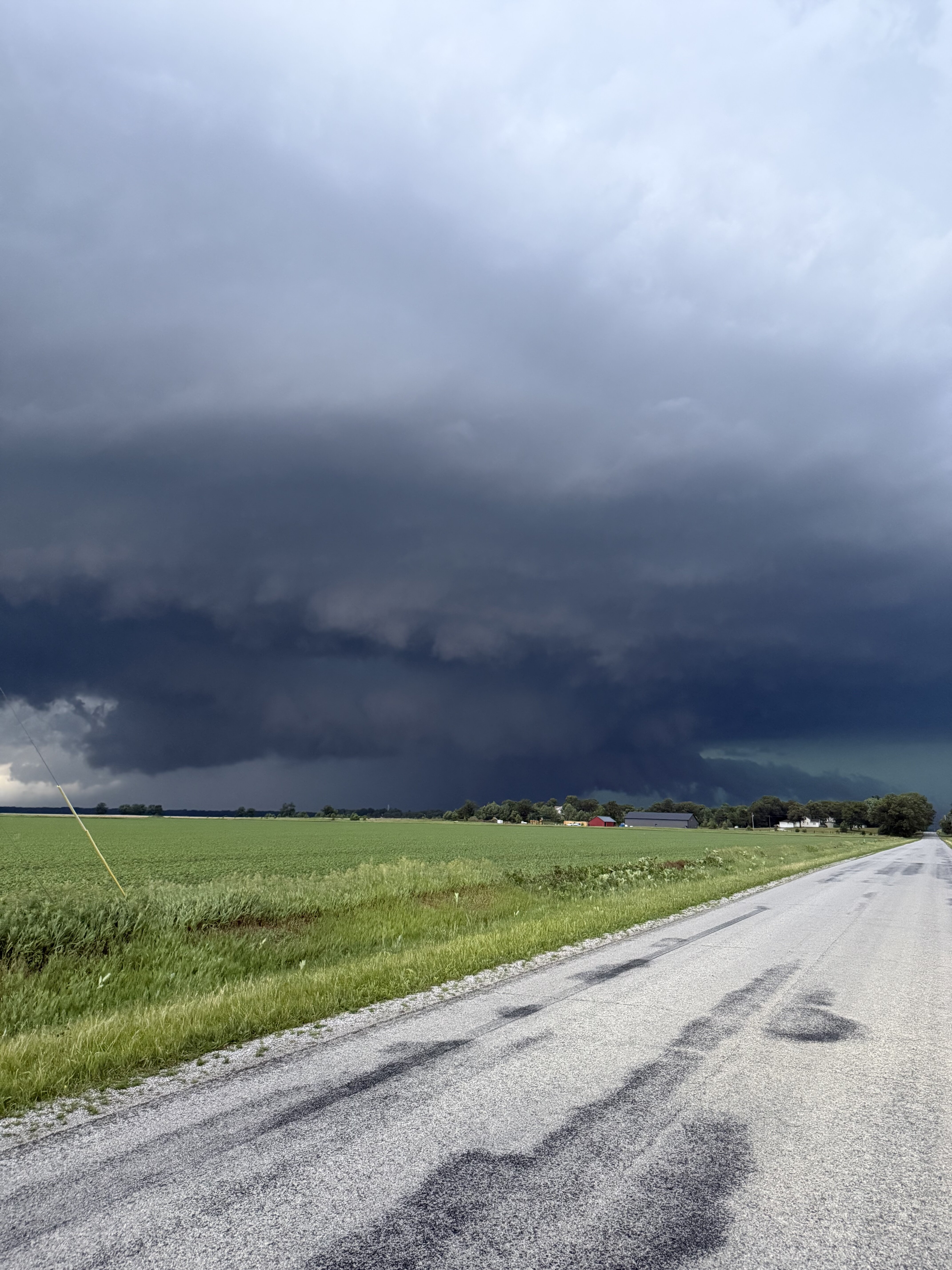
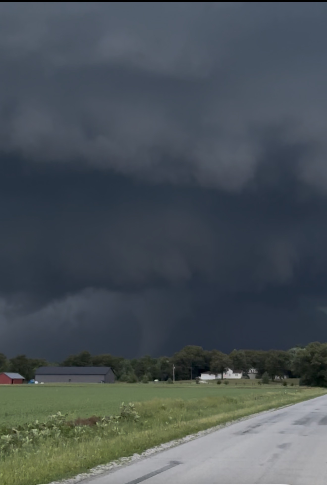
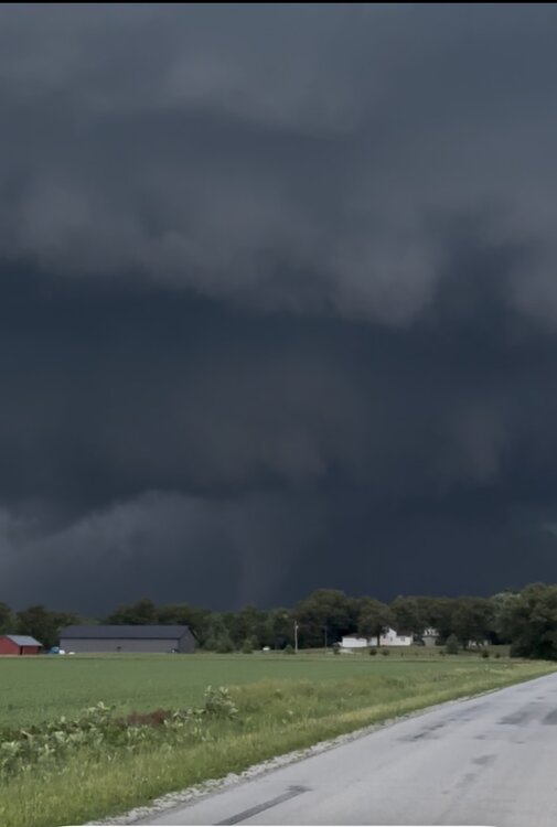
Looking north at roughly the time of this radar scan. It’s from a video I took on my phone lol. Quick “chase” today as I just had to hop to an area of fields just north of my house
- 260 replies
-
- 11
-

-
Similar experience. Had a solid light & sound show for about an hour.
-
May locally grab 6th SVR watch of the season.
-
Expansion of slight risk today into portions of the sub. Suppose the possibility of mildly spicy storms makes up for the blowing dust we have to contend with today.
-
Watching the line come in on the screened in porch. Lovely breeze and a chorus of crickets, frogs & rolling thunder. S tier entertainment.
-
Probably about an hour to hour and a half until arrival here. Shall see if it still can throw some punches.
-
Yeah, we should be able to squeeze a decent late night storm. Despite being outside of the main action area(s) these past few days, has been nice to grab consistent chance at thunder.
-
Should get a round two of boomers late tonight. Not counting on anything svr, but perhaps some enjoyable night time acoustics. House windows have been opened the past couple of days and it’s been wonderful.