Wurbus
-
Posts
550 -
Joined
-
Last visited
Content Type
Profiles
Blogs
Forums
American Weather
Media Demo
Store
Gallery
Everything posted by Wurbus
-
January 2021 Medium/Longterm Pattern Discussion.
Wurbus replied to AMZ8990's topic in Tennessee Valley
Round 2 on the GFS next week on NYE. Looks almost identical to the recent snowfall but gets more of the state involved. -
January 2021 Medium/Longterm Pattern Discussion.
Wurbus replied to AMZ8990's topic in Tennessee Valley
Looked to me that the Euro still had the system, just after New Years, in the gulf; but it got suppressed this run and fizzled out. -
Christmas Eve/Christmas 2020 Arctic Express Snow Obs.
Wurbus replied to John1122's topic in Tennessee Valley
Just for some reference. Todd Howell just said this was the 3rd largest snow in Knoxville on Christmas Eve and the largest since 1966. -
Christmas Eve/Christmas 2020 Arctic Express Snow Obs.
Wurbus replied to John1122's topic in Tennessee Valley
It has stopped here near Karns. I just measured the patio table and it was just a hair short of 4 inches. Very pleased with the way this system turned out. We will see if we get anymore tonight or tomorrow. -
Christmas Eve/Christmas 2020 Arctic Express Snow Obs.
Wurbus replied to John1122's topic in Tennessee Valley
Looking at the radar, it looks like they even have flakes all the way to Atlanta. -
Christmas Eve/Christmas 2020 Arctic Express Snow Obs.
Wurbus replied to John1122's topic in Tennessee Valley
I'm surprised at how quickly it started sticking. Roads are already starting to get white as well. -
Christmas Eve/Christmas 2020 Arctic Express Snow Obs.
Wurbus replied to John1122's topic in Tennessee Valley
Now it is all snow in Karns. -
Christmas Eve/Christmas 2020 Arctic Express Snow Obs.
Wurbus replied to John1122's topic in Tennessee Valley
Just switched over to snow here in Karns area. Edit. Still mixing with rain a bit -
Dandridge Dollop 12/24/20 Storm Thread (Winter Wonderland)
Wurbus replied to AMZ8990's topic in Tennessee Valley
Knoxville down to .5 inch Plume average. Not a great sign for the NAM. -
Dandridge Dollop 12/24/20 Storm Thread (Winter Wonderland)
Wurbus replied to AMZ8990's topic in Tennessee Valley
GEFS Snow Mean. Lot of the "finger" looks, so I think it is really going to depend where those banding features setup.
-
Dandridge Dollop 12/24/20 Storm Thread (Winter Wonderland)
Wurbus replied to AMZ8990's topic in Tennessee Valley
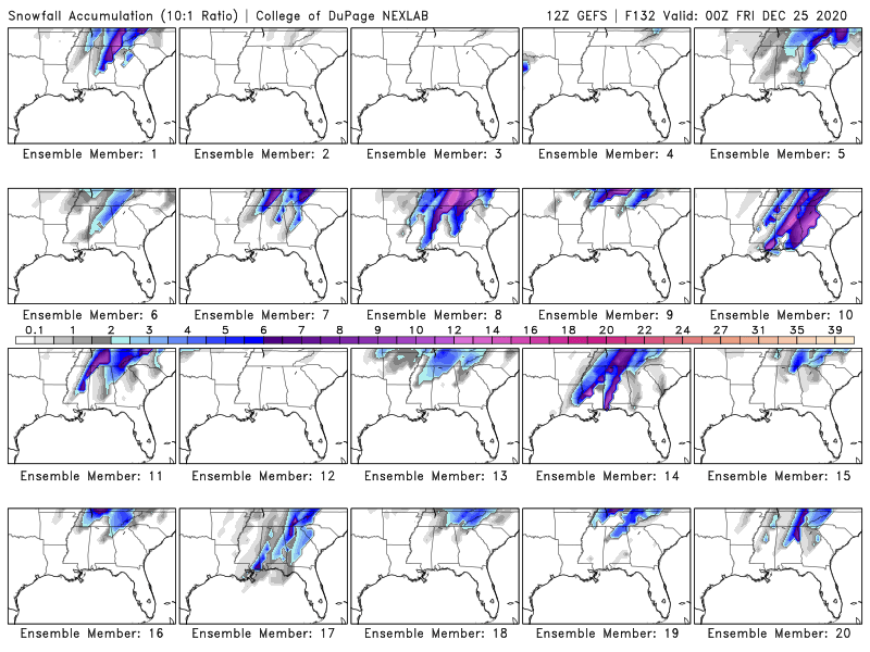
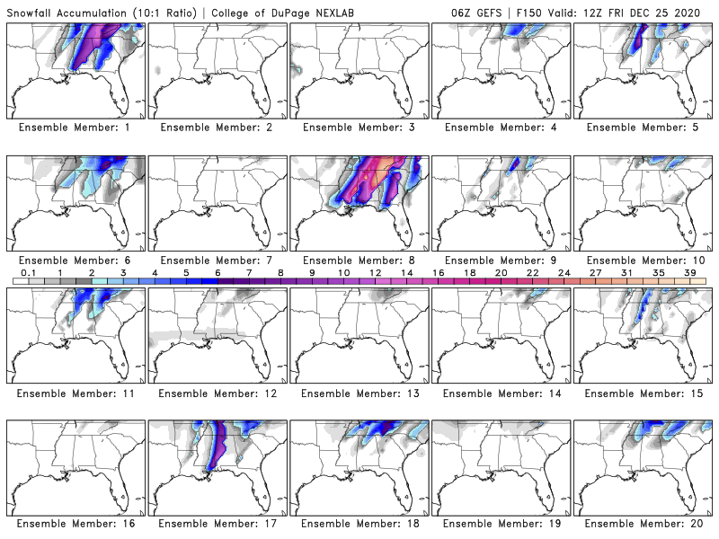
And one that shows 18 inches! Some of those are on steroids -
Dandridge Dollop 12/24/20 Storm Thread (Winter Wonderland)
Wurbus replied to AMZ8990's topic in Tennessee Valley
-
Dandridge Dollop 12/24/20 Storm Thread (Winter Wonderland)
Wurbus replied to AMZ8990's topic in Tennessee Valley
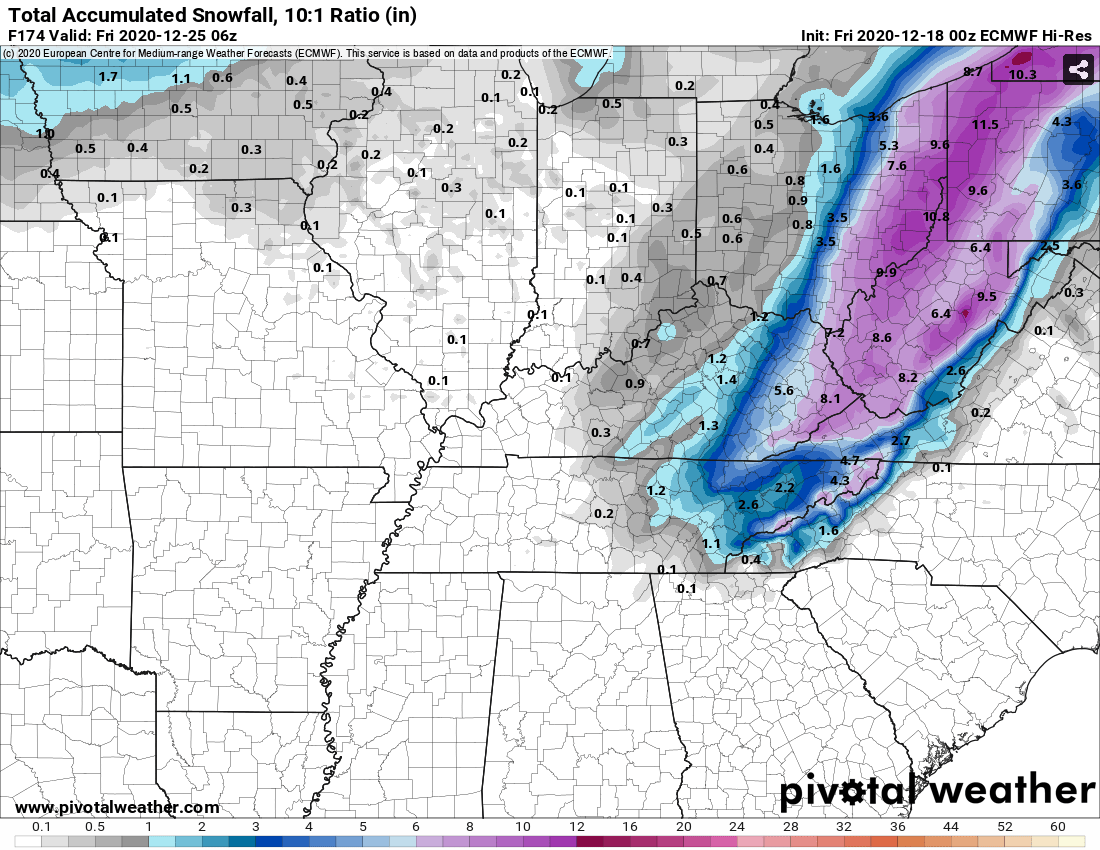
Other than NE TN and the mountains, it appears to be trending the wrong way for most of us. Still snowing in NE TN on this snow map through 84.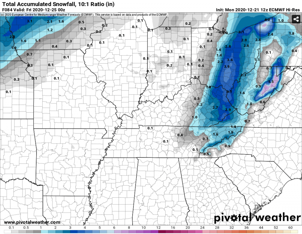
-
Dandridge Dollop 12/24/20 Storm Thread (Winter Wonderland)
Wurbus replied to AMZ8990's topic in Tennessee Valley
Euro looks like it is going to agree with the Ukie -
December 2020 Medium/Long Term Pattern Discussion.
Wurbus replied to John1122's topic in Tennessee Valley
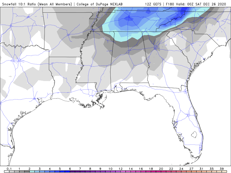
Pretty good snow mean on the GEFS.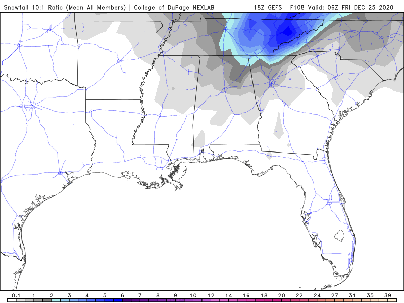
-
December 2020 Medium/Long Term Pattern Discussion.
Wurbus replied to John1122's topic in Tennessee Valley
Wake up or be up all night watching it snow? -
December 2020 Medium/Long Term Pattern Discussion.
Wurbus replied to John1122's topic in Tennessee Valley
If this does come to fruition, would the changeover to snow in eastern areas be happening Thursday evening/night? I always have trouble reading the timing on the models. -
December 2020 Medium/Long Term Pattern Discussion.
Wurbus replied to John1122's topic in Tennessee Valley
Most GEFS members agreeing with the GFS. I count about 75% of the members showing roughly the same thing as the GFS. CMC is showing some light snow across most of the forum area after the front moves through, but not as quick of a changeover as the GFS.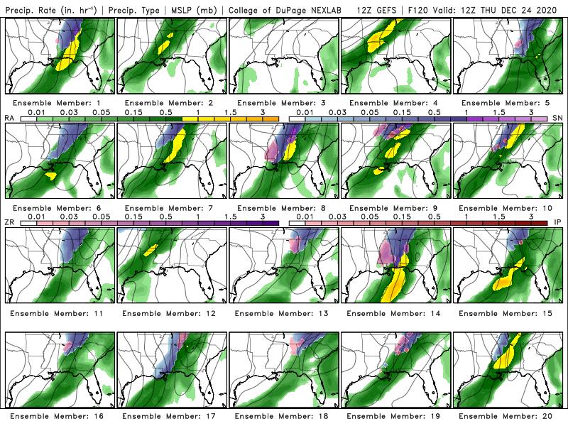
-
December 2020 Medium/Long Term Pattern Discussion.
Wurbus replied to John1122's topic in Tennessee Valley
Man. E3 on the 6z GEFS is a sight to behold.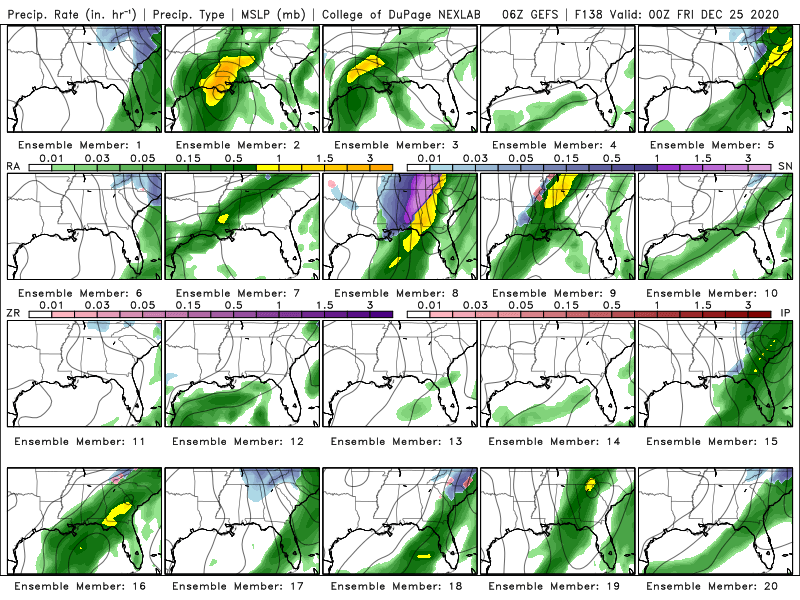
-
December 2020 Medium/Long Term Pattern Discussion.
Wurbus replied to John1122's topic in Tennessee Valley
We definitely have 2 camps and we will just have to wait and see which model caves first. I believe Euro caved to GFS during the last system so we shall see. My guess is we wind up with a blend of the two. -
December 2020 Medium/Long Term Pattern Discussion.
Wurbus replied to John1122's topic in Tennessee Valley
I'm just going to ignore that Euro run and ride the GFS for the next 5 hours. -
December 2020 Medium/Long Term Pattern Discussion.
Wurbus replied to John1122's topic in Tennessee Valley
Doesn't all the models show that low in the Lakes region ahead of the front and then the new low develops in the south along the front? -
December 2020 Medium/Long Term Pattern Discussion.
Wurbus replied to John1122's topic in Tennessee Valley
GEFS has decent representation for this far out as well. I agree that I do like the consistent cold front coming through. This should be a fun one to track over the next 5-6 days.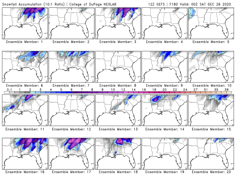
-
December 2020 Medium/Long Term Pattern Discussion.
Wurbus replied to John1122's topic in Tennessee Valley
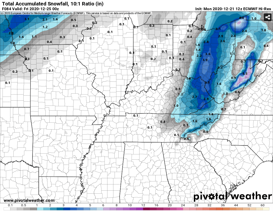
Euro has the low developing along the front. It develops a little late for mid-TN, but East TN gets a little something at the end.
-
December 2020 Medium/Long Term Pattern Discussion.
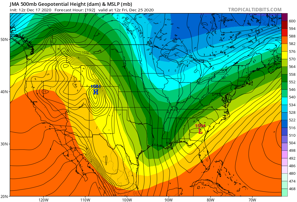
Wurbus replied to John1122's topic in Tennessee Valley
I haven't looked at the JMA model much (honestly don't know what it is usually used for), but this is what it has at 192. Looks pretty good for us to my untrained eye.