Wurbus
-
Posts
550 -
Joined
-
Last visited
Content Type
Profiles
Blogs
Forums
American Weather
Media Demo
Store
Gallery
Everything posted by Wurbus
-
Wind is howling and I hear the rain beating against the windows near Cedar Bluff/Karns. If it switches over soon, and we get pasted, I could see a lot of power outages with trees falling in this wind.
-
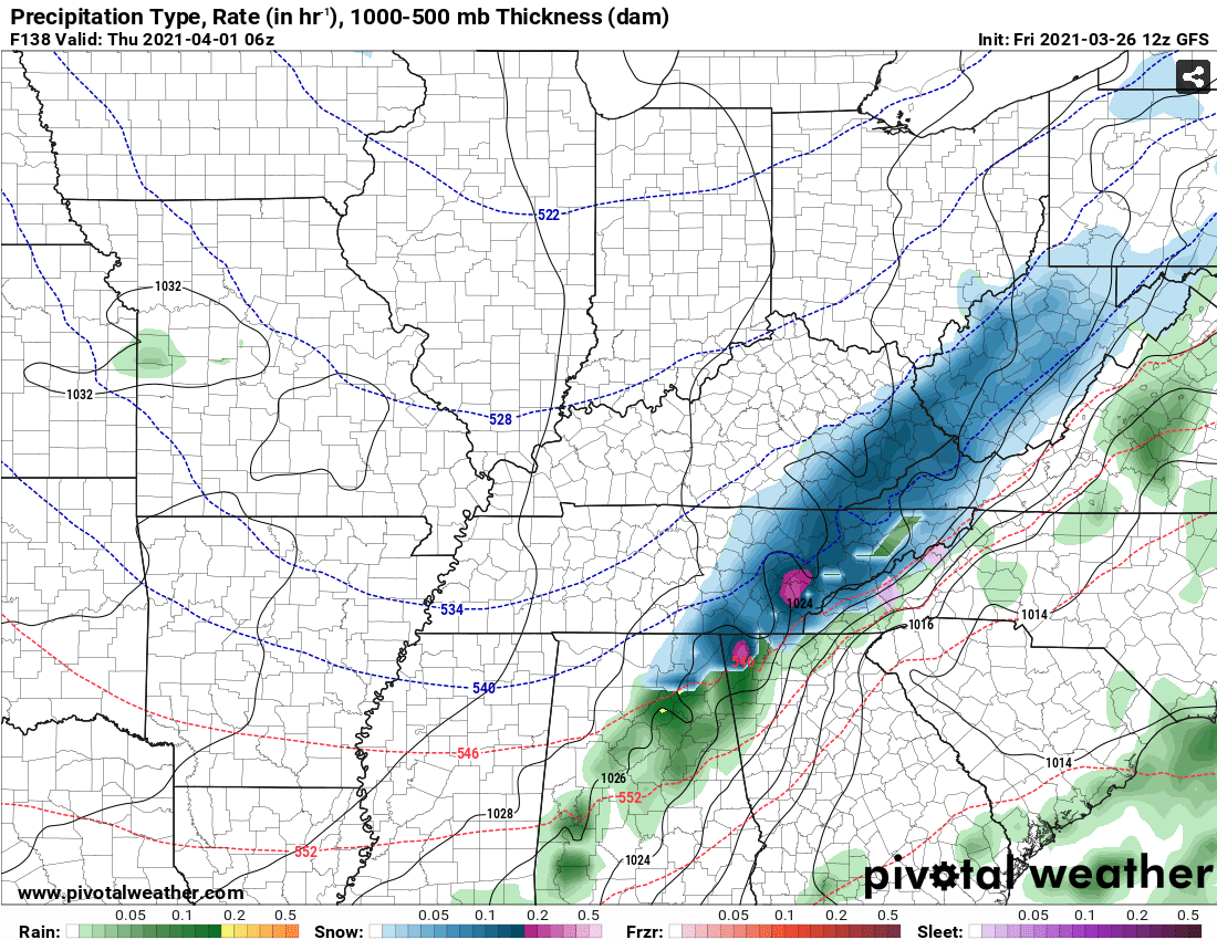
Those rates on the GFS....
-
No one has mentioned it, but just looked at the UKMet on Pivotal and it has basically no snow accumulation outside of the mountains. However, it was more amped with the 2nd system later in the week. Definitely an outlier compared to the other models, but wanted to mention it.
-
HRRR was the same way. Hopefully, this isn't a trend for the rest of the models.
-
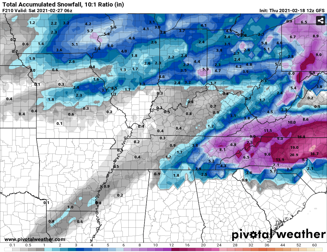
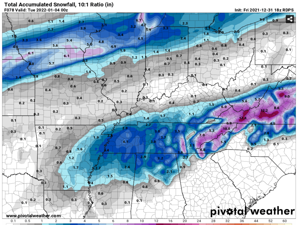
18z RGEM brought it! Nice increase forum wide, besides those 2 pesky snow holes.
-
Plumes had an uptick from 9z to 15z across most Eastern area's. Knoxville only had 1 plume above 4 inches and now has 6 over 4 inches.
-
GFS is playing an April Fools joke

-
TN valley heavy rain/flooding week of whenever
Wurbus replied to janetjanet998's topic in Tennessee Valley
12z models still look on track for 3-6 inches of rain over the next few days. I just had a bunch of water drainage issues fixed around my house a few weeks ago, so this should be a good test for all that work. -
Fall/Winter Banter - Football, Basketball, Snowball?
Wurbus replied to John1122's topic in Tennessee Valley
Weird thing I noticed on the GFS was the snow depth. It shows 8 inches of snow falling in KNX, but a snow depth of less than an inch. I would think IF that much actually fell, we would have at least a couple inches on grassy surfaces. Maybe it is actually showing road snow depth! -
The elusive "It's a week away" storm. Para has it as well, but it is more north and hammers mid-northern KY. CMC is a completely different solution and has the storm in the Midwest.
-
Finally seeing some precipitation near Karns area. Looks like it is mostly sleet with some snow mixed in at the moment.
-
Getting some very fine light flurries here in Knoxville at the moment.
-
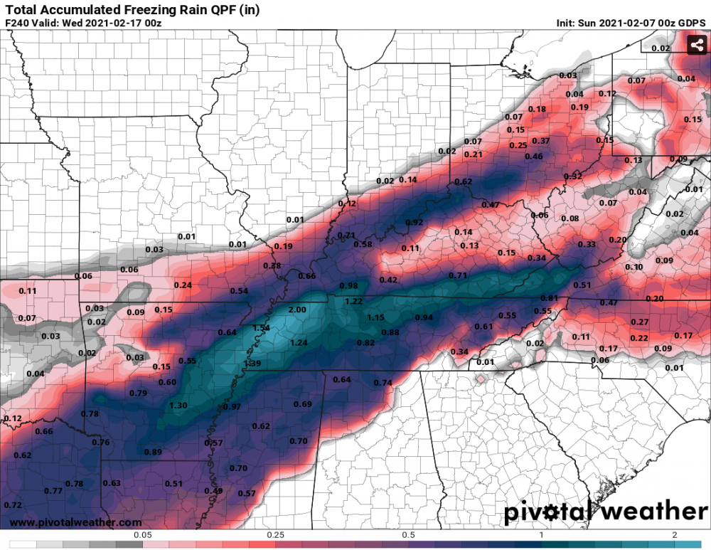
Mostly rain for the 1st system in East TN after the initial onset of FRZ. Middle/West TN still gets in on all the "fun". 2nd system shifted east some, but still all rain for most of middle TN and all of East TN. West TN still has snow/sloppy mess with some backside snow for west/mid TN.
-
FRZ/Sleet across the whole state by 96 except for extreme east TN. Looks like FRZ for Knoxville as well sitting at 32 degrees. We will see if the big chunk of precip comes in as rain or not here in a few.
-
GFS about 4 degrees warmer across the board through 84 compared to 06z.
-
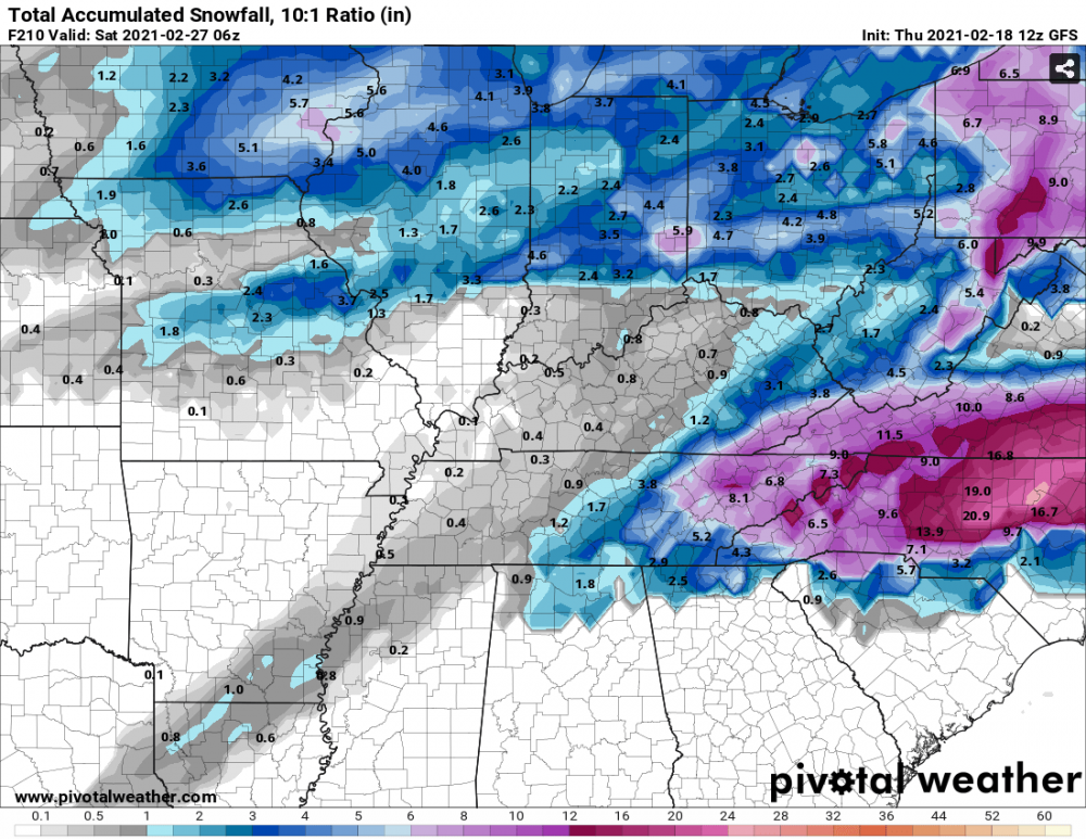
There is a 2nd storm nailing Memphis with snow late next weekend as well. Memphis is going to look like the North Pole if those verify.
-
That is a warm nose from hell. I'm not sure I've ever seen one go all the way up into Ohio
-
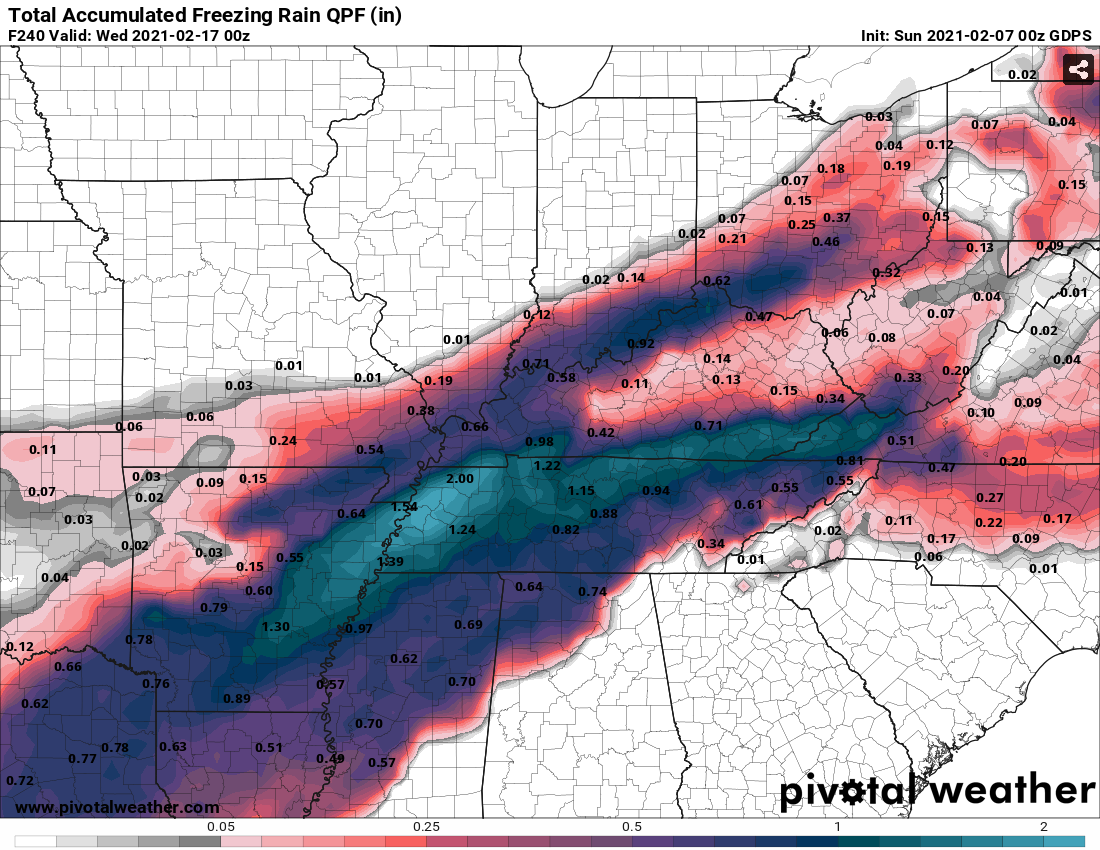
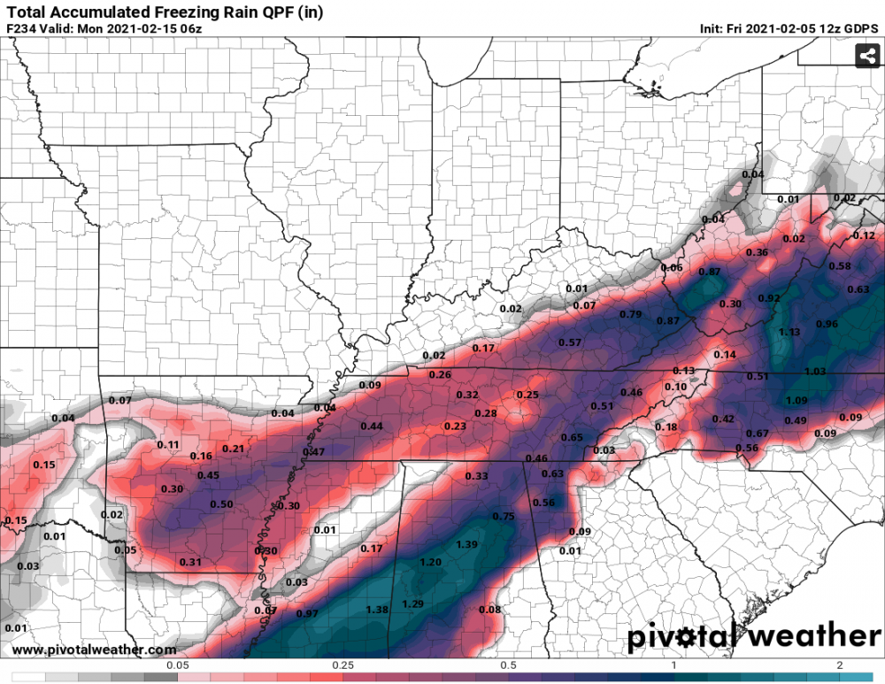
CMC just killed the power across all of TN again.There is still freezing rain coming down in west/middle TN at 240!
-
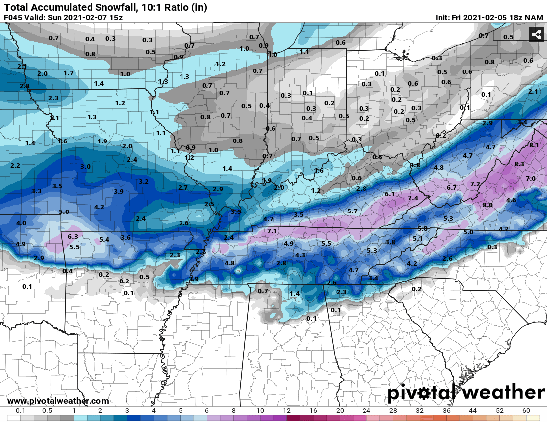
NAM still showing pretty good snow. Looks like an initial thump, and then some backside snow.

-
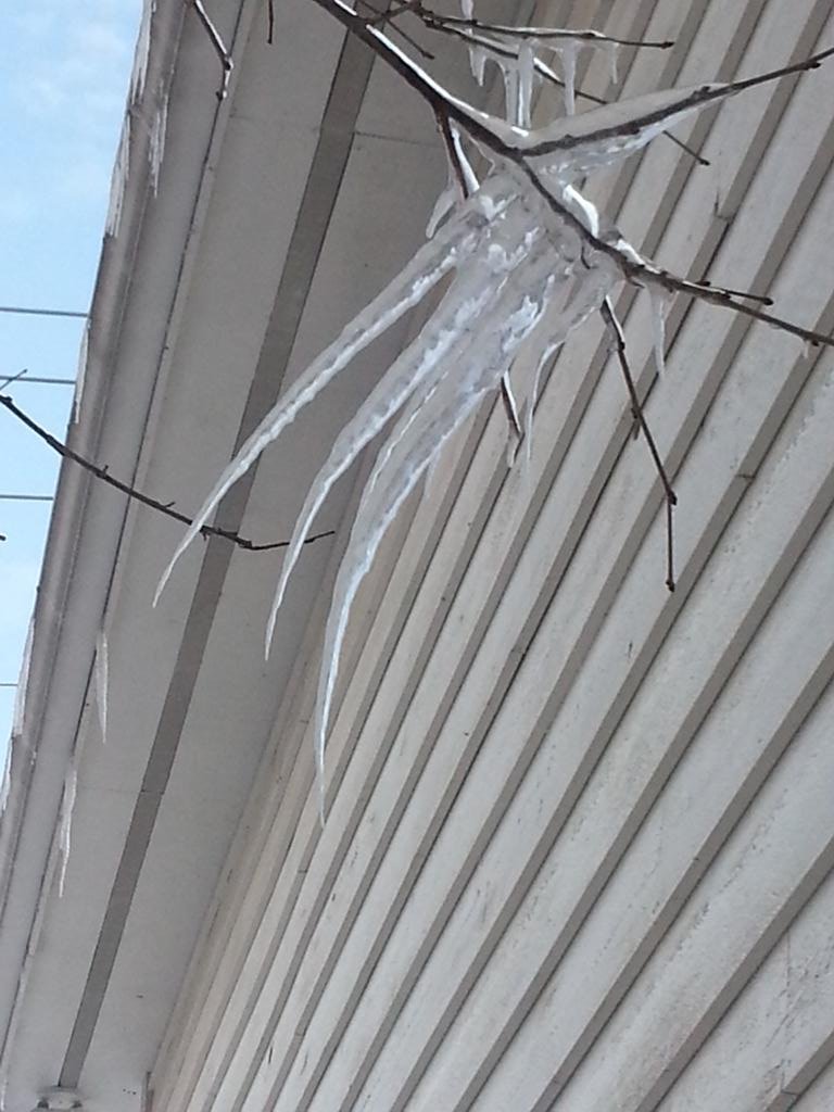
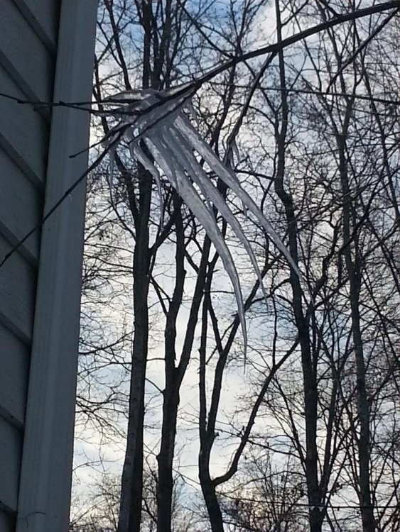
If the upcoming potential ice storm does happen, it reminds me a lot of the storm we had back in Feb 2015, at least IMBY. We had ice and snow, followed by very cold weather and it hung around for awhile. Now the one being modeled on the CMC is much worse. Also, I had an ice, wolverine claw form over several days next to my house back then.

-
Lots of pick and purple on the GEFS members as well toward the end of next week, so definitely a lot of support for a lot of ice for someone in the forum area.
-
Luckily, we still have a ways to go and watching each model run feels like the ups and downs of a basketball game. Euro had all the ice in south Georgia and SC on last night's run, so we will see where it goes on this upcoming run.
-
Single digit and teens for temps as well afterward. That ice won't be melting anytime soon.
-
Icepocalypse. Nearly the whole state gets involved over the run!
-
Nice color coded chart of East/Middle/West TN