downeastnc
-
Posts
9,324 -
Joined
-
Last visited
Content Type
Profiles
Blogs
Forums
American Weather
Media Demo
Store
Gallery
Everything posted by downeastnc
-
Crazy
-
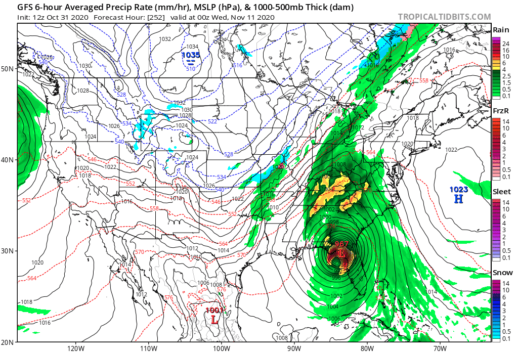
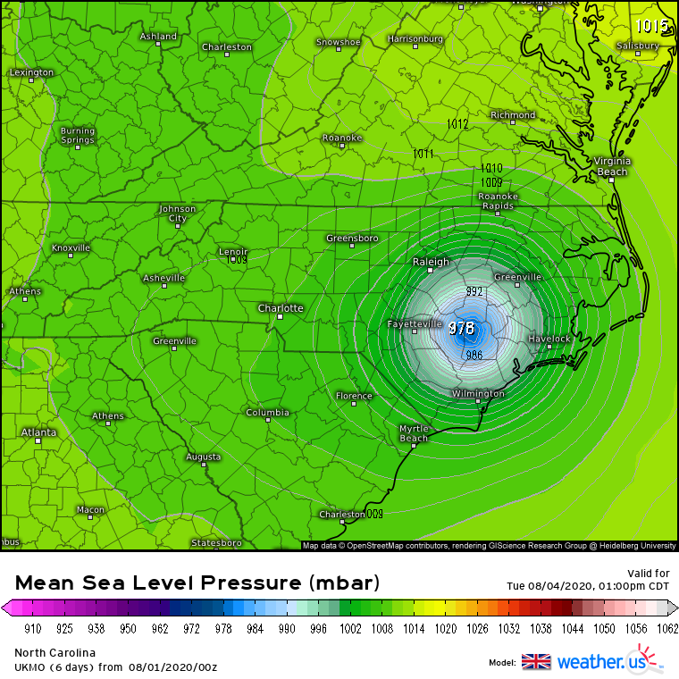
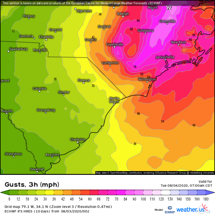
Yeah literally lights out to 10's of millions of people, wind field is just stupid on this thing....and the foothills and mts gets a PRE event that dumps a foot of rain....so the center and east side gets basically a 6-10 hr long 50-70 mph wind event all the way to NE and the west side gets a foot of rain along the entire spine of the Apps.....insanely crazy run, luckily its 10 days out and a weenie run, but this storm is going to form and eventually come north....so maybe its not so far fetched after all.
-
oof.....

-
Just saw a 100 mph gust there in or near Galliano according to this.... https://www.wunderground.com/weather/KGAO
-
This would be a massive issue for the beaches, this wind field is the size of Texas and I imagine the waves and beach erosion would be insane on NC coast.......the GFS has been pretty consistent with this storm the last day or so but it is admittedly way out in fantasy land.....though the GFS did pretty good with the notion of there being a Delta way out in fantasy land too.

-
never warned, about a half mile from the parents and a 1.5 miles from me....
-
Yeah and for a second there I thought we were gonna get smacked around, and we kind of did for 30-45 mins I am sure we had some 60-65 mph type gust and then maybe 45 mins either side of that period we were 40-50......but it was quick 2am to 4am, I will post a few pics later I had to go to work lol.....
-
Lost power at 3am got it back about a hr ago.....hear some chainsaws around the neighborhood and I smelled the pines and heard several trees come down, I think the forward speed kept this thing in check, 4-5 hrs of winds like we had at peak and there would be trees down all over and everyone without power, but it was maybe 2 hrs from the first gust to 40 to the last.....peak was maybe 55-65 mph, it got legit for about 30-45 mins, when the center was almost directly to my west 20 miles or so....and then it was over with winds tapering off to barely TS force again in gust....
-
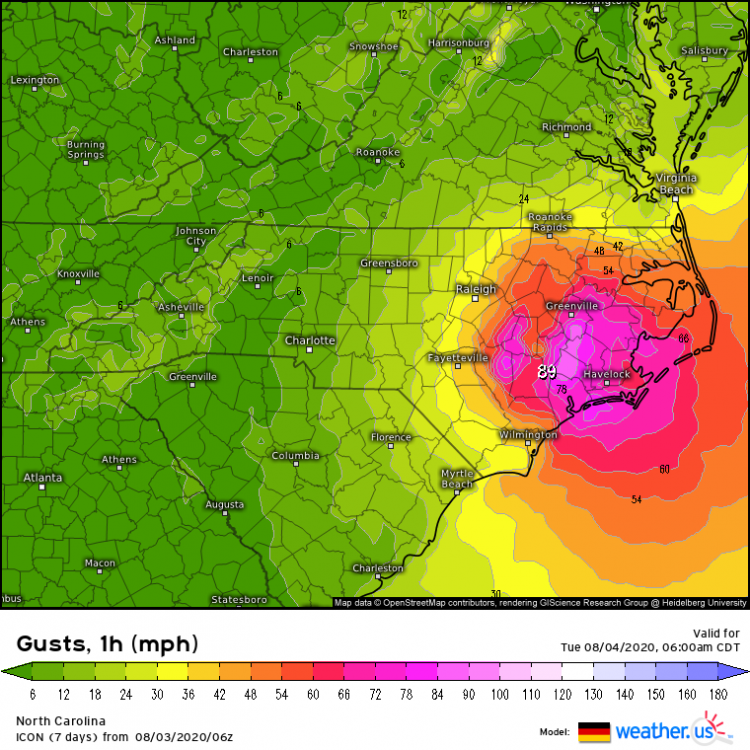
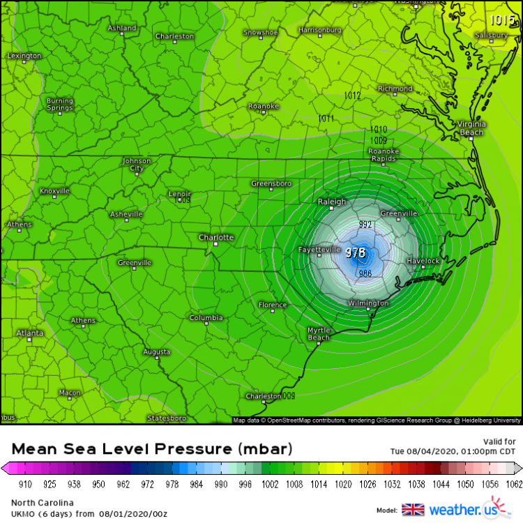
Best guess based on obs so far .....
-
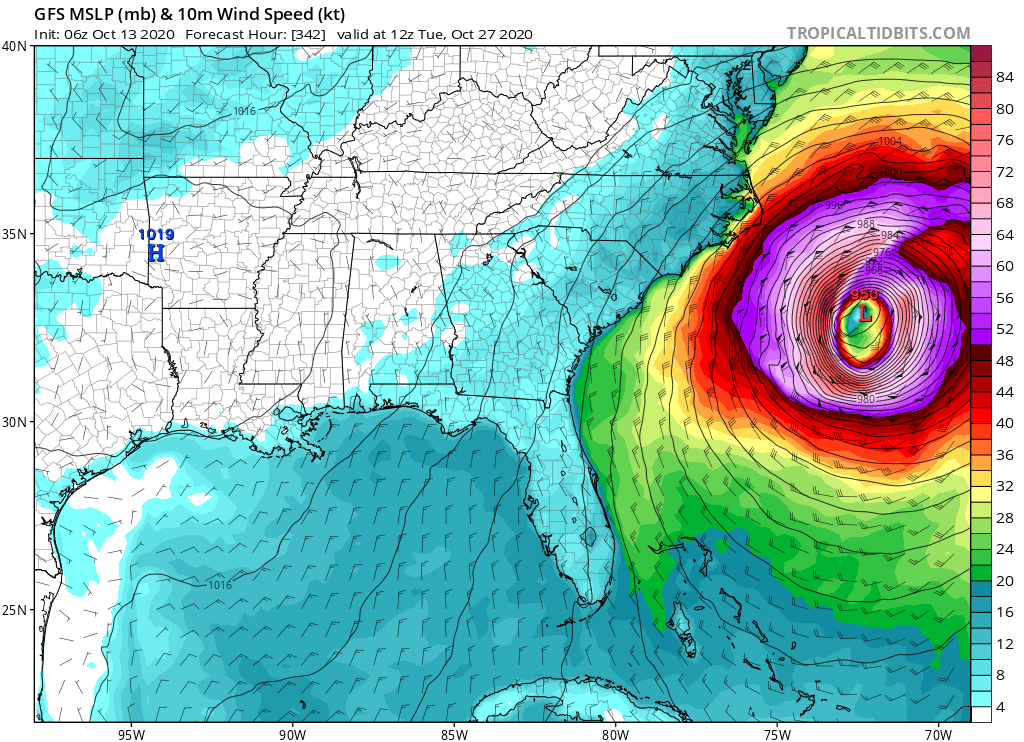
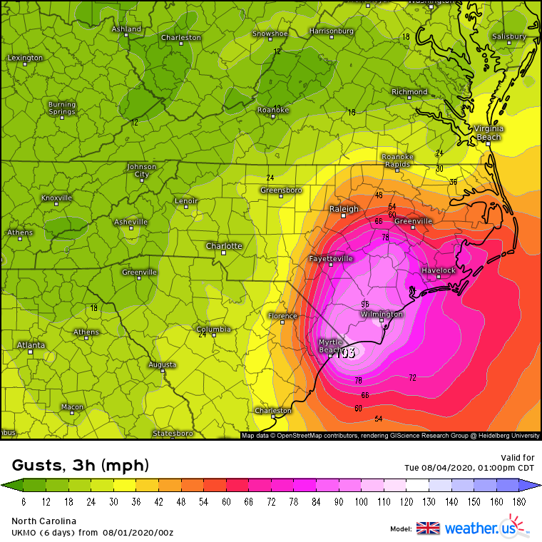
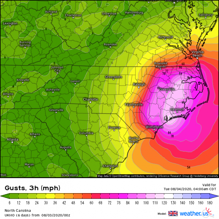
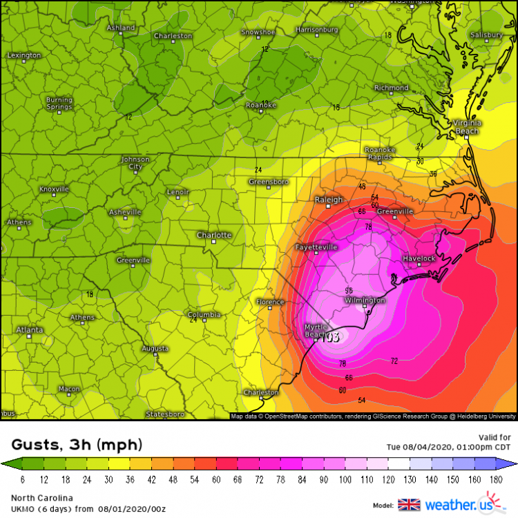
Geez.....these are the wind clown maps and are probably overdone 10% or so....still lights out eastern half of NC..... ICON Euro Ukie
-
Ukie says hi....
-
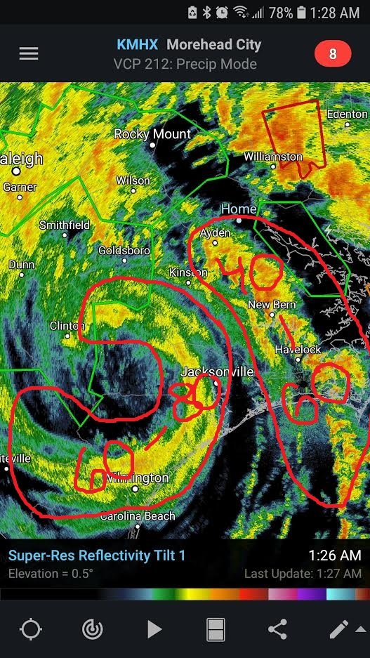
Looks like just south of this one another one is either taking over or there will be two tornados down at the same time
-
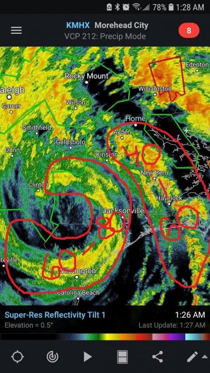
Big TDS with it now.....at work so I cant post it but its intense.....
-
Looking on Google Earth there are several large hog/chicken farms around town and those buildings are made of big long sheets of sheet metal so that would make for a impressive debris sig if they were hit......
-
yeah mid morning to early afternoon could be problematic in central and eastern NC.....soundings are as bad as they get around here.
-
yeah this could get bad Monroe pretty sizable town.....
-
Could be cycling in LA, Arcadia a much larger town looks to be inline if it does.....
-
Yeah hate reading this on the last SPC update... The main question with this outlook is convective mode. There are two possibilities. The first is that the band of thunderstorms will have discrete elements and gaps that will be favorable for supercells and tornadoes. Forecast soundings at 15Z from southern Virginia southward into northern South Carolina show looped hodographs with 0-3 km storm relative helicities in the extreme catogory, generally near or above 600 m2/s2. This would support a threat for strong tornadoes associated with the more dominant supercells. A wind damage and hail threat would be likely with supercells and with the more organized line segments. The second scenario would be that a squall-line is ongoing at 12Z from eastern Georgia northward into the western Carolinas and Virginia. In that case, widespread wind damage would be likely. A QLCS tornado threat would exist with the stronger bowing line segments. Hail would also be possible with the more intense parts of the line. At this time, the outlook reflects the first scenario in which more discrete cells are present across the warm sector at 12Z. In this case, a cluster outbreak of tornadoes would be possible and a strong long-track tornado or two can not be ruled out.
-
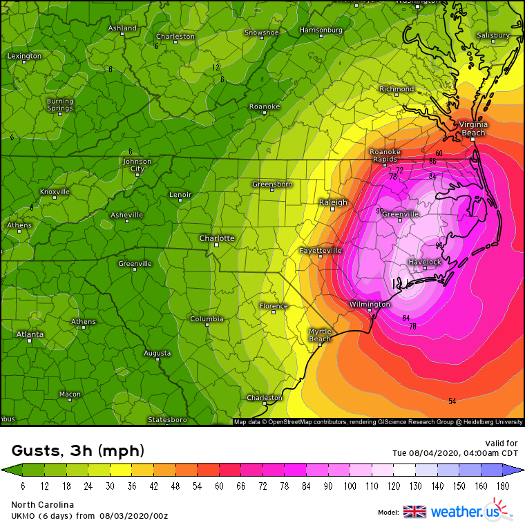
Euro/GFS say it will be a bit windy next week when the big storm rides the Apps with the big high offshore, these are always over done but even if you knock off `15-20 mph from these numbers that still puts us in a wind advisory criteria day with gust to 50ish.....
-
Ukie similar as well.....
-
65 went to grocery store in shorts and a t shirt.....still snow on ground and roofs in a few spots lol....
-
21 degrees last night makes this the first night we have been below 25 all winter.....in fact we have only been below 30 a total of 15 times all winter.
-
-
I am at work now and I actually got 1-2" more at my house than here (about 10 miles north of my house) but ground still covered, the wind was from behind the building so the ground closest to building was protected