SteveVa
-
Posts
355 -
Joined
-
Last visited
Content Type
Profiles
Blogs
Forums
American Weather
Media Demo
Store
Gallery
Everything posted by SteveVa
-
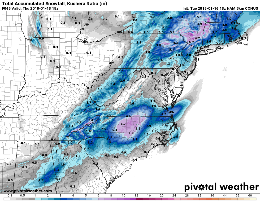
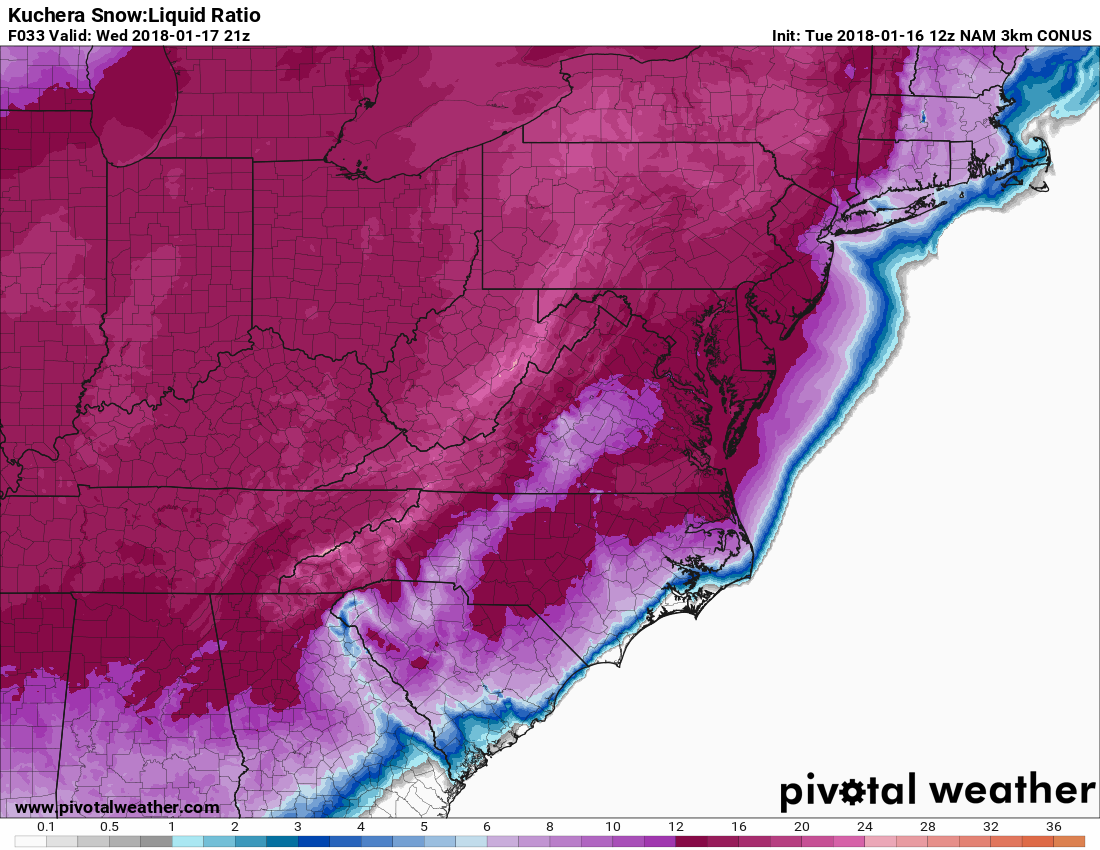
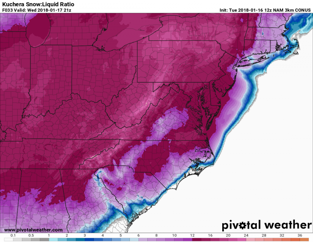
Pivotal weather has the kuchera ratio maps Hi Res 18z NAM Kuchera ratio map for the height of the precip in our area. Healthy 12:1 to 14:1

-
Kids in VBCPS have been out for 7 school days for the Jan 4 super-extra-mega-bomb-cyclone. They will probably be out tomorrow and possibly Thursday. On topic...I don't know what we did to deserve 18z NAM, has about 5" for ORF using Kuchera ratios. RIC might get fringed though.
-
The fog finally let up but I think it's too late to hit our forecast high of 45. Currently 32-33 along the bay, 35-37 close to I-264, and about 40-42 towards the NC/VA border. Pretty big difference within Va Beach. AKQ should be issuing WWA's for the rest of Hampton Roads and extreme NE NC in the next hour or so. IDK why they held off in the first place, since 1" is enough to cause chaos on the roads around here.
-
AKQ lowered their forecast to 1" for Norfolk/Va Beach. They decided not to issue a WWA either, hopefully the band doesn't dry up and we overperform. 33 degrees w/ a visibility of around 1/2 mile. If the fog doesn't clear out in time we could seriously undercut the forecast high of 45.
-
We could see some flurries tomorrow according to some models and Eastern shore maybe even gets a dusting. I'm not too much into it since the boundary layer looks too dry. DGZ saturation isn't the best either. But hey, I'll always take some mood flakes. Wednesday event looks better tonight. Euro remains bullish and the Canadian just spit out a Euro-like solution. Potential is there for a moderate to significant event by our standards. Can we get lucky twice in one winter? Probably not but we shall see lol
-
Of course they see the possibility. I assume they'll go with some more significant wording if the 00z runs hold serve. AKQ mets always go conservative wrt winter wx unless there is an overwhelming models consensus (which there isn't yet) or we are inside 48-72hrs. Adjusting higher if modeling supports is easier than backtracking, especially in a place where any amount of winter precip causes chaos.
-
Yup... like it so far. Again, we're in a good spot if the coastal redevelopment occurs. Let's keep the south trend going as long as we can because we all know it will come NW eventually in the short range. 18z GFS came in a bit more progressive than 12z but is still a great event verbatim. Probably WSW criteria for both of our yards. Wouldn't like to see today's 12z Euro pan out, that would be a lot of cold rain and some back end flurries. EPS has a 2-3" mean for my area, but the spread is still too large to put too much stock on the ensemble mean. What I do like is that a majority of members don't shut us out for the Wed-Thu time frame. Plus, we have somewhat of a h5 agreement on the two main globals which gives me slightly more confidence than usual during a NS dominated winter. It would be nice to score one more time before Feb rolls around. We could be heading into fab Feb too lol. Usually I don't get too much into strat stuff because I don't have a good grasp on it...and people who don't know a lot about it hype it too much. It could be the real deal this time though. A lot of very knowledgeable folks on Twitter seem interested and they know what they're talking about. Gotta be some potential there.
-
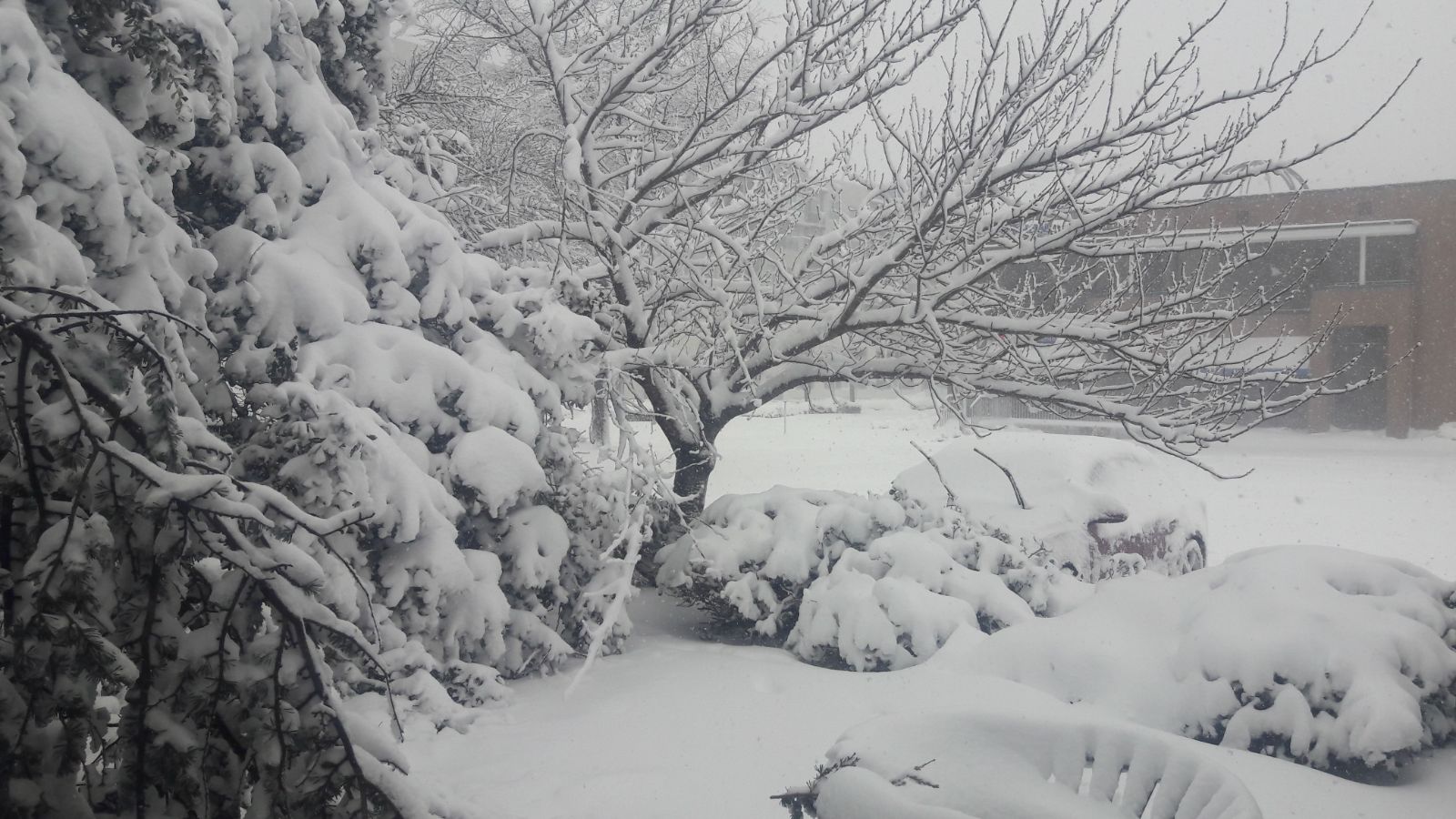
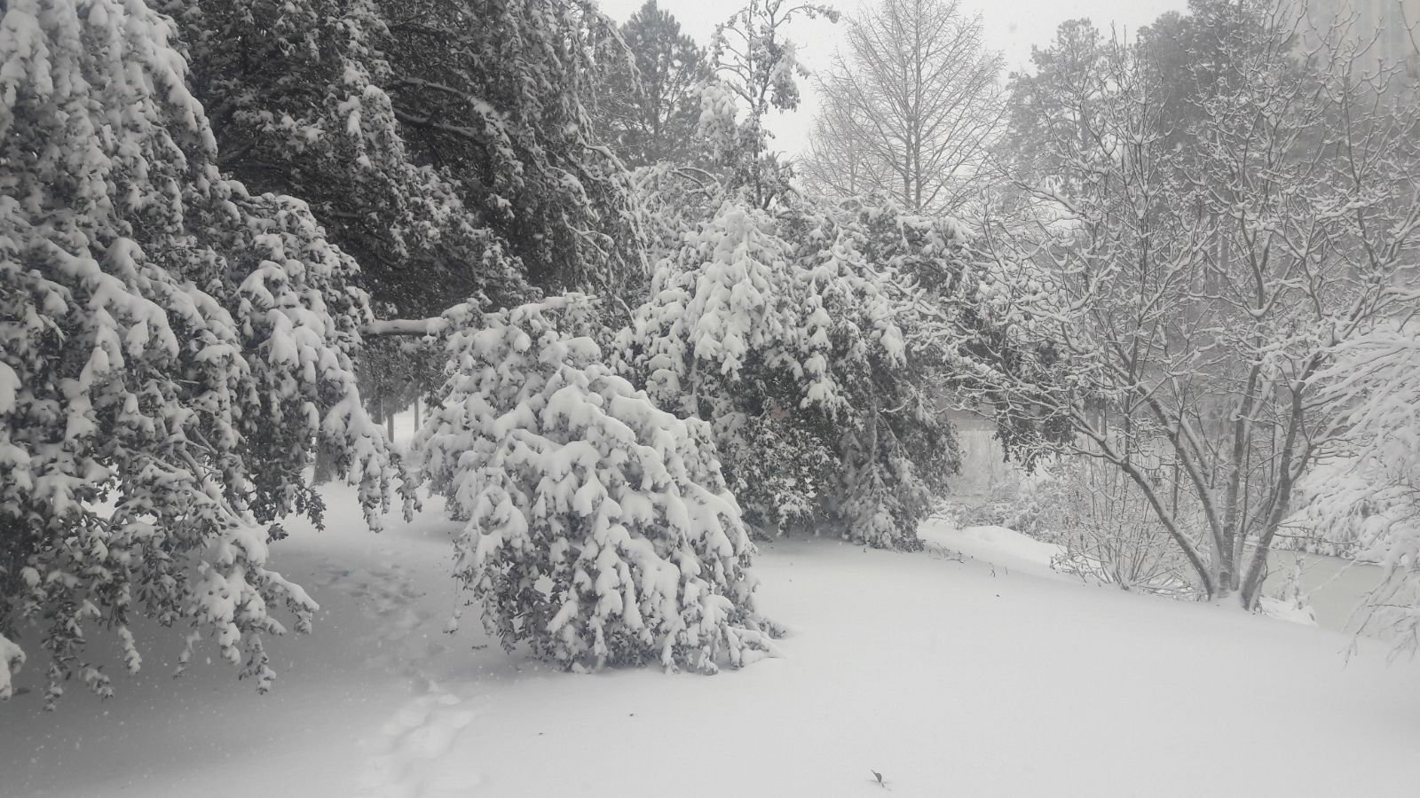
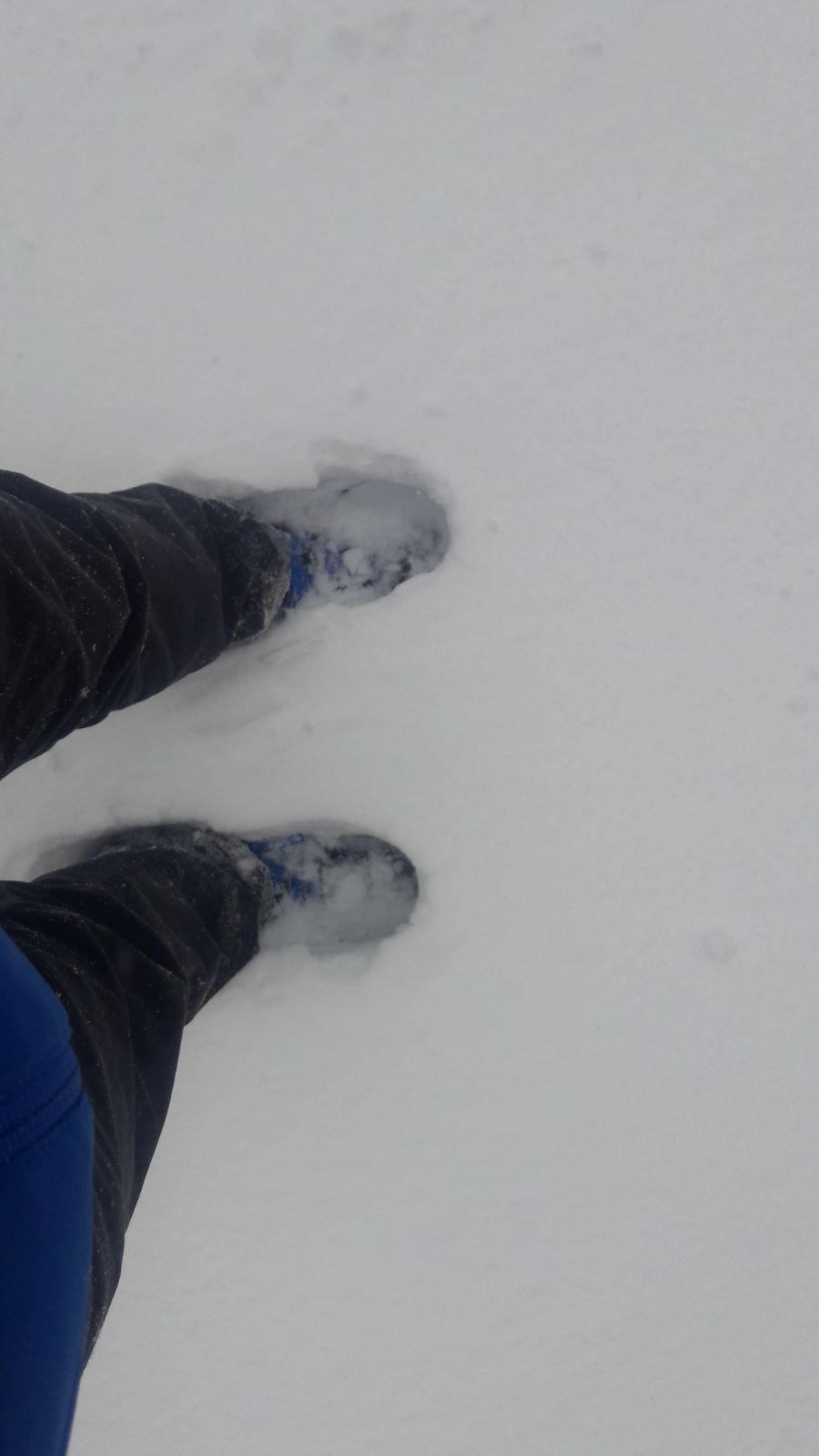
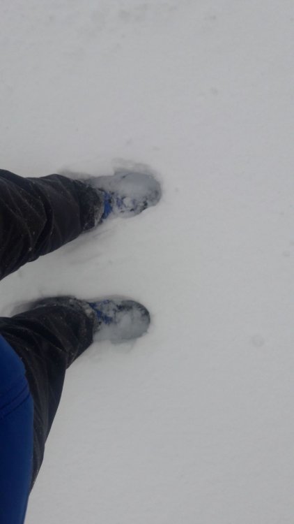
I'd say about 7-8" here. The wind makes it harder to measure exactly. KORF got 10", Hampton got 11" Some pics from this morning
-
I can either report thundersnow (unlikely) or transformers exploding, just over 10 thousand without electricity in the city so far. Not surprising since NTU recorded a 47mph gust.
-
Blizzard conditions in Va Beach with winds gusting into 40s, I drove around for an hour and there is a noticeable uptick in snow as you pass Rosemont. Probably getting close to 4". Here is a picture from 10:30 pm and 12:30 am. They're bad quality because it's hard to take good pics in blizzard conditions lol 10:30 and 12:30
-
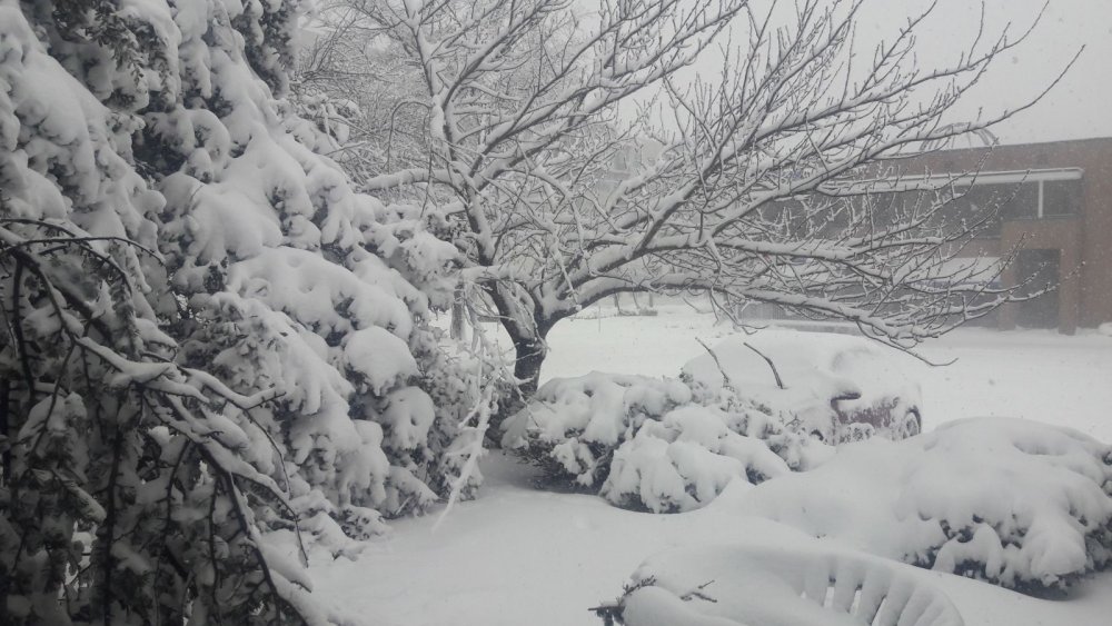
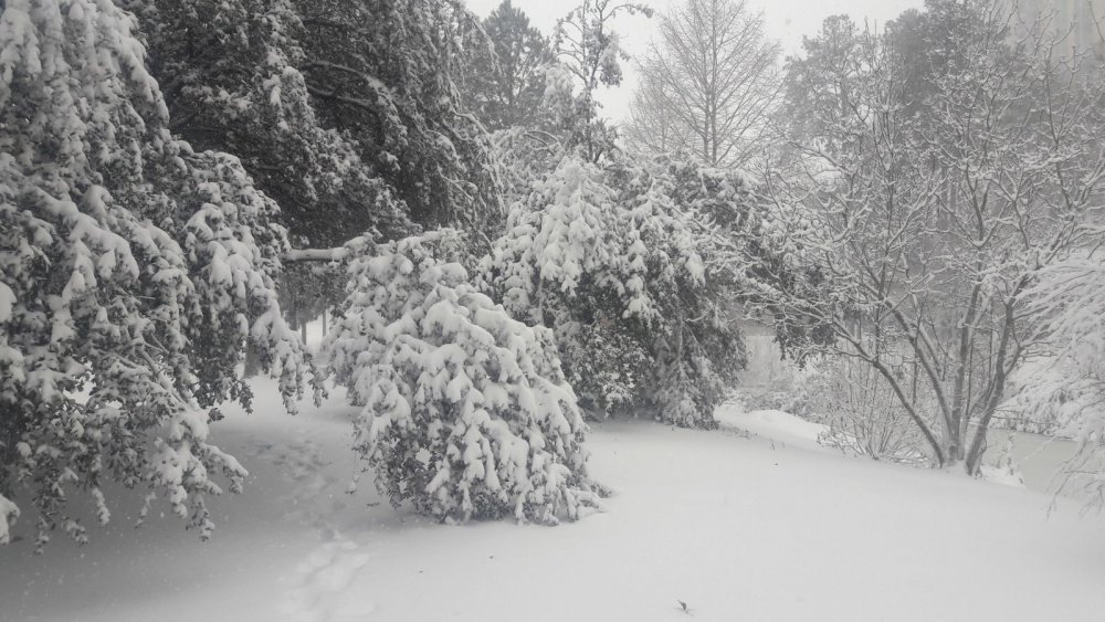
Heavy snow now, visibility under 1/4 mile, approaching 2". Feeling good that we'll reach the forecast of 8-10"
-
Damn this is close, looks like I'm on the right side of the line. Moderate snow since 8pm with no signs of mixing, inch is on the ground but the accumulation is slacking a bit. Winds are starting to get gusty. Location is the town center of Va Beach
-
Interesting, it's just snowing in town center and approaching an inch. Weird how it's raining just a few miles south
-
Mix of SN and IP just started ramping up near Town Center of Virginia Beach. There is just over a dusting on the ground, depending on the surface. Let's get this 8-12 tonight.
-
There it is, the blizzard warning. They upped the totals a little bit too.
-
They might hold off on the blizzard warning up until tomorrow afternoon, but I believe it will be issued. Norfolk/Va Beach/Northampton county maybe? In the point and click forecast on the NWS page, it says 28-33 sustained with gusts up to 47 mph. I noticed mets are less conservative with the blizzard warning anyway since it doesn't really matter if obs don't exactly verify the warning. Not like anyone will notice if the winds gusted to 34 instead of 36 mph, or if the visibility was 1/3 mile instead of 1/4.
-
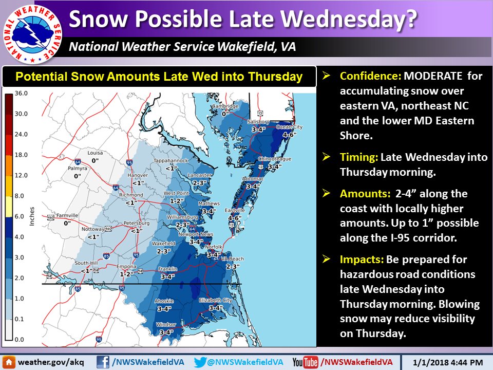
Wishcasting and NAM hugging has become insufferable in the SE forum lol AKQ issued Winter Storm Watches for the area. Current amounts are 3-5", which is reasonable. Looking good!
-
Newest AKQ forecast package. I expect the stripe of maximum accumulations to slowly migrate NW if the trends continue.
-
Had nice bay effect snow showers this morning, it has managed to put down a nice dusting. About the Wed/Thu coastal, I'm trying not to get carried away. A few more steps west and it'll be a sleetfest for VB. AKQ still holding onto rain/snow mix until Thu 6z.
-
Chesapeake Bay effect snow is possible again tonight into tomorrow morning. 850s should plummet close to -20 degrees celsius with some persistent N-NNW wind. Boundary layer will likely be too dry and prevent any accums, but I'll take mood flakes as the ball drops. EPS mean is about 2", which is not too bad but it's likely skewed by a couple of big dogs. 12z GFS is just coming out and did a slight jump west with both precip and SLP. Verbatim still a non event W of I-95.
-
22 degrees in Virginia Beach and flurries! There is a very light dusting so far, let's keep this Chesapeake bay streamer going.
-
Nice light event at KECG! Only saw a brief snow shower up here in Va Beach today. AKQ mentions the possibility for some Bay effect snow in VB and Norfolk, wouldn't surprise me due to strong northerly flow. Let's reel in 0.5" from the streamers lol 35/28
-
In the short time I have lived in AKQ CWA, I noticed that they usually go pretty conservative. Smart play, since it will most likely be a minor impact event if it happens so it's easier to catch up with the forecast overnight if real time obs actually support the idea. Interesting that MHX issued WWA's.
-
It sounds bad, but when the attitudes are somber across the board it can mean we are still in the game. We're at the edge of both forums and usually what works for us doesn't work for anyone else. The Wednesday wave looks more amped on 18z runs of both the NAM and the RGEM. Euro is still hinting at some more development too. Coupled with decent early morning timing, I can definitely see that becoming a 1-3" event for NE NC and SE VA. Friday event is suppressed, but there. I believe we're still in a good place, and at this point I'd rather be hoping for a NW/more amplified trend than for the elusive SE trend. Edit: Frick off GFS, you won't sucker me in again. Shows a massive coastal Jan 1-2 that clobbers E NC and SE VA with a foot of powder. Then follows that up with lows approaching zero for the same area on Jan 3.
-
I still feel like we're in a good spot despite the flattening/suppression on the models yesterday. We saw what happened with the Dec 9 event