

BornAgain13
-
Posts
2,879 -
Joined
-
Last visited
Content Type
Profiles
Blogs
Forums
American Weather
Media Demo
Store
Gallery
Posts posted by BornAgain13
-
-
4 minutes ago, NorthHillsWx said:
Long range NAM but that’s a big time storm growing at the end of the run. Also- the duration of this even looks amazing
That's what I'm liking... is how long of a duration this could be.
-
 2
2
-
-
1 minute ago, eyewall said:
Honestly I would take the 2-4" verbatim from the GFS at 6z and call it a day. Hopefully the amounts go up but we shall see. Overall it is still getting a handle on the suppression factor.
What do you think of the step back from the 6z Control? Or do u put more stock in the 6z eps.?
-
4 minutes ago, TARHEELPROGRAMMER88 said:
Maps?
I scanned the mid Atlantic forum about this storm. They have a lot of maps in discussion
-
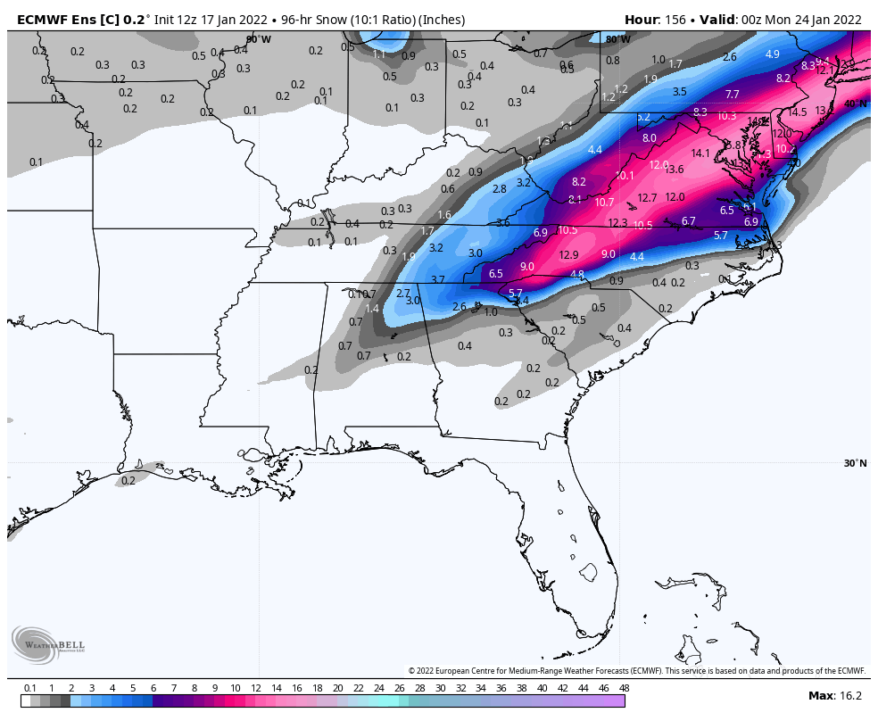
6z EPS is still similar, a slight step back from 0z, but the Control was a big step back from 0z.
-
6z EPS and Control trended towards a mix of GFS and CMC. Could the Euro be the one to cave.... wow
-
1
-
-
Just now, Weather Will said:
WB 7am Sat


Definitely a big change here, a step in the wrong direction!
-
2
-
-
Hopefully the trends in the right direction continue today!
-
Great step in the right direction!
-
0z GFS coming in with a much better solution....
-
1
-
-
I just got Nam'd! 4"+ late Thursday night into early Friday morning and still snowing at the end of the run
-
1
-
-
16 minutes ago, TARHEELPROGRAMMER88 said:
What is this?
So this apparently is the 18z EPS.... which is weird because it's much further south than what the Weather bell one shows... anyone have any idea why?
-
Hopefully the 0z GFS caves tonight....
-
Any 18z EPS maps?
-
 2
2
-
-
And the 18z GFS continues to be opposite of the EURO.
-
18z ICON is a big hit for southern VA
-
1
-
 1
1
-
-
Who will fold this time... gfs or euro...
-
1 minute ago, StormyClearweather said:
Not bad at all down that way...
Keep in mind it's 10:1.

Yep, add kuchera Into this, u will probably ads 3-6" to these totals.
-
1 minute ago, Beach Snow said:
Individual members
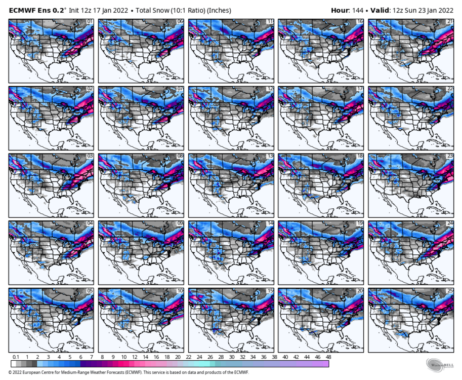
12z EPS looks very similar to 06z, how about the Control @Beach Snow?
-
UK shows both systems , 1 late Thursday and then another one after that... the 2nd one is the bigger one but it is more coastal. ..
-
Just now, Blue_Ridge_Escarpment said:
Nah we just got a foot of snow this way
I would hope so. You are in the mountains lol.
-
 1
1
-
1
-
-
8 minutes ago, wncsnow said:
0 for 2
Maybe for you lol
-
Using Kuchera, because this will not be a 10:1 storm. Ratios should be much higher. The cmc is a moderate event, northern NC into Southern VA and more of a major event for SE VA
-
GFS still trying to fixate on which system to key in on... its more so going with late Saturday into Sunday with the Gulf Low.
-
1
-
-
12 minutes ago, yoda said:

Wow
-
1
-


January 20-22 “bring the mojo” winter storm threat
in Southeastern States
Posted
Brad Panovich was just now using the GFS model in his blog...