BornAgain13
-
Posts
4,468 -
Joined
-
Last visited
Content Type
Profiles
Blogs
Forums
American Weather
Media Demo
Store
Gallery
Everything posted by BornAgain13
-
Definitely understandable!
-
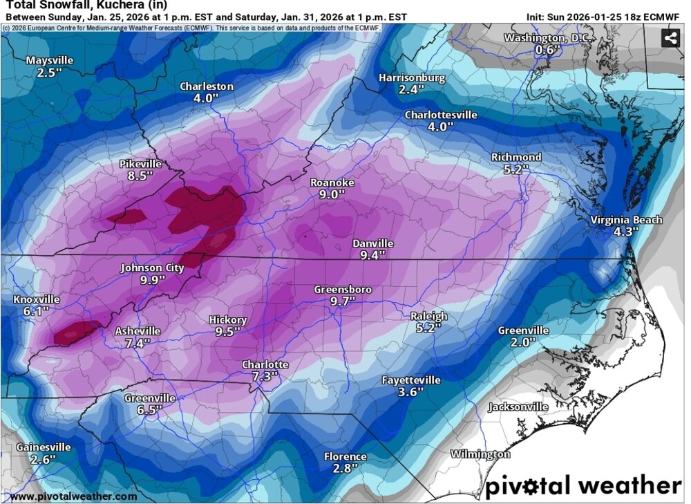
Im sure it wont be showing this at 0z. But something to watch
-
Euro isn't what it used to be. But longer range, I would go with it. As we get closer maybe not so much
-
18z Euro and still snowing
-
18z EURO brings the goods!!
-

Southern Crippler - Get well soon Jimbo Storm Obs
BornAgain13 replied to BooneWX's topic in Southeastern States
System wrapping up here. Right at about 3.5" of Snow/Sleet, mainly sleet. No ZR. -
Southern Crippler - Get well soon Jimbo Storm Obs
BornAgain13 replied to BooneWX's topic in Southeastern States
Absolutely pouring sleet here! And its adding up quickly! -
Southern Crippler - Get well soon Jimbo Storm Obs
BornAgain13 replied to BooneWX's topic in Southeastern States
Big time sleet here. Wow If u want to see snow, turn on the AFC Championship Game. Its ripping in Denver -
Small system on Friday may provide a little snow.
.thumb.png.c23fbeddefc737472b09e40080b59404.png)
-
Southern Crippler - Get well soon Jimbo Storm Obs
BornAgain13 replied to BooneWX's topic in Southeastern States
21.2 degrees here now -
Southern Crippler - Get well soon Jimbo Storm Obs
BornAgain13 replied to BooneWX's topic in Southeastern States
Edit - Heavy Sleet -
Southern Crippler - Get well soon Jimbo Storm Obs
BornAgain13 replied to BooneWX's topic in Southeastern States
The big line has arrived here. Moderate sleet -
-
Southern Crippler - Get well soon Jimbo Storm Obs
BornAgain13 replied to BooneWX's topic in Southeastern States
If this last line is all sleet, we may get 1-2" out of it! Heavy stuff coming. -
UKMET ensemble
.thumb.png.b38c3c9542d106e46eb867e9f676060a.png)
-
GEFS
.thumb.png.04a244a87e7c803e029eb78a2802bf91.png)
-
CMC ensemble
.thumb.png.7b20fdceb46ea9cee28dfaf92dbdfb65.png)
-
EPS
.thumb.png.1fee193f779babbcdd635b1b6a816ff9.png)
-
What does the Google model show? Lol
-
Southern Crippler - Get well soon Jimbo Storm Obs
BornAgain13 replied to BooneWX's topic in Southeastern States
1.75"-2" of Snow/Sleet so far here. Waiting on the last batch of heavy precip.
-
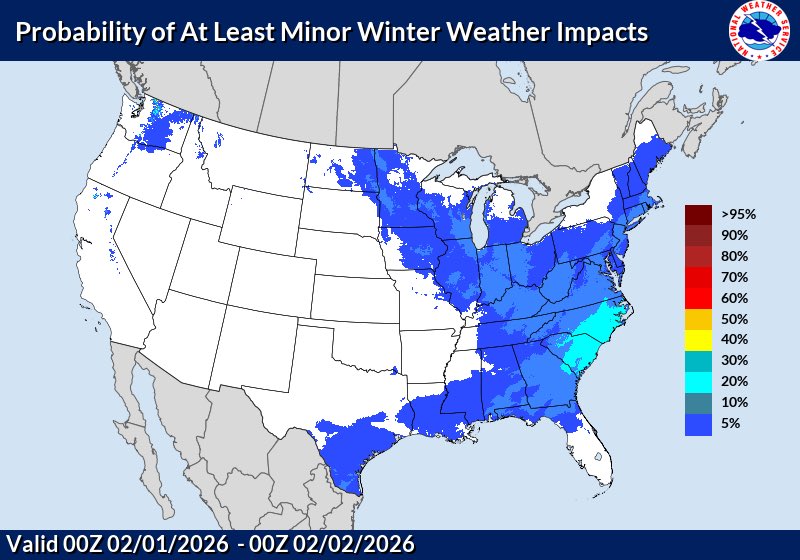
It does look more suppressed on all OPS. But a lot of ensembles still show a decent signal. Worth keep an eye on for sure
-
Southern Crippler - Get well soon Jimbo Storm Obs
BornAgain13 replied to BooneWX's topic in Southeastern States
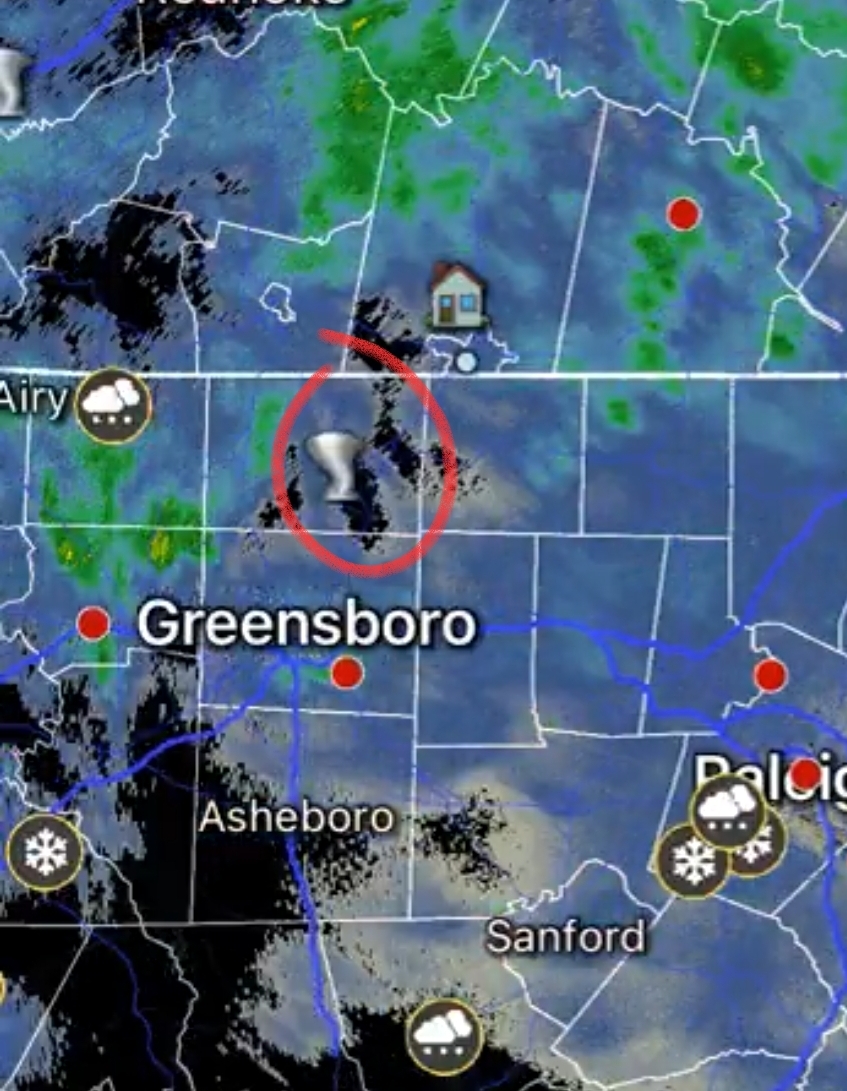
Still getting sleet up this way. Temp is 14.1. Can anyone confirm where the sleet/freezing rain line is? -
Next weekends threat is still there. The OPs are suppressed but the ensembles still have a decent signal. Will be interesting to see what it looks like the next couple of days
-
Southern Crippler - Get well soon Jimbo Storm Obs
BornAgain13 replied to BooneWX's topic in Southeastern States
Mixture of pixie dust and sleet continue here... I will say. I hope everyone is ok in the circle lol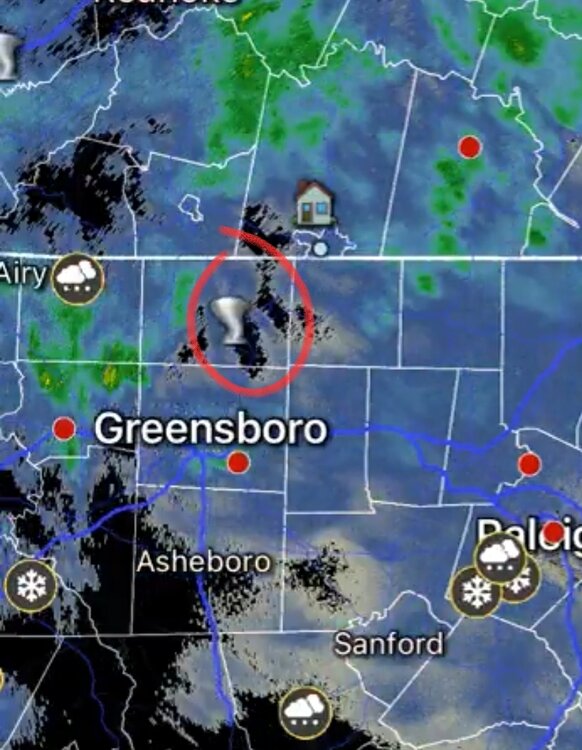
-
Southern Crippler - Get well soon Jimbo Storm Obs
BornAgain13 replied to BooneWX's topic in Southeastern States
The freezing rain is looking horrible for here tomorrow.


.png.77b88f6764890c0e46af0d4221c48b69.png)


.png.6af06d4f03de4fda6c748a3d07a27873.png)
.png.93e62692dd00a4a89d6ade40bd84ce08.png)
.png.86808aa19bd8a653c5b38d6d1f784e42.png)
.png.9ea1470e8349c95f2bfc6808bfa2c1e9.png)