

mckinnonwg
-
Posts
150 -
Joined
-
Last visited
Content Type
Profiles
Blogs
Forums
American Weather
Media Demo
Store
Gallery
Everything posted by mckinnonwg
-
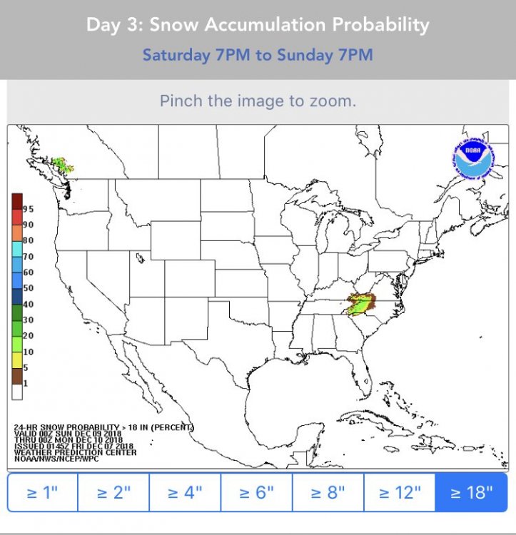
Possible take on the suppression south:
-
I did the best I could with my phone app hahaha
-
So you’re saying there is a chance....
-
Guy has solid stuff
-
He just went all in
-
Hour 81
-
What an awesome job to be paid to head right to the center of these things!
-
I agree. It does a very good job with the various forms of data and comparisons as well. I also have noticed that various sites have different outcomes with the same models. So it's also interesting to cross compare sites. Interesting stuff.
-
I enjoy using this page for models? Does anybody else use COD? https://weather.cod.edu/forecast/
-
Overall observation is the LP exits faster on this run not leaving much QPF behind. Quicker exit with nowhere to go but EAST.
-
Precip shield looks ever so slightly more to the north at hr78 with the LP not as pronounced and hugging the coast.
-
850 temps go lower at hr69 then previous run.
-
HP looks it bit stronger for suppression on 12z
-
Thought everyone might enjoy this blog read....just more information for the masses. I enjoy reading his breakdowns. http://www.stormhamster.com/entry/e120618.htm
-
You could try the following (0-10cm layer): http://www.greencastonline.com/tools/soil-temperature
-
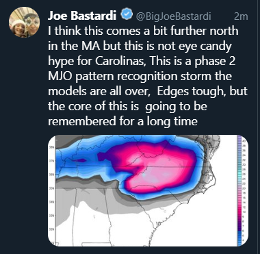
Ole Big Joe https://twitter.com/BigJoeBastardi/status/1070501843015483393
-
Weathermodels.com also hosts the 18z EURO
-
Solid....I see now. Thanks
-
It doesn't appear to be a static image that is found on their public site. It's probably safer that way. Just my assumption.
-
They don't have a long range image or at least not one available to the public
-
This is the current link to the GSP site: https://www.weather.gov/gsp/winter
-
WNC is getting blasted on this run for 12+ hours


