dj3
-
Posts
619 -
Joined
-
Last visited
Content Type
Profiles
Blogs
Forums
American Weather
Media Demo
Store
Gallery
Everything posted by dj3
-

Western Pa / Pittsburgh area Winter Discussion ❄️☃️
dj3 replied to north pgh's topic in Upstate New York/Pennsylvania
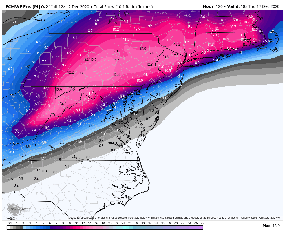
The NAM moved a little east from 6z and still threw a ton of precip back into western PA. Definitely encouraging to see the NAM and EURO a little more bullish on our chances. -
Western Pa / Pittsburgh area Winter Discussion ❄️☃️
dj3 replied to north pgh's topic in Upstate New York/Pennsylvania
Cut back a few inches from 6z but still ok. I was thinking how crazy it is that with all the info we have access to this one is actually still 72 hours out and could possibly shift a bit more either in our favor or the other way. The models have been remarkably consistent with this one so far -
Western Pa / Pittsburgh area Winter Discussion ❄️☃️
dj3 replied to north pgh's topic in Upstate New York/Pennsylvania
Either way it’s nice to be tracking when there was a lot of doom and gloom in winter outlooks. -
Western Pa / Pittsburgh area Winter Discussion ❄️☃️
dj3 replied to north pgh's topic in Upstate New York/Pennsylvania
The snow maps remind me a lot of January 2016 which was also a pretty painful cut off for us. The negative NAO is something we root for but it would be more helpful if there was a strong primary running up into the Ohio valley before transferring. -
Western Pa / Pittsburgh area Winter Discussion ❄️☃️
dj3 replied to north pgh's topic in Upstate New York/Pennsylvania
Definitely frustrating but I’m hoping the western edge of the precip expands a little closer to go time. We won’t be getting jackpotted but I’d take another significant snowfall in December. -
Western Pa / Pittsburgh area Winter Discussion ❄️☃️
dj3 replied to north pgh's topic in Upstate New York/Pennsylvania
Thanks for the analysis MAG! You look to be in a better spot for this one, hoping you guys in central PA cash in big -
Western Pa / Pittsburgh area Winter Discussion ❄️☃️
dj3 replied to north pgh's topic in Upstate New York/Pennsylvania

-
Western Pa / Pittsburgh area Winter Discussion ❄️☃️
dj3 replied to north pgh's topic in Upstate New York/Pennsylvania
The eps maps Weatherwill posted in the ma forum actually look the best they have so far. Quite a few west members in there that give western pa a direct hit -
Western Pa / Pittsburgh area Winter Discussion ❄️☃️
dj3 replied to north pgh's topic in Upstate New York/Pennsylvania
Yea after several runs in the right direction that has us on the losing end of a brutal cutoff. -
Western Pa / Pittsburgh area Winter Discussion ❄️☃️
dj3 replied to north pgh's topic in Upstate New York/Pennsylvania
What a monster look for central pa. Hopefully we can get the precip shield to continue to expand and throw some good snows back our way. -
Western Pa / Pittsburgh area Winter Discussion ❄️☃️
dj3 replied to north pgh's topic in Upstate New York/Pennsylvania
-
Western Pa / Pittsburgh area Winter Discussion ❄️☃️
dj3 replied to north pgh's topic in Upstate New York/Pennsylvania
CMC and GFS both looking like a rain to snow scenario for Monday next week. Looks like things could interesting if the cold push timing is correct. Glad to have something to track again -
Pretty spot on about the snow climo. Elevation in and around the city does make a bit of difference like you pointed out about the airport. Although, there isn't any noticeable uptick unless you are moving into the Laurel Highlands (about 40-60 miles south east of the city). The mountains are in a much better spot for catching some good snows from coastal lows than the city.
-
Pittsburgh PA Area Rest of fall and Winter 2019-2020 thread
dj3 replied to meatwad's topic in Upstate New York/Pennsylvania
-
Pittsburgh PA Area Rest of fall and Winter 2019-2020 thread
dj3 replied to meatwad's topic in Upstate New York/Pennsylvania
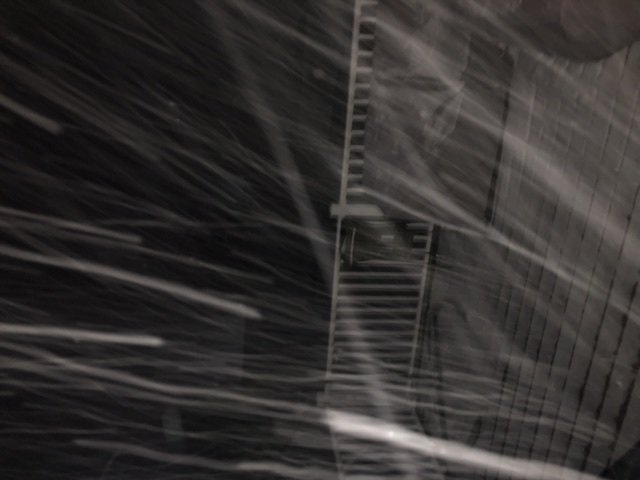
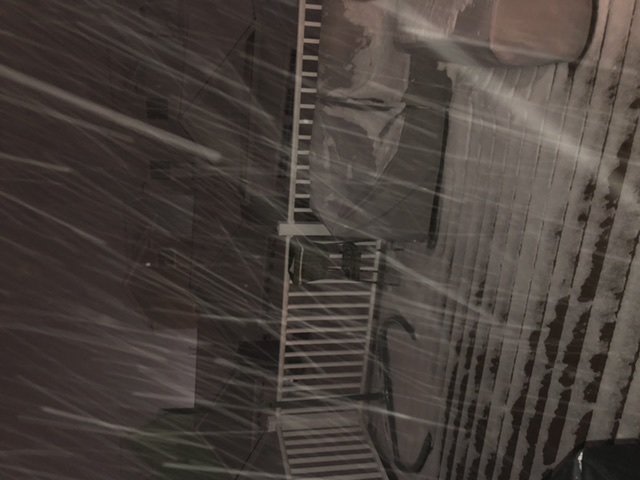
One of the best snow squalls I’ve witnessed. About 15 min of very heavy snow with huge winds. dropped close to an inch in oakmont -
Pittsburgh PA Area Rest of fall and Winter 2019-2020 thread
dj3 replied to meatwad's topic in Upstate New York/Pennsylvania
Looks like a pretty uniform 4-6+ over Westmoreland County. Shifted from where that heavy band was setting up about 24 hours ago with most models -
Pittsburgh PA Area Rest of fall and Winter 2019-2020 thread
dj3 replied to meatwad's topic in Upstate New York/Pennsylvania
This really looks like a brief window of heavy snow. I’ll take it but man what could have been if we had some cold air -
Pittsburgh PA Area Rest of fall and Winter 2019-2020 thread
dj3 replied to meatwad's topic in Upstate New York/Pennsylvania
Yes why I’m looking for consolation in the euro lol -
Pittsburgh PA Area Rest of fall and Winter 2019-2020 thread
dj3 replied to meatwad's topic in Upstate New York/Pennsylvania
Anyone have the 18z euro? -
Pittsburgh PA Area Rest of fall and Winter 2019-2020 thread
dj3 replied to meatwad's topic in Upstate New York/Pennsylvania
The 12z GFS has a perfect miller A track around day 9-10 and we still manage to rain. I was reading a thread psuhoffman started in the mid atlantic forum discussing past borderline events and it was pretty depressing. I'm not sure if it is just a recent run of bad luck or if there is a longer term trend related to a changing climate but it frustrating seeing the lack of cold air ruin these tracks that should work out in the heart of winter. -
Pittsburgh PA Area Rest of fall and Winter 2019-2020 thread
dj3 replied to meatwad's topic in Upstate New York/Pennsylvania
The whole evolution looks too much like a late blooming miller B to me. The primary even though weak just sorta meanders in Indiana before transferring too far north. Pretty crazy the cutoff to our east, I wonder if it actually plays out like shown. -
Pittsburgh PA Area Rest of fall and Winter 2019-2020 thread
dj3 replied to meatwad's topic in Upstate New York/Pennsylvania
The above map is pretty hilarious. Could not draw it up worse. -
Pittsburgh PA Area Rest of fall and Winter 2019-2020 thread
dj3 replied to meatwad's topic in Upstate New York/Pennsylvania
It really is too bad we don't have a better airmass leading into this weekend's system as we would probably looking at prolonged light to moderate event. Models seem to be picking up on another southern stream event for next weekend, although cold rain as depicted on 12z Gfs. It would be frustrating for 2 close misses like that with late January temps but it is what it is I guess. -
Pittsburgh PA Area Rest of fall and Winter 2019-2020 thread
dj3 replied to meatwad's topic in Upstate New York/Pennsylvania
That would make sense since the airport is only a few miles away, although I didn't realize there was that much elevation west of the city. The river definitely seems to impact accumulations. Last year there were a couple of times when driving a mile or two up the hill into Plum/Penn Hills you could tell a difference in the amount of snow on the ground. -
Pittsburgh PA Area Rest of fall and Winter 2019-2020 thread
dj3 replied to meatwad's topic in Upstate New York/Pennsylvania
Anyone live in the area near Robinson? There must be some decent elevation out this way. I started working here a few years ago and I can't get over the difference in snow here compared to home (Oakmont).