Normandy Ho
-
Posts
3,295 -
Joined
-
Last visited


-
Roger Smith, who ran our seasonal forecast contests, passed away
Normandy Ho replied to GaWx's topic in Tropical Headquarters
Rest in power brother -
HOT SAUCE

-
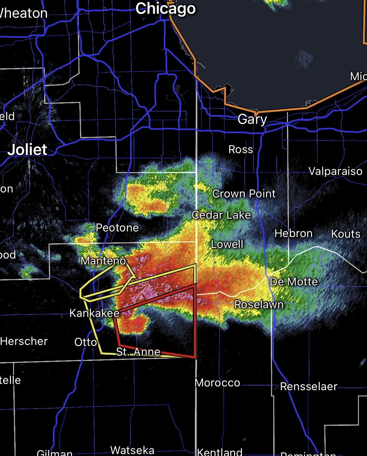
You should be chasing bruh the slab daddies are just to your south! Not even a long drive
-
ALEK in the screw zone you hate to see it
-
Locked back in I love slab daddy season. Good luck to the affected areas
-
Tornadoes happening while the lake is still frozen is nasty work
-
Enjoy seems like a hell of storm
-
What was the intensity at landfall?
-
iCyclone's Hurricane Melissa Report
Normandy Ho replied to vortex95's topic in Tropical Headquarters
HAWT -
Major Hurricane Melissa - 892mb - 185mph Jamaica landfall
Normandy Ho replied to GaWx's topic in Tropical Headquarters
For sure the Montego Bay damage consistent with cat3 winds -
Major Hurricane Melissa - 892mb - 185mph Jamaica landfall
Normandy Ho replied to GaWx's topic in Tropical Headquarters
On top of two other cat fives. Just a stupid season . From the images I’ve seen this is some of the worst wind damage I’ve ever witnessed. Turning the west end of Jamaica brown from space is wild -
2025 Atlantic Hurricane Season
Normandy Ho replied to BarryStantonGBP's topic in Tropical Headquarters
Nah I think we get a couple more things. I agree Melissa is the last big dog tho -
Major Hurricane Melissa - 892mb - 185mph Jamaica landfall
Normandy Ho replied to GaWx's topic in Tropical Headquarters
This. The main difference between them is size -
Major Hurricane Melissa - 892mb - 185mph Jamaica landfall
Normandy Ho replied to GaWx's topic in Tropical Headquarters
Agree the backside after she kisses water again will be vicious -
Major Hurricane Melissa - 892mb - 185mph Jamaica landfall
Normandy Ho replied to GaWx's topic in Tropical Headquarters
I wouldn’t say it’s all horizontal with canes, but the scale of the circulation is such that any vertical component wouldn’t be strong enough to suck you upwards. But yea in general you are correct. I do think hurricanes and tornadoes are more similar than one would think (which is why they look like each other on radar, size of the circulation Being the major difference)