eyewall
-
Posts
13,321 -
Joined
-
Last visited
Content Type
Profiles
Blogs
Forums
American Weather
Media Demo
Store
Gallery
Everything posted by eyewall
-
That looks real bad. Lots of houses completely gone as well.
-
-
-
These bands are going to be very problematic throughout today.
-
Oh yay the chaser version of "Kevin Martin"
-
-
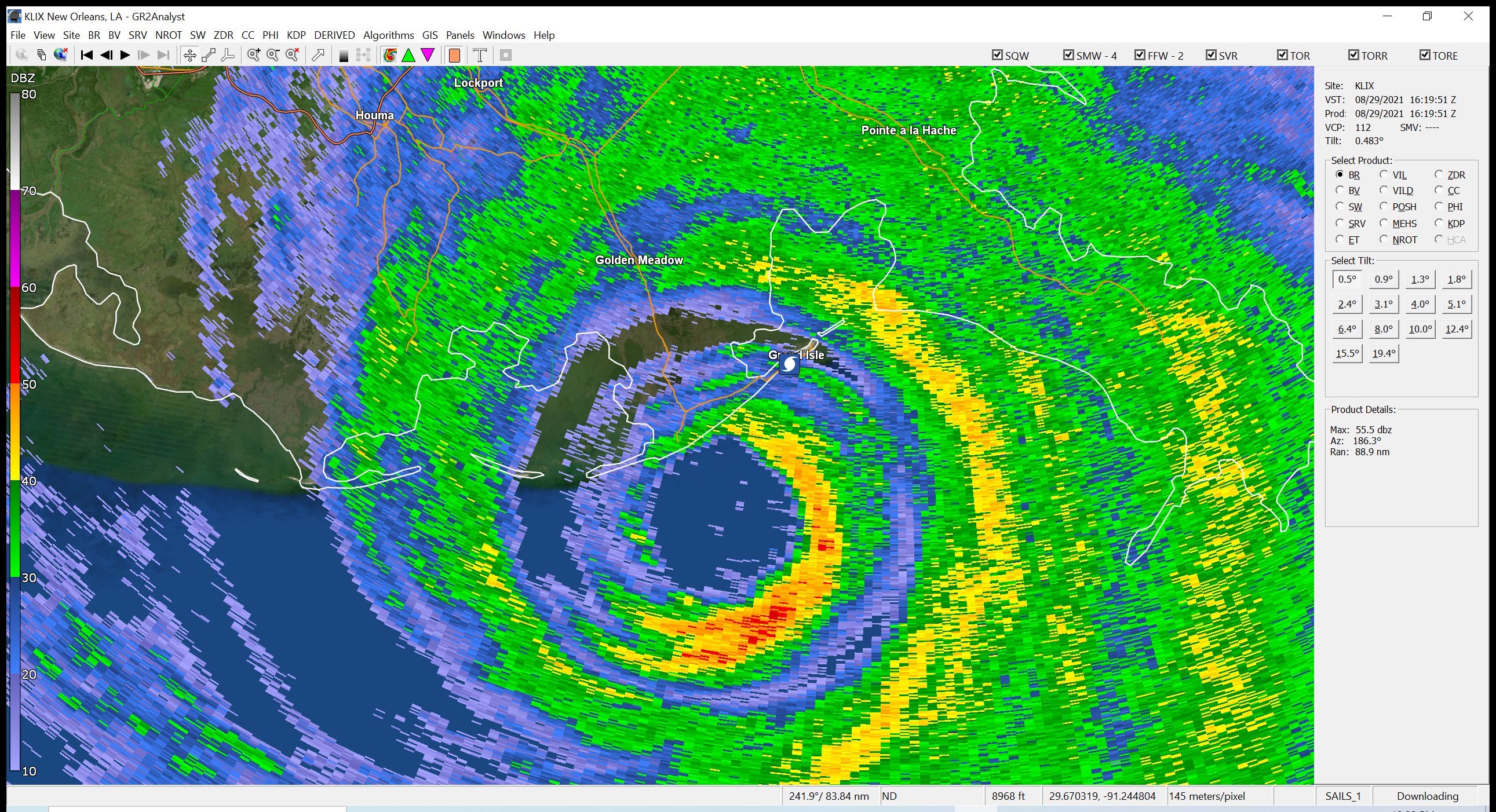
The eye looks almost better on recent radar frames. It is moving due north for sure with an occasional NNE wobble. Going to be VERY close for NOLA proper. Going to be a rough ride for sure in Kenner.
-
Because calling it land in Louisiana can be very generous but the winds are starting to decrease as of the latest advisory.
-
Down to 130 mph at the latest advisory.
-
I believe it has made the northward turn. Even a NNE wobble. Lockport will go right through the eye.
-
I wonder if it is recording hi res footage as well.
-

-
yeah it is picking up again.
-
Yeah I think they are almost in it.
-
I saw a piece of a structure float by on the Grand Isle feed.
-
Even if that does start now that isn't good news for NOLA because of windfield expansion.
-
Some on twitter were trying to claim an EWRC has begun but I am not sure there is evidence for that in the recon data as of now.
-
I am really concerned for Houma in terms of core winds. I am starting to get increasingly worried about NOLA
-
Ida looks like she is struggling a bit this afternoon with Cuba and SW shear. Cloud tops have warmed and the presentation is more ragged.
-
Yeah we will have to see if that will occur or if it event slips east of NOLA like Katrina did and slams Bay St. Louis.
-
-
They will rebuild!
-
Someone please make that a gif
-
I honestly wish there was a more accurate wind field depiction for over land. NHC shows the TS winds onshore in southeastern New England but no ob on land supports anything close to sustained TS winds.
-
Landfall should be somewhere in southwestern RI. This means not much of a wind event for central/western LI and NYC. Some low end TS winds in gusts for the most part, especially east. This is a rain event for the NYC Metro mainly.