Raleigh AFD:
Cold high pressure will again build
into the region in the wake of the departing low Sat night. While
the exact track of the low remains uncertain, the overall character
and track of the system remains consistently a Miller A scenario,
which (as noted in the previous discussion) favors a p-type
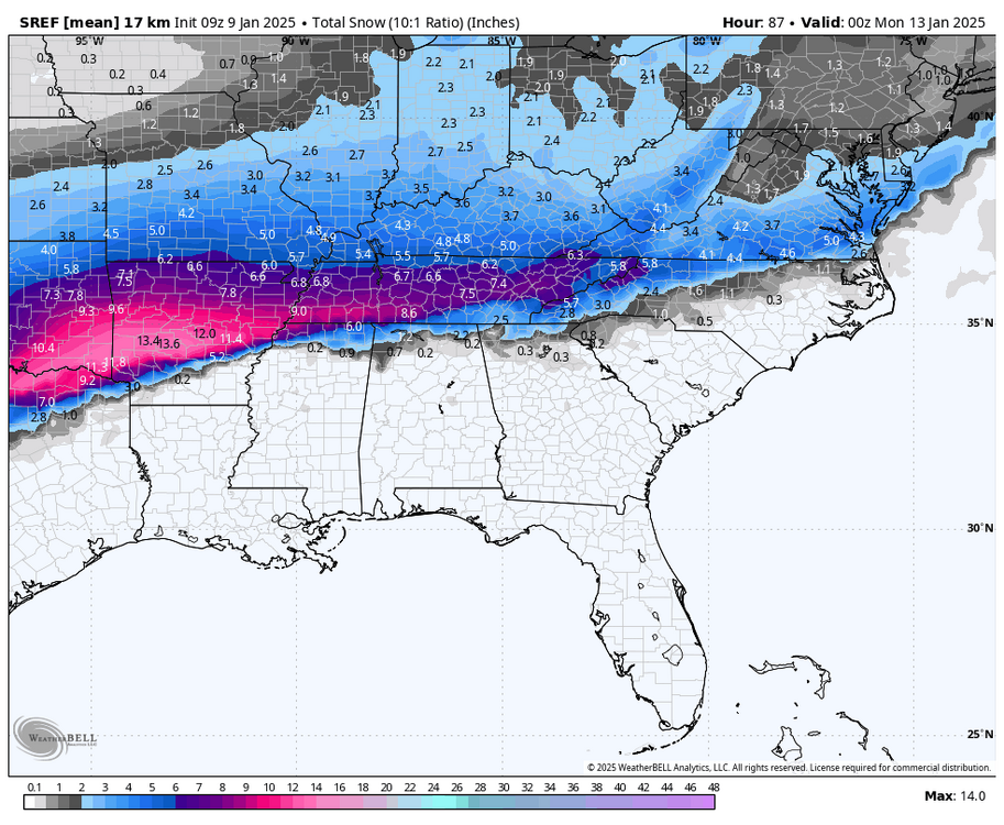
distribution of mostly rain/snow with a narrow corridor of mixed p-
type separating the two regimes. With the cold air in place and
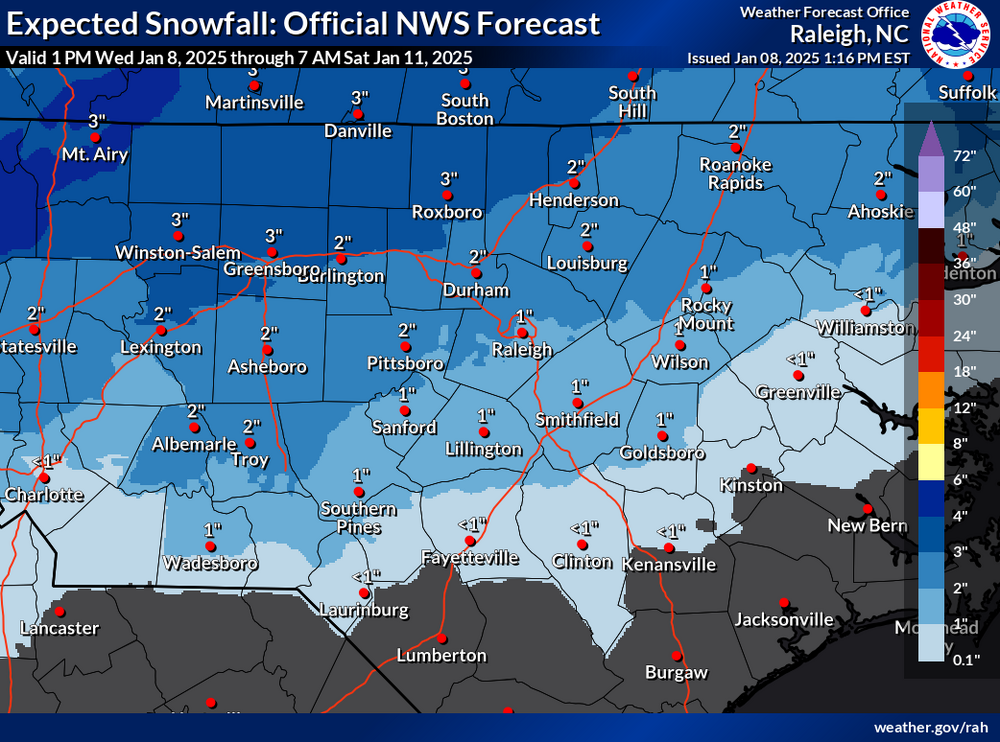
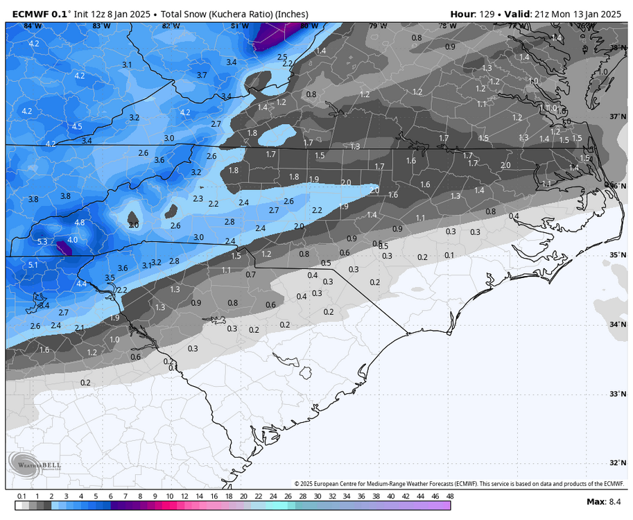
sufficient lift and saturation in the dendritic growth zone, latest
guidance suggests snow at the onset in most, if not all locations.
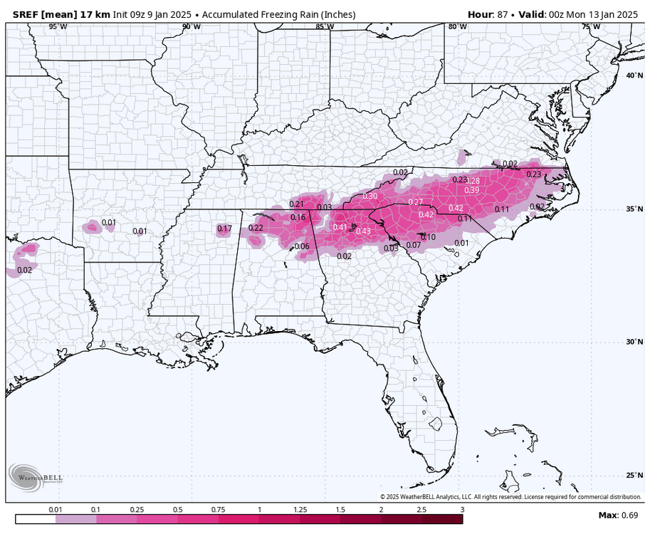
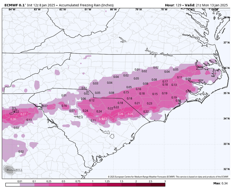
As the low approaches, a strengthening warm nose aloft could be
strong enough to melt the falling snow, which would result in either
sleet or freezing rain (where sfc temps are at or below 0 degrees C)
depending on whether it is able to refreeze before making it to the
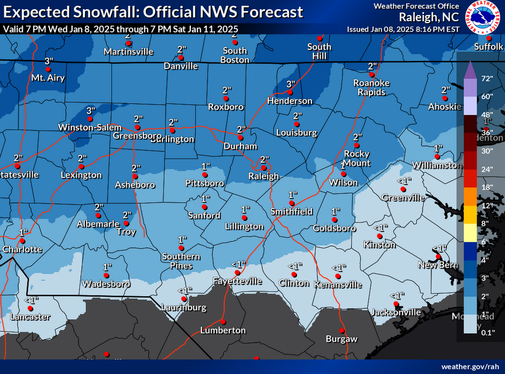
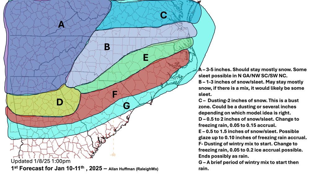
ground. Some of the biggest questions continue to be where the
rain/snow line will set up and how much sleet will mix in and over
what area, both of which will impact total accumulations. There is
still too much uncertainty to answer those questions with much
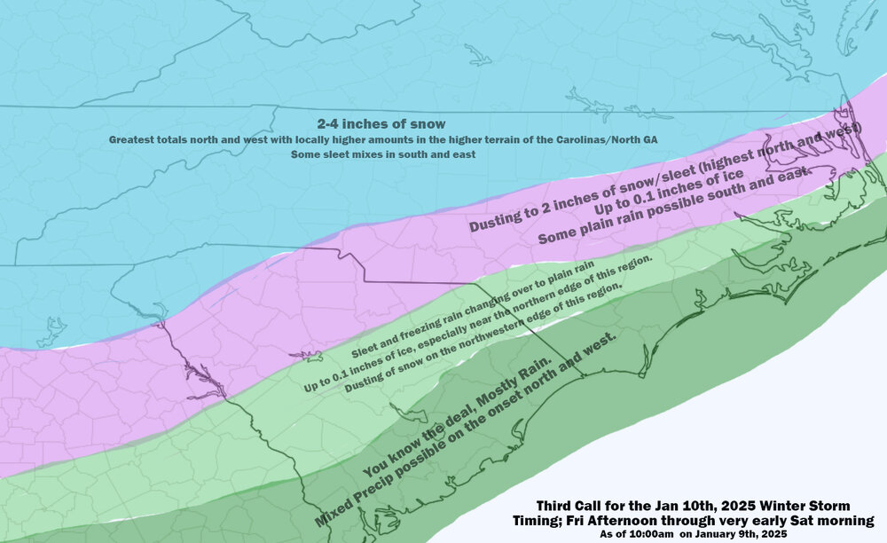
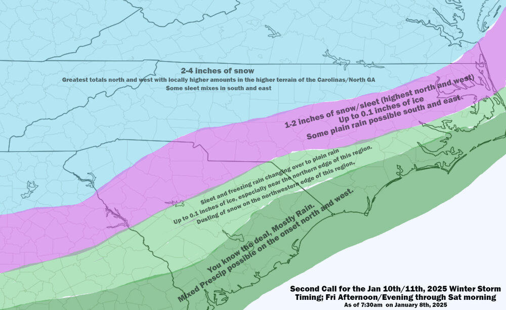
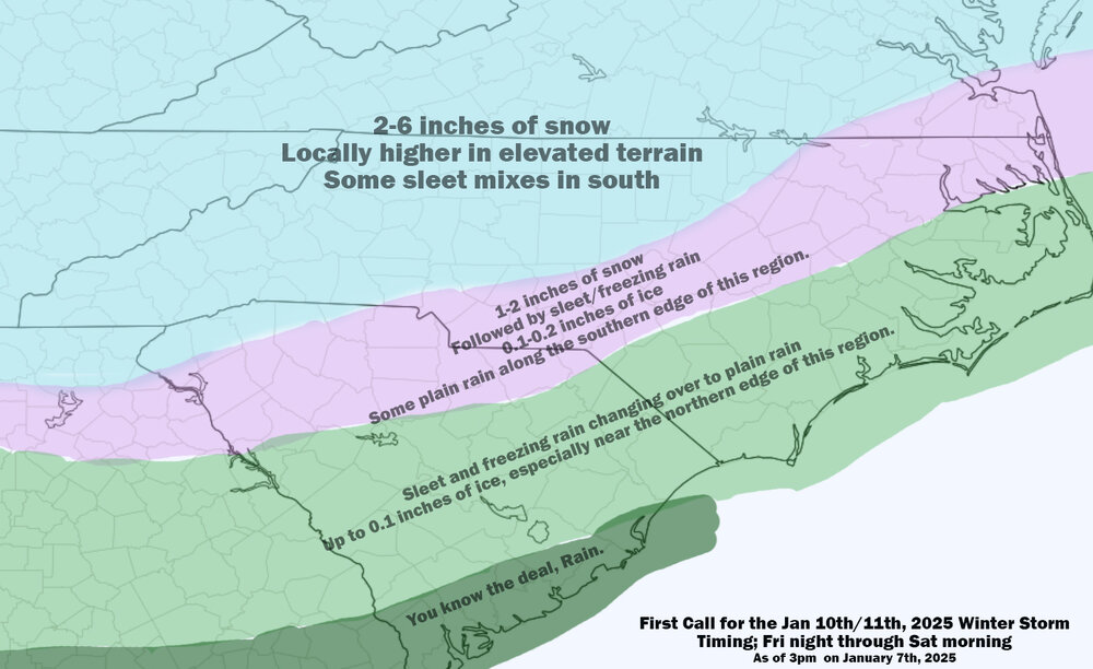
confidence. Latest available guidance generally suggests the
rain/snow line should lift nnwwd through the area Fri night as the
low lifts along the Carolina coast, possibly making it as far as the
climatologically favored I-85 corridor, with mainly snow to the
north, a wintry mix along, and mainly rain to the south of the line.
Precipitation onset will likely be between 21Z Fri and 03Z Sat, with
the precipitation quickly exiting the area Sat late morning/early
aft.


