eyewall
-
Posts
12,466 -
Joined
-
Last visited
Content Type
Profiles
Blogs
Forums
American Weather
Media Demo
Store
Gallery
Everything posted by eyewall
-
I have to look and see how often it has snowed at the end of September at the summits.
-
COVID restrictions in the Northeast prevented me from visiting for this. Thank you for the shots though. It looks like fall will be early weatherwise here as well and I am hoping the NC High Country puts on a show soon after delayed and dull foliage the previous two years. There are already signs it could go early. Some of the summits exceed 6K feet here so a wide variety of climate zones.
-
Yeah the last two years were pretty bad so hopefully this is a good one.
-
How is the foliage looking in the mountains? Any sign it is going early this year?
-
We definitely busted low in Raleigh but I expected that.
-
This is sure to cause some confusion for those following 22
-
This is definitely not needed.
-
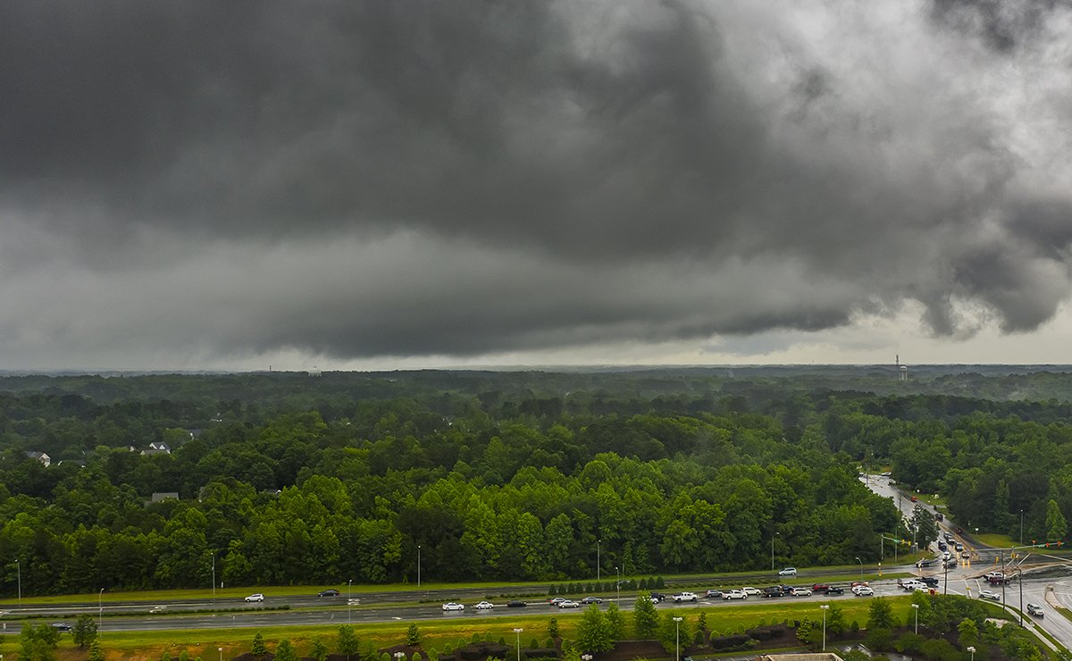
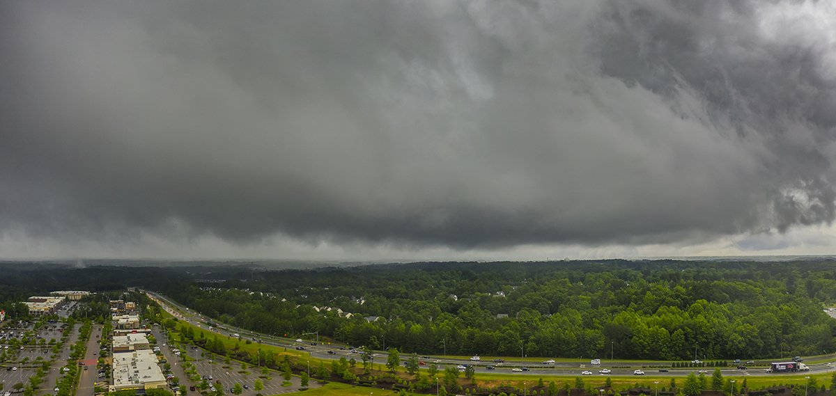
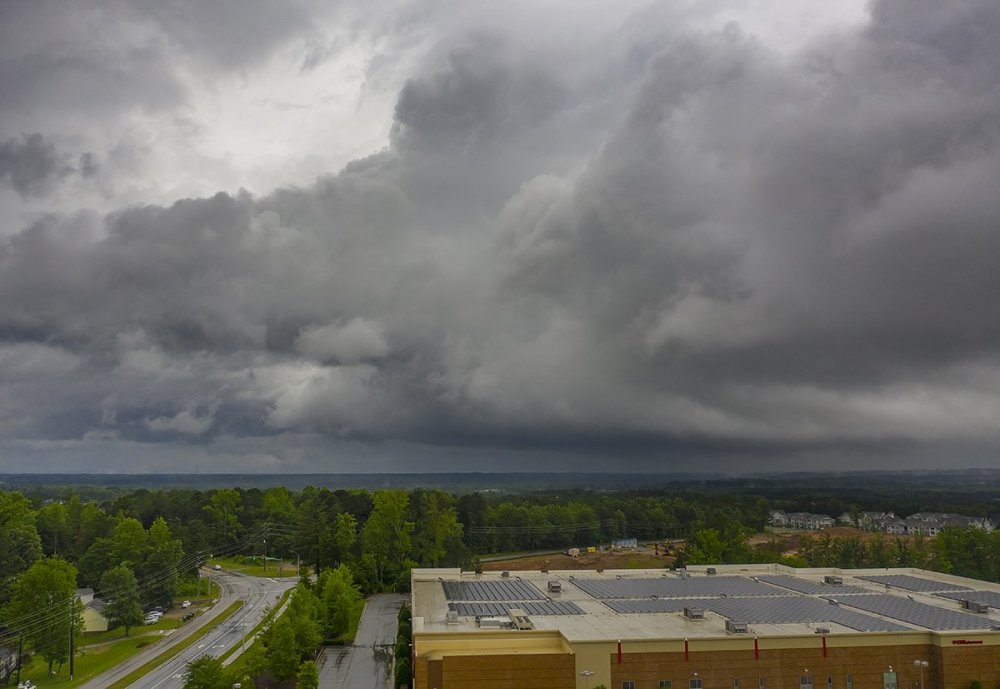
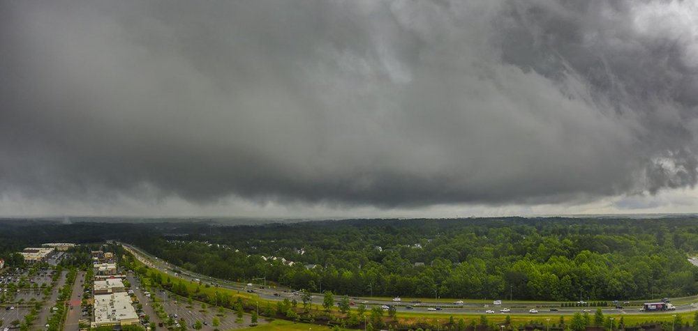
Some shots of the big outer rain band that approached Raleigh around 5:30pm on 8/3:
-
yes!
-
I doubt anyone will see that except the immediate beaches at most. I would say in the populated areas, maybe gusts to 60 in a couple of spots. The sustained 60 is over open water.
-
That looks amazing!
-
We had one downpour on this side of Raleigh yesterday and that was it. The models were backing off earlier this week but yeah another bust.
-
How are the Rhododendrons looking at the higher elevations? Is it too late?
-
Spring 2020 New England Banter & Random Obs
eyewall replied to CapturedNature's topic in New England
MT trip? URGENT - WINTER WEATHER MESSAGE National Weather Service Missoula MT 1049 AM MDT Mon Jun 15 2020 MTZ007-170000- /O.NEW.KMSO.WS.A.0007.200617T0000Z-200617T1800Z/ Butte/Blackfoot Region- 1049 AM MDT Mon Jun 15 2020 ...WINTER STORM WATCH IN EFFECT FROM TUESDAY EVENING THROUGH WEDNESDAY MORNING... * WHAT...Heavy wet snow possible. For elevations 5000 feet and higher: total snow accumulations of up to 8 inches possible. Locally higher amounts of 12 to 15 inches possible in the highest terrain (above roughly 6500 feet). * WHERE...Butte, Georgetown Lake, Highway 12 Garrison to Elliston, Homestake Pass, and MacDonald Pass. * WHEN...From Tuesday evening through Wednesday morning. * IMPACTS...Travel could be very difficult. Backcountry conditions could become difficult, if not dangerous, during this time. -
Meanwhile in MT: URGENT - WINTER WEATHER MESSAGE National Weather Service Missoula MT 1049 AM MDT Mon Jun 15 2020 MTZ007-170000- /O.NEW.KMSO.WS.A.0007.200617T0000Z-200617T1800Z/ Butte/Blackfoot Region- 1049 AM MDT Mon Jun 15 2020 ...WINTER STORM WATCH IN EFFECT FROM TUESDAY EVENING THROUGH WEDNESDAY MORNING... * WHAT...Heavy wet snow possible. For elevations 5000 feet and higher: total snow accumulations of up to 8 inches possible. Locally higher amounts of 12 to 15 inches possible in the highest terrain (above roughly 6500 feet). * WHERE...Butte, Georgetown Lake, Highway 12 Garrison to Elliston, Homestake Pass, and MacDonald Pass. * WHEN...From Tuesday evening through Wednesday morning. * IMPACTS...Travel could be very difficult. Backcountry conditions could become difficult, if not dangerous, during this time.
-
Yeah it busted hard for Raleigh. All the rain remained just to the west.
-
Additional showers and storms are likely to develop along the surface to 925 mb front/trough from s-cntl VA swwd across the NC Piedmont later this afternoon; and these will become numerous to widespread while settling only slowly sewd across the US Highway 1 corridor in cntl NC through early tonight. That activity is likely to pose the greatest risk of flash flooding, focused between 20Z Thu and 06Z Fri.
-
Yes indeed. My altitude was 100-200ft AGL in these.
-
There were a few mini supercells in southern Wake yesterday and of course one prompted a tornado warning. I got a few aerials as these rotated through:

-
Very cool. Thank you for sharing. Looks like mostly rime up there with the dusting of snow.
-
I unfortunately didn't make it out to Carvers Gap as I am needed at work today. The radar didn't look all that impressive overnight but I am sure they got something.
-
That is our plan as well. Hope to see you there.
-
Any cams showing snow yet?
-
I remember those May snows well when I was up there. Looks like I will be headed up to the NC Mountains overnight. May be an inch or two of snow at 5K feet at sunrise. That would be just about at the latest recorded snow I believe.
-
Yeah it will be a heck of a trip with no sleep but might be worth catching one of the latest snows on record in NC.