eyewall
-
Posts
12,466 -
Joined
-
Last visited
Content Type
Profiles
Blogs
Forums
American Weather
Media Demo
Store
Gallery
Everything posted by eyewall
-
Most definitely the worst stretch of being so close yet so far away I have ever experienced here with days of cold rain rubbing in the salt. I hate having to wait all the way until next winter for another shot.
-
Yep we can thank the mountains for that.
-
Honestly I would take a torch at this point since we are not getting any snow.
-
The NAM is better at depicting the BL but don't rely on it for QPF when looking at the next ice potential.
-
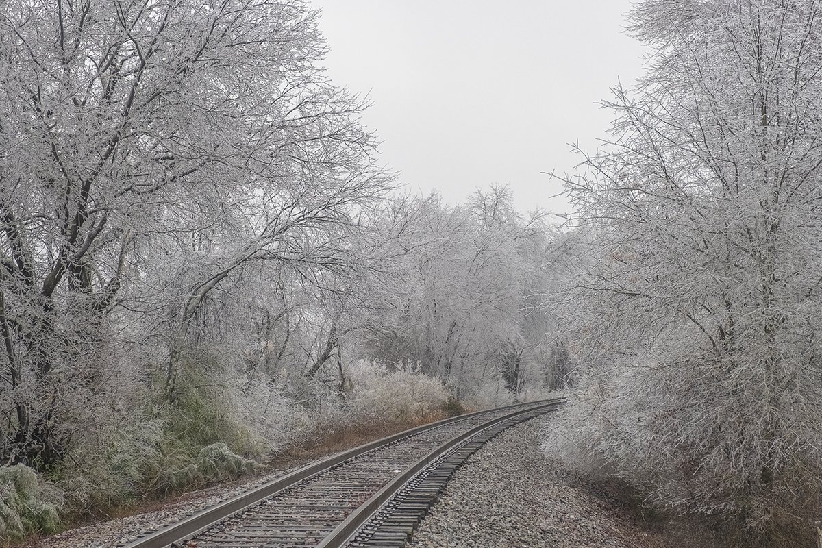
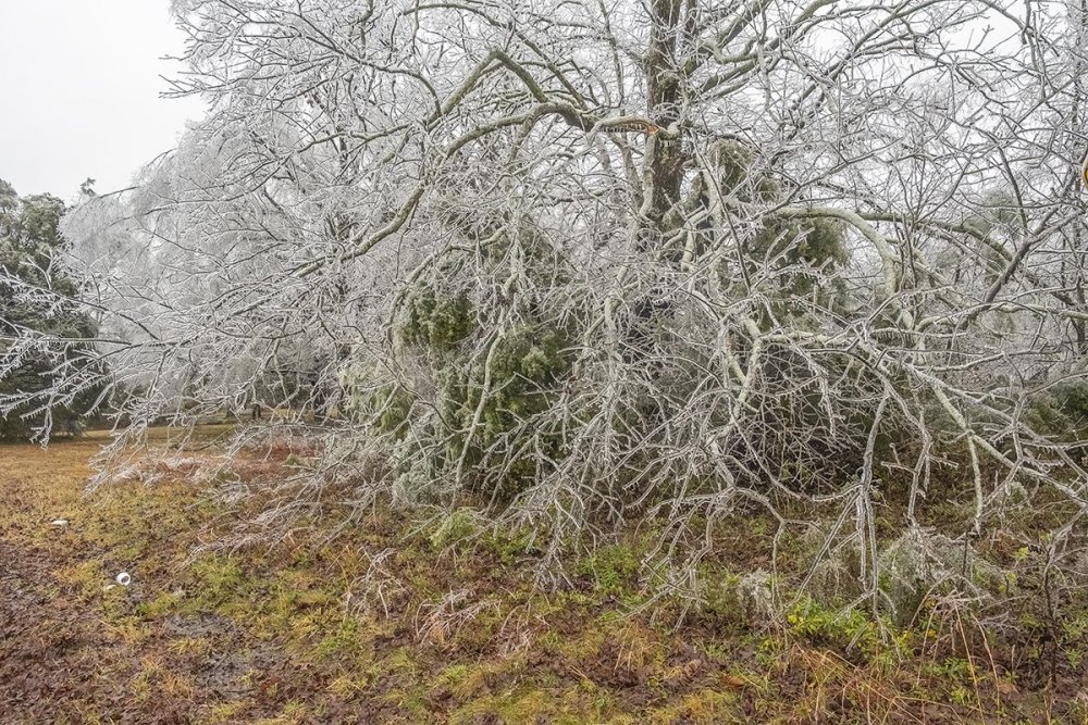
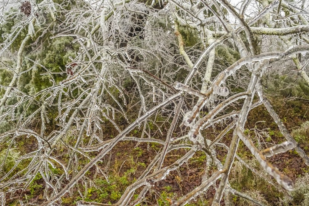
Henderson NC ground shots:
-
Thank you! Wish I got there a bit sooner.
-
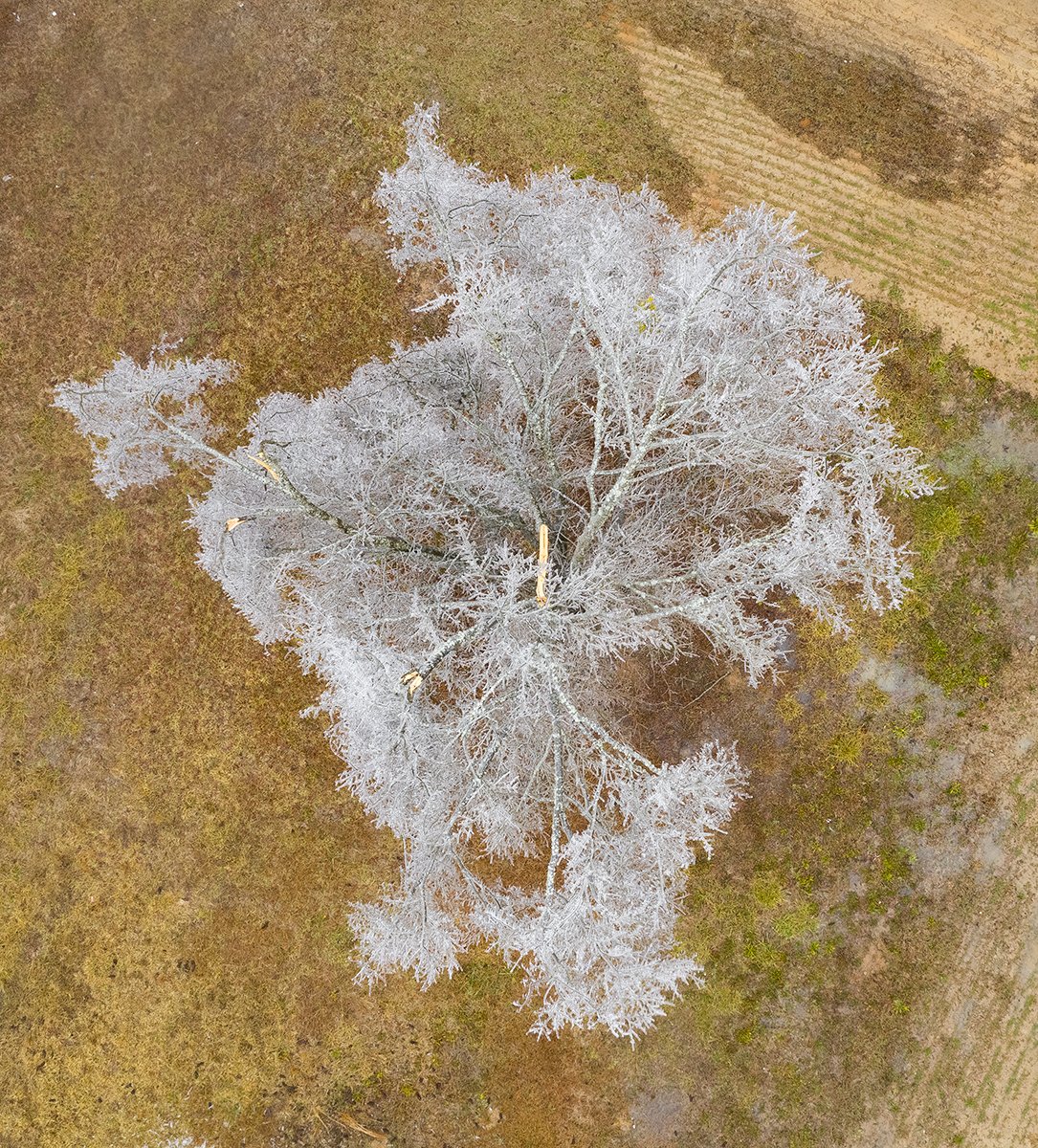
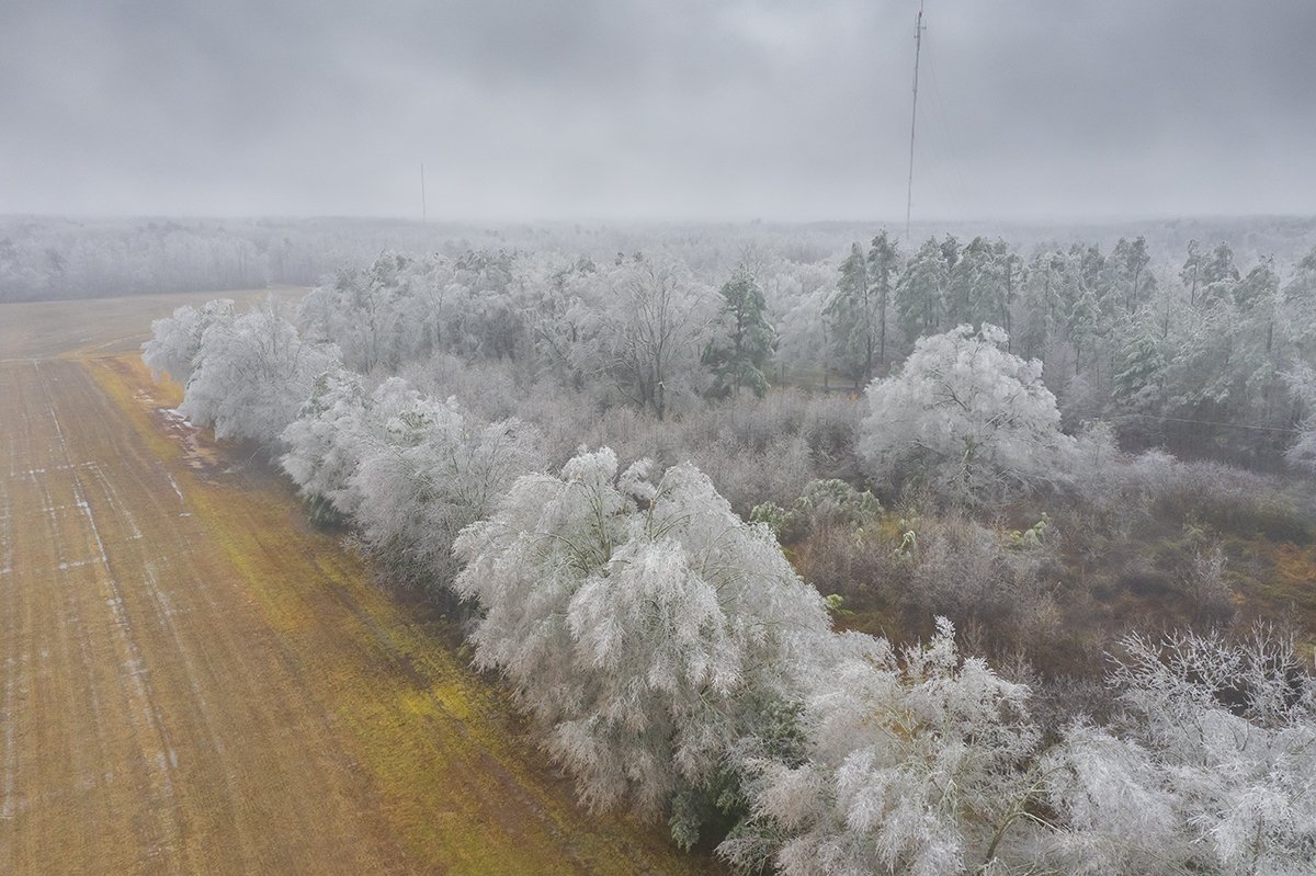
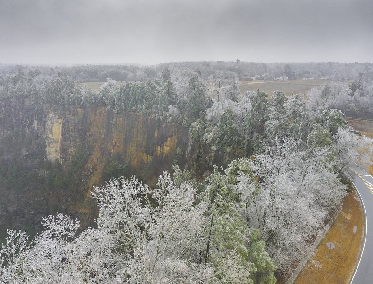
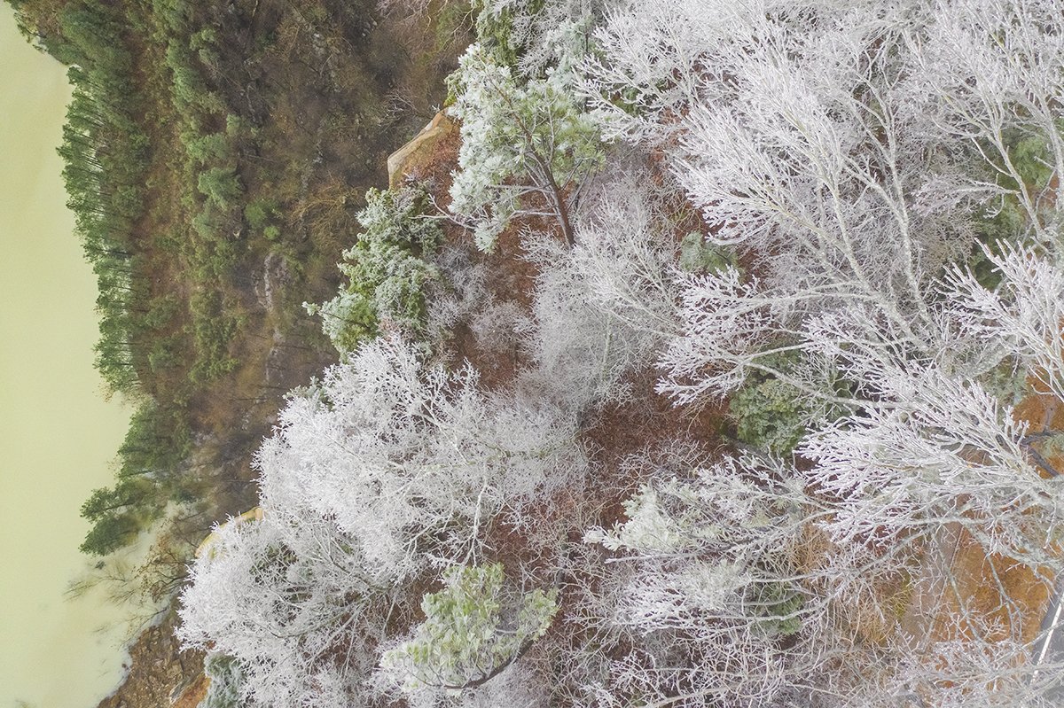
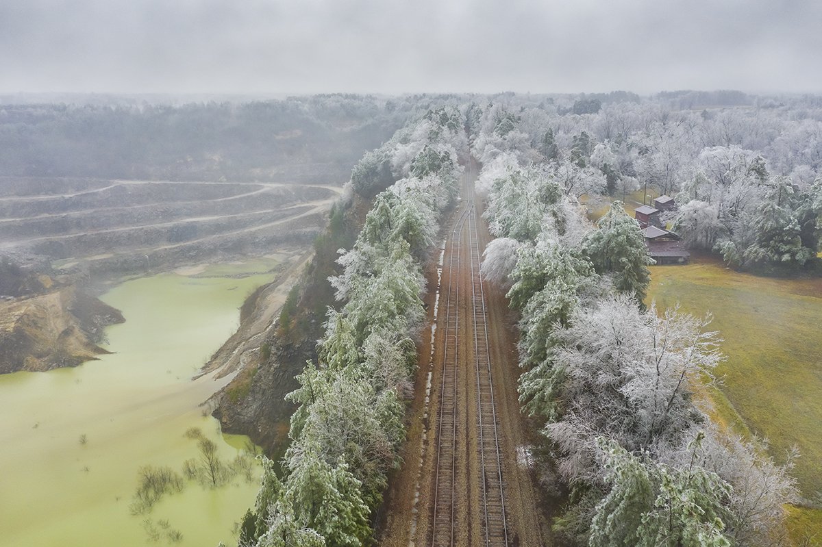
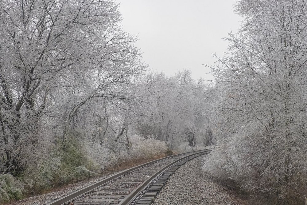
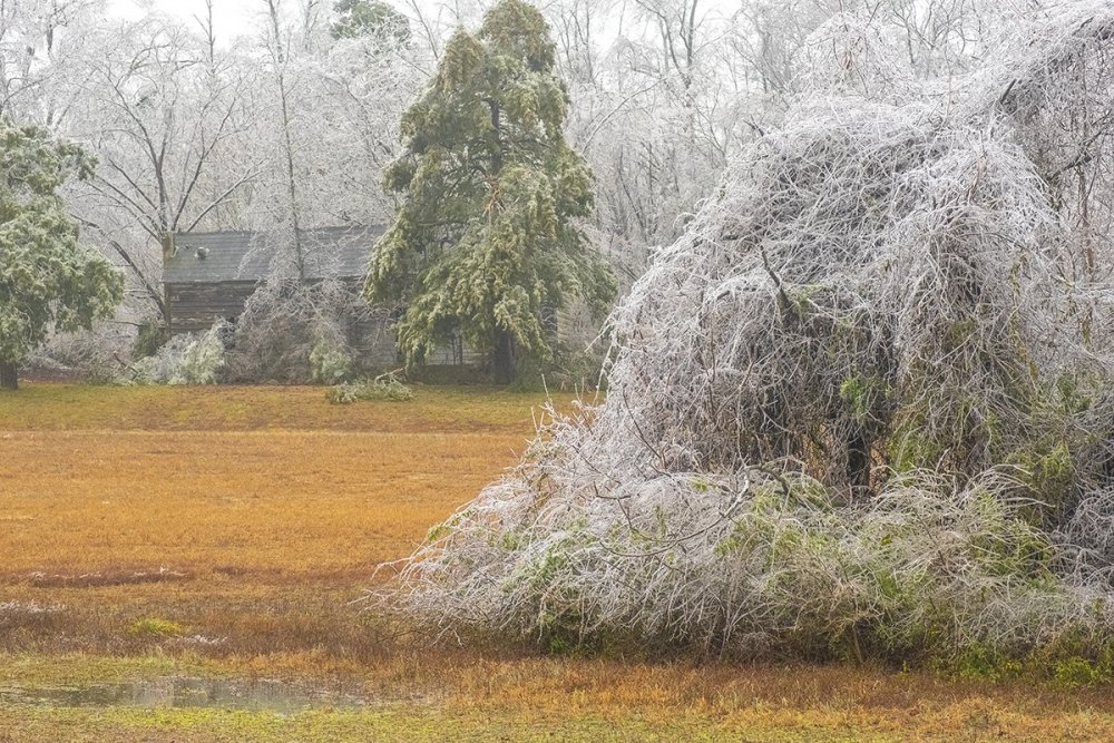
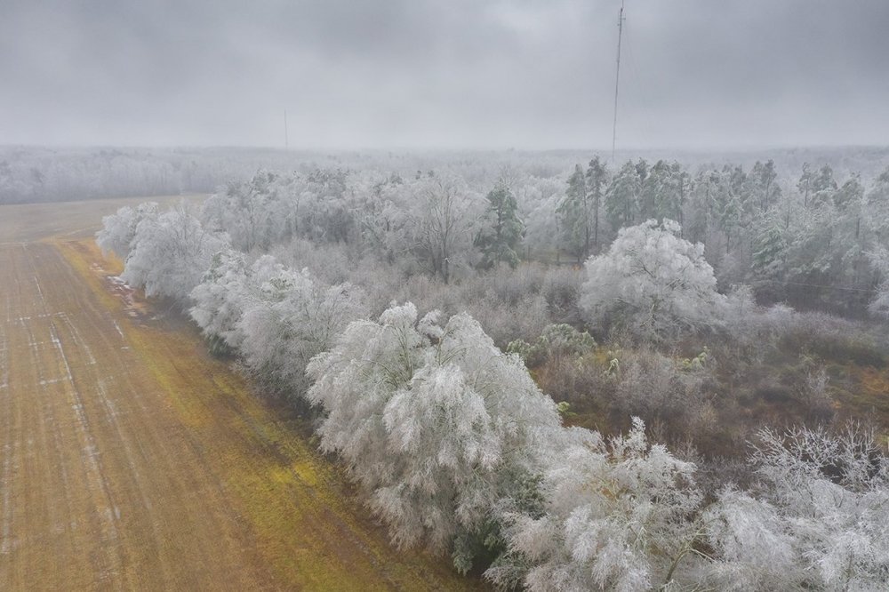
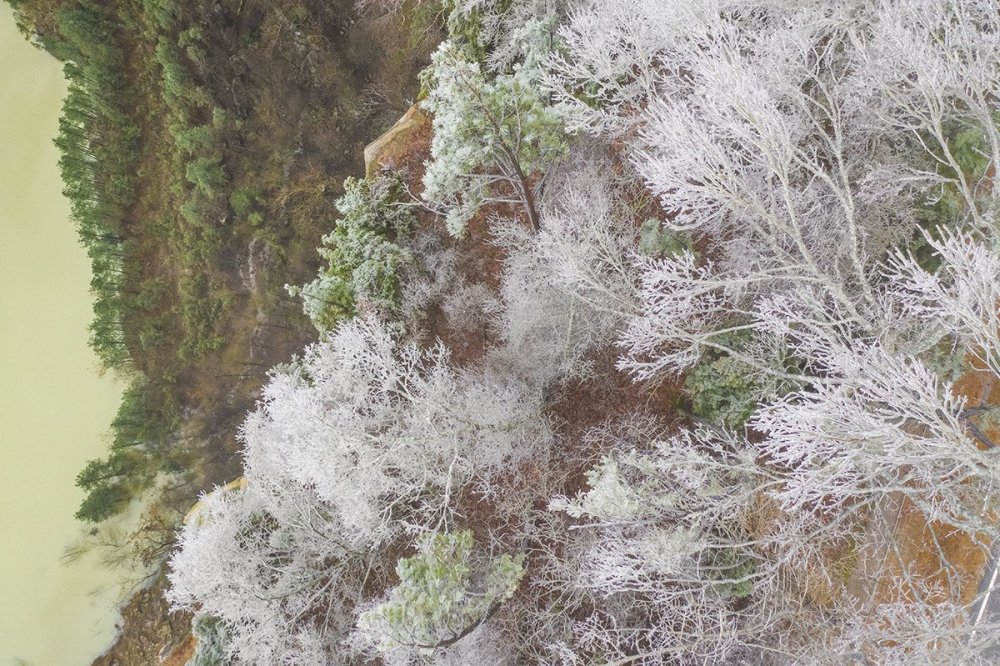
Some drone shots I grabbed in Henderson NC after work before it got dark. It was already beginning to melt by this time:


- 450 replies
-
- 18
-

-

-
I will post some shots from Henderson tomorrow (Sunday). They are via drone and from the ground. Quite a bit of tree damage there near thr quarry area. Ice accrual was probably around 0.3 inches or so and it had already been melting by the time I got there.
-
I am referring to the extended stretch of 30's and rain.
-
I am 44 and this is definitely among the worst I have seen.
-
Anyone know how it looks in Henderson? I am wondering if their 30F ob is actually right.
-
Yeah our region is pretty much going to be the only one without anything more than a minor hit this year.
-
Yeah it just sucks hands down. The worst is the long wait until next winter. I can't stand the heat of July and August. The only upside is maybe a a few severe chases.- Yeah we can get something in March, but unless it is a nocturnal event it has a hard time against the sun angle.
-
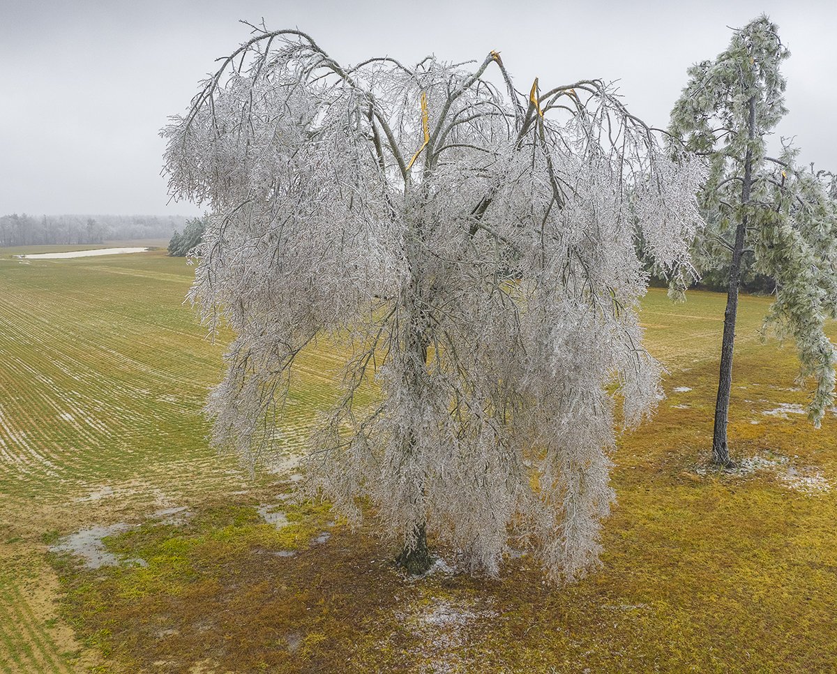
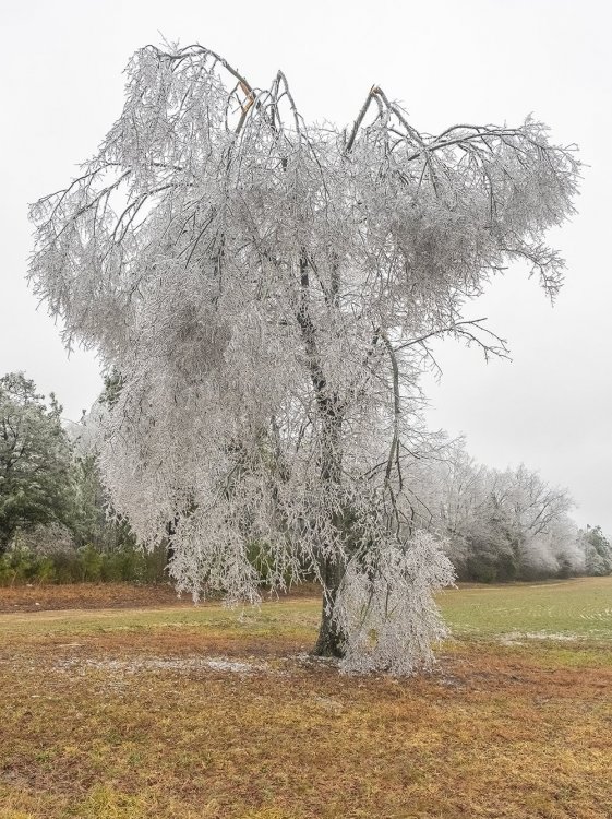
Thanks. I was going to try and get some aerials of icy trees. I know tomorrow will be more so but I will have to hope for a break from work to do that.
-
Anyone know what it is looking like right now up by Henderson?
-
It is maddening to say the least. I pissed off a lot of people but it seems like I was mostly right for my area with the exception of one minor event. We barely pulled that off as it was. The Mid-Atlantic won the year as did persistence. Welcome to the cliff.
-
It is complete misery without question. The 12z globals are a bloodbath. The only reason this winter doesn't get an F here is the one minor event we did have. It is a D.
-
I was hoping to at least get some ice storm drone shots if we couldn't pull a warning level snow event. The one minor snow will have to suffice.
-
Raleigh came in with a tough discussion to read for those hoping for next week: Significant model disagreements remain for Monday night into Tuesday morning. ECMWF has been taking the surface low west of the mountains while the GFS has been keeping a secondary low offshore. Recent runs of the GFS However have started to trend more towards the Euro, which would yield a warmer solution with most of the Mid-Atlantic in the warm sector. There will be an influence of northerly flow at the surface to begin the day with cold air trying to make its last efforts to move into the area before the strengthening surface low pressure system in the Deep South moves into the Ohio Valley. Biggest threat looks to be a brief period of freezing rain early Tuesday morning quickly changing to rain by late morning. Still more details needed to be sorted out for this period as uncertainty remains high. Tuesday both long range models are in good agreement that the aforementioned low pressure system from the Gulf will slightly strengthen and move up across GA and to the west of our region. Rainfall is expected to last through Tuesday ending late Tuesday night into early Wednesday morning. Expect dry conditions on Wednesday with temperatures in the 50s.
-
Thank you all.
-
Thank you!
-
Thank you
-
Ok you are right and I am sorry. I have not been doing well outside of weather with a friend permanently damaged health wise by COVID and he lost his dad to the illness. I suppose I let that carry over to my posts here without thinking it through first. Anyway, I am awaiting the RAH discussion to see their line of thought given the latest runs for next week.
-
Technically I did not see the thundersnow where I was, but yes we did have that one minor snowfall which was nice. The overall pattern however has primarily been in the Mid-Atlantic's wheelhouse storm after storm.
-
I am aware but I am referring to the overall setup east of the mountains this year.