eyewall
-
Posts
12,466 -
Joined
-
Last visited
Content Type
Profiles
Blogs
Forums
American Weather
Media Demo
Store
Gallery
Everything posted by eyewall
-
I think it is similar to SPC probs within 25 miles of any given location but for a much bigger area. Maybe within 100 miles?
-
Newton Grove in NC is a nice go to as well.
-
I think we may need to add Thursday to this thread too but definitely the first big Dixie Alley event of the year.
-
Should be a nice hit for Hagerstown.
-
This is the time of year I hate most because I know the heat will be here soon enough.
-
It is a D- here.
-
If I commented right now I would probably be banned.
-
February 18-19 MAJOR Ice Storm Threat
eyewall replied to NorthHillsWx's topic in Southeastern States
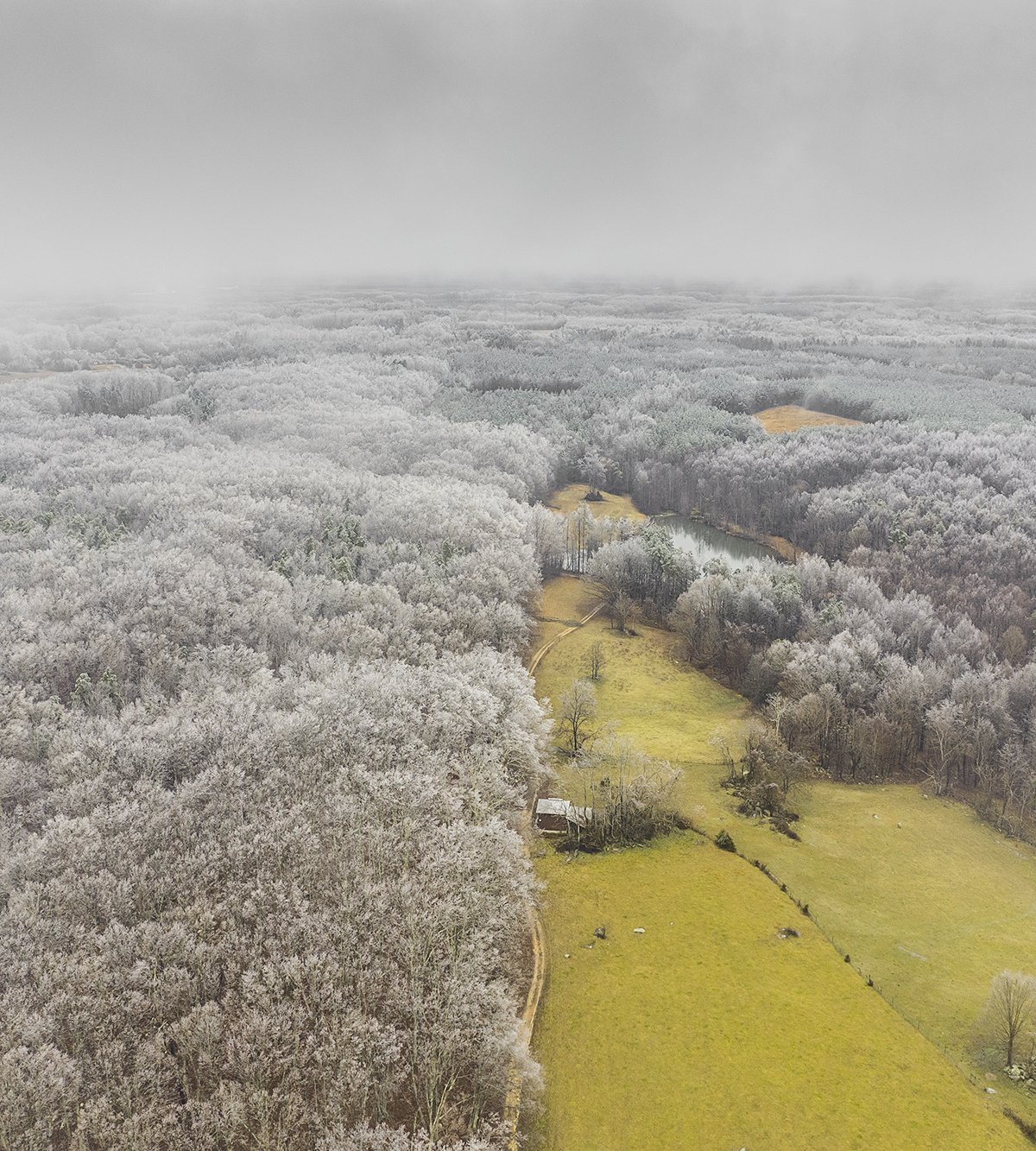
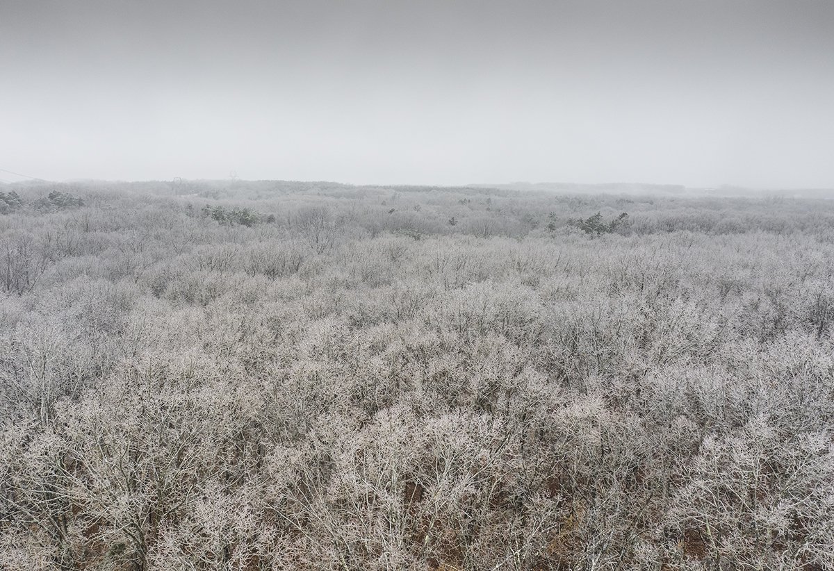
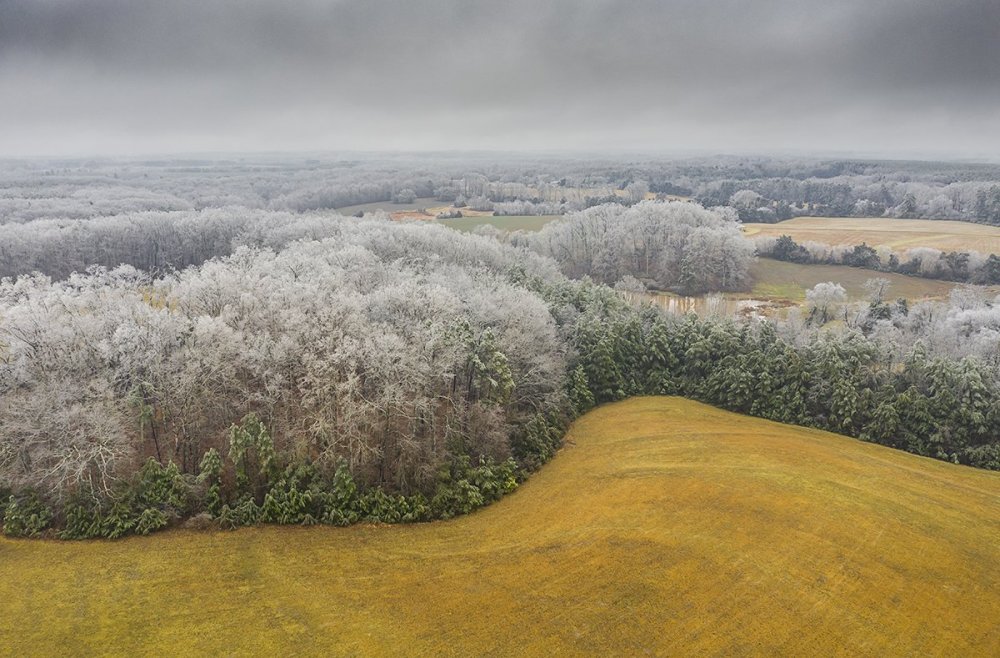
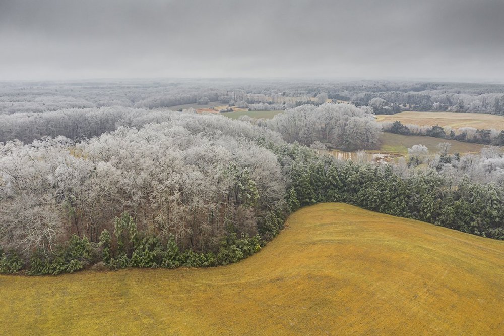
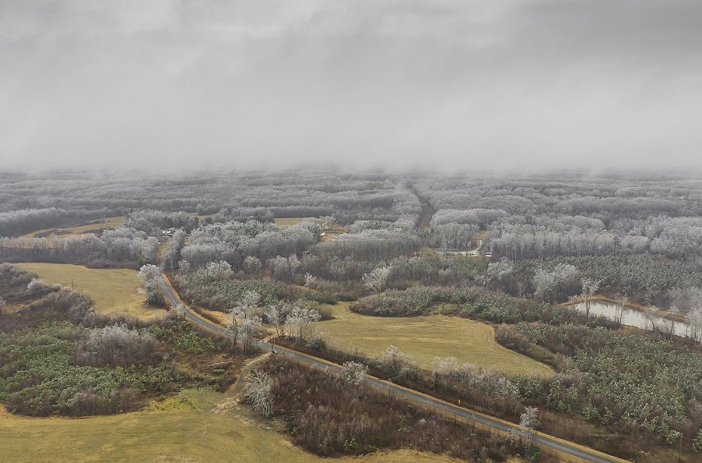
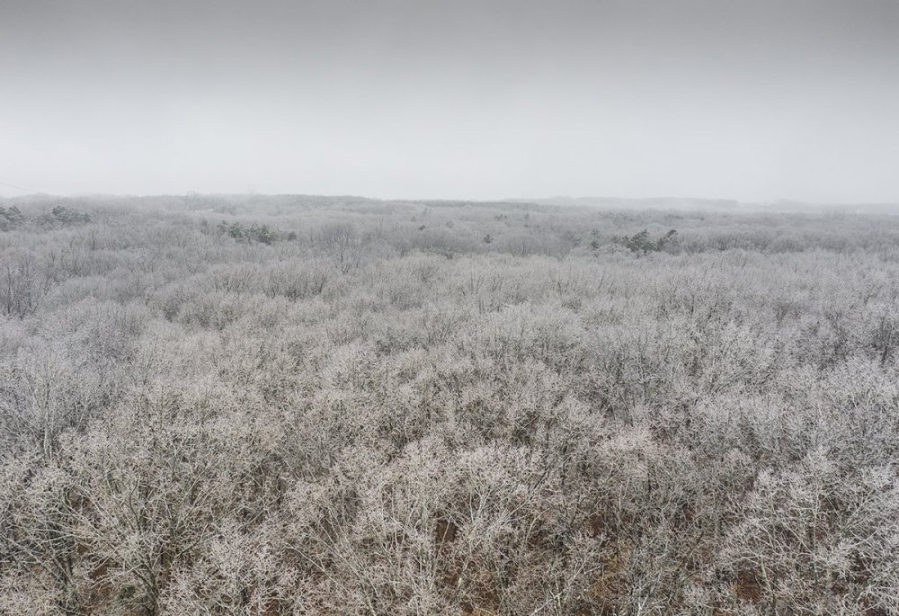
A few more (some are re-edits):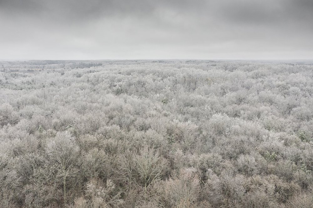


-
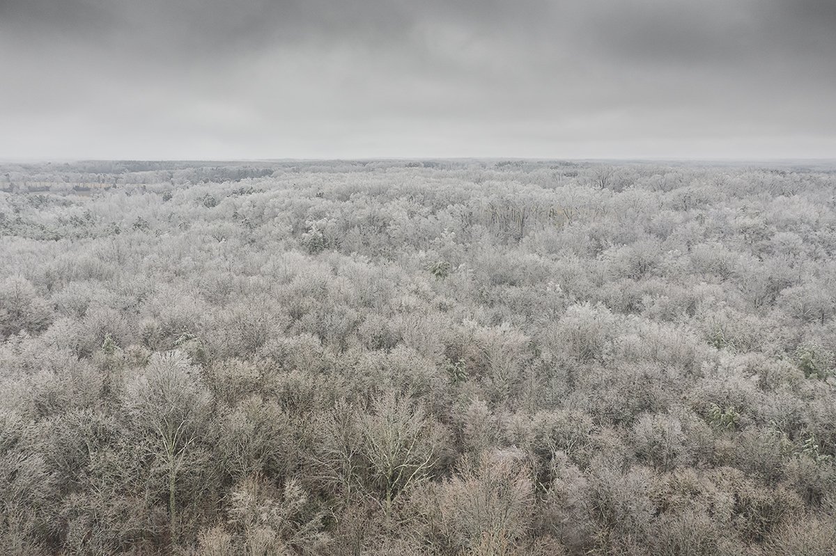
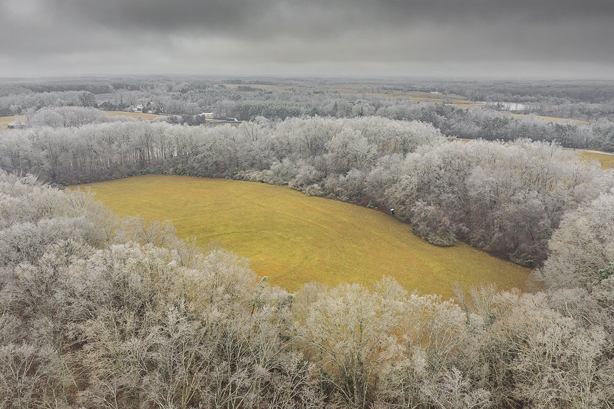
February 18-19 MAJOR Ice Storm Threat
eyewall replied to NorthHillsWx's topic in Southeastern States
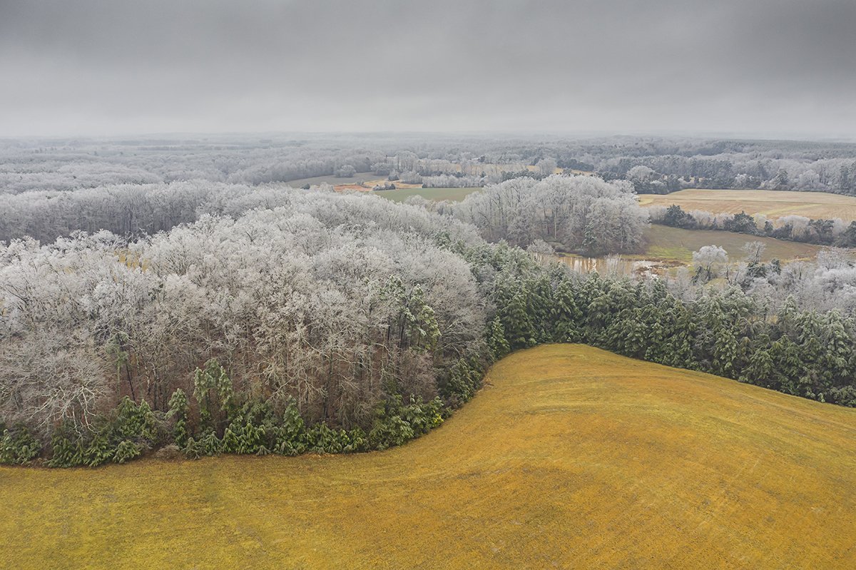
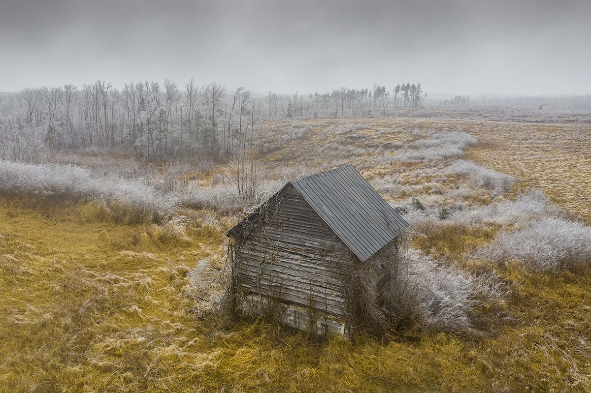
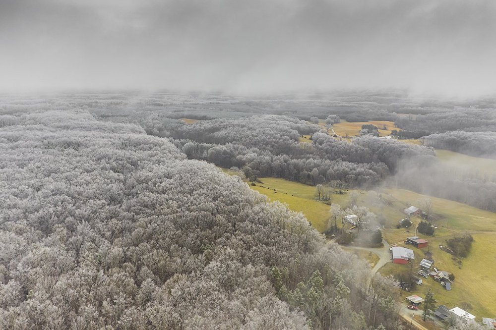
Yeah looked like there was a round 2 up there. Some pics from today: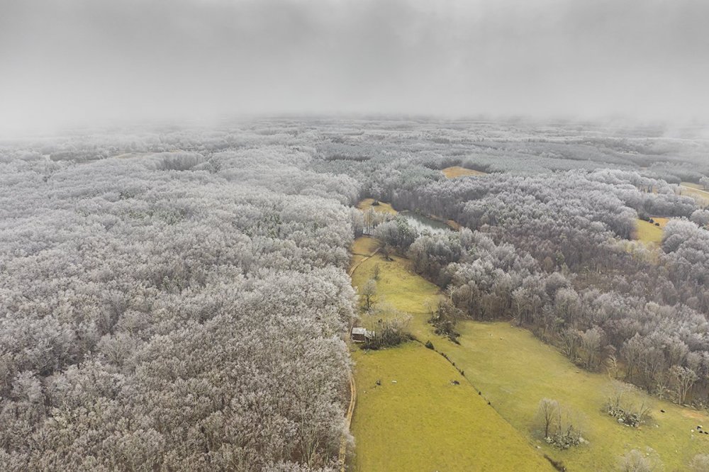


-
February 18-19 MAJOR Ice Storm Threat
eyewall replied to NorthHillsWx's topic in Southeastern States
Anyone know if Roxboro added any overnight? No significant power outages reported that way overnight. -
February 18-19 MAJOR Ice Storm Threat
eyewall replied to NorthHillsWx's topic in Southeastern States
Looks like some solid ZR showers in Roxboro tonight. I am going back in the morning. -
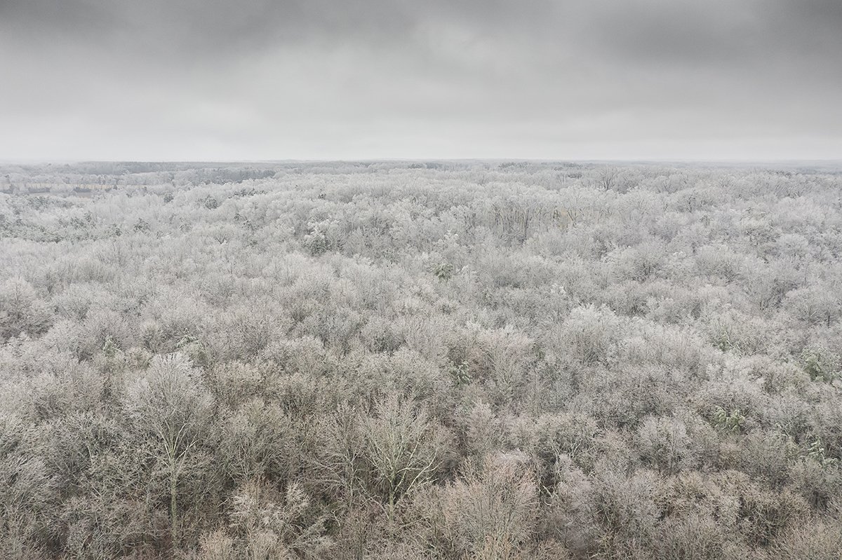
February 18-19 MAJOR Ice Storm Threat
eyewall replied to NorthHillsWx's topic in Southeastern States
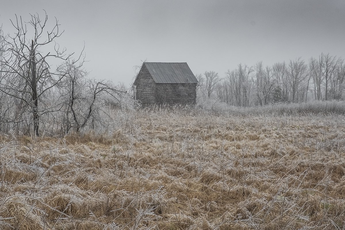
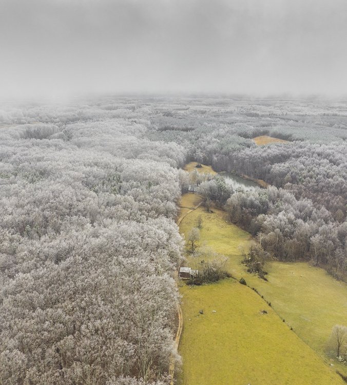
Actually just north of the border on the VA side for the cabins and the icy trees were a few miles north of Roxboro in person county off 501. -
February 18-19 MAJOR Ice Storm Threat
eyewall replied to NorthHillsWx's topic in Southeastern States
One more from the ground: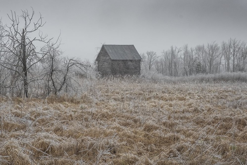
- 970 replies
-
- 13
-

-
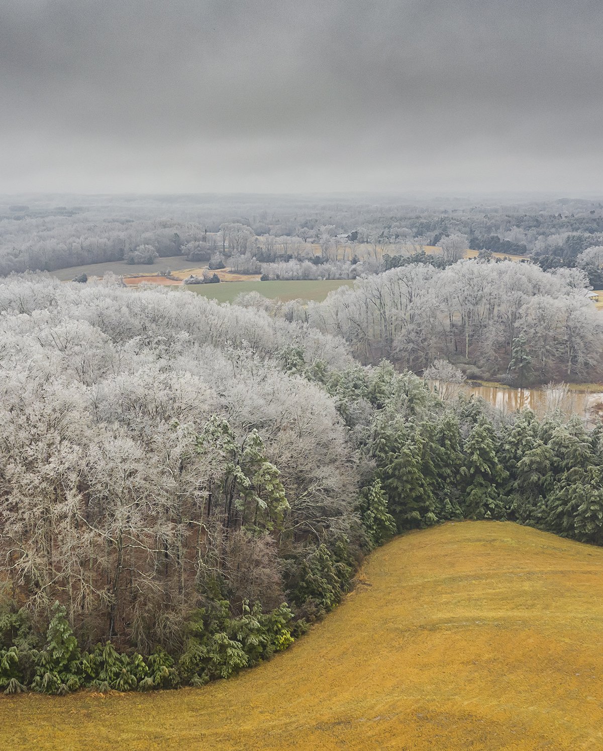
February 18-19 MAJOR Ice Storm Threat
eyewall replied to NorthHillsWx's topic in Southeastern States
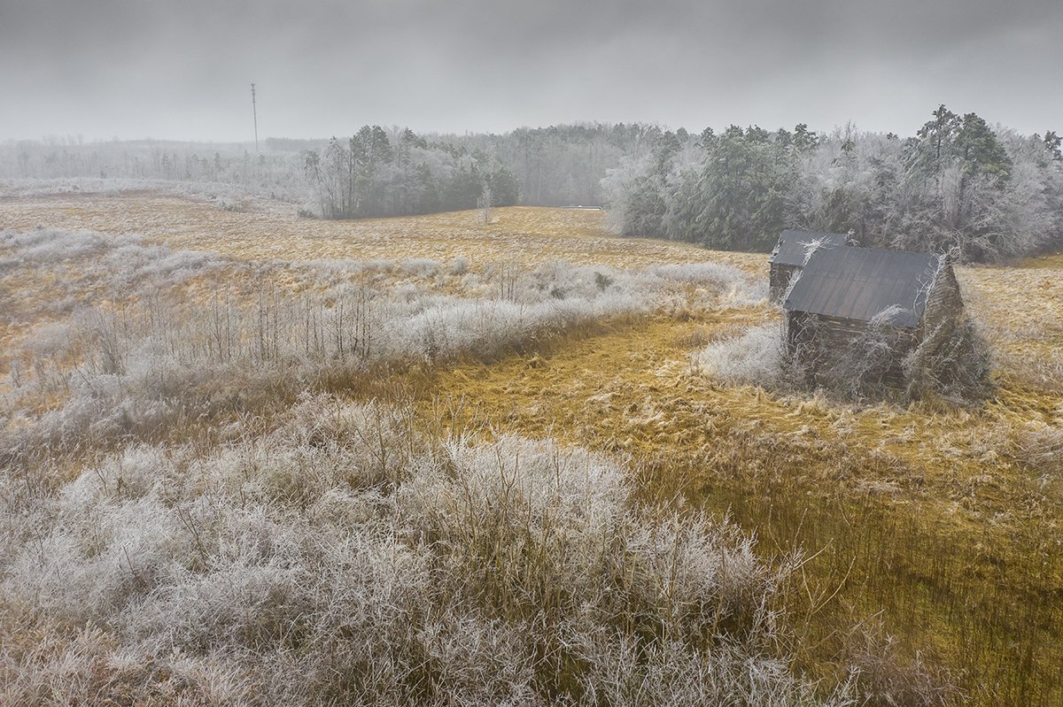
Just north of Roxboro near the VA line this afternoon.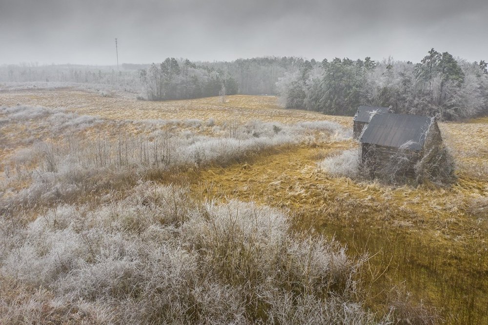
- 970 replies
-
- 23
-
-
February 18-19 MAJOR Ice Storm Threat
eyewall replied to NorthHillsWx's topic in Southeastern States
Anyone know how it is looking around Pilot Mountain/Hanging Rock? Looks like Roxboro might be a bust for drone shots given the QPF issues. -
February 18-19 MAJOR Ice Storm Threat
eyewall replied to NorthHillsWx's topic in Southeastern States
I haven't been outside but I can't see a noticeable glaze here. We did have some sleet at the onset for sure. I plan on headed to Roxboro a little later to see what it looks like there. -
February 18-19 MAJOR Ice Storm Threat
eyewall replied to NorthHillsWx's topic in Southeastern States
40s still in Raleigh lol. -
February 18-19 MAJOR Ice Storm Threat
eyewall replied to NorthHillsWx's topic in Southeastern States
I said earlier we saw this more than once this winter where the models get aggressive as we close in on an event only to pull back at the last second. It got RAH a couple of times. I wonder if we are seeing it again now. -
February 18-19 MAJOR Ice Storm Threat
eyewall replied to NorthHillsWx's topic in Southeastern States
Either way I plan on getting shots around Roxboro tomorrow and I agree in thinking no matter what I think there will be a significant ice event there through the Triad and portions of western NC. Obviously southern VA as well. Max ice amounts of 0.4-0.6 seem reasonable for now. Raleigh picks up 0.1 and perhaps 0.2 to the northwest on 540. -
February 18-19 MAJOR Ice Storm Threat
eyewall replied to NorthHillsWx's topic in Southeastern States
We have seen it before this winter with the models getting aggressive only to pull back a bit northwest at the last minute. RAH busted on a few winter storm warnings this year because of that. -
February 18-19 MAJOR Ice Storm Threat
eyewall replied to NorthHillsWx's topic in Southeastern States
Usually as ou approach .25 or greater. -
February 18-19 MAJOR Ice Storm Threat
eyewall replied to NorthHillsWx's topic in Southeastern States
Looks like I will be headed toward the Triad for drone shots. -
February 18-19 MAJOR Ice Storm Threat
eyewall replied to NorthHillsWx's topic in Southeastern States
I just don't see how that much ice accrual occurs with temps in the 30-32 range. You really need 28-29 with a sustained cold air feed keeping it there for the well over 0.25 amounts. -
Temps still don't look great on the NAM
-
Pretty much this. NAM only gets those areas down to 30-32 which isn't good enough for a high end event. Raleigh may touch 32 briefly but mainly 33-36. wash, rinse, repeat.