eyewall
-
Posts
12,466 -
Joined
-
Last visited
Content Type
Profiles
Blogs
Forums
American Weather
Media Demo
Store
Gallery
Everything posted by eyewall
-
Nailed it!
-
Nice dendrites in this band! This is that high ratio stuff we want.
-
Yep eating crow with my snow cream
-
Yeah it was 80 on New Years. It is a beautiful storm.
-
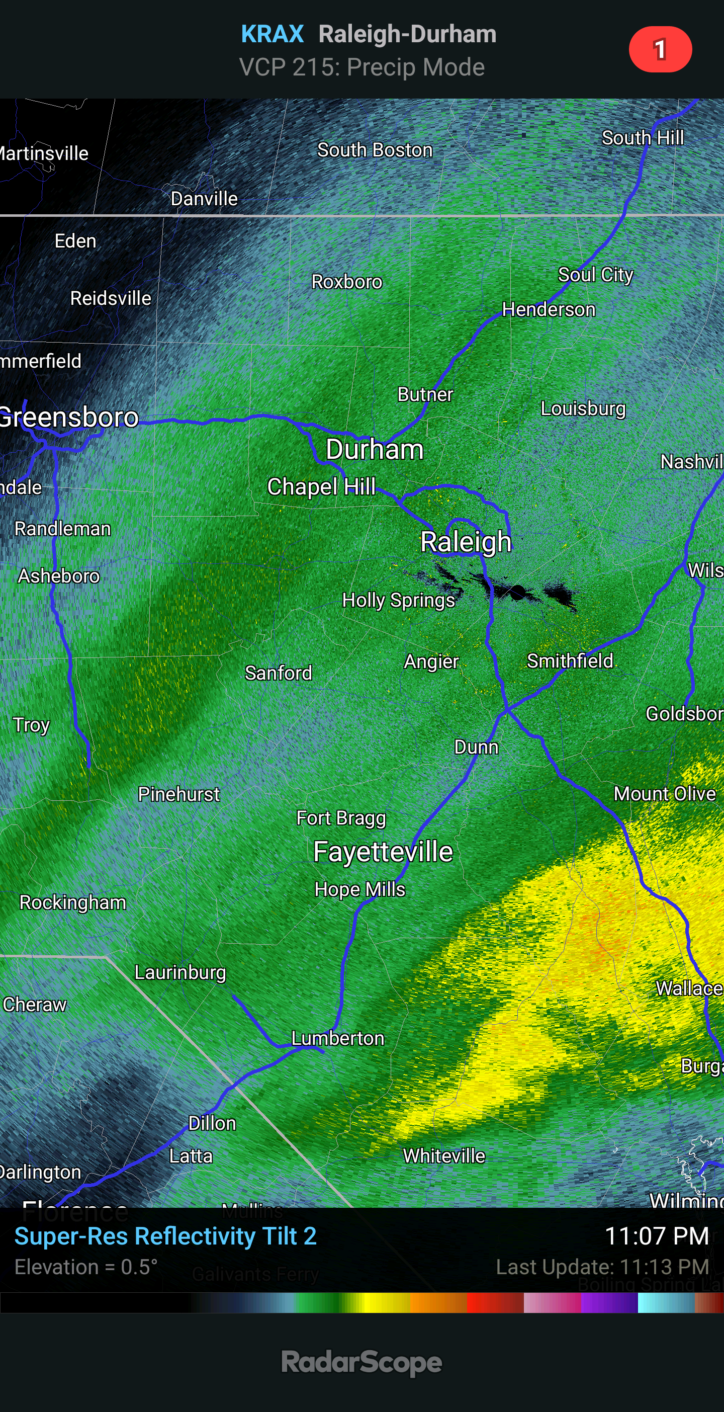
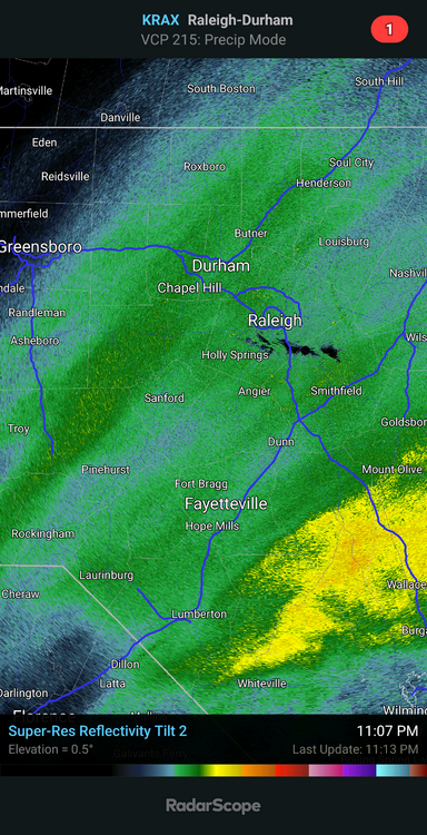
That band west of Raleigh is the real deal.
-
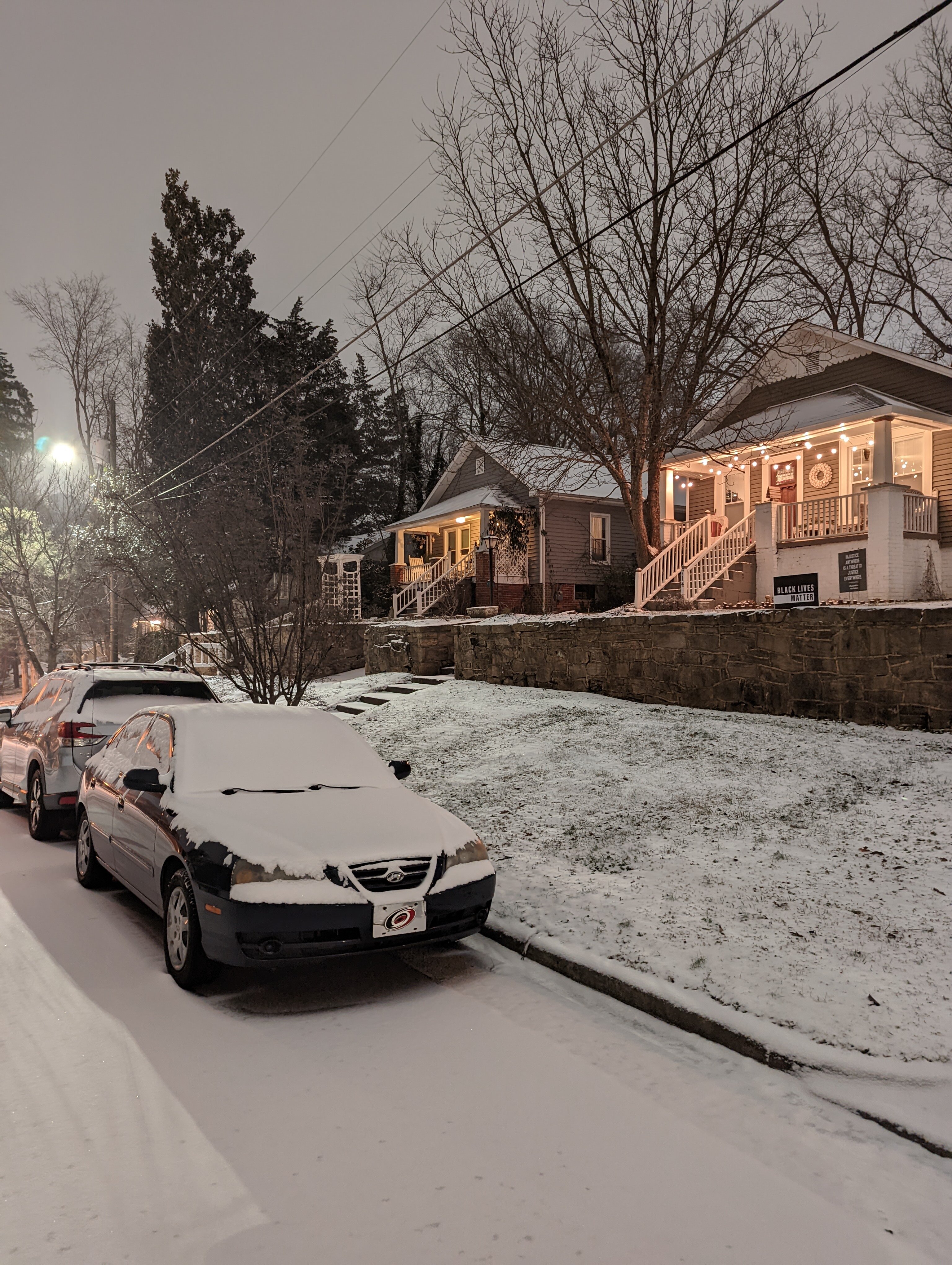
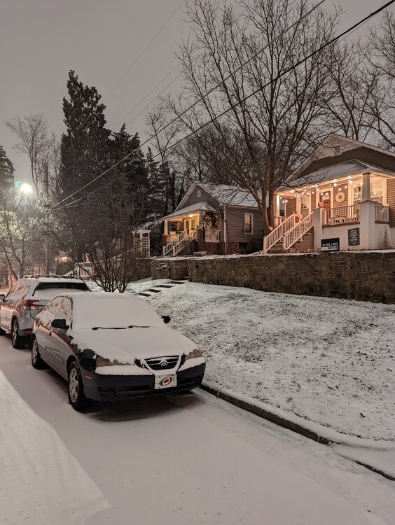
Coming up on 2 inches here.
-
Ask and you shall receive. Picking up now
-
At this rate it is going to be tough making the low end of the forecast amounts. We will build an inch evey 5 hours or so with the current growth.
-
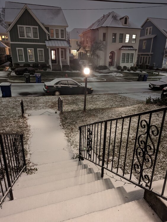
Growth is still lacking a bit but looking better. Definitely a real powder out there, something rare for NC outside the mountains/foothills.
-
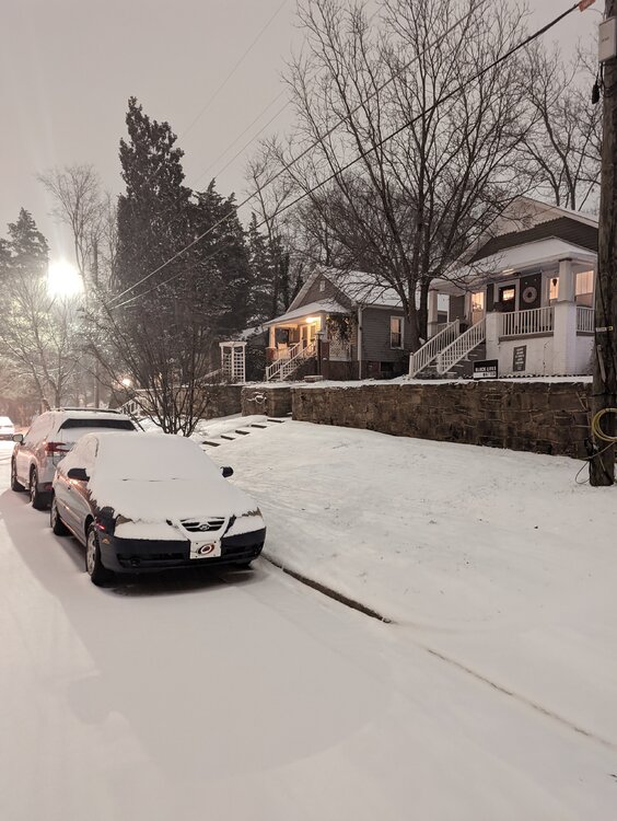
Raleigh at 7:30pm
-
Dusting in Raleigh so far with steady light snow. Need some better snow growth to really start building accumulation.
-
January 20-22 “bring the mojo” winter storm threat
eyewall replied to lilj4425's topic in Southeastern States
Some of that is mixing with IP/ZR -
Dendrites given the temps I would think.
-
Flurries in Raleigh which means the column has saturated enough for now.
-
January 20-22 “bring the mojo” winter storm threat
eyewall replied to lilj4425's topic in Southeastern States
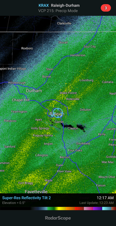
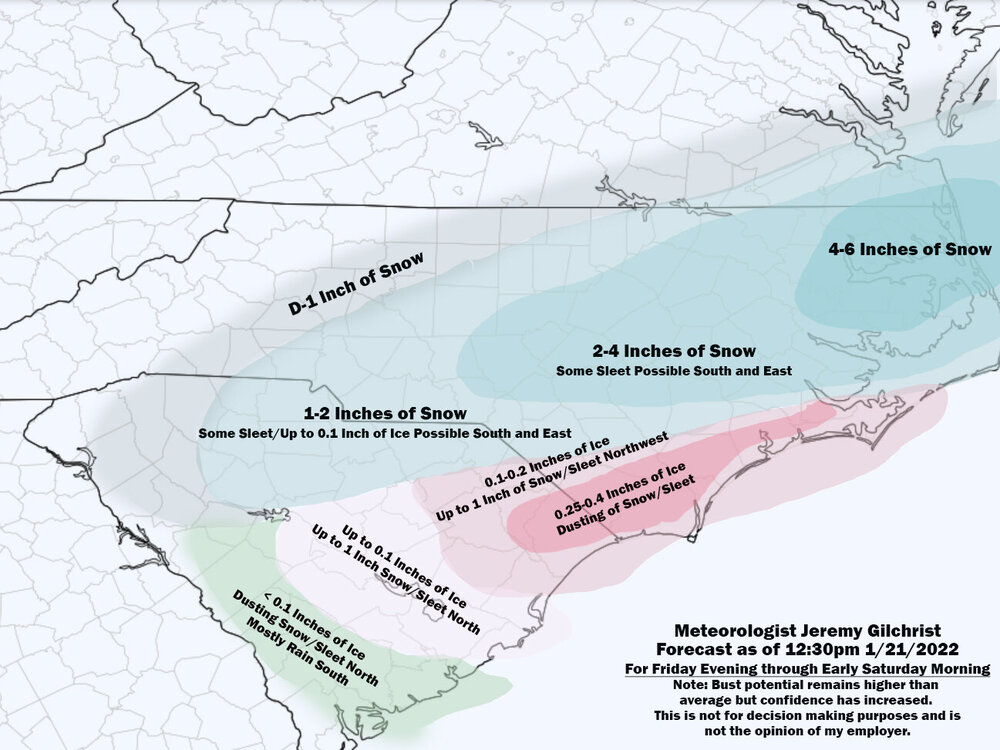
Latest guidance and observed trends are increasingly supportive of a high potential for heavy snow bands to develop over portions of central and eastern NC over the next 15 hours, with the focus on the 7p-3a time frame. The latest surface analysis shows frigid high pressure nosing down through central NC with cold/dry air advection, including single-digit dewpoints just to our N. Radar continues to show spotty elevated returns facing this dry subcloud layer and thus not reaching the ground. However, this is expected to change as the deep layer forcing for ascent strengthens as we head into the evening, resulting in saturation of the column and a blossoming of wintry precip over central NC, all in tandem with a band of increasing H7-H5 fgen from the central Piedmont E nearly to the coast between 02z and 08z. Most large scale models depict much stronger and more focused upper divergence over north-central and northeast NC than previous runs showed, and the potent mid level shortwave trough crossing the region this evening/tonight now takes on a neutral to slightly negative tilt as it reaches central NC. High res model guidance including recent HRRR runs also show well the bands of heavier precip starting this evening. Much of the area will see a fully below-0C column except for the SE, roughly along/SE of a Maxton-to-Goldsboro line which will see some warming aloft, although the expected degree of glazing in the SE has trended lower in recent model runs, and even this area may see decent snowfall with fairly light icing except for areas SE of Clinton. Given the higher confidence in the occurrence of heavy snow bands, have bumped up storm total snow to 2.5-4.5" along and east of a Wadesboro-to- Roanoke Rapids line. Areas NW of here will likely see some snow, but lasting a shorter time and with a lower threat of heavy snow, so we issued an advisory for the remainder of the area, except Forsyth, for snow totals up to 2". A quick exit of the precip from W to E is expected by sunrise or very soon thereafter. Lows from the teens to lower 20s. Chilly NW winds through the night will culminate in daybreak wind chills into the single digits to lower teens. -GIH -
Probably my final call here:
-
January 20-22 “bring the mojo” winter storm threat
eyewall replied to lilj4425's topic in Southeastern States
2-4 inches in the Warning. -
967 LOL:
-
January 20-22 “bring the mojo” winter storm threat
eyewall replied to lilj4425's topic in Southeastern States
I don't think they will do that. I think if they feel there is a decent chance at 3+ they will go warning -
January 20-22 “bring the mojo” winter storm threat
eyewall replied to lilj4425's topic in Southeastern States
I think the GFS wants to develop a bit of banding, especially against the transition zone to IP/ZR. That wouldn't be unusual. To the north it is better ratios getting the job done. -
January 20-22 “bring the mojo” winter storm threat
eyewall replied to lilj4425's topic in Southeastern States
-
January 20-22 “bring the mojo” winter storm threat
eyewall replied to lilj4425's topic in Southeastern States
They are not going to budge until the precip shield becomes established. -
January 20-22 “bring the mojo” winter storm threat
eyewall replied to lilj4425's topic in Southeastern States
I would say needs to be closer to 3 to make for some good photos. We shall see. -
January 20-22 “bring the mojo” winter storm threat
eyewall replied to lilj4425's topic in Southeastern States
Too much uncertainty. This is a crapshoot so brace yourselves. The zones have the same for me as some of the warning areas though. -
Yeah that is what we have over here by Oakwood.