eyewall
-
Posts
12,465 -
Joined
-
Last visited
Content Type
Profiles
Blogs
Forums
American Weather
Media Demo
Store
Gallery
Everything posted by eyewall
-
Still no clear answer but I would take the 12z run
-
It is not unusual for models to underestimate start times for precip with overrunning events.
-
I used to wish for 1 winter storm warning event a year but now I just want to see the grass covered.
-
Everyone is showing trauma responses to the last several winters I think.
-
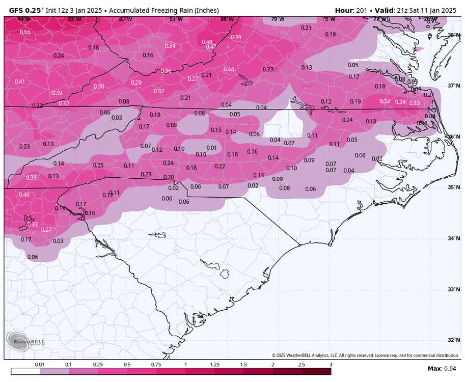
The 6z GFS shows more of a Miller B with the storm. The first low weakens in Ohio and the eastern low takes over and rolls right through central NC (another move inland). This new low then bombs out as an inland runner through NJ/NYC before cutting ENE south of the Maritimes.


-
The one on the 17th will verify because I have to leave town then.
-
Sleet is typically around a 4:1 ratio. Most I have seen in one event is around 3 inches back on Long Island in the 90's
-
Some of these traces I believe are hail as well.
-
Yeah I never thought it would be this bad. We could easily have to wait for year 4
-
The climate is shifting for sure.
-
An inside runner like the GFS.
-
The low is another tick farther north than the 6z GFS. This trend usually doesn't reverse. There is no cold air feed and it is turning into an inside runner.
-
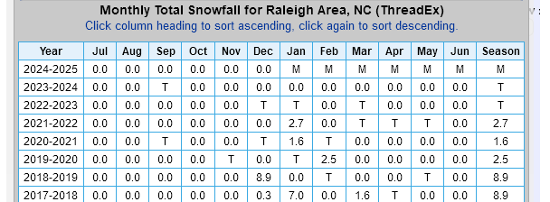
IF we do lose this one in central NC I think the chance at the futility record for Raleigh rises substantially.
-
I have a feeling we may ultimately lose this one to the north as well.
-
Had a brief rain/snow mix in Raleigh
-
At this point in Raleigh I will treat it like Mobile, Alabama. It will be an absolute miracle if it does snow here at all.
-
we need it 60 miles farther south.
-

-
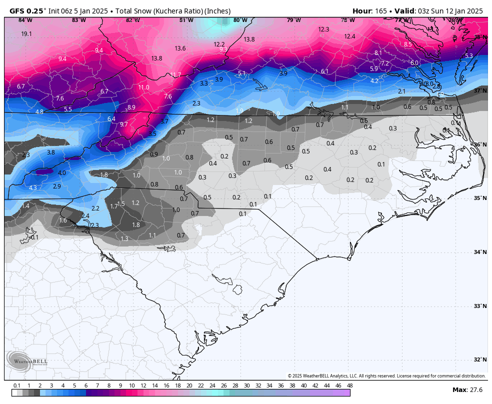
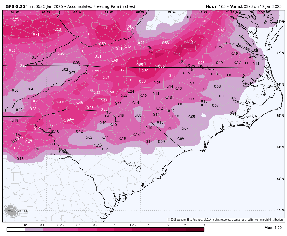
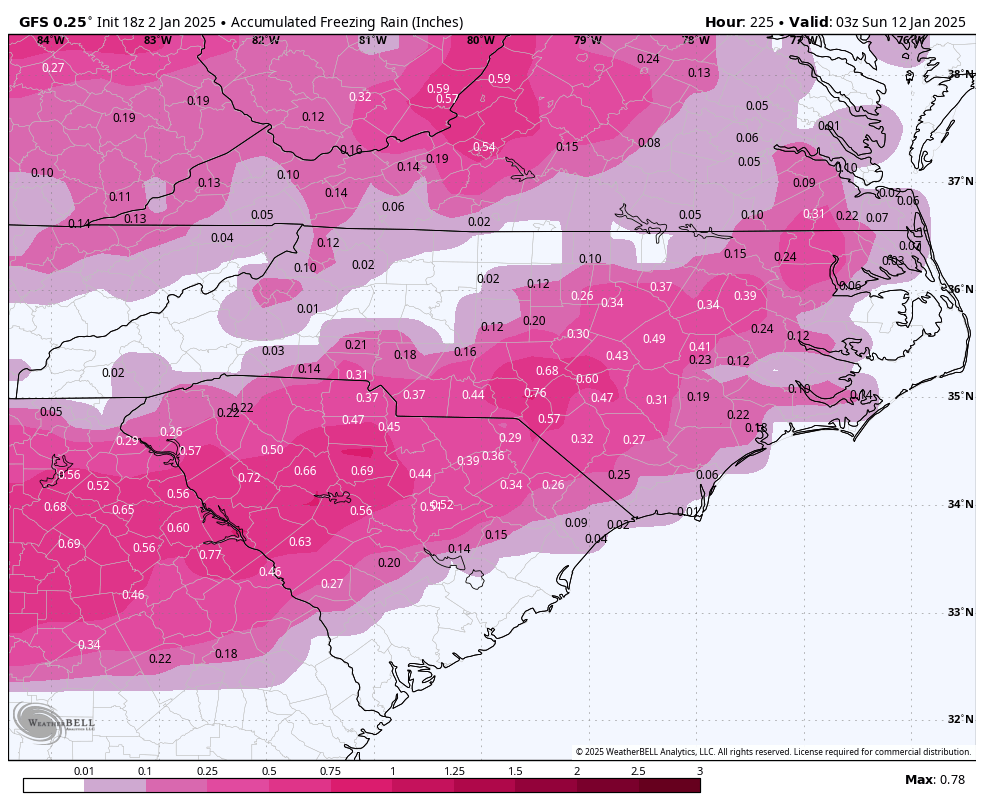
Mainly ZR and mixed P for RDU on the 12z GFS op run for the system next week.
-

-
you and me both. It is almost as if we have seen this movie before.
-
I am leaning towards no.
-
Well it was fun while it lasted.
-
G4 in progress right now. IF it holds until after dark we may have an aurora chance
-
Definitely not a good trend for the 7th.