sbnwx85
-
Posts
1,317 -
Joined
-
Last visited
Content Type
Profiles
Blogs
Forums
American Weather
Media Demo
Store
Gallery
Everything posted by sbnwx85
-
There should be a pretty excellent, extended lake response with the continued NW flow coming starting next weekend (Knocks on wood).
-

Winter 2020/2021 Short Range Discussion
sbnwx85 replied to Chicago Storm's topic in Lakes/Ohio Valley
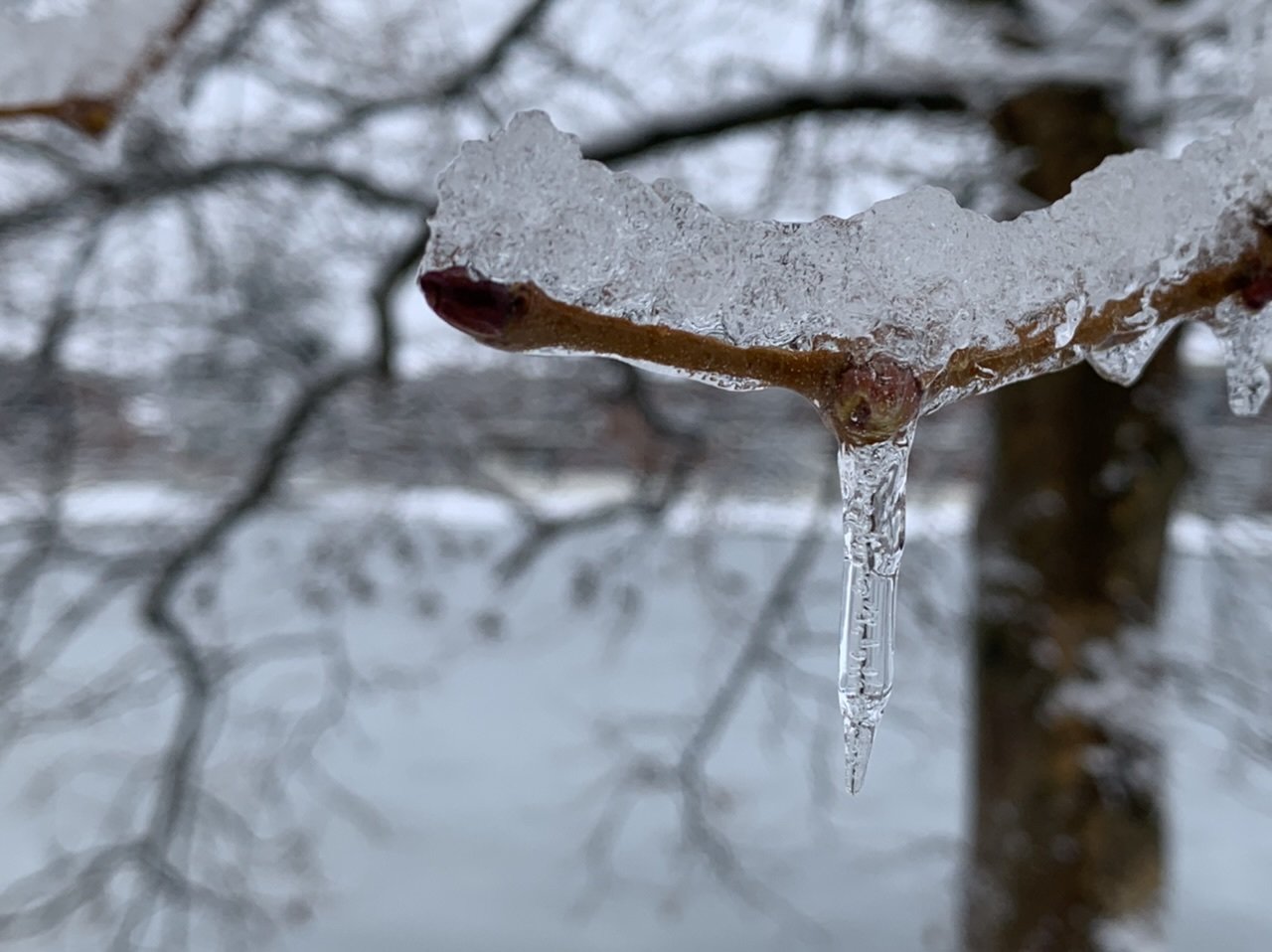
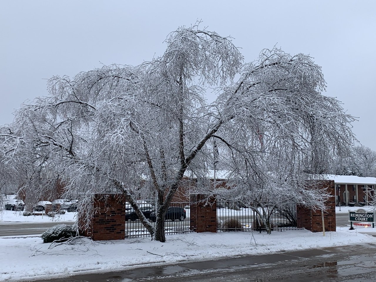
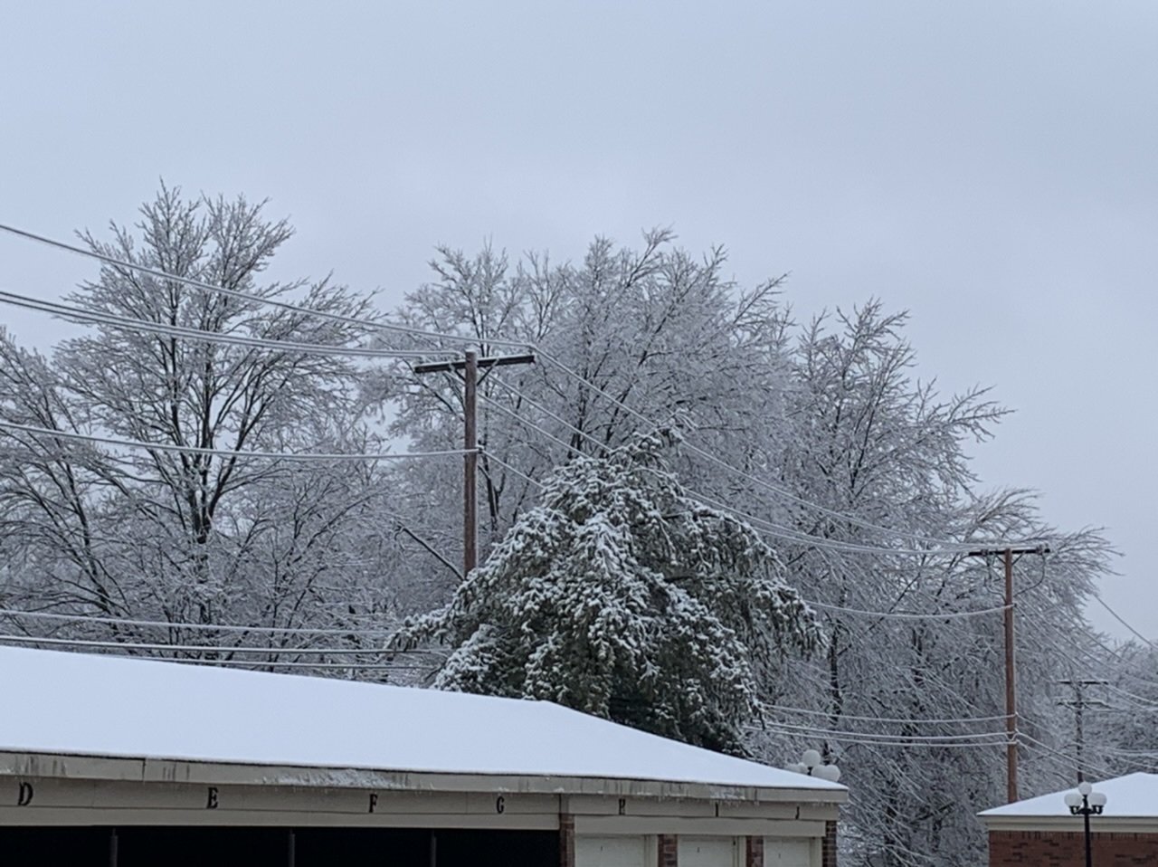
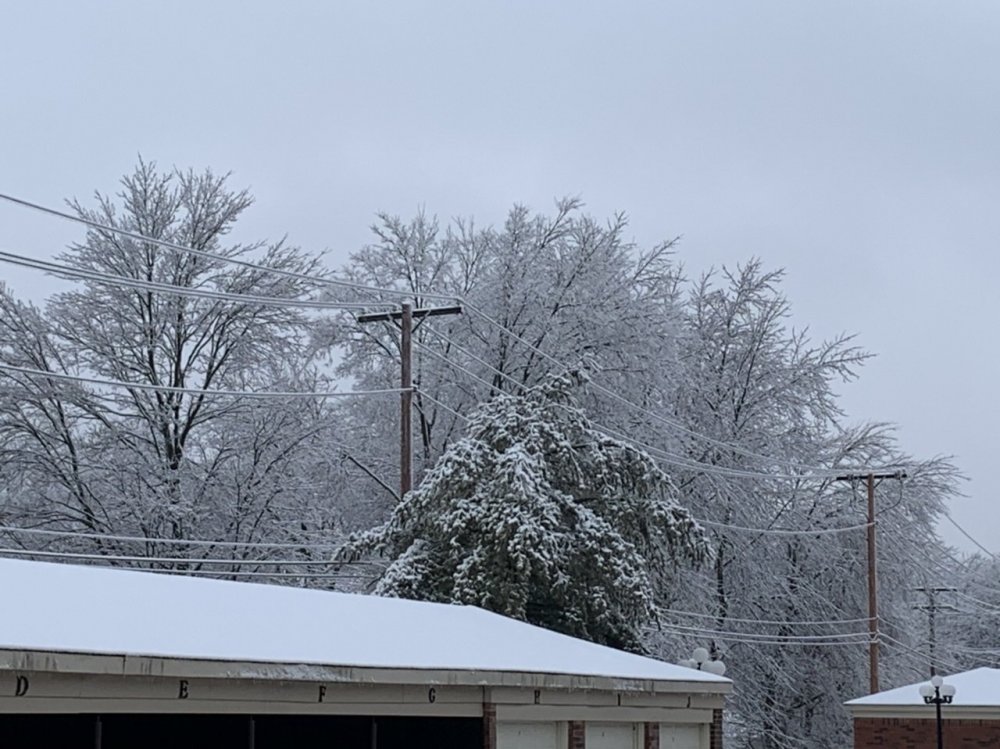
Ice has been slow to melt here. The snow that fell last night is still on on top of the ice. Pretty remarkable and beautiful. But there’s also plenty of ice on the trees and the wind is starting to blow again. Not real excited for the inch or two of cement coming. I’m afraid we’re going to see outages skyrocket overnight and into the morning. -
Snow that fell on top of the ice knocked out power to over 31,000 in South Bend-Elkhart. Fortunately mine is still on but it’s going to be a long day for power crews.


-
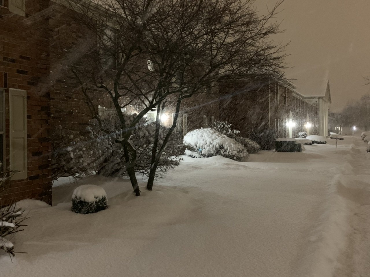
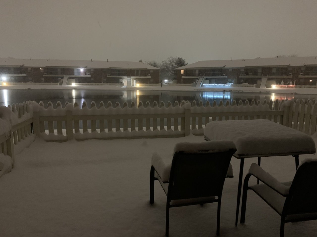
Wet snow coming down on icy trees tonight should make for some beautiful pictures in the morning. I’ll have to get up before temps get above freezing tomorrow.
-
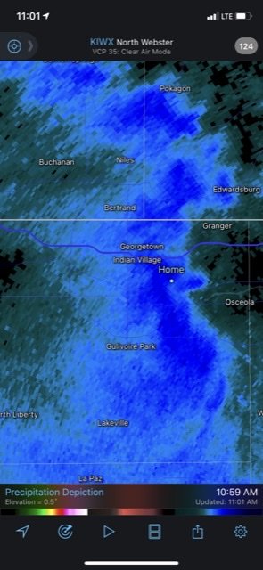
Flipped to snow here. Coming down at a good clip. Ended with only about 0.1” of ice here. Some areas nearby had closer to 0.2” with some minor tree damage and power outages. Overall, my local NWS did a good job with the forecast.
-
It's been all freezing rain here but the accretion has been very inefficient. It's not sticking much to the cars. I measured just 1/16th of an inch on some tree branches. Have had some heavy freezing rain but lots of runoff.
-
Been slammed at work so haven't been able to go look around outside. Roads are an absolute mess though. Looking out the window it looks like a light glaze.
-
Even if those totals are cut in half that's going to be an absolute mess.
-
About 4,700 Ameren Missouri customers without power. Only 612 for Ameren Illinois. https://outagemap.ameren.com/?wt.mc_id=-twitter-il-3576683855
-
Happy New Year, all. Fine day for an ice storm. HRRR keeps me at or about 30 degrees all day. I’m working dayside in my newsroom. Let’s have some fun.
-
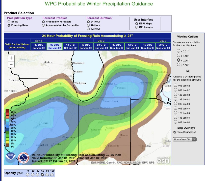
Not for nothing, the WPC has upped the probability of MBY getting to .25” of ice to 50%.
-
Already down to 20 at KSBN thanks to some local clearing overhead.
-
If nothing else it has been consistent in showing a donut of plain rain in Northern Indiana. Not saying it's right, but it is interesting.
-
Good write up from IWX. Area Forecast Discussion National Weather Service Northern Indiana 246 PM EST Thu Dec 31 2020 .SYNOPSIS... Issued at 246 PM EST Thu Dec 31 2020 Dry conditions tonight will give way to a round of wintry weather on New Years Day. Precipitation will begin as an icy mix Friday morning, changing to all rain from south to north Friday afternoon into Friday evening. Roads will likely become very slippery for a time until temperatures warm above freezing. Quiet weather on Saturday is then followed by a chance for snow Saturday night into early Sunday. && .SHORT TERM...(This Evening through Friday Night) Issued at 246 PM EST Thu Dec 31 2020 Ice accumulations/impacts remain the primary concern on New Years Day as a moisture-laden stacked low kicks north to Missouri, then opens east-northeast through central IL/IN and northwest OH later Friday into Friday night. The main slug of moisture (and organized precip shield) tied to leading isentropic ascent and strong 800-600 mb fgen is expected to lift north into our IN/OH counties btw 12-15z Fri, and into MI by 15-17z. At the surface, easterly winds will unfortunately maintain temps near to just below freezing as the approaching storm system forces a corridor of moist and warm air over it. The result will be a wintry mess, with the potential for some snow and sleet to mix in initially thanks to wet bulb cooling. The best chance for sleet/snow to hang on more than an hour or so is across far northern zones as 12z models did come in a farther south with the track of the system, and thus slightly cooler warm nose temps into lower MI. A very quick transition to freezing rain is expected elsewhere as the warm layer exceeds 5C over a rather shallow/marginal near sfc layer. How quickly the freezing rain transitions to rain and potential impacts (ice accretions) remains sensitive to the near freezing sfc temps. Confidence is high for at least a 3 hour duration of freezing rain, and medium confidence in a 6 hr or greater period as sfc temps try to creep up to 33-34. As for ice accums, possible limiting factors include warm droplets having trouble freezing and heavier rainfall rates. Given these lingering uncertainties, opted to hold pretty close to the previous forecast on timing and ice accums, generally 0.10-0.25" which lines up nicely with the WW.Y. There remains some potential for ice accums to overachieve (>0.25; Ice Storm Warning) in mainly ne IN, far nw OH and south-central MI if the colder solutions and longer fzra duration verify. If these higher end ice accretions verify there could be a low threat for isolated power outages as easterly winds will gust 20-30 mph for a time. Precipitation should trend more drizzly from south to north approximately 21z Fri-02z Sat before the main low pressure system tracks through with more organized precip Friday night. Some wet snow could mix back in Friday night across far nw IN and lower MI within the system trowal/deformation axis. Little to no snow accumulation is expected, though some additional light icing cannot be ruled out Friday night mainly along/north of US 6 as sfc temps linger near freezing. &&
-
Pain.
-
^username checks out.
-
I'm probably going to be the only one who cares but someone with more knowledge of how to read the models can chime in. Noticing it now appears the Canadian and now the Euro keeping things at or below freezing for my area while it's raining for most of the duration of the event. Looks like temps will be in the low 30's so ice accretion won't be at its most efficient, but not getting above freezing would not be fun.
-
Out on dinner break. Absolutely ripping.
-
Confirmed snowing here. Light to moderate. Might get an inch before it moves north.
-
HRRR keeps ticking up ice accumulation totals each run in N Indiana and SW Michigan. IWX extended the WWA further east, too. Might end up being a little bit more of an interesting night than I anticipated.
-
We could use the rain if we’re looking for some kind of a silver lining.
-
I'm grateful for living downwind of Lake Michigan but even my Christmas Day lake effect snow pack is gone already. All 8+ inches of it save some of the big piles of snow. I guess I'll take a tenth of an inch of ice on each wave this week before changing to plain rain. Maybe an inch of front end snow on wave 1 Tuesday night.
-
Monster ice then rain.
-
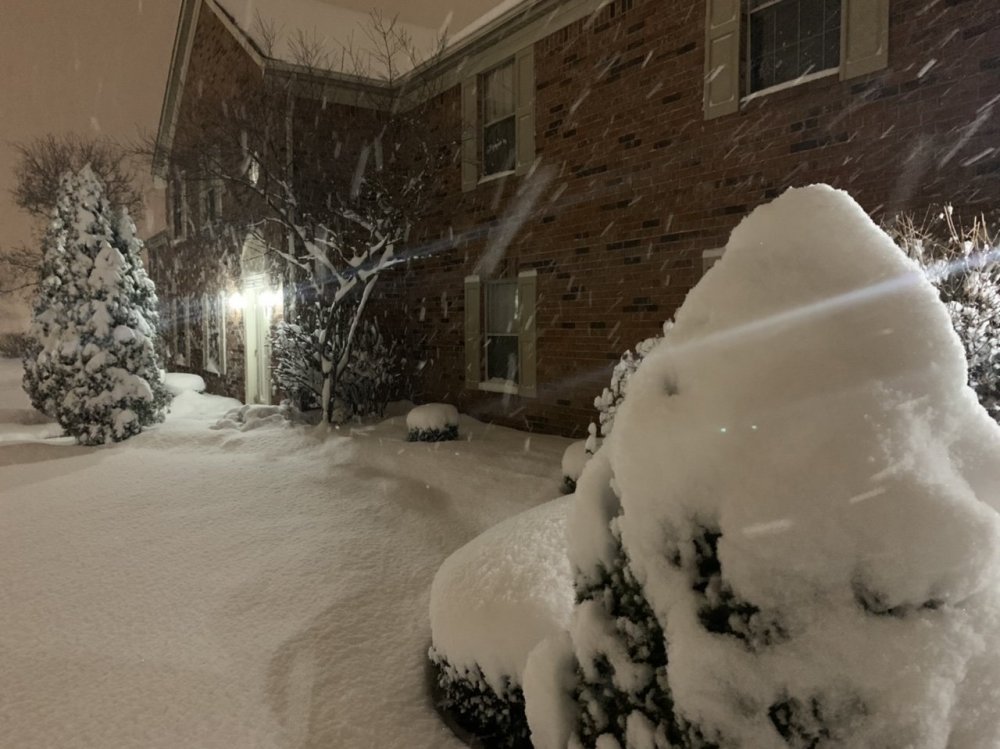
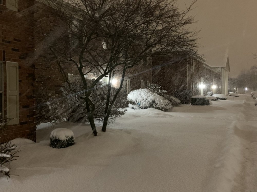
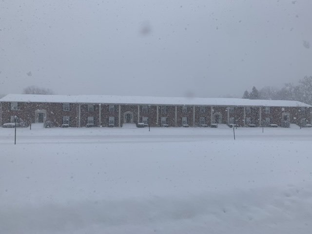
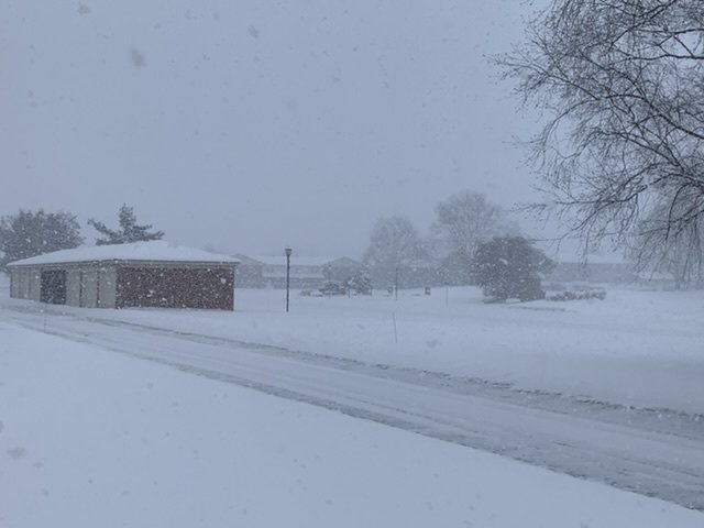
Just got back in from what will probably be the last heavy snow burst. Will measure again later but I’d guess we got about 8-9 inches. A beautiful sight!
-
Pumped. Sitting right on the eastern edge of a snow band. 6.75“ so far. Merry Christmas all!