sbnwx85
-
Posts
1,317 -
Joined
-
Last visited
Content Type
Profiles
Blogs
Forums
American Weather
Media Demo
Store
Gallery
Everything posted by sbnwx85
-
-
IWX holding serve with the watch but did expand it northward to include the entire CWA. They're wording shows they're going with 4-7 in Michigan counties, 4-8 everywhere else.
-
Weenie post: 3k NAM with a beautiful lollipop over St. Joseph County, IN. Lock that in.
-
QPF may not be as high IMBY as other areas in the forum but the ratios should be a little better with colder air in place throughout. Going with 6.5".
-
-
GFSv16 also keeps moisture hanging around longer during the day Sunday adding to much higher totals in northeast IN, northwest OH and southern MI. NAM dries things out quicker.
-
Currently thinking 5-8 inches is a safe bet for my neck of the woods. TV mets forecasting anywhere from 3-6 inches to 6-12 inches. My station waiting until tomorrow to create a snow map.
-
For whatever it’s worth the NAM Kuchera totals at hour 84 are generally only about an inch less than the GFSv16 totals at hour 84. At least in Northern IL and IN.
-
Feeling really good about this one. Tomorrow should tell the tale about how this one will play out for the I-80 corridor in Indiana. GFS has been pretty consistent for heavy snow here and the Euro is trending further north.
-
I told myself last night I wouldn't constantly monitor the board and models but here we are.
-

Jan 25-26th Potential Something Part 3
sbnwx85 replied to Chicago Storm's topic in Lakes/Ohio Valley
Some moderate snow here. Starting to accumulate but not terribly efficiently. It’s remained all snow as far as I know. -
Jan 25-26th Potential Something Part 3
sbnwx85 replied to Chicago Storm's topic in Lakes/Ohio Valley
Snowing here but nothing really accumulating. -
Jan 24-26th Potential Something Part 2
sbnwx85 replied to Chicago Storm's topic in Lakes/Ohio Valley
-
Jan 24-26th Potential Something Part 2
sbnwx85 replied to Chicago Storm's topic in Lakes/Ohio Valley
Brutal Euro run for Indiana and Michigan folks looking for a warning criteria snow. Horrible. Certainly not throwing in the towel but this trend toward shearing out before the best snows get this far east is getting hard to ignore. -
I assume there's a pretty decent amount of freezing rain south of the heaviest snow on the 18Z Euro run? Asking for a friend...that friend is me.
-
-
That's as far north as I want the GFS to go, thanks.
-
Considering how heated things are getting on the forum we're not going to have any cold air in place at all.
-
Oh, yeah. We'll be fine. We just haven't had a major non-lake effect storm though in about three years. I work in a newsroom and the public is already getting antsy asking stupid questions and trying to compare this to the Blizzard of '78.
-
I went to the store this morning to beat the rush over the weekend. Officially under a Milk and Bread Watch as far as I'm concerned.
-
I haven't seen a double-digit snowfall since I lived in Central Illinois in March 2013. If I can just get to 10 with this storm I'll be happy camper. Looks like it's going to be a close call at this point.
-
-
Winter 2020/2021 Short Range Discussion
sbnwx85 replied to Chicago Storm's topic in Lakes/Ohio Valley
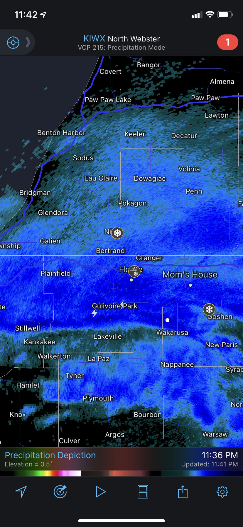
I haven’t seen or heard it but apparently there’s some thundersnow to my south!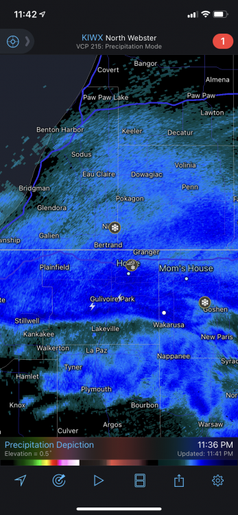
-
Winter 2020/2021 Short Range Discussion
sbnwx85 replied to Chicago Storm's topic in Lakes/Ohio Valley
Mostly graupel here with the recent shower that came through. Local news crew hit a pretty good snow burst in the western part of the county. -
Winter 2020/2021 Short Range Discussion
sbnwx85 replied to Chicago Storm's topic in Lakes/Ohio Valley
IWX has yet to issue a Snow Squall Warning since they were created a couple seasons ago. Thoughts on any of these squalls reaching warning criteria on Friday? That's gonna be about the most fun I think I'll get out of this system.