

sbnwx85
-
Posts
1,318 -
Joined
-
Last visited
Content Type
Profiles
Blogs
Forums
American Weather
Media Demo
Store
Gallery
Everything posted by sbnwx85
-
I’d eyeball about 3.5 inches around Mt. Prospect. Looks like about the same or maybe a touch more back home in Mishawaka. Next clipper and lake effect look promising on the HRRR and RAP.
-
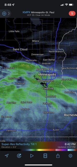
Nice banding setting up around the Twin Cities.
-
Will be enjoying this one at the girlfriends house in the northern burbs. Picked a good spot.
-
Got about an inch from lake-effect overnight. It's surprising we're only an inch below normal for the month, so far. However, we are way below average for the season.
-
IWX feeling the frustration of this winter: Confidence rapidly diminishes with the hybrid clipper to follow early next week. This northern stream wave will have some pacific moisture work, with a separate leftover closed low over the Four Corners likely ejecting east-northeast through the TN/OH Valleys by around Tuesday. It would fit the trend this winter if fgen/WAA snow passes north (or clips our far northern zones) and deeper moisture with the southern stream waves gets sheared well south...keeping the snow drought going. This is actually the model consensus at this time, but still worth monitoring going forward given all the moving parts and large spread in solutions.
-
Got a dusting of lake-effect so far tonight and it's lightly snowing. Counting my blessings.
-

Winter 2021-22 Short/Medium Range Discussion
sbnwx85 replied to Chicago Storm's topic in Lakes/Ohio Valley
@Hoosier and I going to be on either side of a healthy lake-effect event this week. -
Pain.
-
It's pretty neat to follow a storm that impacts different parts the subforum twice...while completely missing half of the subforum.
-
GFS gonna try and have me back in the game very soon.
-
Would be nice to have the models ramp up an event as we get closer for once.
-
Ended up with about an inch of wind-blown lake-effect. About 30 minutes to my northwest, Niles, MI got over 8 inches. A spot an hour north of me got 22 inches. Gotta love lake-effect.
-
Keep that band moving south, please. So far just flurries here.
-
Main lake bands stay to my north on this side of the lake through Thursday night. There should be some impressive totals under the main banding of snow in Michigan. Hoping to squeak out 2-4 here.
-
That’s all I needed to hear!
-
Not advocating for a WSW in my county...but a little surprised IWX didn't go with one for LaPorte and Berrien. I think they'll do a little better with snow totals thanks to the lake.
-
IWX going Winter Wx Advisory. Highest totals of 4 to 7 in northwestern counties. INZ003-004-MIZ077-078-010430- /O.NEW.KIWX.WW.Y.0012.220101T1800Z-220102T1200Z/ La Porte-St. Joseph-Berrien-Cass- Including the cities of Michigan City, La Porte, South Bend, Mishawaka, New Carlisle, Walkerton, Niles, Benton Harbor, St. Joseph, Fair Plain, Benton Heights, Buchanan, Paw Paw Lake, Dowagiac, Cassopolis, Edwardsburg, and Marcellus 316 PM EST Fri Dec 31 2021 /216 PM CST Fri Dec 31 2021/ ...WINTER WEATHER ADVISORY IN EFFECT FROM 1 PM EST /NOON CST/ SATURDAY TO 7 AM EST /6 AM CST/ SUNDAY... * WHAT...Snow expected. Total snow accumulations of 4 to 7 inches. Locally higher amounts possible, especially near Lake Michigan. * WHERE...In Indiana, La Porte and St. Joseph Counties. In Michigan, Berrien and Cass Counties. * WHEN...From 1 PM EST /noon CST/ Saturday to 7 AM EST /6 AM CST/ Sunday. * IMPACTS...Travel could be very difficult. * ADDITIONAL DETAILS...Snow, possibly mixed with rain at the start, will develop Saturday afternoon and may become heavy at times late Saturday afternoon into Saturday evening.
-
Nice 19" lollipop over the north suburbs.
-
Since I'm awake...12z HRRR put the snow axis a bit south of 6z. Drier in northern IL outside of lake-effect/enhancement. 6z 12z
-
Pretty rude I’m up for work before 8am for the first time in a year and I’m not in a Winter Storm Watch. Rooting for a half inch of sleet at this point.
-
Here's the 18z GFS map for inquiring minds. Lock it in.
-
They weren't juiced enough to post.
-
Sitting relatively close to the rain/snow line here and one thing I've noticed is there's not a huge ice threat as the storm advances north. Ice might be more of a threat back toward Kansas and Missouri, but not so much to the north. IWX seems to like the more snowy solution to this point: .LONG TERM...(Thursday Night through Wednesday) Issued at 223 PM EST Wed Dec 29 2021 This is where it gets interesting. Confidence continues to increase that the Great Lakes Region will experience a potentially significant winter event...the confidence is still low on exactly where, when and how much of an impact. Continued trends are for a more southerly trajectory...which would favor more snow vs. rain and somewhat higher snow ratio. However that also would be a situation that has less moisture to work with. Regardless...keeping the trend of the previous forecast and have bumped up PoP for Sunday as the flow would favor Lake Enhanced snow. Will begin pushing messaging via Social Media for the upcoming weekend and trending toward a colder solution.
-
Lock it in.
-
Gotta keep reminding myself not to get overly excited about anything for another 48 hours.


