sbnwx85
-
Posts
1,318 -
Joined
-
Last visited
Content Type
Profiles
Blogs
Forums
American Weather
Media Demo
Store
Gallery
Everything posted by sbnwx85
-
I know how annoying it can be to read about lake-effect snow for those outside the belts, but it's all we have right now. Winter Storm Watches are up in Michigan a couple row of counties along the shoreline. This reminds me of the Christmas lake-effect blizzard from two years ago... although not quite as cold or as windy. It's still going to create a mess and at least blizzard-like conditions. Hopefully the messaging gets out there. I imagine there's already some "snow fatigue" for those buried over the weekend.
-
That clipper should reinvigorate the lake effect machine after it passes through. Winds will be higher than previous events this week so it’ll be even more impactful in areas that have snow on the ground. I think 3-5” is a good call here with a multi-band set up covering a wider area.
-
One of the bigger forecast busts we’ve had in a while. My 3”-6” call for South Bend was horrible but not as bad as NWS’ 8”. I think too much shear inland prevented the lake bands from getting into Indiana. Parts of SW Michigan did well with 10+”. On to the next one.
-
Looking like some big bust potential on the lake-effect locally. Bands seem to be setting up more to my east. HRRR catching onto it as well. I may get shutout at home but still end up with several inches at work.
-
Someone in SW Michigan could wake up to a foot and a half of snow by tomorrow morning. DISCUSSION... Issued at 120 PM EST Mon Dec 2 2024 Strong ern lake Michigan centered thermal troughing driving robust low level convergence zone and intense lake snow bands this aftn through sw MI. Background steering flow weak attm but will pickup a bit heading into tonight and expect this will spread further inland into the South Bend metro especially north of US20. Overlap of potential mesolow tracks puts ground zero for the heaviest storm total snowfall accumulations around 18" across nrn Berrien and perhaps into nwrn Cass with much less south and east given limited inland penetration before these bands breakup quickly Tue morning.
-
Very scientifically interesting AFD from IWX this morning on the lake effect potential. DISCUSSION... Issued at 440 AM EST Mon Dec 2 2024 Overall no major changes to the forecast thinking from yesterday. Highest confidence in 8+" remains over the eastern half of Berrien County into NW Cass. Lower confidence in warning-criteria totals for St. Joseph IN but latest hi-res suggests far northern portions of the county will get clipped with heavier rates later today. Did delay the start time for areas outside of Berrien/Cass though. Went with advisory for northern La Porte, Elkhart, and St. Joseph (MI) with the lowest confidence on the eastern side of St. Joseph (MI) and the western side of La Porte. No headlines to the south but may have to watch northern Marshall and northern Kosciusko. We will continue to fine-tune the location of the lake effect snow bands through today and some changes to headlines may still be possible. Details below... Morning water vapor shows robust shortwave currently diving into the Upper Midwest. Low level wind profiles will continue to slowly veer through tonight as this midlevel trough axis passes and low level lake aggregate troughing becomes better established. LES which is currently hampered by WNW fetch, dry air entrainment, low inversion heights, and overall meager instability will gradually intensify and organize through tonight. Equilibrium levels still expected to climb above 10 kft by this afternoon per latest hi-res forecast soundings. 0-2km delta theta-e values also drop below zero by this afternoon and strong ascent/supersaturation in the DGZ will promote large flakes and high (potentially over 20:1) SLR`s. Of greatest concern though is the increasing potential for meso-low formation over SE Lake MI and into Berrien County this afternoon as suggested by the latest runs of the HRRR and RAP. Already starting to see some hints of this in latest GRR radar imagery given overall weak synoptic flow becoming increasingly convergent over the eastern lake thanks to very warm lake waters/induced troughing. If this verifies...much higher snowfall totals are likely in the 18-00Z time window. Models have been mixed on whether this feature drifts far enough south to impact South Bend before dissipating but latest runs seem to be trending further south and this was the primary reason for going with a warning in St. Joseph (IN). There may be a brief lull in activity during the evening hours before the low level flow veers further and briefly connects with Lake Superior during the late overnight hours. Even here some models are hinting at a "type-VI" (dominant single band with a meso-low on the southern end) moving down the lake in the 06-12Z period. Instability parameters remain highly favorable but final lake effect band intensity and snowfall amounts will be heavily driven by the degree to which this band can become organized. The biggest negative factor for this event continues to be the highly variable low level wind directions. Stronger synoptic flow is anticipated tonight with only a brief window of favorable down-axis fetch/Superior connection before flow quickly backs once again Tue AM. Significant questions remain if this will be enough time to allow a single band to fully develop, or if (as hi-res models suggest) it is more of a broken/transient hybrid with pockets of heavier snow and possible small-scale circulations that never fully organize into a single continuous band. Either way the chances for heavy snowfall rates to remain stationary in one particular area for a long time remain low and warrant a cautious approach to overnight snowfall totals for now. Additional changes are quite possible as we progress into tonight though. Continued to make very few changes to the NBM-initialized long term grids. LES will end quickly late Tue AM as flow backs SW and dry conditions will persist trough most of Wed. Highs even climb above freezing on Wed with some brief but modest WAA. This will be short- lived though as another deep upper low dives into the Great Lakes Wed night and sends a strong cold front through the area. Moisture availability is not ideal but expect some SCT rain showers along the front followed but blossoming lake effect snow behind the front. Still plenty of time for adjustments but currently expect strong NW flow will bring a cold (but dry) airmass with limited fetch for significant snow accumulations. LES ends by Fri with a longer period of light WAA expected over the weekend into early next week that will return temps to seasonal norms.
-
Latest HRRR run makes me think I’m going to be under.
-
Cloudy and cold today. A couple flurries. It was nice to see the sun yesterday. Lake effect still looking good for tomorrow. I’m thinking 5-8”+ for the Michigan counties just north of South Bend. 3-6” throughout the city seems like a good bet.
-
60 cm is 23.622 inches if you’re wondering
-
That ‘99 storm cemented my love of winter forever. I grew up in nearby Elkhart - just 15 miles away from South Bend. But it was far enough away from the lake that the biggest lake effect event I can remember from my childhood was around 6”. Elkhart did get a 18” lake effect event back in 2019.
-
I hope so. Monday’s event has potential to be intense but relatively short. The best lake effect dynamics have north and east of here so far. Still lots of potential with the NW flow next week.
-
Tomorrow, believe it or not, is December. The start of meteorological winter. The best three months of the year. Cold and dry outside the lake belts to start. Speaking of lake belts…
-
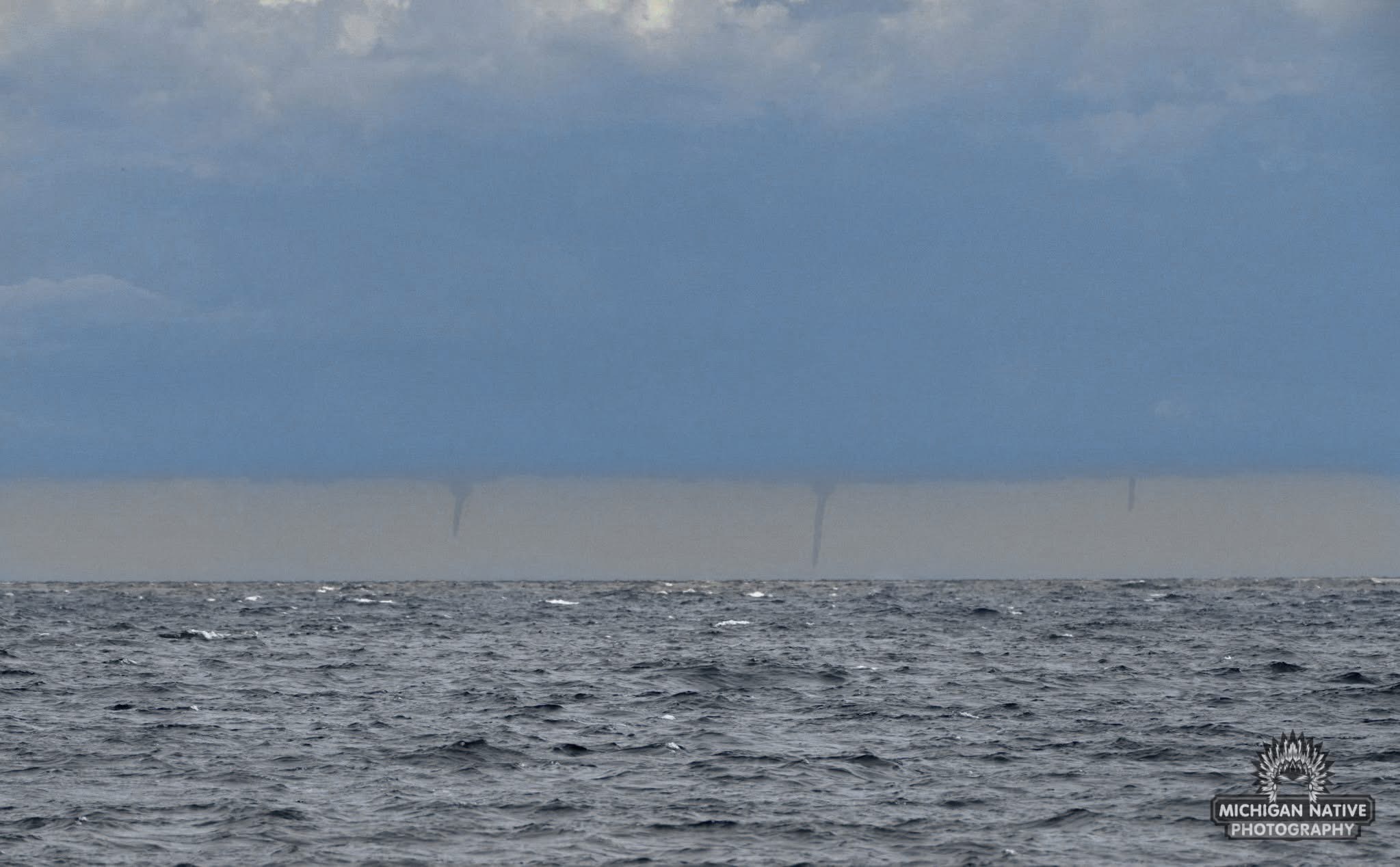
Found on Facebook: triple water spouts on Lake Michigan from St. Joseph.

-
Constant mood flakes today. Best banding will stay in Michigan today and Sunday. Hi-res models are picking up on a decent band that could bring 6+ inches locally Monday night. Still a long way to go.
-
Mood flakes and cold on this Black Friday. A bit of a dusting on the grass.
-

Winter 2024-25 Medium/Long Range Discussion
sbnwx85 replied to michsnowfreak's topic in Lakes/Ohio Valley
Clippers next week remain just a little too far north for most of us. I can't even get the winds to get NW enough to get lake effect bands into Indiana. Hopefully we can get a something to sneak further south. GFS has a nice storm in fantasy range though -
Saw some flurries on the way to work. Best lake effect snows will be to the north this weekend. If I can squeak out a DAB I'll be satisfied at this point.
-
Winter 2024-25 Medium/Long Range Discussion
sbnwx85 replied to michsnowfreak's topic in Lakes/Ohio Valley
I think the mets at IWX are anxious to leave for Thanksgiving... this might be the shortest AFD I've seen considering there's plenty to talk about. Area Forecast Discussion National Weather Service Northern Indiana 134 PM EST Wed Nov 27 2024 .KEY MESSAGES... - Lake effect snow showers with accumulations up to 1-2" possible for Berrien and Cass counties late Thursday through Friday. - Unseasonably cold through mid next week. Highs in the upper 20s to low 30s with lows in the teens. && .DISCUSSION... Issued at 134 PM EST Wed Nov 27 2024 Modified arctic airmass will spread south across the Great Lakes in wake of low amplitude disturbance ejecting through the OH valley tonight/Thu. A few snow showers possible northwest Thu morning before giving way to lake banding Thu night into Fri morning as low level lake thermal trough intensifies. However expected dry entrainment along wrn/srn flank of Lake Michigan will curtail development and doubt much more than an inch of snow possible north of the MI/IN stateline. Otherwise brief window does exist toward daybreak Thu for some snow to mix in south of US24 within departing rain shield. Relatively warm sfc temps and rainfall overnight here will preclude any snow accumulation. Remainder of the period will be quite cold and dry beneath dominant upper low taking shape near James Bay. Temp anomalies Fri-Tue will run 10-15 degrees below normal. && .AVIATION /18Z TAFS THROUGH 18Z THURSDAY/... Issued at 1142 AM EST Wed Nov 27 2024 A shortwave and attendant sfc low over the Central Plains will track east through KY tonight. A blossoming precip shield along a leading elevated baroclinic zone is expected to barely clip KFWA this evening into the early overnight on the far northern fringe of this system. Ptype at KFWA looks to be primarily liquid, though a brief mix or changeover to wet snow cannot be completely ruled out by mid-late evening. Opted to drop KFWA into MVFR during this time, with better chances for IFR cigs/vis just south of the terminal into tonight. No impact at KSBN otherwise with light winds through the period. && -
Winter 2024-25 Medium/Long Range Discussion
sbnwx85 replied to michsnowfreak's topic in Lakes/Ohio Valley
Those outside of the lake belt can ignore this you’re if sad about no snow… lake effect set up looks good especially Friday and Sunday into Monday morning. WNW winds will favor Michigan more on Friday. Sunday could be a bigger day for northern Indiana with a more NW flow and even colder air blowing down the lake. Also noting, although outside the subforum, this should be a major lake effect event for upstate New York. Winter Storm Watches are already up there. -
Winter 2024-25 Medium/Long Range Discussion
sbnwx85 replied to michsnowfreak's topic in Lakes/Ohio Valley
Autocorrect knows me too well -
Winter 2024-25 Medium/Long Range Discussion
sbnwx85 replied to michsnowfreak's topic in Lakes/Ohio Valley
Certainly looks good from Black Friday thru the following Tuesday. That weekend clipper should beer winds more northwest to bring the bands deeper into Indiana. But like you said, you never know for sure with clippers. -
Winter 2024-25 Medium/Long Range Discussion
sbnwx85 replied to michsnowfreak's topic in Lakes/Ohio Valley
I’m going guess the NAM still stinks 12z GFS at least shows some possible frontogenisis snow showers Wednesday but keeps the Thanksgiving low well south. It tries to bring a weakening clipper through the area Saturday… clippers can surprise though so it bears watching. -
Winter 2024-25 Medium/Long Range Discussion
sbnwx85 replied to michsnowfreak's topic in Lakes/Ohio Valley
Eye candy. 12z Euro kuchera post-Thanksgiving Day system, post-lake-effect, and end of run. -
Winter 2024-25 Medium/Long Range Discussion
sbnwx85 replied to michsnowfreak's topic in Lakes/Ohio Valley
GFS making a baby step in the right direction too. Still too far south for me but at least it’s showing snow again for some areas. -
Winter 2024-25 Medium/Long Range Discussion
sbnwx85 replied to michsnowfreak's topic in Lakes/Ohio Valley
To your point... in my amateurish observations over the years you can basically double whatever the global models put out in terms of lake-effect. Both GFS and Euro are spitting out about a foot in SW Michigan between Black Friday and the following Tuesday. Could be some big boy totals when all is said and done!