Eskimo Joe
-
Posts
24,403 -
Joined
-
Last visited
Content Type
Profiles
Blogs
Forums
American Weather
Media Demo
Store
Gallery
Everything posted by Eskimo Joe
-
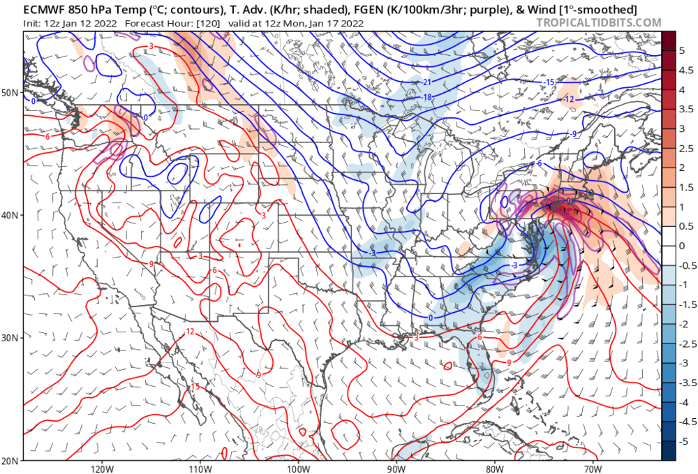
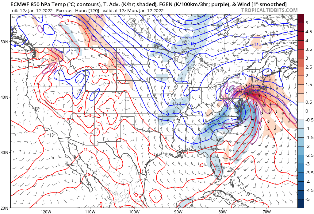
Check out the winds at 850 mb...screaming from the SE. That will erode cold air no problem.
-
06z EPS mean snowfall would bring DCA to near full climo for yearly snowfall.
-
06z GEFS were nice. I'd buy in a heartbeat. Distinct east shift.
-
Only 1 miss on the EPS, almost everything else is warning criteria snow/sleet I-95 west it seems.
-
There are a ton of big hits from I-95 west on the 18z EPS.
-
With respect to potential coastline impacts, not frozen precip. Should have clarified.
-
18z GFS hammers coastal areas...would be some respectable impacts from that along Delmarva.
-
18z Euro appears faster
-
IMO, inside 72 to 84 hr their worth is diminished.
-
He came to LWX from Elko.
-
Confluence looks more robust and the antecedent high pressure looks better positioned.
-
Good trends on the GFS so far.
-
Ray still works for LWX. Solid forecaster. His site gets me through those hot winter rain storms.
-
The 18z NAM appears to be a step in the right direction at 500.
-
That week weenies from DCA to PHL pulled triple 7s on weather slot machine several times.
-
Camp David (KRSP) METAR: https://aviationweather.gov/adds/tafs/?station_ids=KRSP&std_trans=translated&submit_both=Get+TAFs+and+METARs Site R (XIF) METAR: https://aviationweather.gov/adds/tafs/?station_ids=XIF&std_trans=translated&submit_both=Get+TAFs+and+METARs
-
Yup. Between 1,000 - 1,800 ASL. Camp David ASOS is ~1,900 ASOS and Site R is ~900. Those two ASOS's are good for discerning minute warm/dry layers during events.
-
There's the money track. Give me that all day.
-
You gotta get a house in Sabillasville my friend.
-
highs are now trending warmer post storm...possibly low 40s MLK day and Tuesday. There doesn't seem to be some big post storm discharge of cold air.
-
Man, the things I'd do for a last minute trend east to keep everyone west of the bay as some form of frozen.
-
Wonder if we see this thing trend a bit weaker as we near and maybe not as wound up? Would mean a further east trend. It's happened before. I know @Ellinwood talks about satellite ingestion of data has improved D5+ scores, but a weenie can hope.
-
Euro seems to be the best case scenario right now. Low end warning snow/sleet then dry for I-95 immediate suburbs, big storm US 15 west. EDIT: Give it a 50 mile east shift and everybody wind bigly.
-
Pretty decent lift with the WAA snow and along the backside, I-81 and points west probably get slammed from this. If only we can get this like 50 - 60 miles east.