

StormchaserChuck!
-
Posts
2,274 -
Joined
-
Last visited
Content Type
Profiles
Blogs
Forums
American Weather
Media Demo
Store
Gallery
Posts posted by StormchaserChuck!
-
-
Well I know QBO was going to be perfect if we were to have an El Nino. 14/14 chance it would be negative as of the April analogs.
-
Yeah, I believe -0.5 to 0.5 is the best. The rest is data or something.
-
A lot of -NAO's in August lately.. 2014, 2015, 2016, 2017, 2019.. not necessarily -NAO Winter time
-
12 minutes ago, Maestrobjwa said:
I do have a question...why do la ninas repeat but el niños don't? Smh With this upcoming game winter (assuming it's nina as it may be), we've had 4 ninas in the last 6 years! And two instances of back-to-back...sheesh
That's a good question. I think normal SSTs are normal North/South Hemisphere across during El Nino's.
-
2 hours ago, WxUSAF said:
Bring it home for us, chuck.
I would ideally love to see Arctic ice melt to 2.4 or something, so that we can have some good Canadian reaching storm threats.
-
La Nina is going to strengthen.. -4 in subsurface next few days.
.thumb.png.8c7d9a3025b3bca5a00f27cc5cec2b88.png)
Gotta love the -PDO/+IO
-
 1
1
-
-
N. Atlantic is great -NAO signal.. Weak La Nina coming. I like 95-96, but there are no Alberta Clippers, pattern is north 100-150 miles. (Actually 95-96 wasn't a La Nina in the subsurface, it was Neutral, 92-93 and 93-94 were El Nino in the subsurface)
.thumb.png.bbce13f949d7728c15ae9fe02dc37e2a.png)
-
I'd go with 20, into Nov, Dec
-
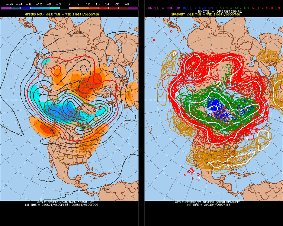
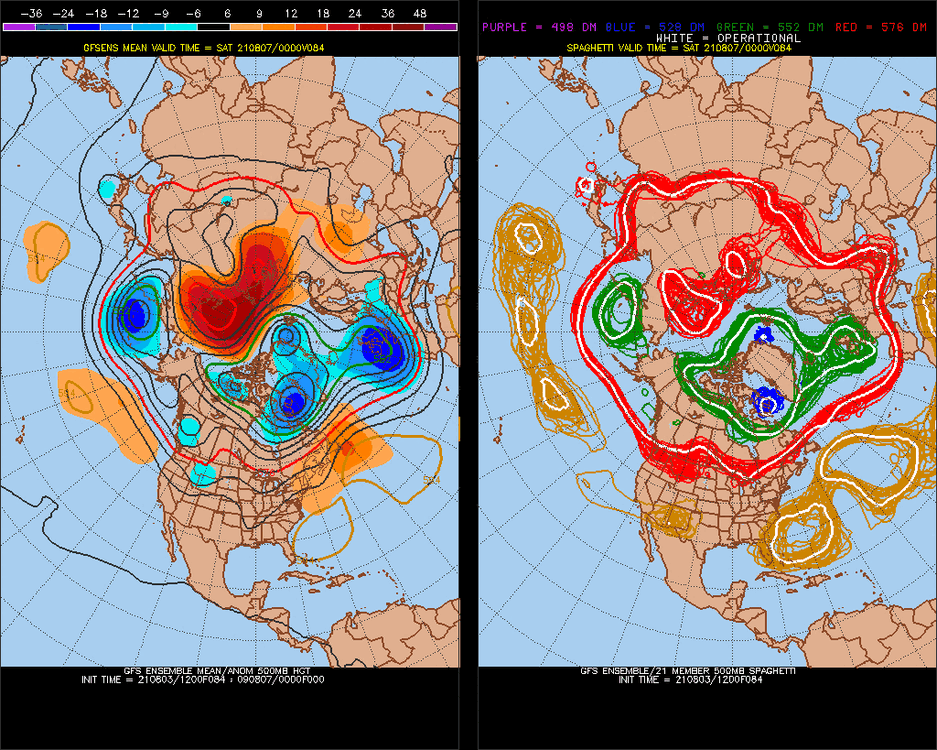
Good post, something to track, but nothing is showing up in the 500mb.
-
1
-
-

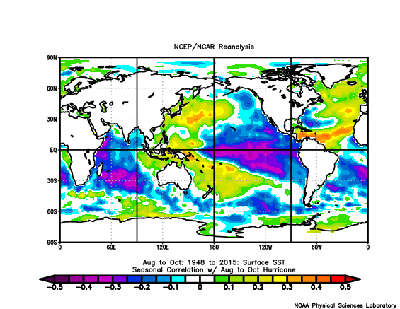
Aug 14 analogs
-
It's going to get warm, this one might overperform
-
Yeah, it seems like the whole Pacific Jet is drying up.
-
1
-
-
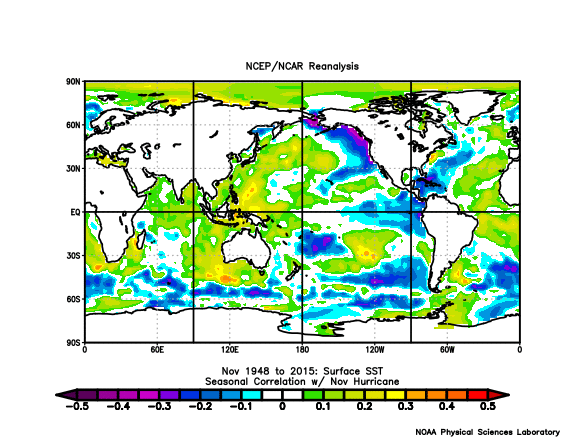
Aug 12 of most active seasons
-AO persists

oh
-
nothing? PDO is like -4. La Nina is a face. Atlantic storms 20+ IS A slight NAO sigal, but correlated with -PNA/+EPO . It snows in the Winter.
-
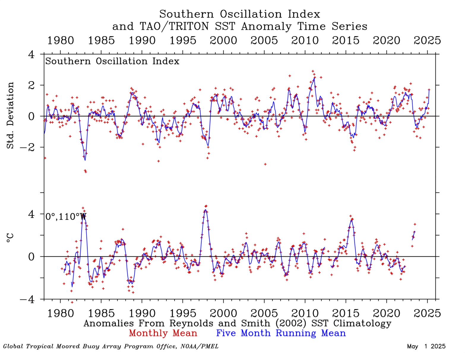
We last had a pretty good SOI/SST difference (higher SOI vs warmer SST, cold ENSO) in 2011-2012.
https://www.pmel.noaa.gov/tao/drupal/assorted_plots/images/soi_110w_drupal.gif
-
1
-
-
Nice little rebound huh

-
Not warm subsurface except inthe Spring, March-May there will be a warming trend. I wouldn't be surprised if we don't go La Nina though.
-
1
-
-
42 minutes ago, jconsor said:
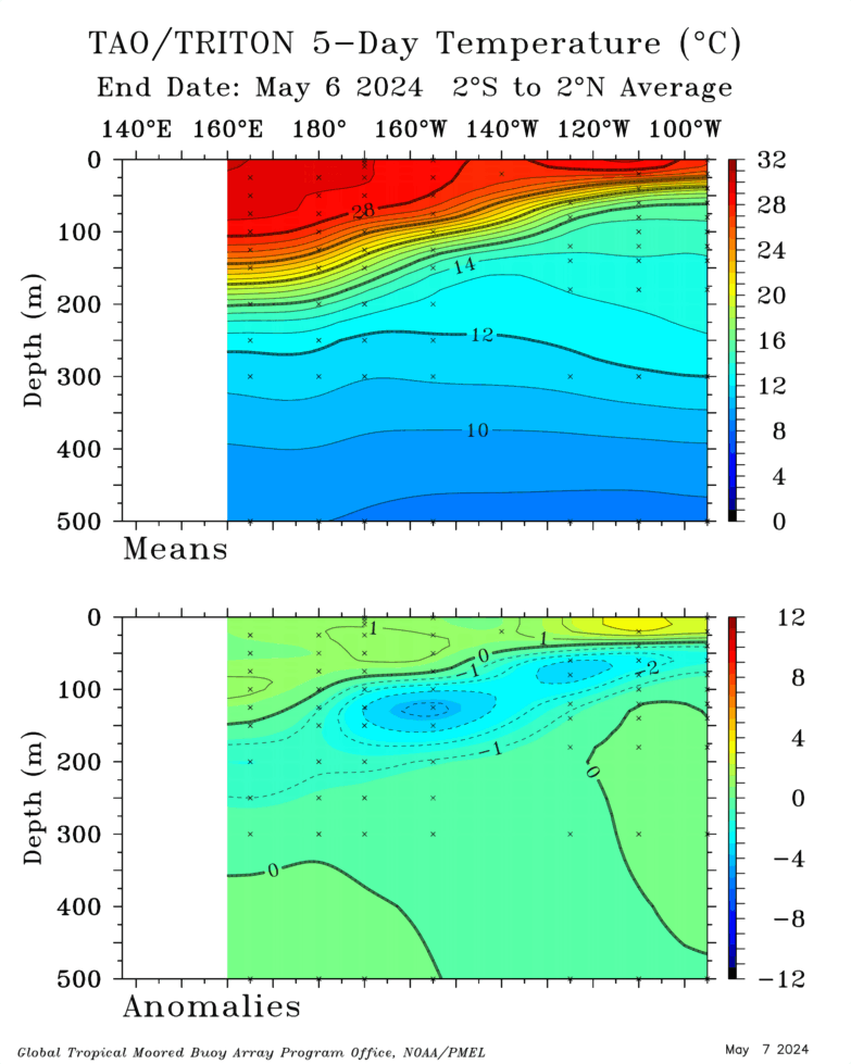
@StormchaserChuck! Very impressive subsurface cooling! Have we ever seen -4C at subsurface with surface anomalies still in the neutral range (>-0.5C)?
I've found that the subsurface has a higher immediate correlation to the N. Hemisphere 500mb pattern (0.90) vs surface ~(0.80), for example.
If we hit -4, the over/under on storms this year is 20, I think.
-PNA pops up at Day 5. Maybe we'll see -4 hit then.
.thumb.gif.4ff450729389549ade7ce42afa3730f2.gif)
-
Come on -4.. I think it will happen.
-
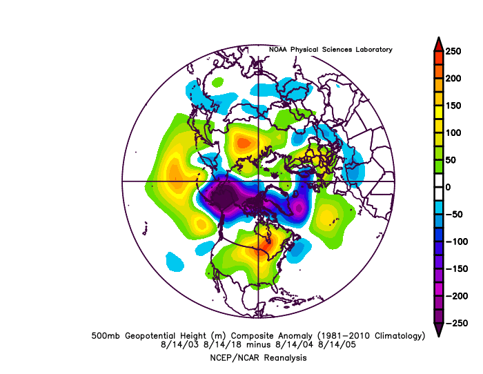
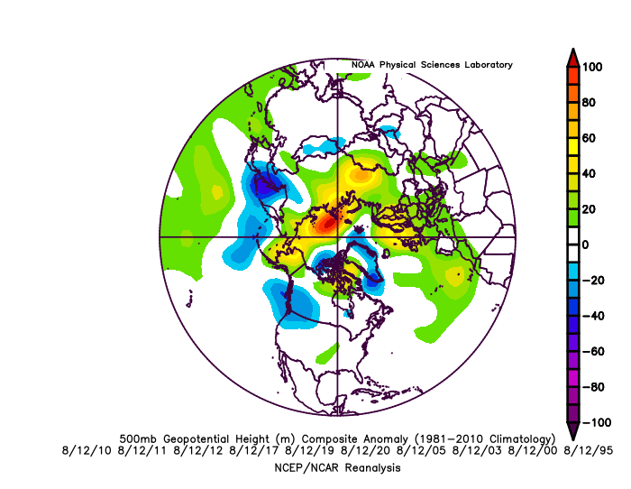
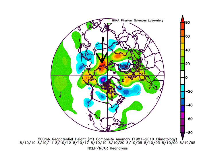
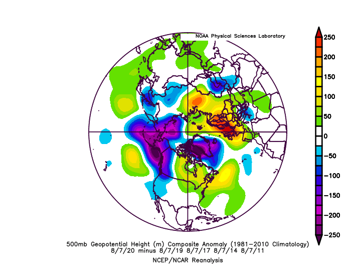
This is interesting.. I wonder if we are setting trend for Winter.

Analogs
-
Yeah, this +AO is lasting right into the Winter.
-
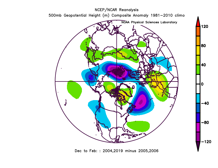
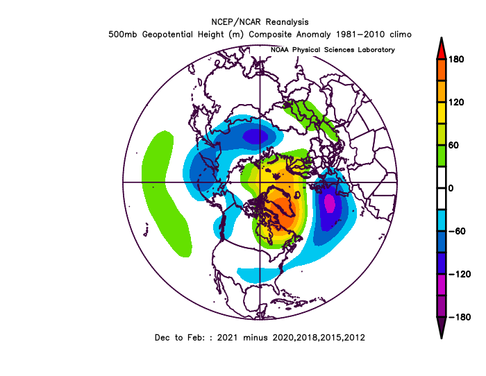
That is one heck of a -PDO, image looks like it's the dominant pattern this Winter. Even if it's very cold, the surface should not be as cold. We also have a good +IO, I doubt we see dominant 4-5-6 MJO waves though.
-
2019 and 2020 had a -NAO/-AO on July 27-Aug 6, but not years previous going back to 2013/2015 El Nino..
1998 and 1997 had a +NAO/+AO.. last years fwiw
-
-4 on here would be a really big deal for an active season (time sensitive)
-
1
-
.png.5456b6a19697d5a15f9f1bddeab78a06.png)
.png.c1aef9e297a0d938d76f09fc8574384a.png)

.gif.949628b35638f9205988cd5a5162b470.gif)
Winter 2021-22
in Mid Atlantic
Posted
Subsurface is -4, surface is barely negative.. fwiw accelerating ENSO into the late year.
fwiw