

StormchaserChuck!
-
Posts
2,273 -
Joined
-
Last visited
Content Type
Profiles
Blogs
Forums
American Weather
Media Demo
Store
Gallery
Posts posted by StormchaserChuck!
-
-
Just another thing, I really like a-NAO for the Winter
-
 1
1
-
-
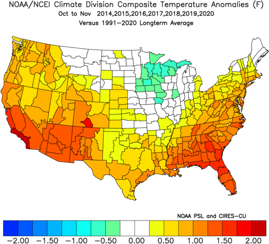
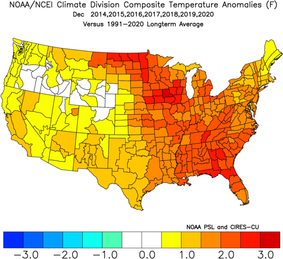
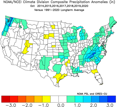
November is the only month 2014-2020 with normal rainfall, All others were >75/25
-
On 9/29/2021 at 2:25 PM, weathafella said:
And bos had 96. Your old Wilmington location averaged close to 50% more and you ended up with 20% less. So our individual perceptions are borne out by that statistic.
Yeah, we had dry, powdery snow in '96. It was pretty awesome.
-
I think we are kind of controlling the Pacific with potential landfalls to an extent.
-
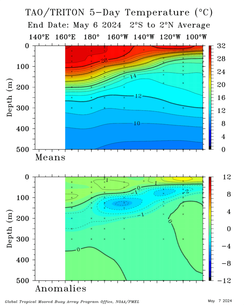
La Nina is really getting going
https://www.pmel.noaa.gov/tao/drupal/assorted_plots/images/TAO_5Day_EQ_xz.gi(f)
It will keep strengthening on the surface probabably.
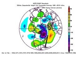
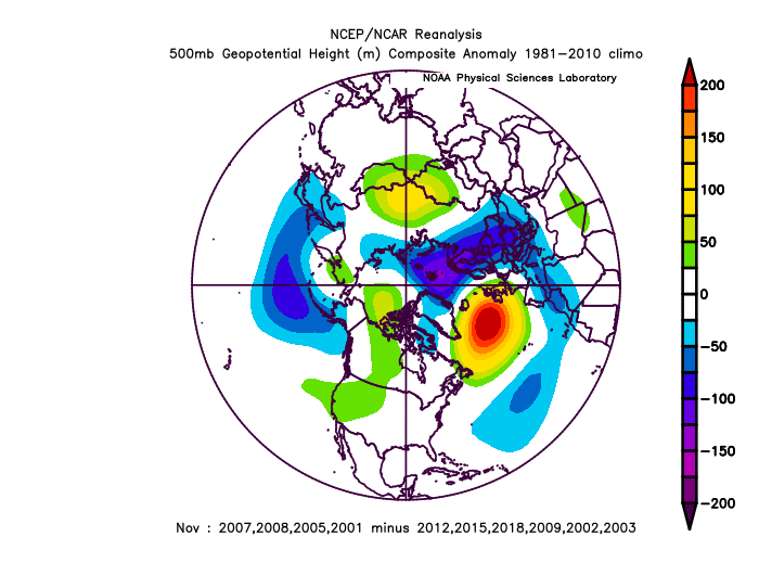
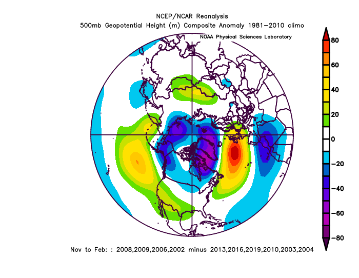
There has never been a -PNA October during La Nina! The greatest was +120dm in 2007 and 2008, we had the strongest two, but I think both had a stronger EPO. Since satilte data in 1948- 1955, 1975, 1985, 6 years were strong +PNA/La Nina. Last year, 2020 was +PNA/La Nina.
Models through mid-October have about a +200dm -PNA, and we have never really done that before for the month of October in La nina since 1948. It will be interesting to see if we beat the 2007/8 record of +120dm for themonth. (last year was +PNA October-LaNina)
-
1
-
-
-
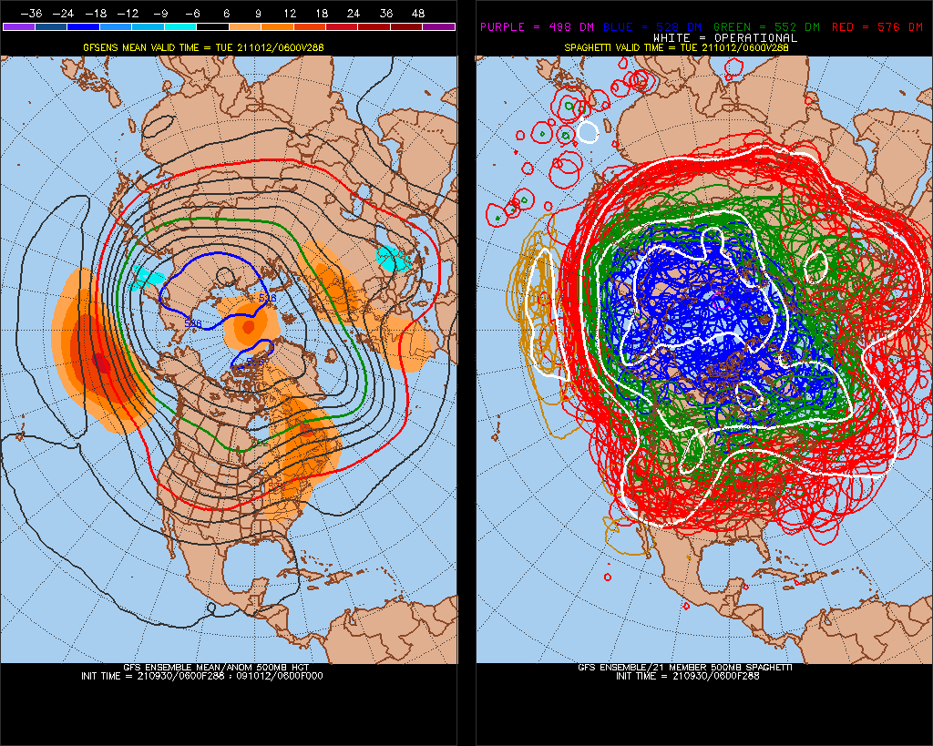
It looks like Nino3.4 will probably hit Moderate La Nina. -PNA, almost all of the time Dec1 - Mar31. 122 days, I say we have a mean+anomaly 500mb ridge north of Hawaii every day.
-
(site can't be reached 4x). We might HAVE A SOLID WINTER-PNA now.
-PNA Winter. Probably >+70dm Dec-Mar
-
Yeah, Moderate La Nina Winter (Nino 3.4)
It wil be interesting to see where we go the next 2 years, evening out. I think we are behind on Arctic sea ice.
-
Do you know that we haven't had a -PNA/>0.0EPO October since 2008 (weird since almost all Winter's have been)
Models are strong on this, analogs 2001,2007,2008
We have had above average rainfall across the US 75/25> for 7 October's in a row- negative AOhappening. Will be interesting to see what happens with this.
Analogs to next 15days models of -PNA
-
Actually, that's after October 3. We could do like 9-10 more storms.
-
Before an +EPO Winter (this Winter's going to be +EPO)
-2019 had 7 storms here on out.-
2018(-EPO) had 3 storms
2017(-EPO) had 4 storms
2001 (before biggest +EPOWinter) had 7 storms here on out.
-
I go for a firehose/roaring Pacific Jet.
-
I bet the wet streak continues, the whole US was +75/25 greater every of the last 7 year's.
-
10 hours ago, 40/70 Benchmark said:
I have heard some speculation that we may have an el nino like STJ.
It might precede +subsurface ENSO momentum ~March/April
-
1 hour ago, floridapirate said:
Outside of boards like this, is anyone aware of Sam?
When I was in a mental hospital when Cat 5 Micheal was making landfall, it was like a global blackout.. quietest I've ever experienced.
-
Only real match to precip pattern/West-STJ loops around Rockies
Is last year
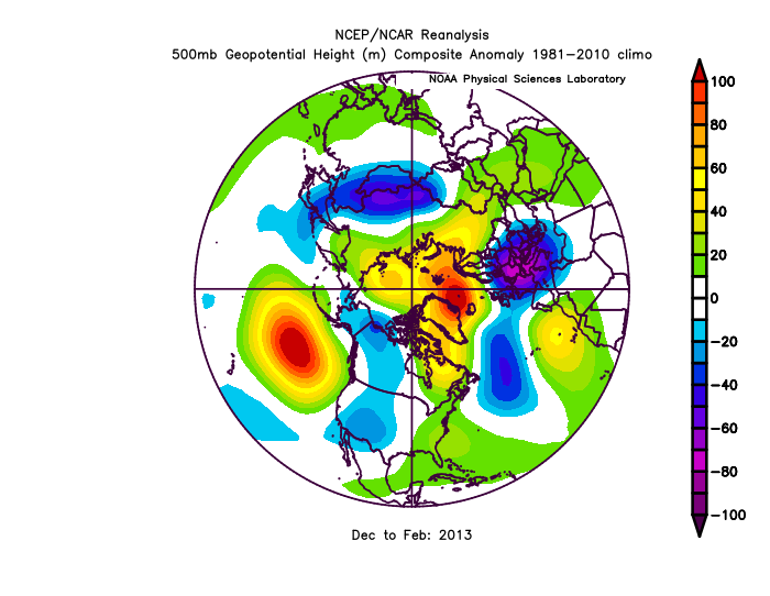
2012
-
Last 7 years, the trend
-
Really wet actually 7 October's in a row.

-
Really wet actually 7 October's in a row
-
1
-
-
lol, 18,18.17,19
-
2 hours ago, CoastalWx said:
What exactly are you trying to say.
We might get some localized El Nino conditions maybe.
-
Programs ending, or nonending 25 years ago, I've never experienced anything like this before.
-
 2
2
-
-
We are going to have maybe the 1 or 2 highest global ACE ever.
-
1
-


Winter 2021-2022
in New England
Posted
93-94 was pretty awesome too. A lot of people don't know thatit was a subsurface El Nino~. I always wanted a bigger ice storm.