

StormchaserChuck!
-
Posts
2,273 -
Joined
-
Last visited
Content Type
Profiles
Blogs
Forums
American Weather
Media Demo
Store
Gallery
Posts posted by StormchaserChuck!
-
-
I'd watch for the PNA to change ~Jan 15.
-
 3
3
-
 1
1
-
 2
2
-
-
Sorry guys, this the last 5 Winters before the strongest -PNA on record this year.
-
1
-
-
The last 4 Christmas' + 2 days. 5 -NAO Christmas' in a row. I said a week ago this mean we could then wane away.
-
It's not holding up in the subsurface, when PNA leads, it means something for 1 year ahead.
-
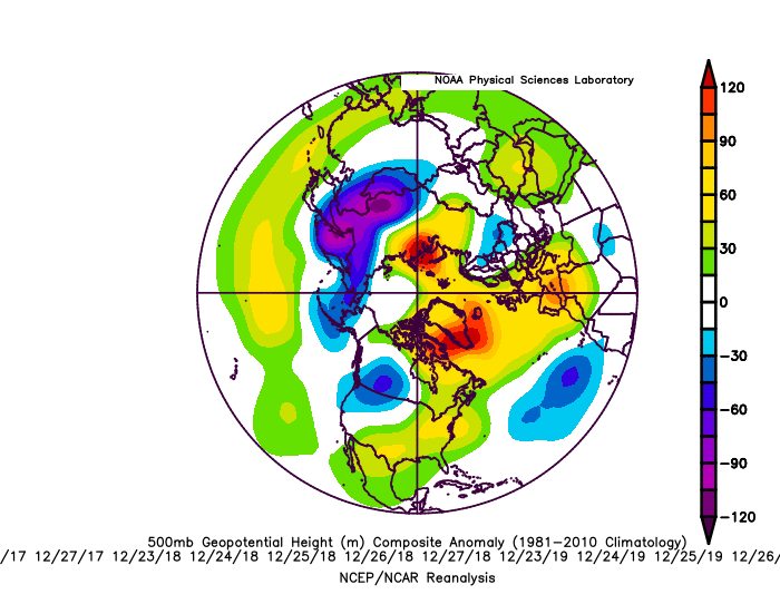
Here's something really cool.. The last 4 Christmas' + 2 days, 20 analogs Dec23-27, 2017-2020. In the midst of a very +NAO Winter time. It happens again this year(5 in a row.)!

-
Didn't realize the slight movement north or south in the Pacific High pressure, -PNA, makes a big difference, we are borderlining +pressure in Alaska, -EPO, and it's cold, 30s, today and yesterday, despite +600dm -PNA.
-
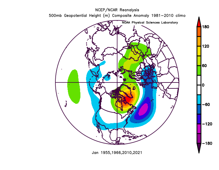
Strongest -PNA probably on record now.. I don't know about the early 1900's, but I think that was mostly +PNA/+PDO. late 1800s maybe. For this time of the year, Dec 1955 and 2010 hold 2nd and 3rd place, both Strong Nina's. As I guessed, central and eastern subsurface have cooled +0days with -PNA pattern.
-
 1
1
-
-
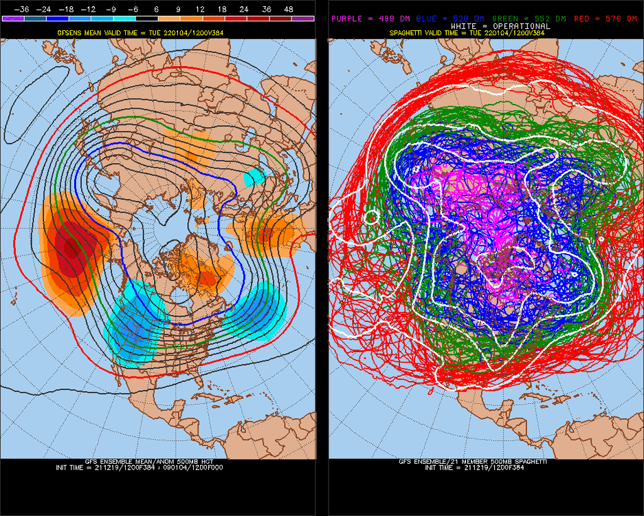
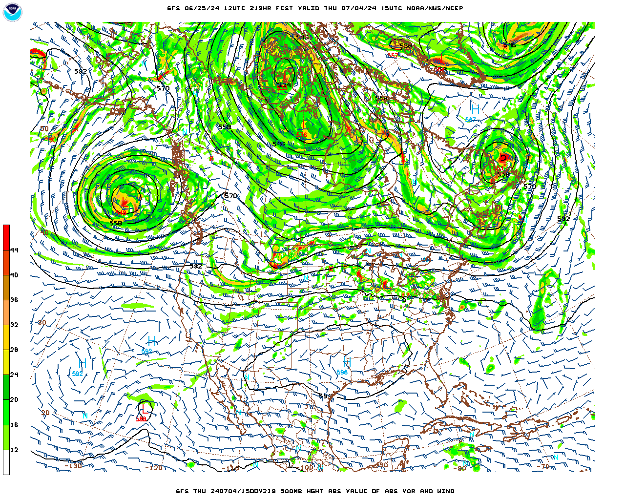
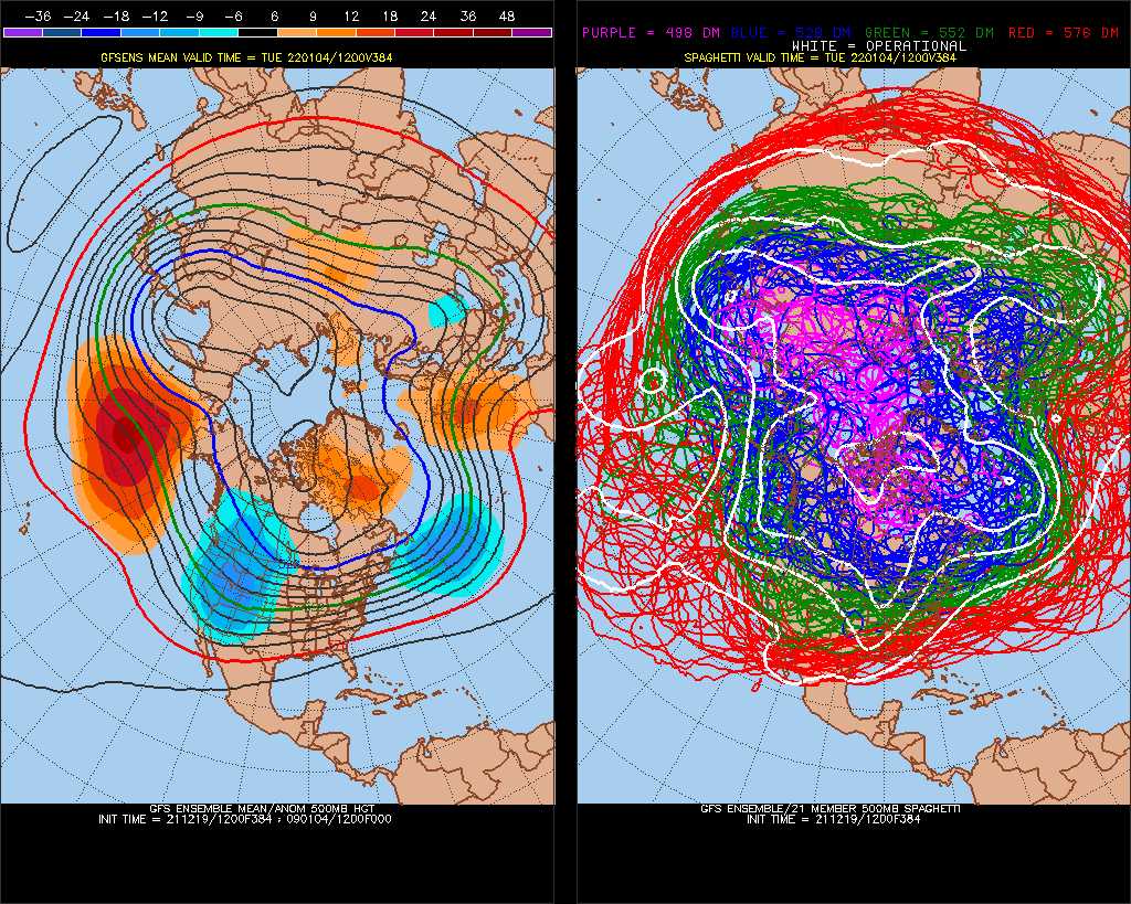
Pink on the GFS ensembles now through 168hr 7 days. I've been watching these long term models every day since probably 2001, and I've never seen that deep and long of a 500mb anomaly. And, it's at 55N degrees!
Some perspective: Dec 1 - Jan 3 will come in at +380dm. In 75 years Since 1948:
2. is +280 in 2010
3. is +230 in 1955.
-
Yeah, cold Stratosphere has a -40dm +0d correlation. If it happens without the stratosphere a lot, that's a decadal -NAO cycle. I wouldn't be surprised though if in verification it trends a little less -NAO.
-
1 hour ago, psuhoffman said:
Problem with that is you’re taking only one factor in isolation. There are radically different results mixed in there. What you’re seeing is that years with a super -PDO AND a pos AO/NAO the pattern is such a torch it outduels the -pdo/-AO years in the means. I have no doubts if the AO flips back positive for the remainder of winter we are screwed. I’ve said many times we NEED NAO help in a Nina. But if, big if, we get the NAO to be cooperative at times that changes the metric and what years in that large sample are most relevant.
Yeah, a +100dm/-70dm signal of 20 analogs(/75) over a 3-month period is really strong. (only 3/90 days of the sampleset is in the roll forward)
-
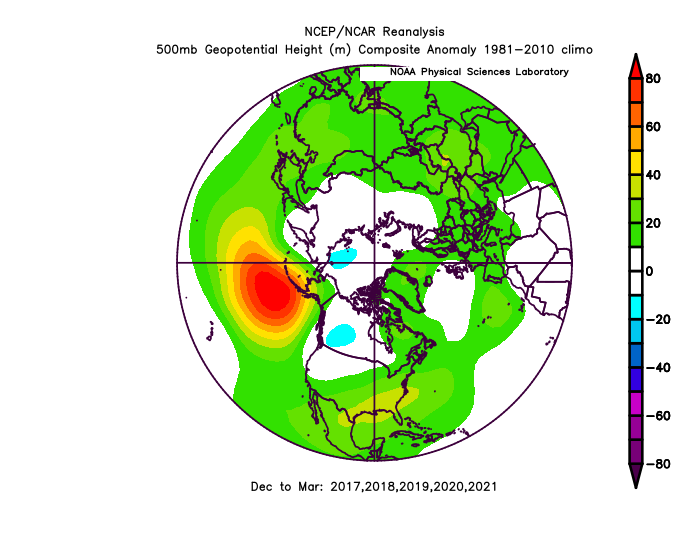
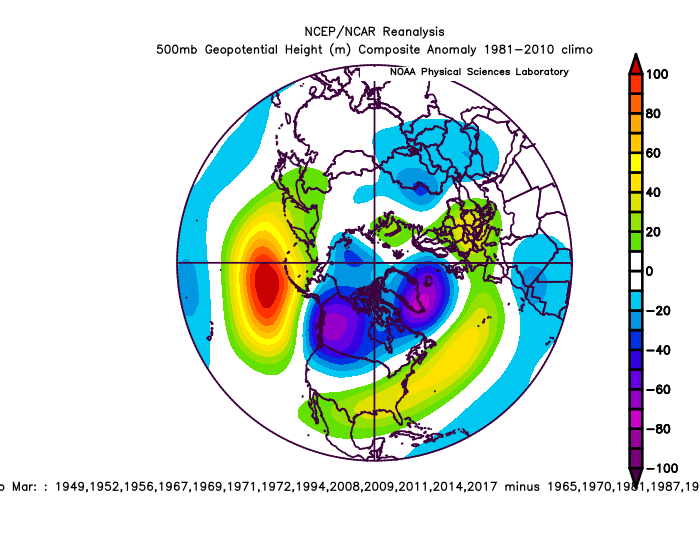
I posted this in the NYC subforum yesterday.. when Dec1- Jan3 -PNA dominates, is most dominant index, what the rest of the Winter brings, 20 analogs over 3-months since 1948.

-
Weak, we will have above average temps if this verifies
(They might be over doing the -PNA because of how blosterous it has been.)
-
1
-
-
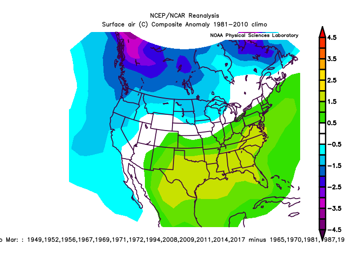
We haven't had dry snow in a long time that lasts.. the last few years all snow totals are gone in 3 days. I didn't like 09-10 much for this reason too. -PNA -NAO is better in this regard
")
-
Cold today.. -NAO comes into initialization, and it really fades out on LR models.
-
2
-
1
-
-
I would bet on the Packers vs the Ravens, best case scenario Ravens lose 27-17, and even that should be loss vs spread because they are home.
-
I think we will switch PNA phases Jan 5, 10, or 15. Maybe later because the 384hr model has +300dm nearly still. NAO has been like a blotch since August, meaning the normal climate pattern was less -NAO, and it's like the -NAO has been pasted there. That may continue? We have been so opposite of last year, I love hugging that right now, but we had a monster -NAO last January, top 4 west-based -NAO on record actually, since 1948. I wonder if the NAO/AO trends positive when the -PNA lessens?
-
1 hour ago, Ralph Wiggum said:
Problem is, it hooks up with the SER on several ens members and forms a mild full lat ridge in the East US.
A repeat of October.
-
2
-
-
This looks good, I like those shortwaves digging in the West coming under the 498dm Polar vortex. 107mb gradient. Wonder how much warm air convection we can trend towards.?
-
384hr GFS
-
Another perspective
-
2 minutes ago, Great Snow 1717 said:
..the point is there are no signs of a long lasting winter pattern setting up. And that some individuals continue to ignore/.downplay what the pattern(s) has been producing for months.
November was cold and October was -NAO
-
11 minutes ago, Great Snow 1717 said:
Edited your post.
Actually, it looks like Jan-Feb 2023 will be -PNA.
-
1
-
-
Most -PNA's for Dec 1- Jan 3 .. this year will be #1 of all time by a good 20%. It's a tough pattern to break, but I think we will break this mid-Jan and maybe Feb with more +PNA, because of subsurface ENSO trends, and our ongoing opposite tendency to last year. This +100/-70 as a 20-analog composite of 3-months is a strong very strong baseline signal.
v Jan 1-Mar 31, my dataset ends Jan 3.

-
I love how west-based the -NAO is.. only 4 January analogs
-
1
-
January Medium/Long Range Discussion
in Mid Atlantic
Posted
Yeah, that's bad
Severe thunderstorm watch for the Midwest.