StormchaserChuck!
-
Posts
2,274 -
Joined
-
Last visited
Content Type
Profiles
Blogs
Forums
American Weather
Media Demo
Store
Gallery
Everything posted by StormchaserChuck!
-
2 La Nina's
-

2021-2022 ENSO
StormchaserChuck! replied to StormchaserChuck!'s topic in Weather Forecasting and Discussion
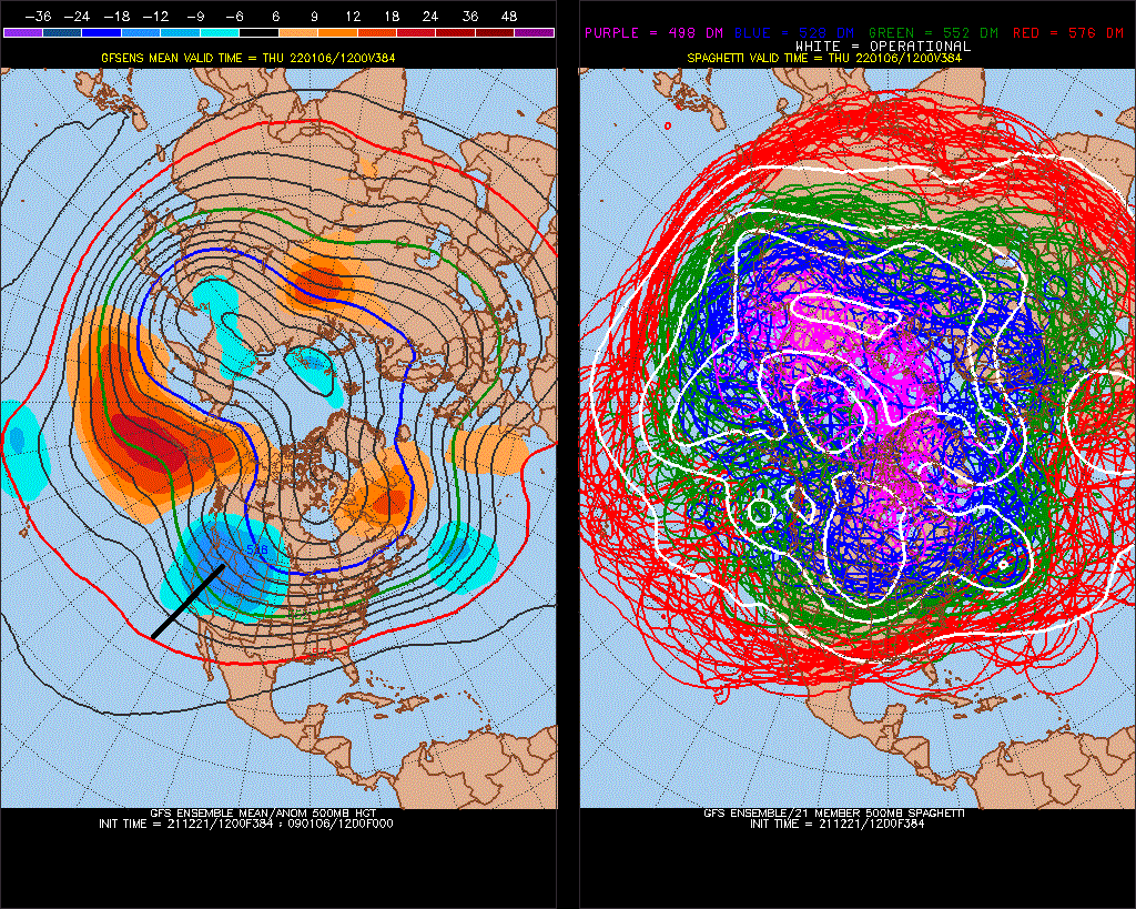
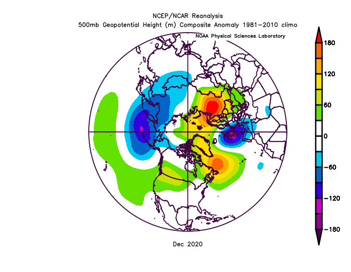
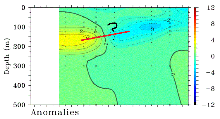
^ That's some +5> subsurface water, while the -PNA Is 640dm (5std over a month) Even though we look like we have a Strong El Nino brewing, it will take more than 1 year to recover globally from the Nina-phase. -
Mid to Long Range Discussion ~ 2022
StormchaserChuck! replied to buckeyefan1's topic in Southeastern States
When the NAO goes negative for a while, years, the PNA will go more positive(cycle). -
It's not even real. Someone is making you sick because of energy-judgement. mood-impressiveness or whatever.
-
It will shift in 15-20 days.. the subsurface ENSO is not La Nina at all. The pattern is less about ENSO than longer term happenings. It might not be a deep +PNA, but we will see a brake.
-
January Medium/Long Range Discussion
StormchaserChuck! replied to WinterWxLuvr's topic in Mid Atlantic
I expect this to trend more -EPO.. maybe soonthereafter -NAO coming back. We all know PNA Is going + Jan 10-15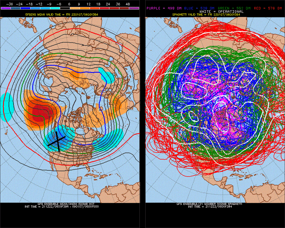
-
January Medium/Long Range Discussion
StormchaserChuck! replied to WinterWxLuvr's topic in Mid Atlantic
09-10 sucked, we had 30% of what the records show because everything melted so fast. -
January Medium/Long Range Discussion
StormchaserChuck! replied to WinterWxLuvr's topic in Mid Atlantic
-AO correlates to +PNA. (AO minus NAO)
-
To even out with the Pacific patterns in dominance, we need a +700 to +900dm -NAO.
-
January Medium/Long Range Discussion
StormchaserChuck! replied to WinterWxLuvr's topic in Mid Atlantic
I think EPO is king, because cold air sits over land. -EPO/+NAO Winter's were pretty impressively cold, 01-02 was kind of -NAO/+EPO 97-98 was -NAO too lol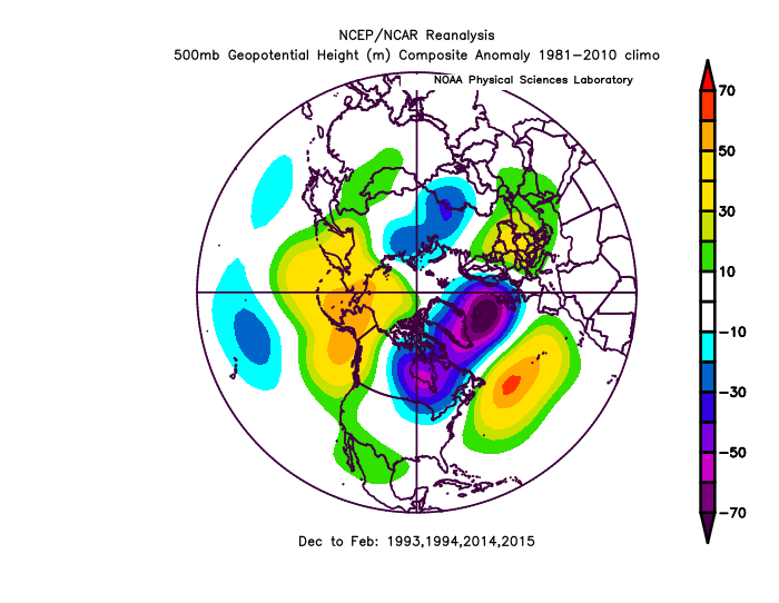
-
Good post, I wonder if global climate evolution would return to normal if we had several years of big -NAO.. Seattle had 19" of rain last month, which I think was an all time record.
-
I dont know what Santa Claus is
-
January Medium/Long Range Discussion
StormchaserChuck! replied to WinterWxLuvr's topic in Mid Atlantic
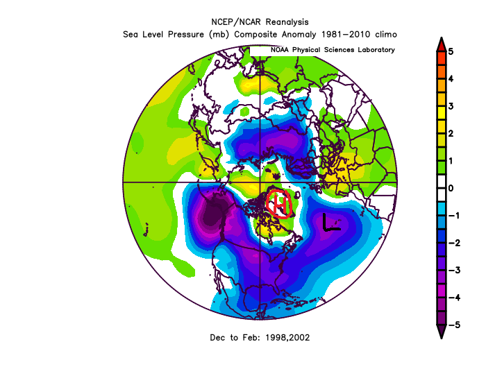
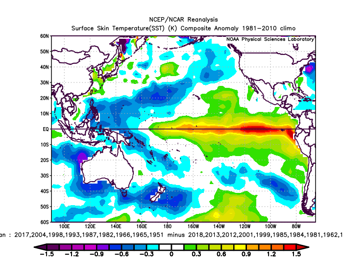
Actually, with the 6SD -PNA this December vs warm subsurface ENSO, we are likely to see, the opposite of if it's leading a Strong El Nino event, and next Jan-Feb are likely to be -PNA. (2010-2012, 1955-1957). I always thought a Nov-Dec Kelvin wave would lead big +ENSO event the next year, but we seem to do opposite, it's a "sign" maybe for 1-3 years ahead, but the ENSO climo seems to reverse. -
Mid to Long Range Discussion ~ 2022
StormchaserChuck! replied to buckeyefan1's topic in Southeastern States
It's coming next year too. probability is high for Jan-Feb 2023. -
January Medium/Long Range Discussion
StormchaserChuck! replied to WinterWxLuvr's topic in Mid Atlantic
There is a chance models are just wrong about Jan 1-5 -PNA [or maybe it's lagged], this is what the last 20 times Pac NW was cold Jan 1-5 (strong signal now) looked like ,ENSO state-verifies opposite, believe it or not January full month of 20 analogs (Jan 1-5 Pac NW cold dataset) 20 years ^I was curious if that is any lead for us.

-
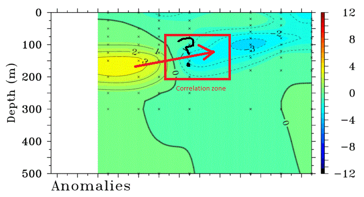
Again, this is what ENSO looked like the last 20 times we had cold NW in the first 5 days of january (since 1948) Subsurface ENSO > correlation to pattern than surface so this is what I'm thinking
-
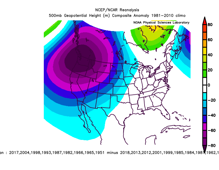
Cold Pac NW first 5 days of January, last 14 times since 1967, flips in February (January composite is -NAO too). fwiw This is interesting because cold NW is associated with opposite pattern.

-
2021-2022 ENSO
StormchaserChuck! replied to StormchaserChuck!'s topic in Weather Forecasting and Discussion
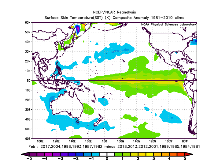
What's interesting is that lately, since 1980, cold Pac NW first 5 days of January, Jan 1-5, is followed by +PNA/El Nino-like February I say that's interesting because cold Pacific NW is a -PNA pattern. Extend it out to top 20 years since 1948, and this is what you get for February. One more time to show you what I'm describing v same dataset/time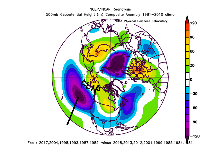


-
January Medium/Long Range Discussion
StormchaserChuck! replied to WinterWxLuvr's topic in Mid Atlantic
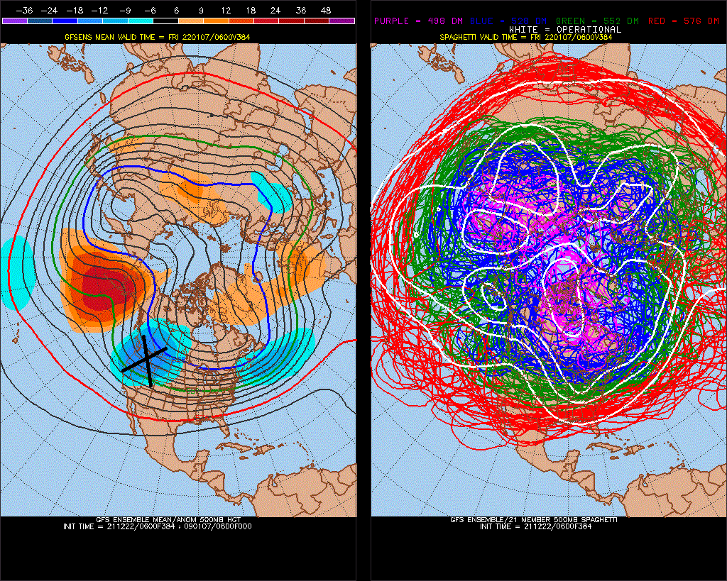
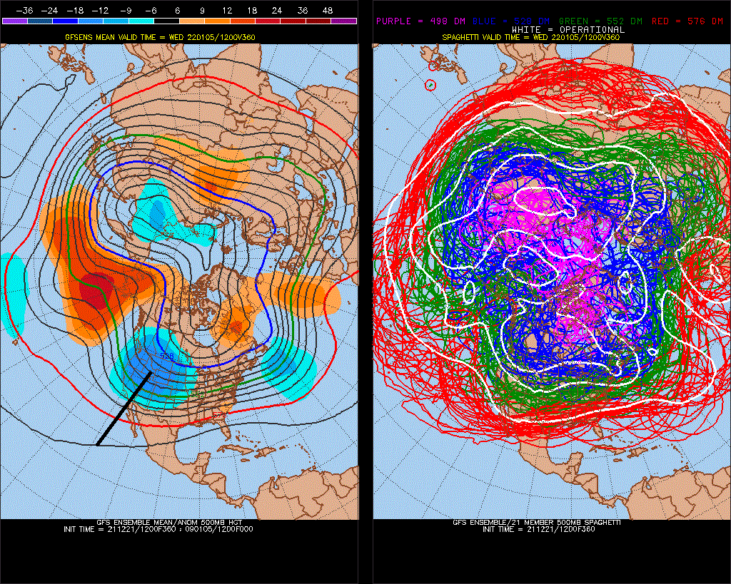
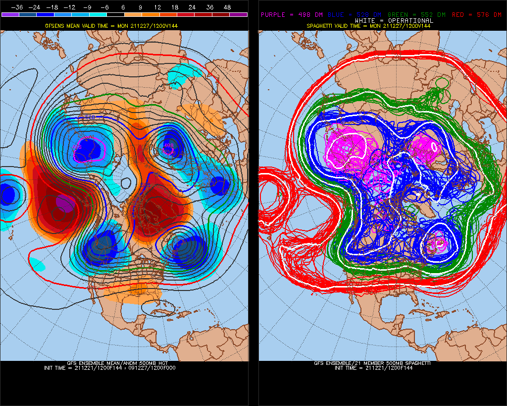
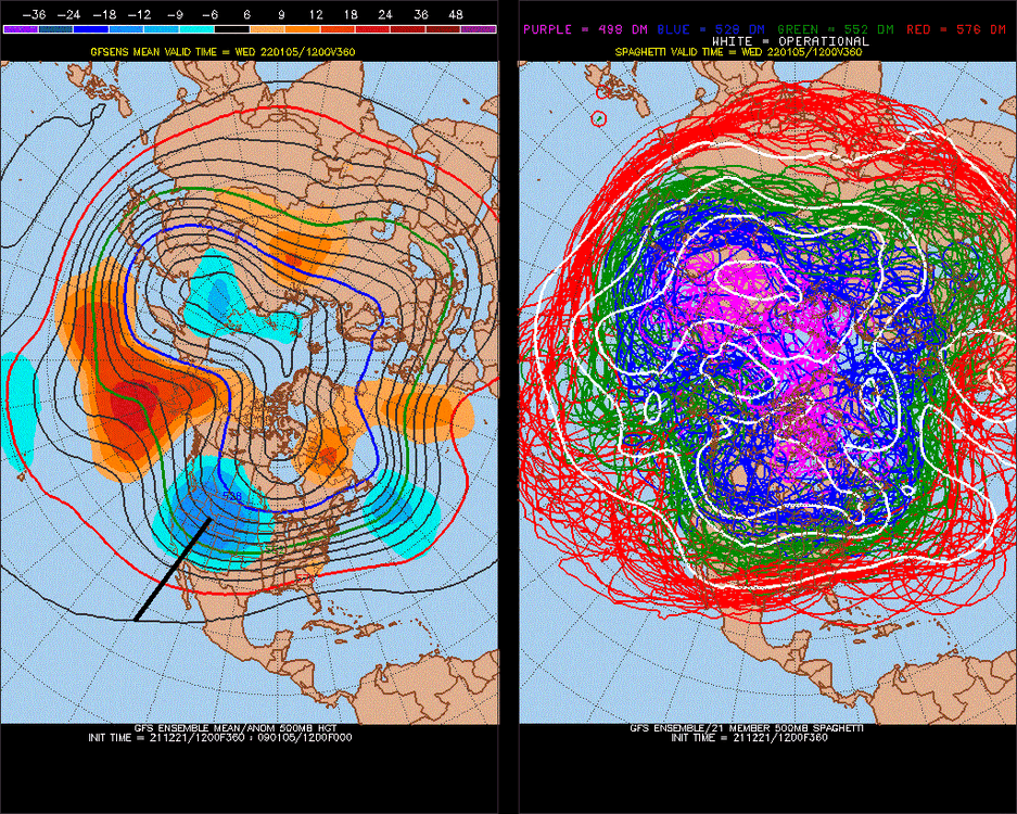
Here we go.. 4th reload of the +480contour(pink) -PNA, new model trend/record. You can tell that this wants to blast the Pac Jet thereafter, maybe it will trend different future runs.
-
I hope MJO812 gets snow. Seems that the NAO trends are good this year, we've been negative 4/6 months.
-
January Medium/Long Range Discussion
StormchaserChuck! replied to WinterWxLuvr's topic in Mid Atlantic
Especially because we've had snapbacks at a mathematical 75-80% lately. Seems we're in a range. I believe the PNA will go positive ~Jan 15. It will also be positive 2-21-2022. -
How about the quality of the water, it's not as good now as the '90s. I had a snowstorm in 2018 that looked like styrofoam.
-
January Medium/Long Range Discussion
StormchaserChuck! replied to WinterWxLuvr's topic in Mid Atlantic
Give me rain in Intl falls! -
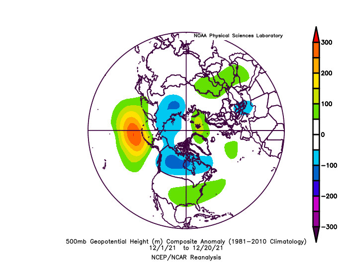
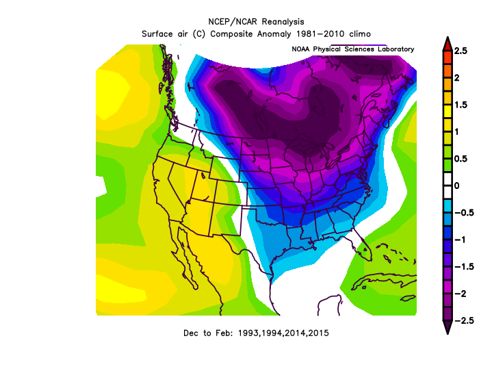
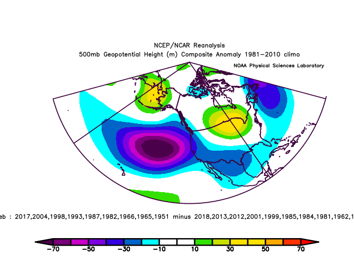
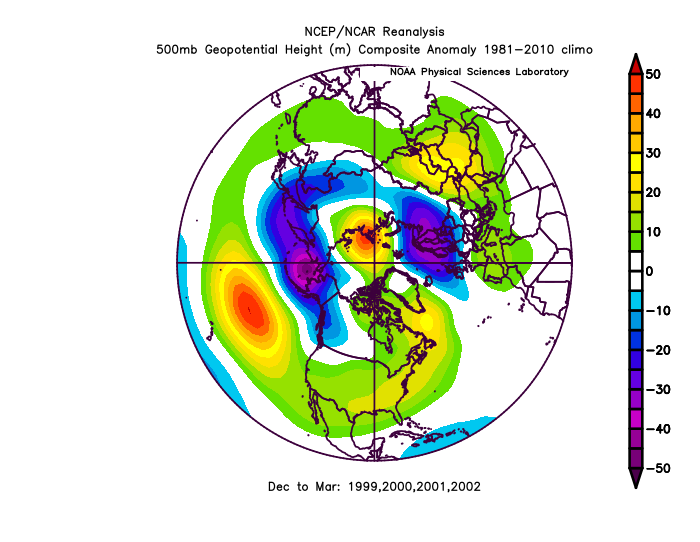
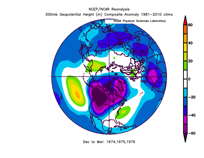
We are going on the 6th year of record breaking -PNA, after the 15-16 Strong El Nino (1year) We have seen similar things in the past... The 1997-98 Strong El Nino reversed for 4 years. 1982-1983 Strong El Nino reversed for 3 years. 1972-1973 Strong El Nino reversed for 3 years. So these Strong El Nino's happen since the satelite era of 1948, and we reverse it, is 3x longer 4/4 times. Recently it's 6x greater. The bounce back > Strong El Nino effects. 4 is a small sample, but still.. (When the bounce back was weakest 84-86, we followed that with 6/8, 8/11 +ENSO years thereafter.)
-
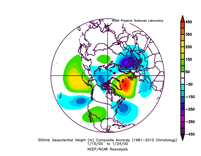
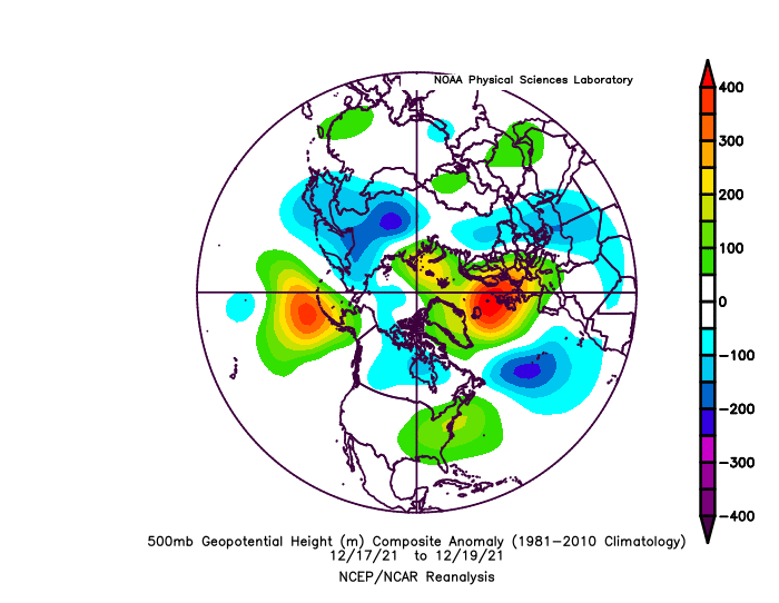
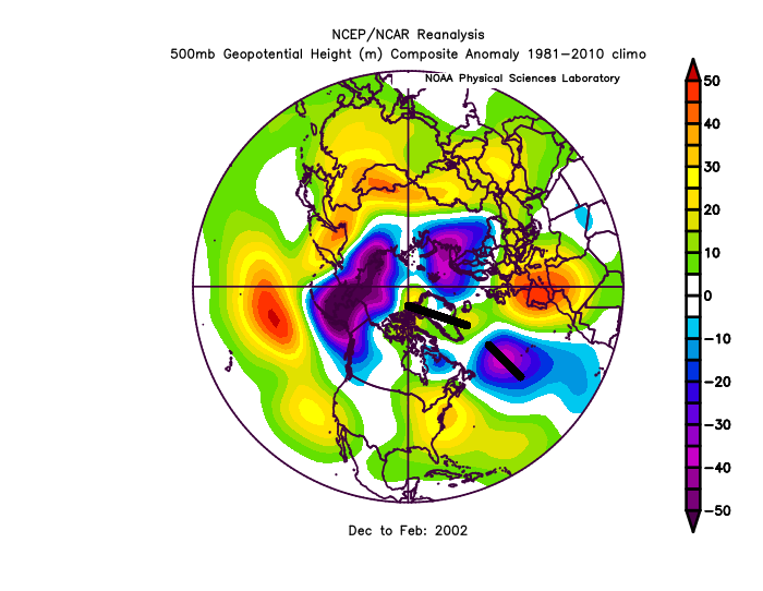
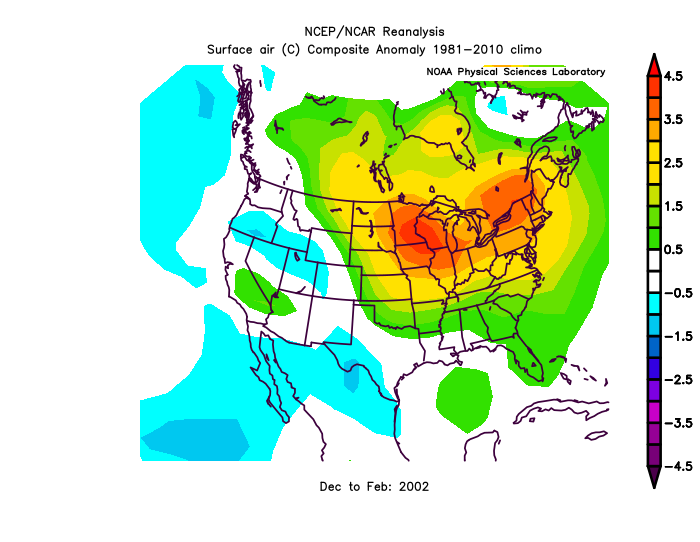
Unfortunately, things are just warmer now. This is 10 days before Jan 25, 2000: Now similar pattern.. blah. (NAO will be centering to a match next 7 days)