

StormchaserChuck!
-
Posts
2,273 -
Joined
-
Last visited
Content Type
Profiles
Blogs
Forums
American Weather
Media Demo
Store
Gallery
Posts posted by StormchaserChuck!
-
-
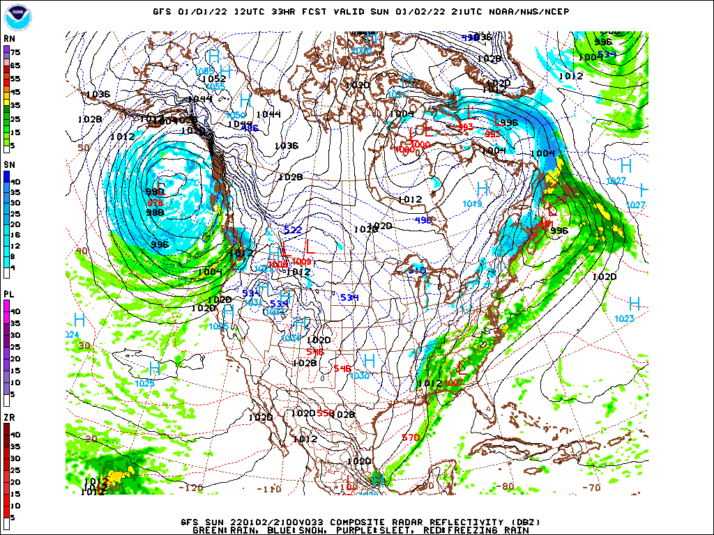
It actually misses north.. these maps are rarely wrong.
-
 4
4
-
 1
1
-
 1
1
-
-
I like the threat, the NAO is not going more positive in trend.
-
 2
2
-
-
-NAO definitely the dominant pattern this Winter.
-
2
-
-
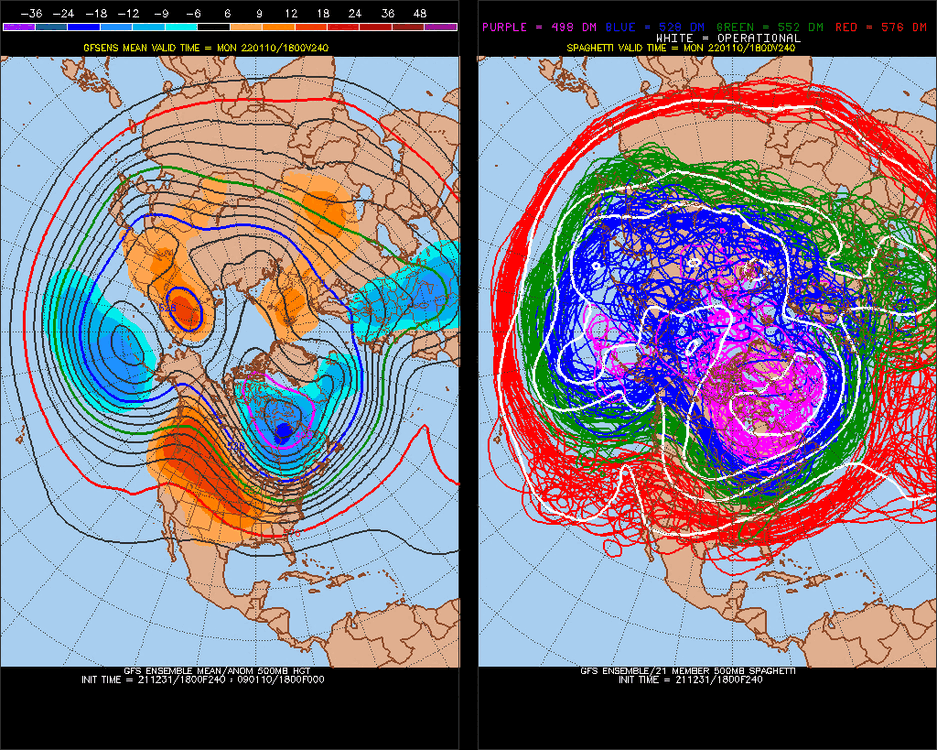
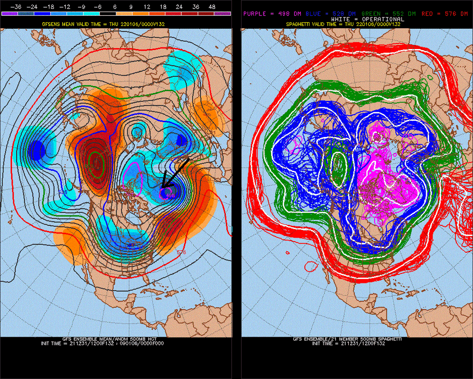
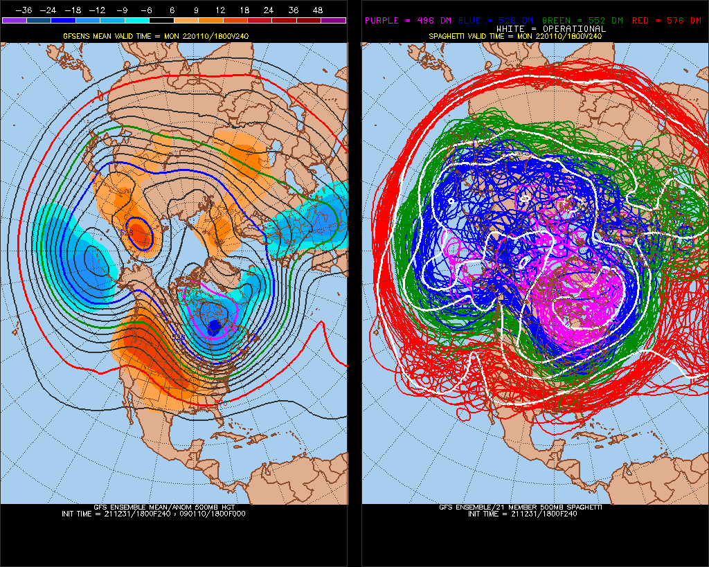
+PDO pattern (-EPO or +PNA) holds now through Day 15-16, on GFS ensembles. Will probably go back to -PNA for February.
-
10 minutes ago, The 4 Seasons said:
Congrats on the storm, i guess the JuJu worked! We're up here getting cucked in New England, but you guys enjoy, you definitely deserve it
If it's that far NW, there's going to be a 12-14" jackpot.
-
12z They had +NAO peaking at the same time +PNA peaking in a 6-hour frame, Day 9 on the model.
-
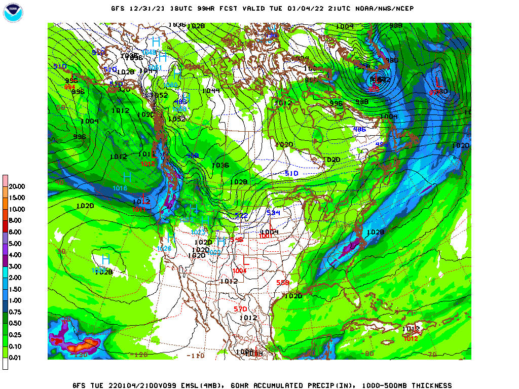
Still a south model bias, it's in the 50's, too warm for Richmond to get 10"+
-
1
-
-
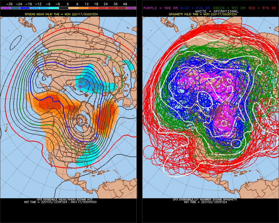
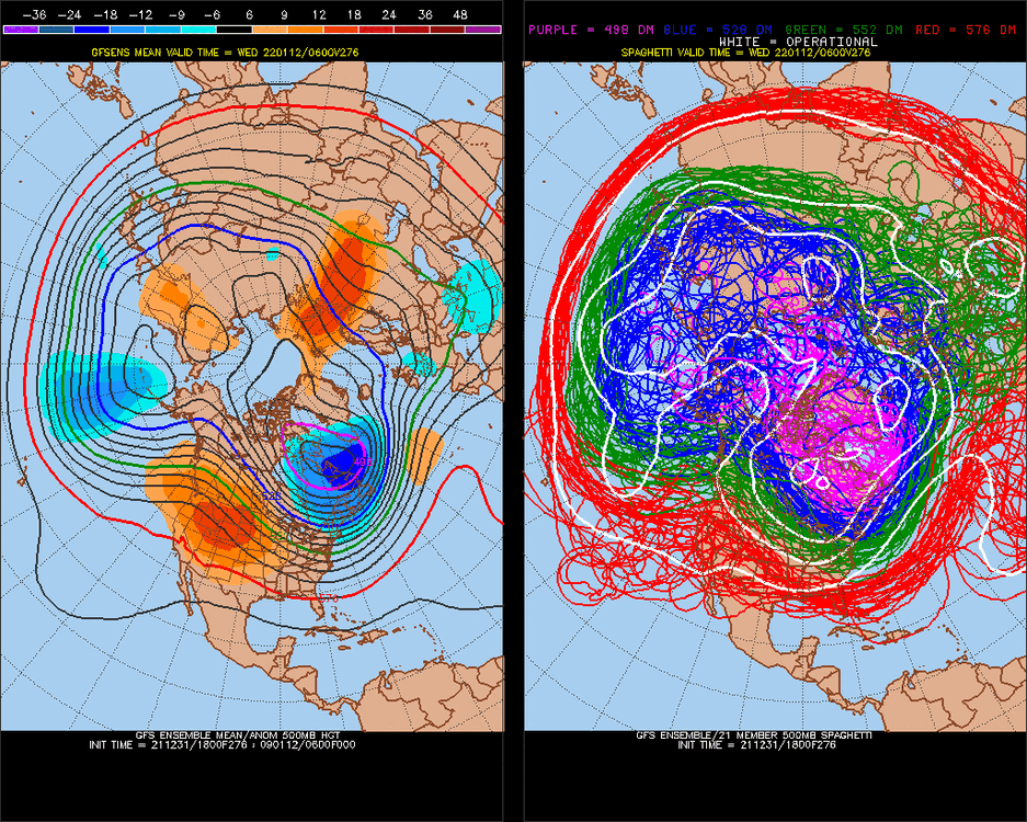
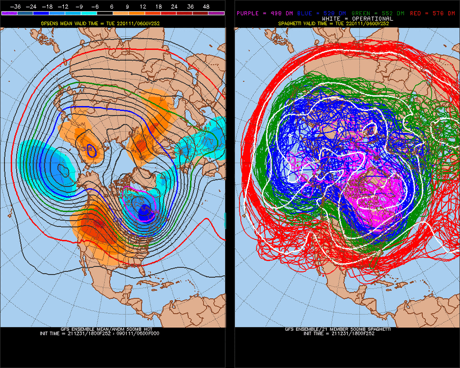
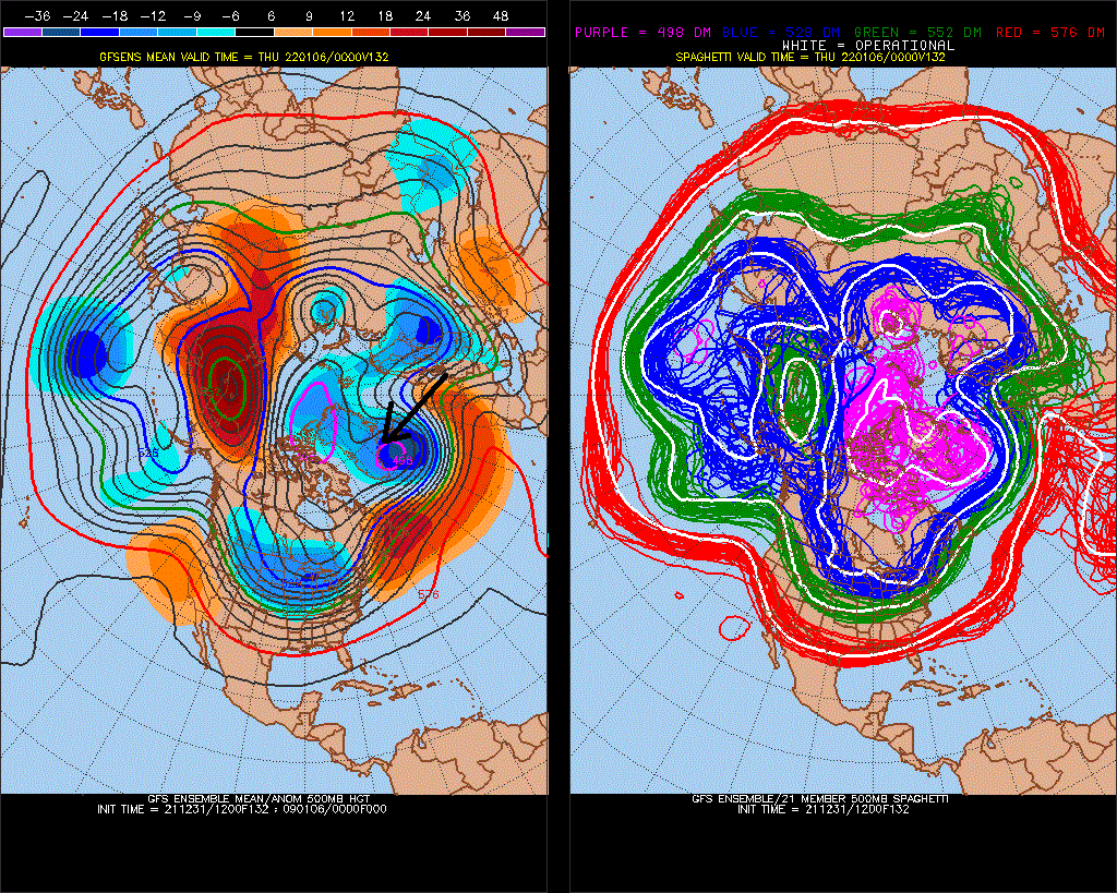
Big -EPO at the end of the 12z GFS ensembles run. I had a -NAO analog signal for January, so it might go more -AO/northern Greenland+ridging in medium/long term trend. Watch Jan 15-25 to maybe be cold.
-
4 minutes ago, Prestige Worldwide said:
You are the PNA man. Great calls on it
Yeah, I would probably live in Hawaii
-
Big +PNA dropping in GFSensembles hr156. Do you know that in the satelite era (since 1948) all major anomalious blocks, have turned to negative anomaly after?
-
3
-
-
1980 was the biggest +PNA on record, +2.42... we actually have a -PDO (GOA low, ridge west) for this one.
-
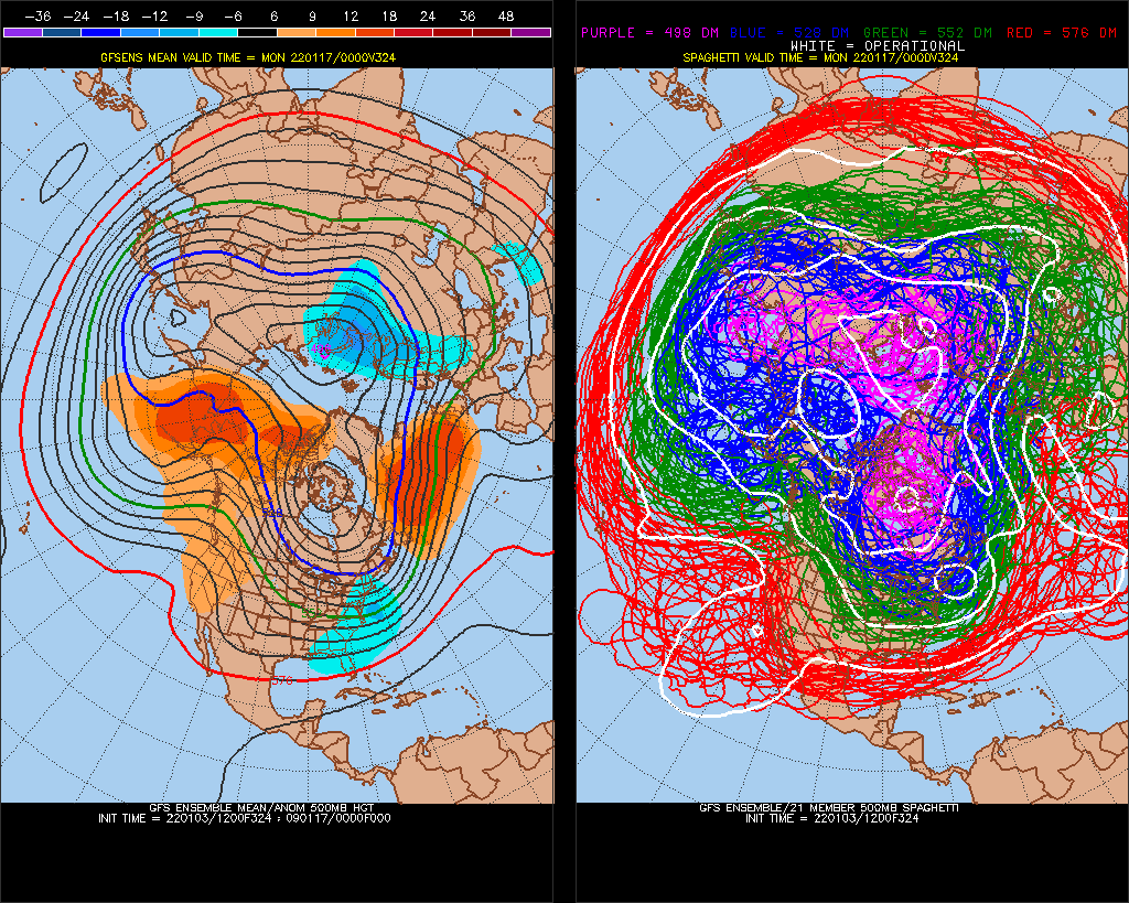
January will borderline storms, as the N. Hemisphere continues to revolve around the East Coast.
-
This right here continues to show GFS SE bias
-
Again, Richmond sees big snowstorms in late Nov-Dec. This has the feel of trending north.
-
I think it will come NW still, but how much is dampened by the NAM. slight adjustment NW to verification. Maybe 1-3", 2-4"
-
Pretty good +PNA incoming.. probably turn my ^zone to +
-
1
-
-
Good call by on +PNA during a La Nina January.
~1-9-2023 we'll go into -PNA
-
I doubt there are 3 posts here in the last hour.
-
5/9 Richmond's biggest storms were in December.. 4/9 all other months.
-
1
-
-
If your stuck in this no weather discussion, sorry...
-
3" qpf, a miracle would do it

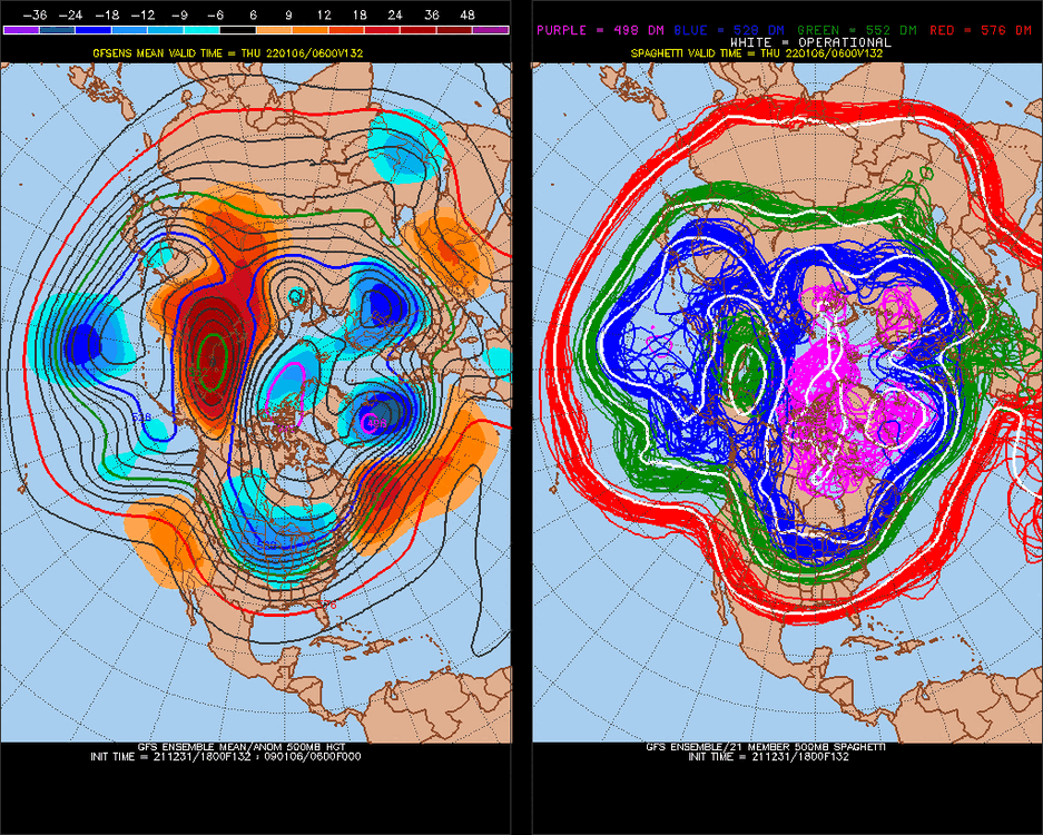
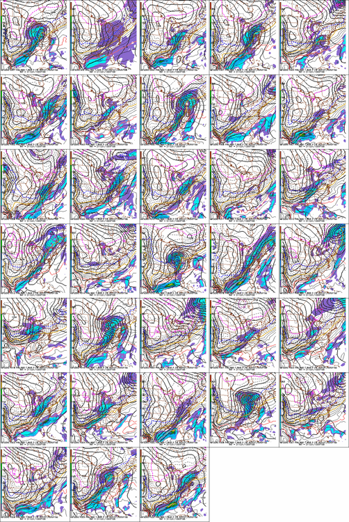
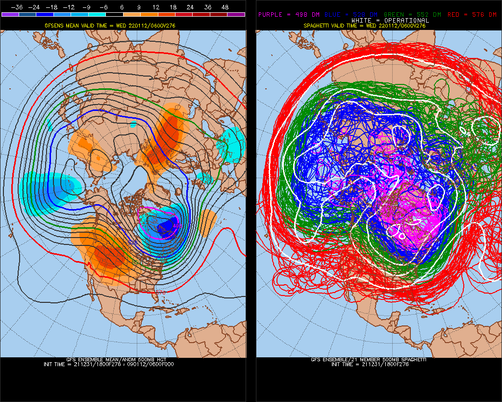
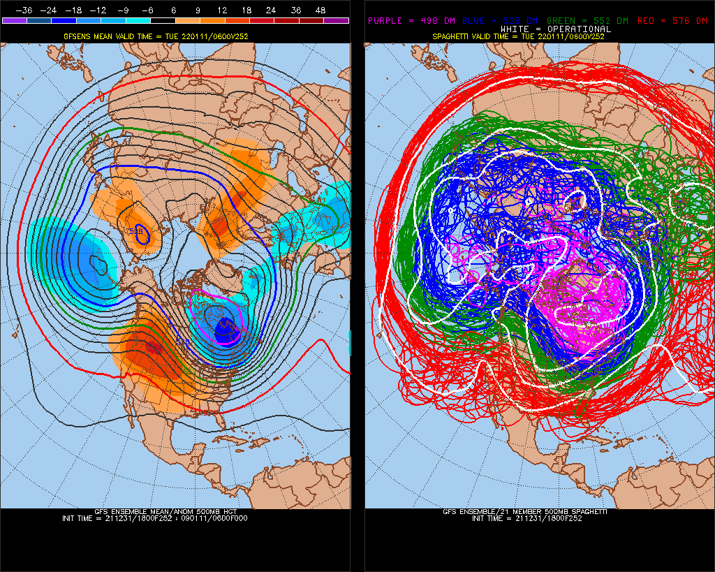
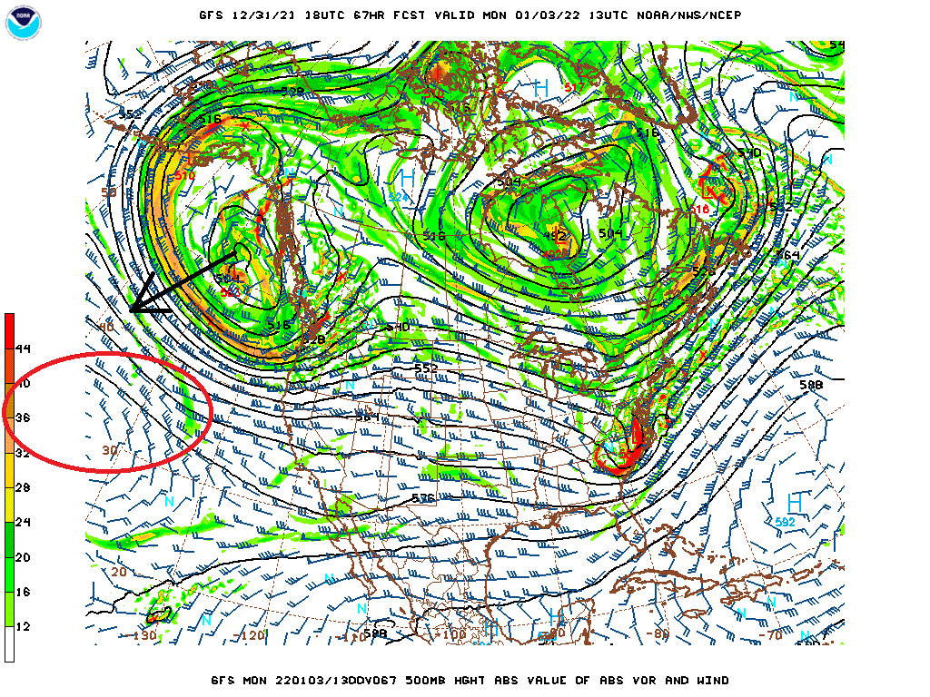
We need the GOA Low to trend more SW/dig more. I've seen it, actually this is a common model trend for the same timeframe as we get closer(1st low breaking in a pattern). The problem is, I think we can reestablish -PNA a bit (red circle). GOA Low stays strong and digs more, we have a snowstorm. 1:10 odds I'd say, full phase 1:50.

(I have a feeling not everyone is reading my posts)
-
 1
1
-
2
-
-
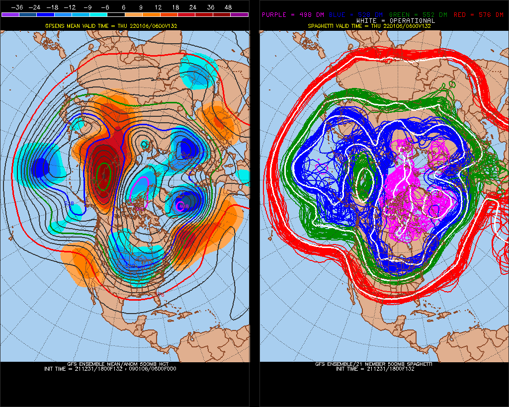
More neg tilt this run!
-
Just now, nw baltimore wx said:
Did Chuck just say we have a blizzard coming on Monday?
It's definitely going to trend NW, at least at 18z and 6z. might lose some STJ moisture though as NAO trends more - and PNA (north of Hawaii ridge) more -. GOA lows are like real movements in same time model trends, final 72hrs goes more SW/undercut. I'd say like 4-8" I-95 or NW of I-95, maybe 10". worst case scenario it's a really wet snow event(loss of STJ moisture is what I'm most worried about in trend), but SLP will come a little NW
-
1
-
-
This is a pretty good +PNA, but do you see my point about the NAO, we directly correlate right to positive.
If we can trend less +NAO or more -AO, this is a good snow chance.
-
1
-
January Medium/Long Range Discussion
in Mid Atlantic
Posted
I've been watching them, and it happens as it snows. They have 100% of the time been in the general range. Sometimes you cant tell from QPF if it's 5-10" or 1-3".. it's good