

StormchaserChuck!
-
Posts
2,273 -
Joined
-
Last visited
Content Type
Profiles
Blogs
Forums
American Weather
Media Demo
Store
Gallery
Posts posted by StormchaserChuck!
-
-
hang back, hang back (it will-it always does)
watch for it to get more cutoff/bombsouth though
/snow north of Richmond though (5/9 Richmond-centered storms are in Dec)
-
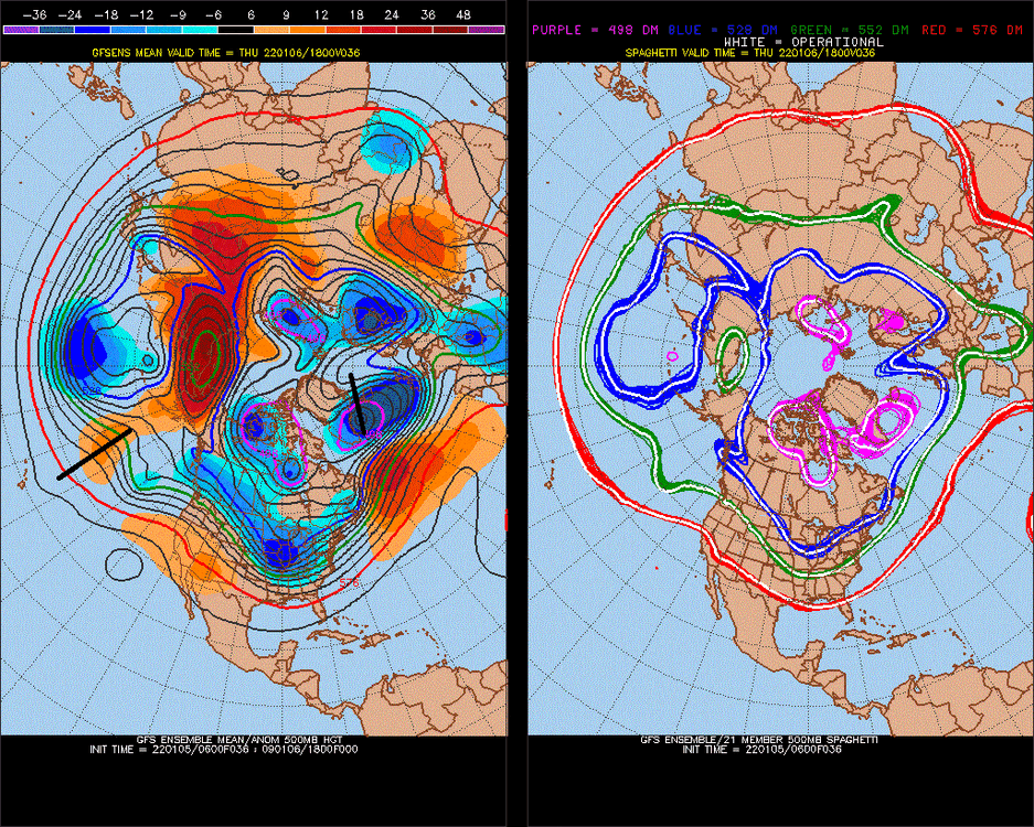
So much for that +NAO projected LR, It's a -NAO pattern this year. Feb 7-9-2022 +NAO is a big test.
.thumb.gif.c84d5ed49f25d090e2bdac787c860429.gif)
(^The timing of this -NAO lifting out isn't going to match STJ energy.)
-
warmth is gravitating to the land, but it's a really good pattern. +AAM measures Earth momentum.
Again, I like that cutoff piece for a snowstorm.
-
 1
1
-
-
3 hours ago, WxMan1 said:
If we are, then it's about damn time. Our last El Niño was 6 years ago. We are due.
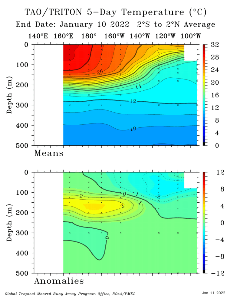
CPC maps are stronger, they have +6c in the central subsurface. history shows not much correlation, although 87-88 was negative in the subsurface during El Nino, and that was followed by a Strong La Nina.
re: the storm, Well, it's 25 degrees right now.
-
If the 1st piece slows down/holds energy back..
-
We are heading into El Nino, it looks like

I showed you the counter example, 1987-88 where the cold subsurface water during El Nino gave us a lot of southern jet High pressures. I think the warm bubble in the subsurface won't last past April-May, but it does directly correlate to +PNA conditions directly(when 165W-135W is warm-warming).
-
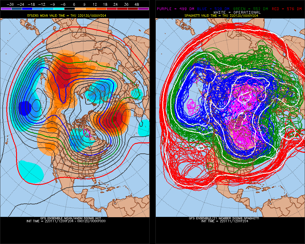
STJ moisture is good Jan 22-26 it looks like.
-
 1
1
-
-
This is the one I'm looking at.
If we have a -EPO/+PNA pattern the last week of January, this will be a big snowstorm probably.
-
 2
2
-
-
STJ near Mexico
GFS ens's are borderline going back to -PNA/something at Day 15, so we'll see
-
1
-
-
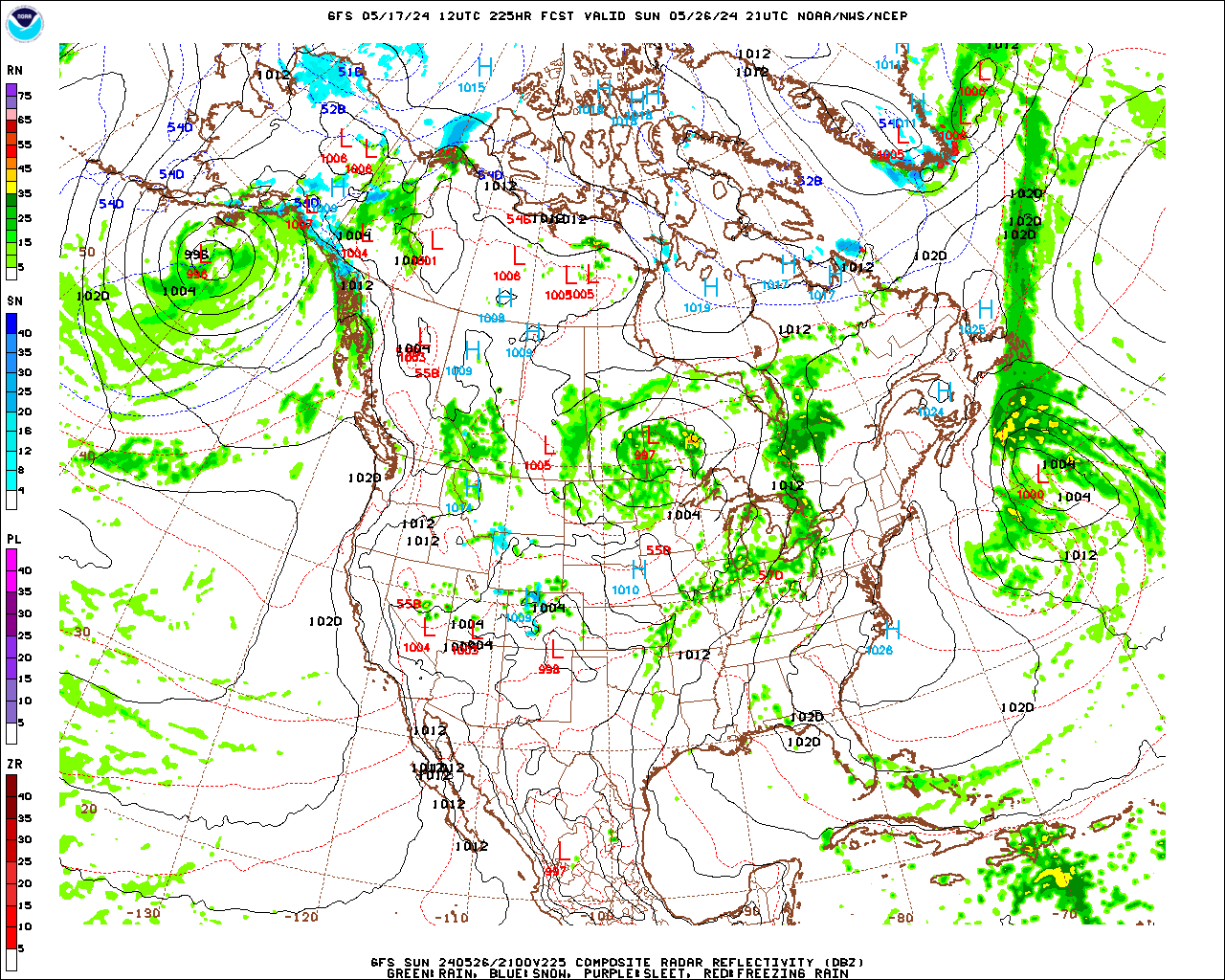
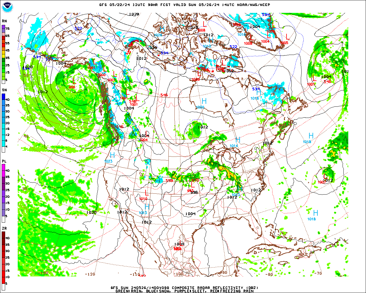
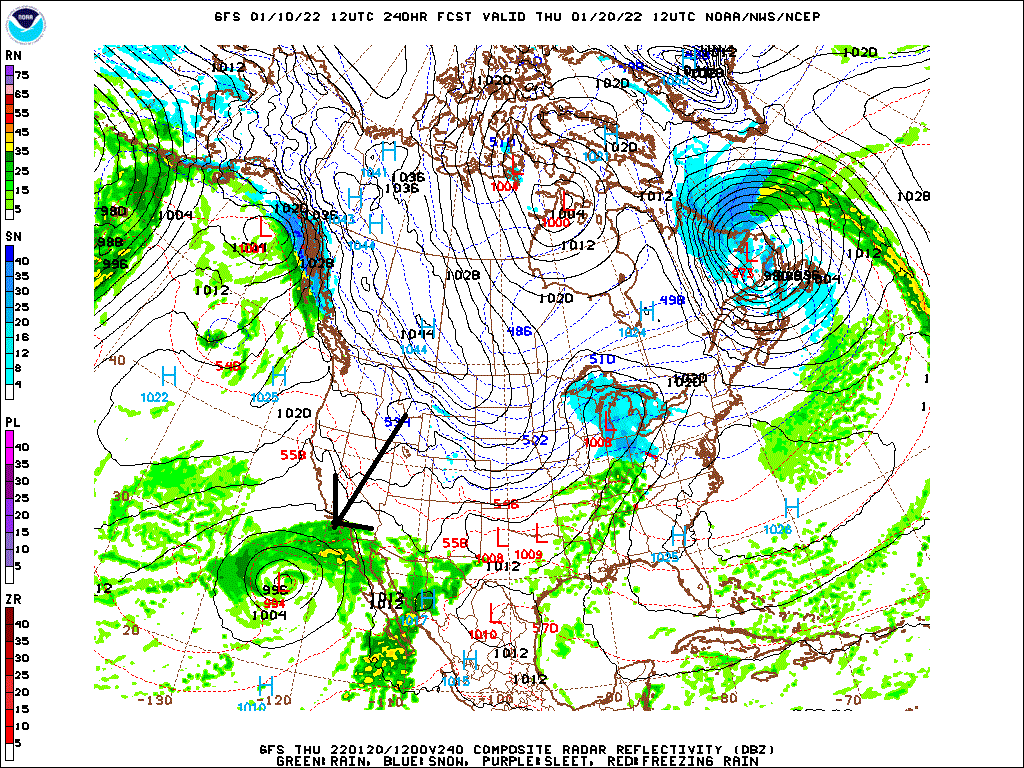
Let's see what's going on here at 98hrs
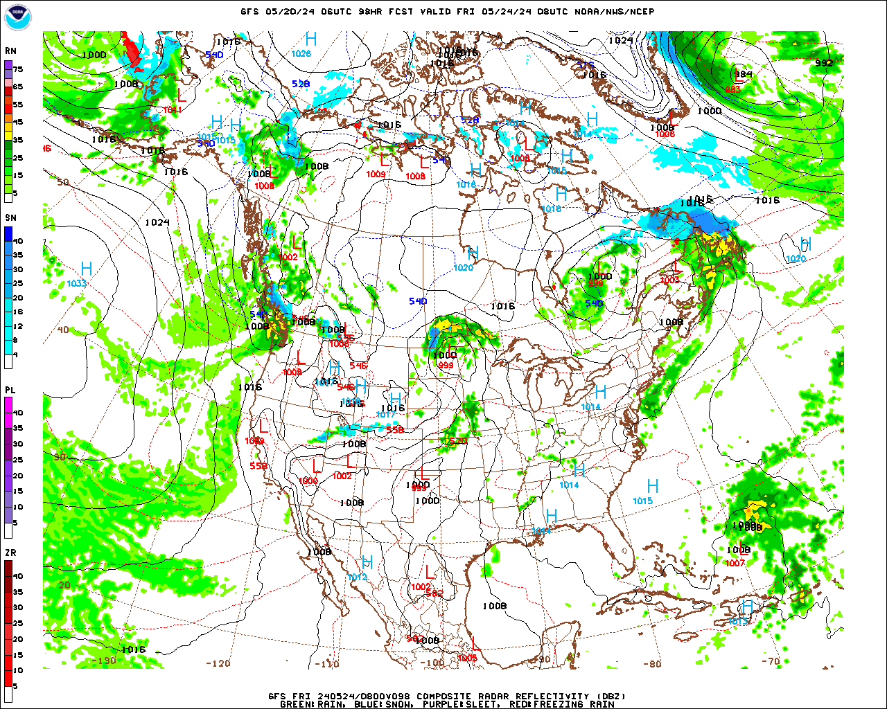
This would be a great chance to trend west if not for this complete depletion of reverse-Dec -PNA. It's too strong otherside/+PNA. We miss it. NAO-PNA are running together wrt every storm. ^1040mb High pressure, we aren't even that cold believe it or not
-
Yeah, Obviously when the -PNA comes back it's going to stick around for the Winter. Our window is small. I do have a +PNA signal 2-21/22-22 though.
-
1
-
-
Yeah, let's see what is happening though
-
10 hours ago, raindancewx said:
Cracks me up to see people so happy with the snow in the East today and in recent days. It's extremely common for the East to get snow after a wet West December in week two of January if you look at the history. I think three of my five analogs had snow for the NE on 1/7.
well, 90% of the population never sees snow. GW might be a program, too
-
Yeah, warm pool should be centered in 2-3 weeks. surprised me. In this age of weather derivatives, etc. It should be interesting to see what happens, +PNA in La Nina +2-3 weeks from now (after what's already happening)?
-
-PNA for Feb, March, April, and May, I think.
I have a +PNA signal for 2-21-2022 and 2-22-2022, and we have been reversing last year in the Pacific pretty good (strong -PNA February), but I think we will pull it off 4-month in a row after this.
-
STJ looks juicy for this one
-
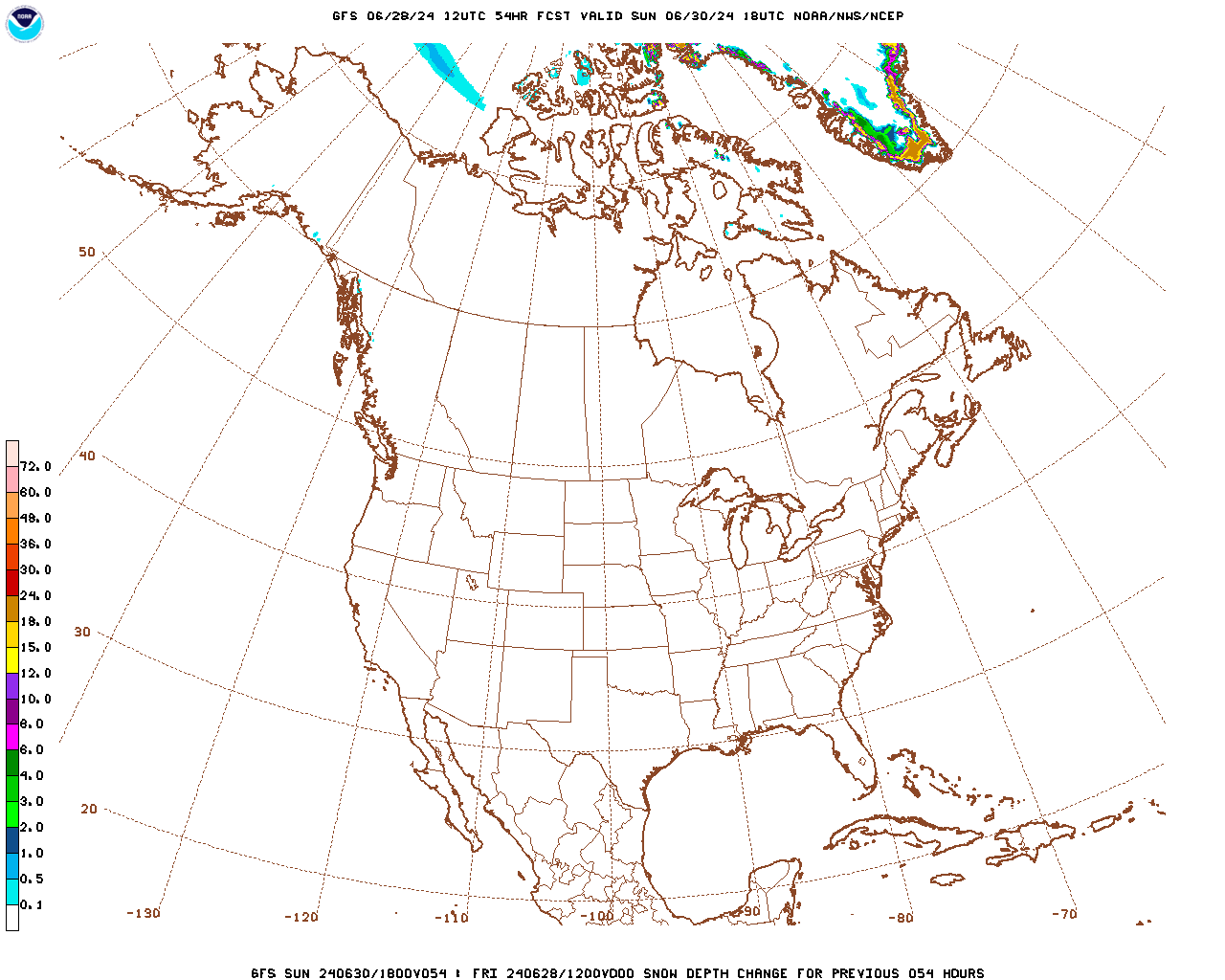
6 minutes ago, Always in Zugzwang said:
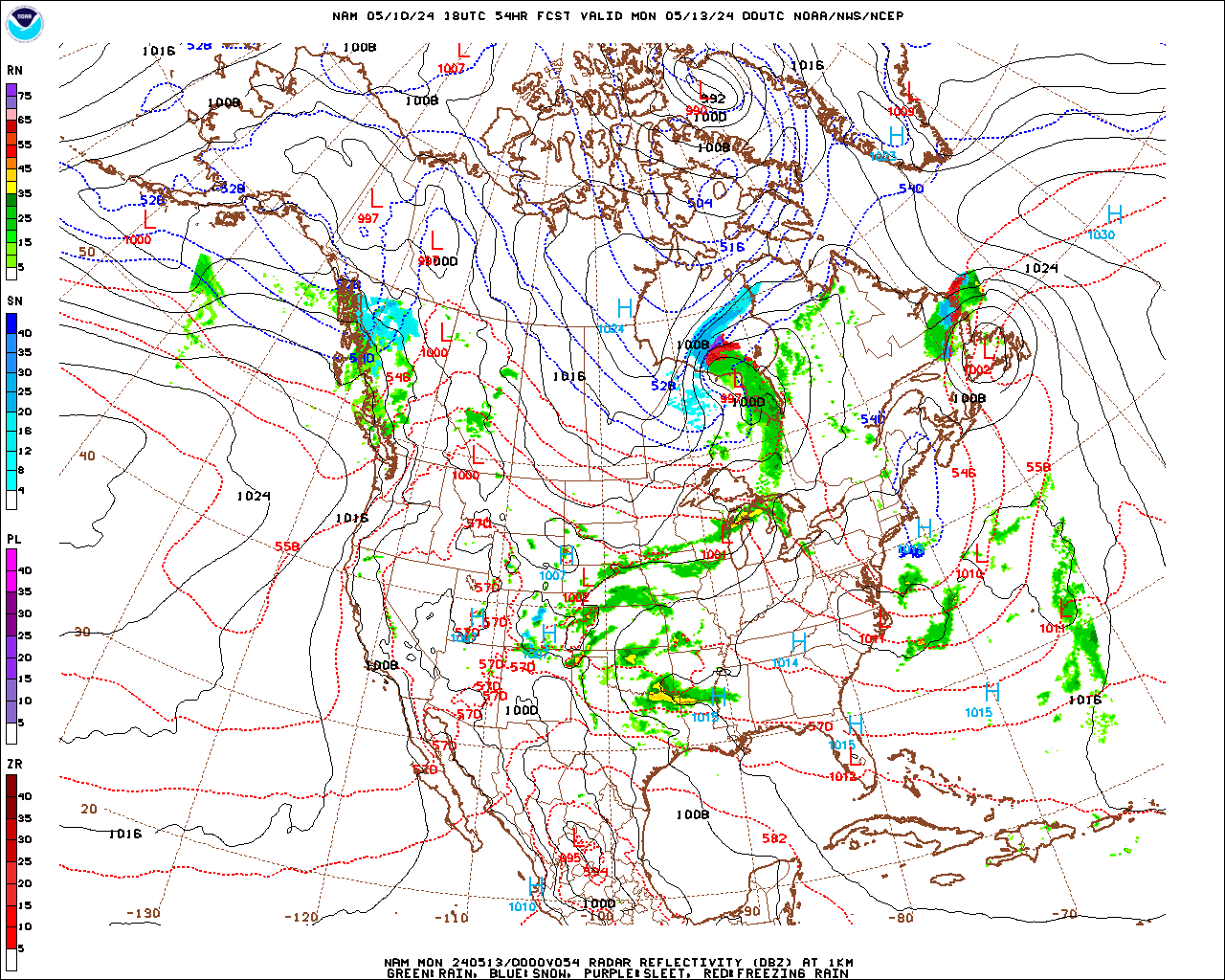
I believe @high risk explained this type of plot the other day. As I recall, it represents the total snow depth change through the time period (in this case through 54 hours from 12Z today). It's not the same as what TT and other sites show, which gives the snow depth of the event itself. Keeping in mind that today and tomorrow there will surely be a decent amount of snow melt (being above freezing), I can see a net of zero or not very much considering that. But that's not indicative of how much falls for this particular event by itself.
Of course, we may "only" see less than an inch or 1-2", but you get the idea.
Yes, I've been watching it for 4 years. What falls, not in 6 hours, but overall is reprented. Totals were always lower when that map was low. simple mmk
-
Don't underestimate this one.. even as starting as snow briefly, everyone loves a good +PNA(not going to trend warmer)
-
1 minute ago, mappy said:
I can't read that. Can you?
Yeah, we're going to get less than 1".. 1-2" if we're lucky
-
 1
1
-
1
-
 4
4
-
-
here.. accurate totals
 b
b
-
3
-
3
-
1
-
-
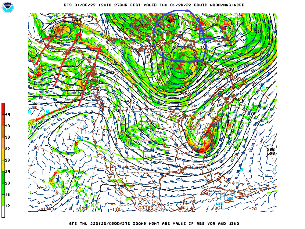
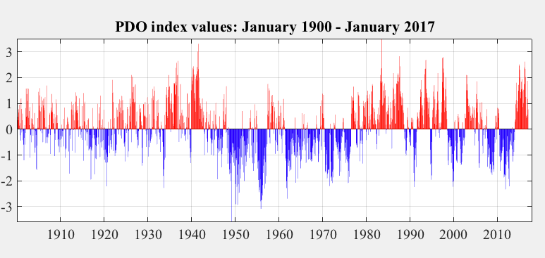
Watch the gravity over the SW Rocky mountains/warm Denver over the next few years.
(We really need a Strong El Nino to even things out) We had a peak -PDO in the 1950s, didn't even out until 72-73, (65-66 was a -PNA El Nino) so we'll see.
-
Like I said though, -PNA popped, pattern changes to cold after 36hrs.. which makes me feel less good that it hasn't happened already. It will happen though it's too short term, but blah
-
1
-
-
5 minutes ago, WEATHER53 said:
Dc is in a snow pattern
Surprise -PNA/SE ridge
-
Just now, stormtracker said:
Come here Chuck. Have a seat. I have news.
Opening the borders of Canada?
-
3
-
.gif.d7c1fb6e31a3d91818d72c0c95a0f237.gif)
January 2022 temperature forecast contest
in Weather Forecasting and Discussion
Posted
Wish I would have went colder in Chicago, NAO was the wild card.. it had been negative against trend-analogs going into this 4/6 months
-EPO really hit it too. In October I said +EPO Winter's averaged 7 named storms that point on, and we had 0 then after 19 early.