

StormchaserChuck!
-
Posts
2,274 -
Joined
-
Last visited
Content Type
Profiles
Blogs
Forums
American Weather
Media Demo
Store
Gallery
Posts posted by StormchaserChuck!
-
-
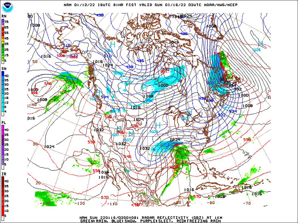
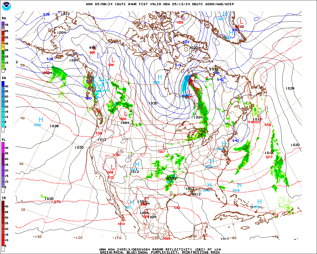
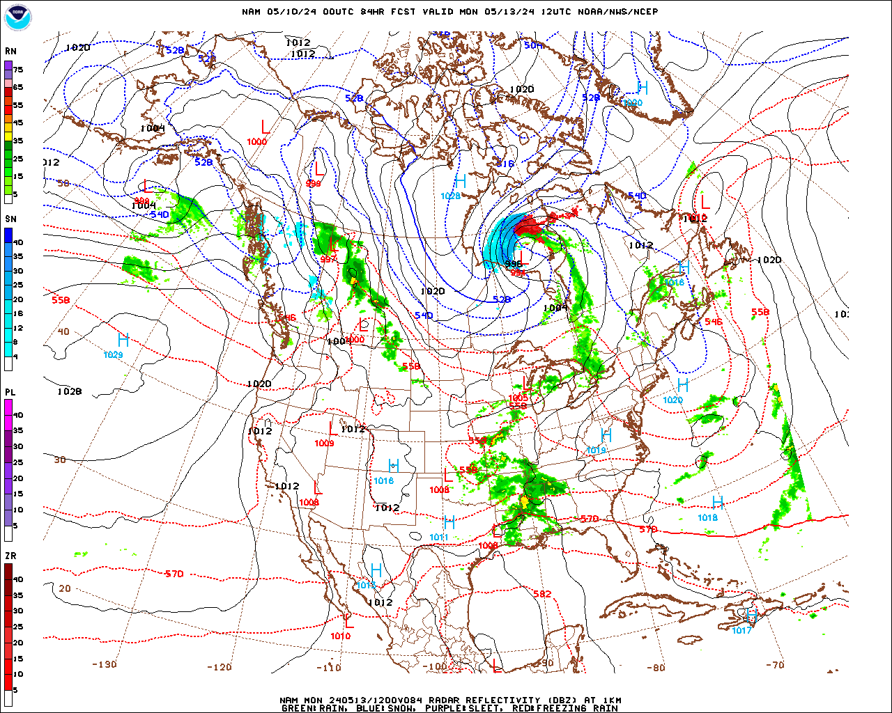
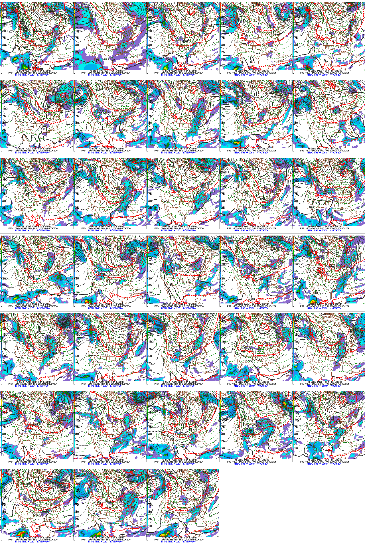
0z NAM
-
 1
1
-
-
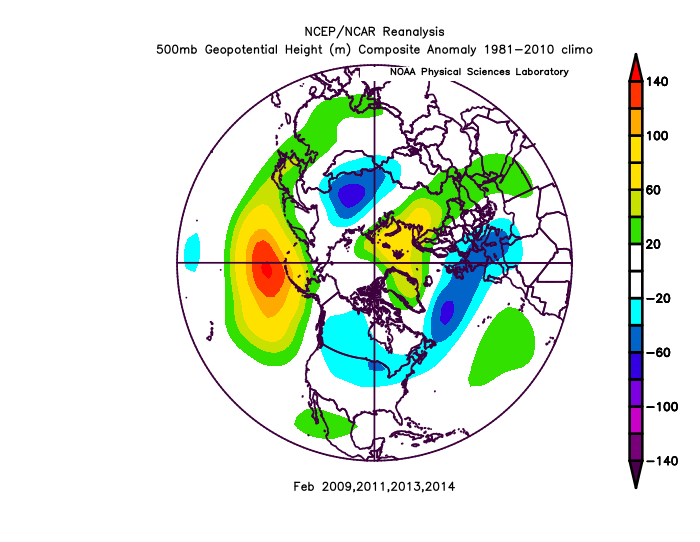
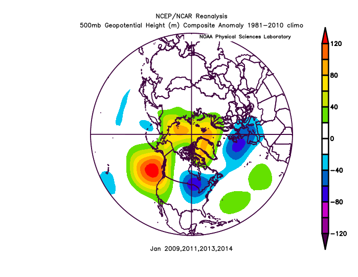
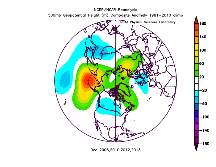
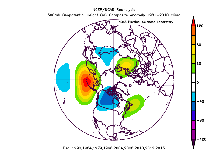
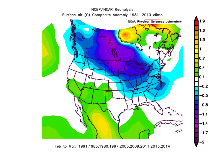
Biggest January snowstorms I could find, surprisingly all +6-8 days from our event.
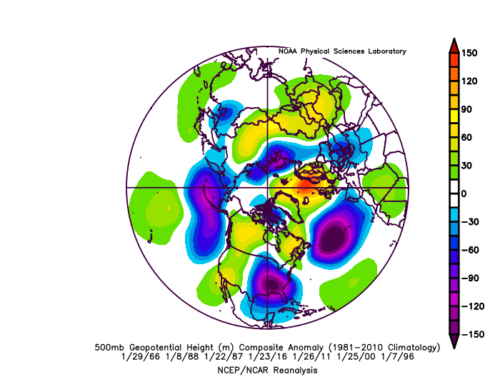
Take out the Strong El Nino and it looks like this
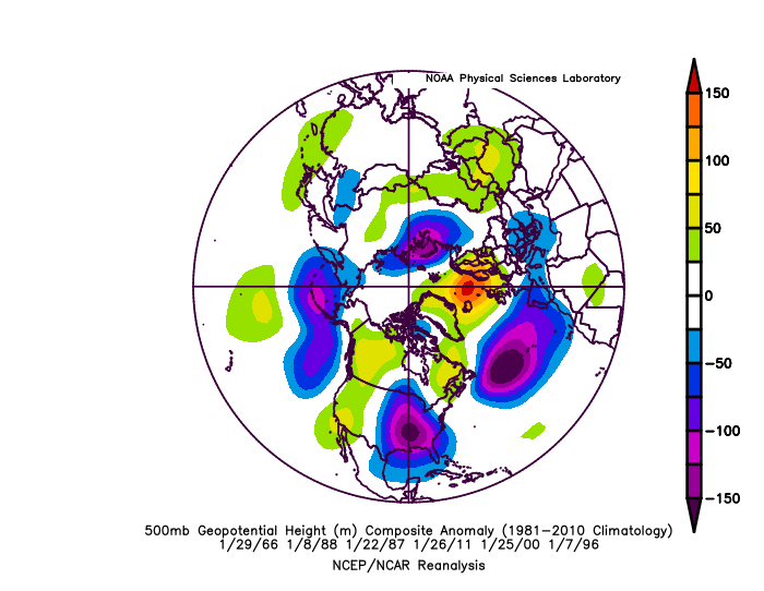
-AO or west-based -NAO seems to be the core feature. ^-NAO SLP is strong in 6 analogs. Ridge over the northern landmass, that's all
-
GFS is too far NW. -NAO since theyear2000 sticks low pressure's to the coast, it will trend SE.
-NAO,-NAO,
-
1
-
 2
2
-
-
Really looks good guys
^18-24" Westminster, MD
-
 1
1
-
-
This is what I like, personally. If not this February, next February.
Believe it or not, but if we go +PNA this February, we will be more likely to have La Nina conditions next Winter or -AAM(+NAO), but a -PNA February would be in line with movement toward +ENSO conditions, and there would be a significant warming of Nino3.4 February or March.
-
Dec-Jan roll forward (only +analogs)
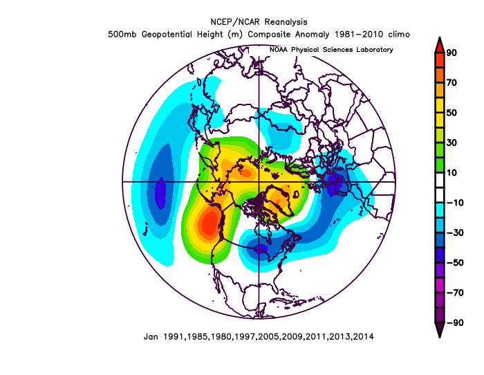
Not sure I agree with switch to El Nino conditions for the Summer, but here are the analogs (cold-+PNA January)
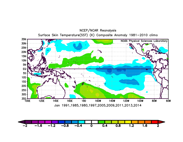
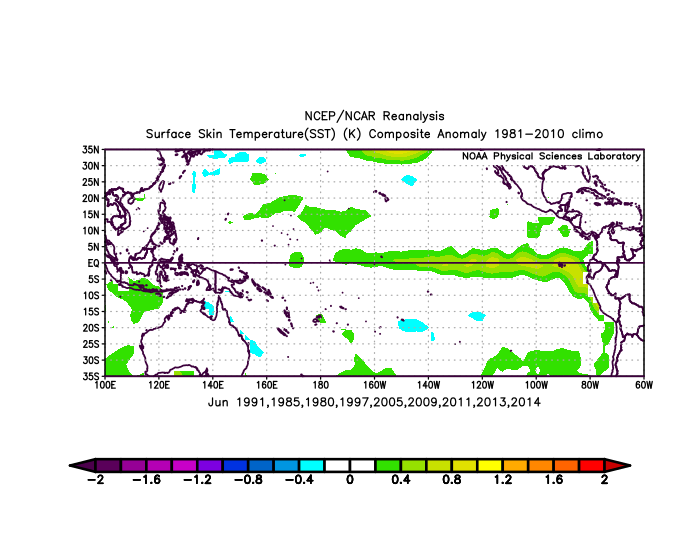
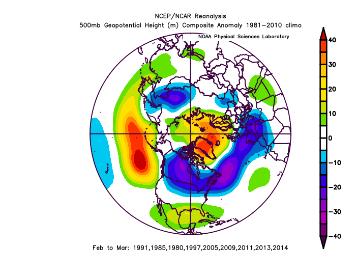
*Notice how the -PNA relocates back in Feb-March despite ENSO changing.
-
1
-
-
5 minutes ago, Ji said:
JMA FTMFW
Makes the most sense, it always boomerangs toward the JMA then away from it though.
-
 1
1
-
-
I don't like the ridge over the SW today and tomorrow.
-
1
-
-
There's nothing to drive it north inland, it will redevelop off the coast pretty far south
.thumb.gif.2f097d19a206f137170f1aeb17d56092.gif)
It's not a very cold storm though, but likely snow NW I-95.
.thumb.gif.a6338d0ab888779a71e4217c1198d95e.gif)
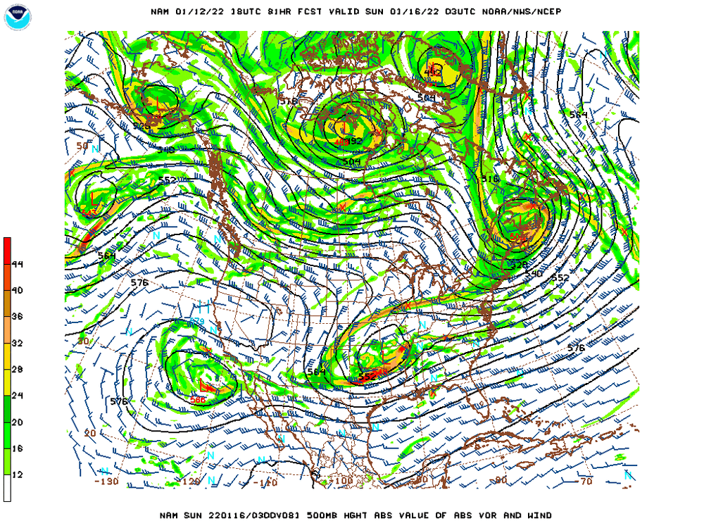
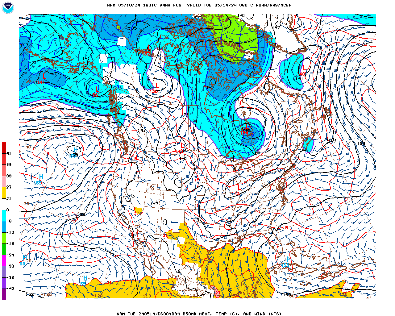
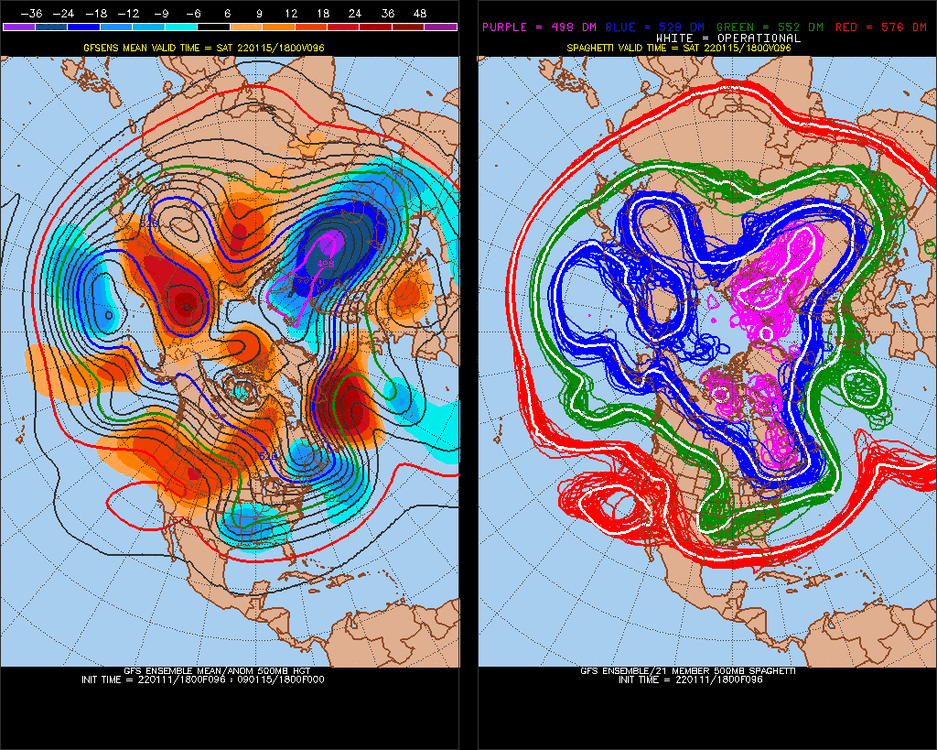
-NAO, Pacific is favorable.. This H5 is not an inland runner. Pacific ridge is peaking north.. the Low in Canada may even phase more. 108 is big adjustments still.
-NAO storms gravitate toward the coast.
-
 1
1
-
-
114-120 is a long time.. it will trend east. I've seen it since the year 2000, -NAO or any High pressure over Greenland puts these low pressures on the coastline like gravity.
-
1
-
3
-
-
Some of these solutions are really wet, and we still have time to trend for a perfect scenario. It's going to be hard to rain I-95 and NW with -NAO. Storms for the last 10-20 years have been maxing NW of I-95, I wouldn't expect an Apps track.
.thumb.gif.9a6f0f456fddf78848879bfb9fc3cab5.gif)
-
It's hard to imagine that we'll get rain when there's a 2SD -NAO. Pacific isn't that bad either.
-
ENSO subsurface should peak +warming in about 7 days, then I worry about -PNA trend. We might clear January though.
-
I like this threat
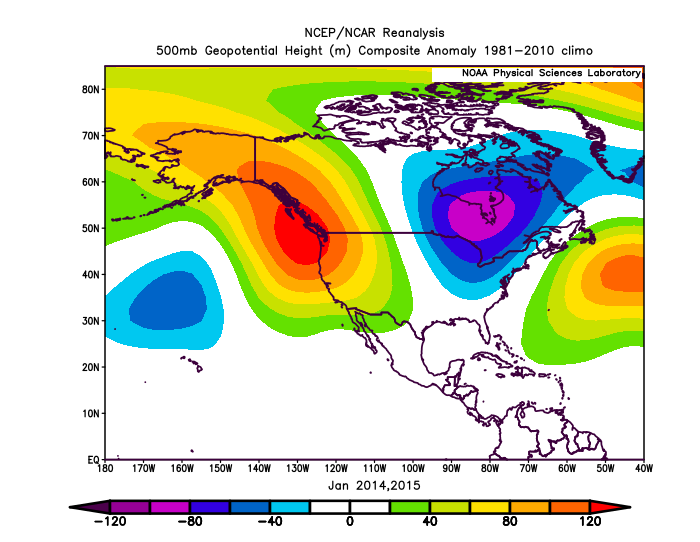
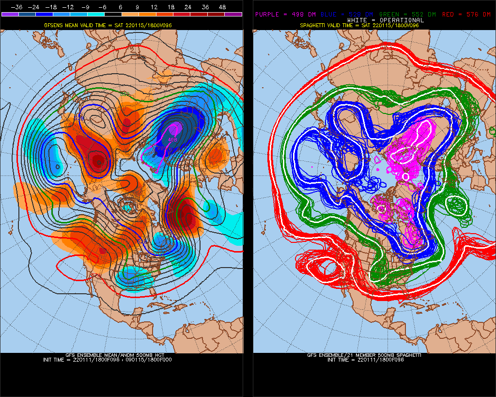
How did you guys do with 582dm off the West coast in 2014,2015?

-
NAO is negative
looks better than 18z
-
1
-
-
looks good to me.. 12-15" and the GFS has a dry bias.
-
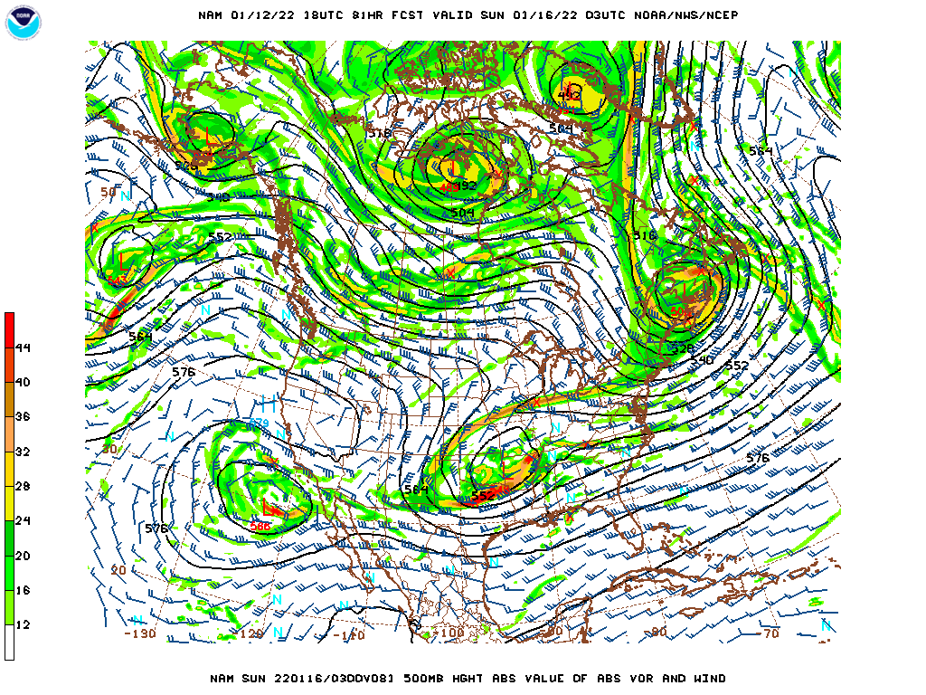
Love the NAM at 84hrs
-
1
-
-
38 minutes ago, LibertyBell said:
it happened in 2015-16, 1993-94 and 1984-85 with positive NAO too.
Maybe watch Feb7-9 to be cold (+NAO)
-
See how are we are doing all this with NAO +.. probably most +NAO day of the Winter today/tonight
-
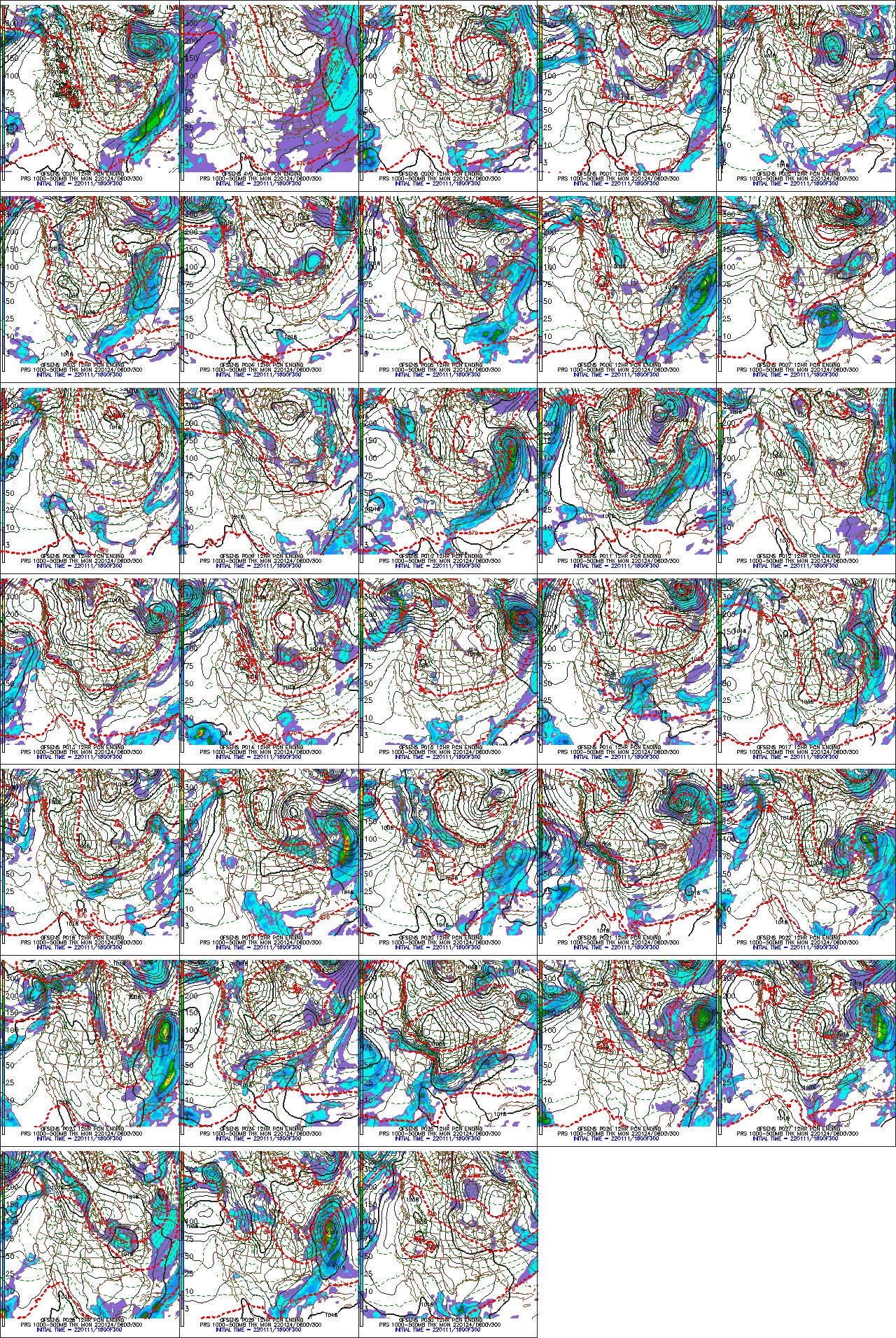
Models go out 15day, but watch for extension of +PNA pattern, +16-20 days
Then on 2-1, it switched
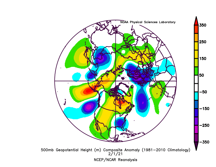
^-PNA signal
vBack to +PNA
Might break the +PNA after 2-21/22-2022 though.
-
1 hour ago, wdrag said:
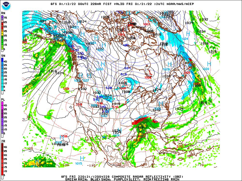
Unsure if anyone posted but CPC has some interesting possibilities for 19th-22nd including a chance of heavy snow basically Chicago to New Haven northward and a high prob of very cold air invading the upper Midwest.

I like this for our biggest snow of the year, then it will warm up -PNA, but may be -NAO too into Feb-March-April. I really like -PNA March.
-
STJ moisture hits Jan 22-24
near Mexico here v
-
Im not really sure why we have a ridge in central Canada though
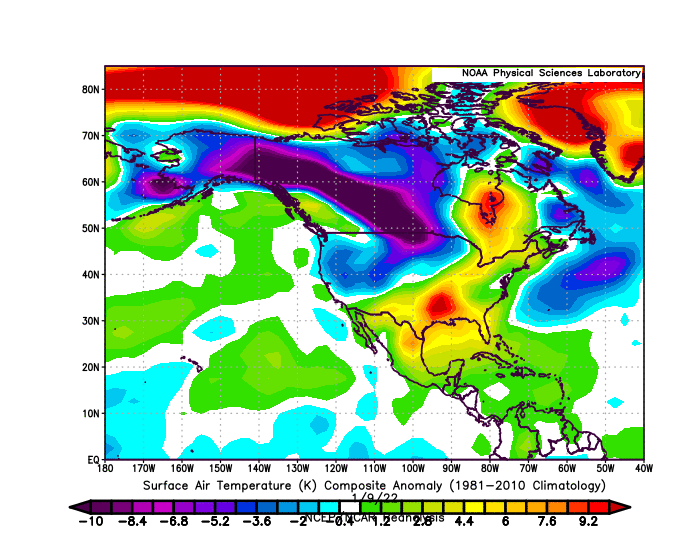
Been cold so far
-
I want us to just melt to get to some normal climate conditions. we've been in this computer matrix for a while. Let it melt. alot. take the satelites down, etc. dont start controlling your own place.. lol. Stop the freeze-melt by melting completely.
-
1
-

.gif.65f867eff46e35347adc7b4f6eea770f.gif)
.gif.8e3b89a145b2a00ff942cb830350fdf3.gif)
.gif.2c5daf99d3e96e48ddaba19b3d1d9f29.gif)
2021-2022 ENSO
in Weather Forecasting and Discussion
Posted
Analog to last years Kelvin wave
The whole Pacific is lifting north into the Artic circle.. this did a +PDO thing, which was interesting because an El Nino didnt develop, it turned back to la nina.
Let's see if we have a similar pattern for the next 40 days.