StormchaserChuck!
-
Posts
2,274 -
Joined
-
Last visited
Content Type
Profiles
Blogs
Forums
American Weather
Media Demo
Store
Gallery
Everything posted by StormchaserChuck!
-

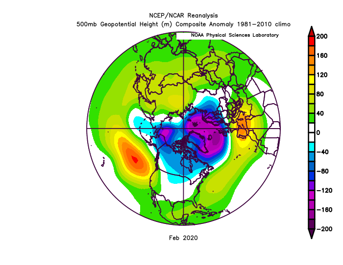
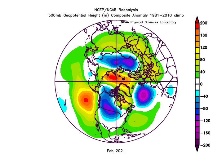
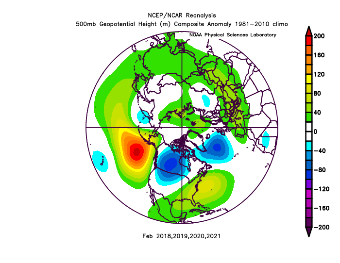
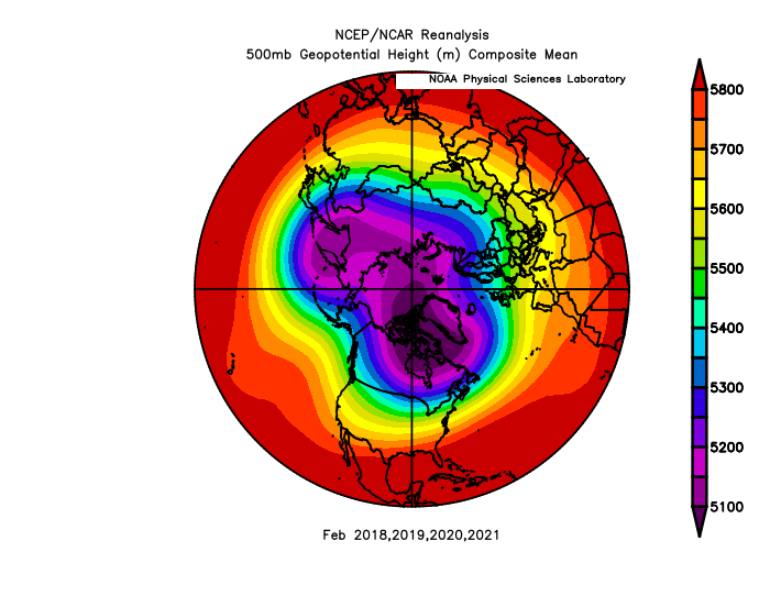
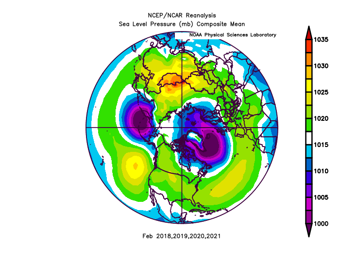
The last 4 February's
StormchaserChuck! replied to StormchaserChuck!'s topic in Weather Forecasting and Discussion
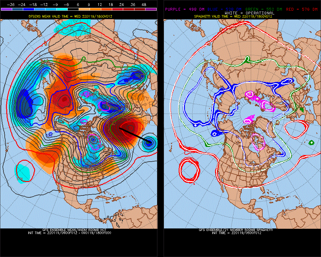
12z GFS ensembles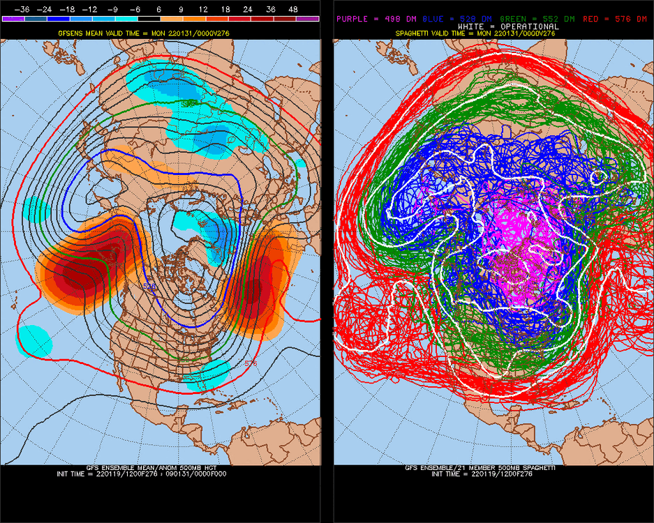
-
The last 4 February's
StormchaserChuck! replied to StormchaserChuck!'s topic in Weather Forecasting and Discussion
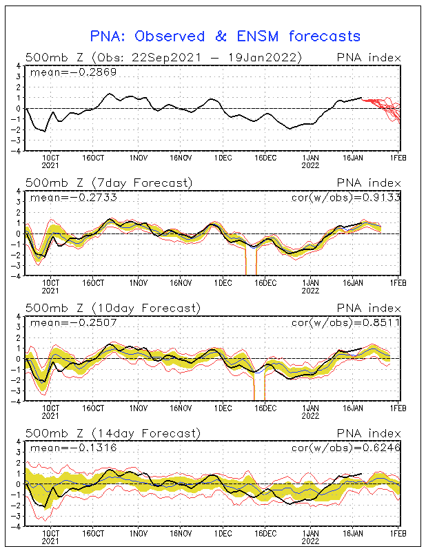
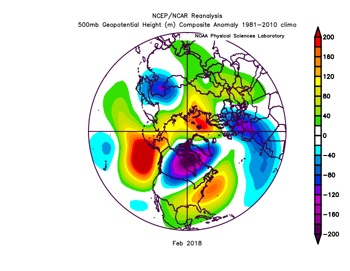
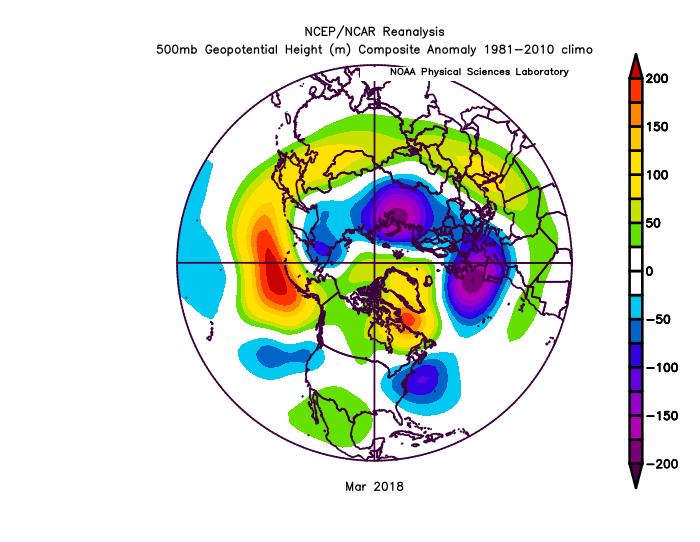
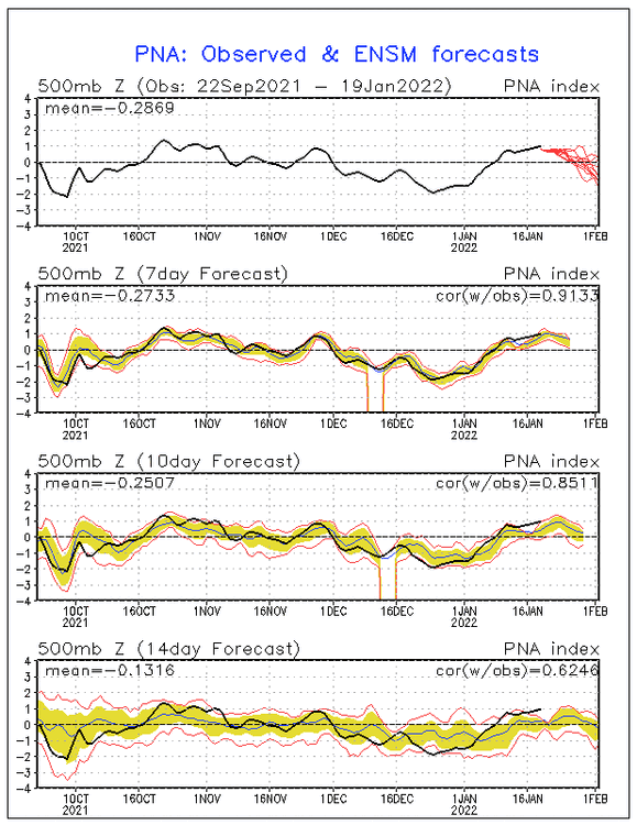
More recent extreme's in 2nd half of Winter -PNA's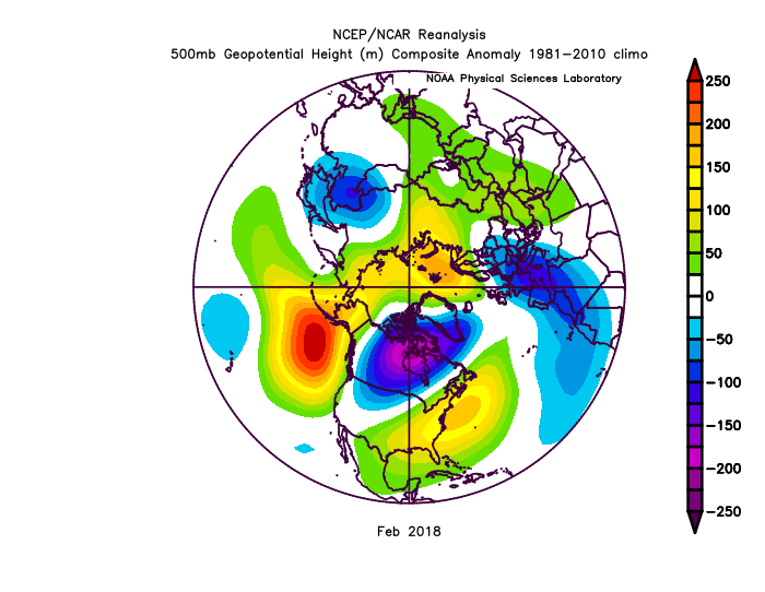
-
Are we due for a 2018-like -PNA? Maybe a -NAO?

-
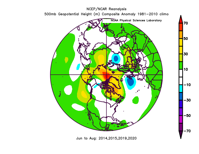
588dm on models a few days from now, I can't find any examples close, but since 2013 we have danced + and - to the pattern. +matches -matches Summer +matches -match's
-
January Medium/Long Range Discussion
StormchaserChuck! replied to WinterWxLuvr's topic in Mid Atlantic
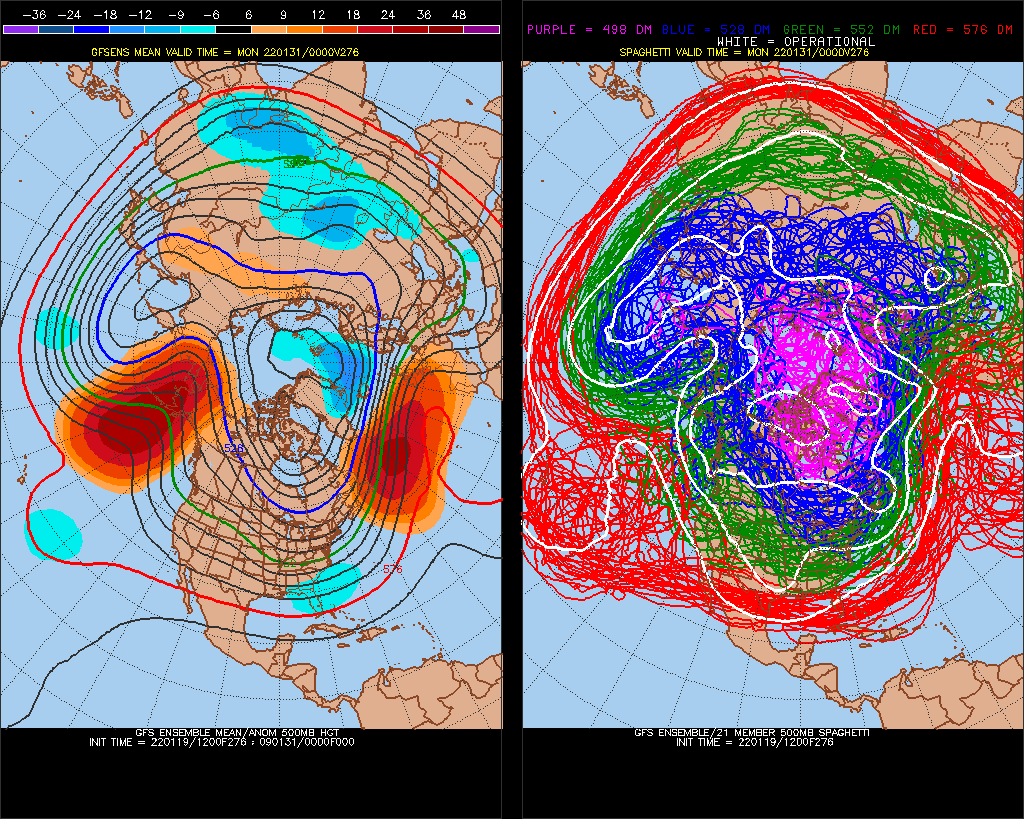
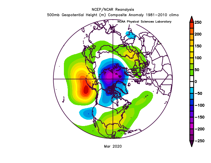
588dm now off the West coast, largest of all model runs so far. We are beating 2015's recent record acclimate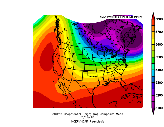
-
January Medium/Long Range Discussion
StormchaserChuck! replied to WinterWxLuvr's topic in Mid Atlantic
-
January Medium/Long Range Discussion
StormchaserChuck! replied to WinterWxLuvr's topic in Mid Atlantic
this is a pretty strong -NAO, we might have something coming out of it short term. We don't historically get big storms rising out of +PNA to -PNA. >582dm in the N. Atlantic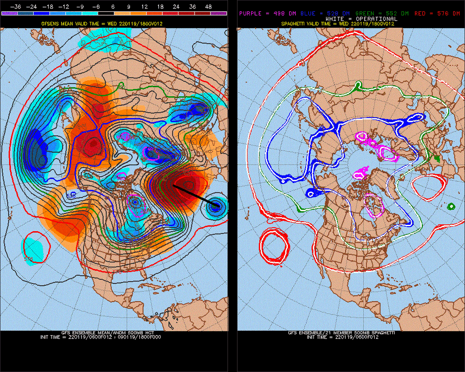
-
January Medium/Long Range Discussion
StormchaserChuck! replied to WinterWxLuvr's topic in Mid Atlantic
This is pretty brutal in the Pacific, again the only other time I saw sustained +400dm -PNA as an ensemble mean 12-15 days out was before December. http://www.meteo.psu.edu/fxg1/ENSHGTAVGNH_6z/ensloopmref.html -
2021-2022 ENSO
StormchaserChuck! replied to StormchaserChuck!'s topic in Weather Forecasting and Discussion
Coldest SSTs of this years La Nina in Nino 3 now -
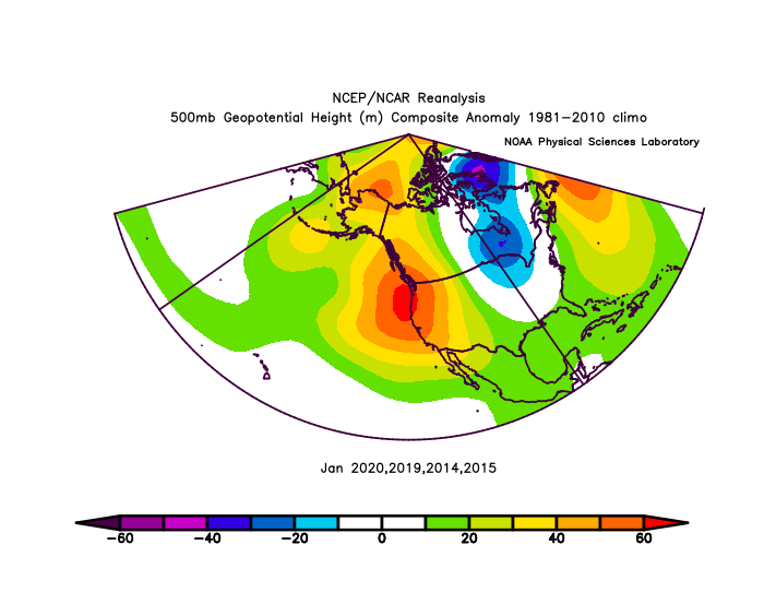
January Medium/Long Range Discussion
StormchaserChuck! replied to WinterWxLuvr's topic in Mid Atlantic
Winter may be over guys. Look at this trending When the +PNA breaks, it might get very warm.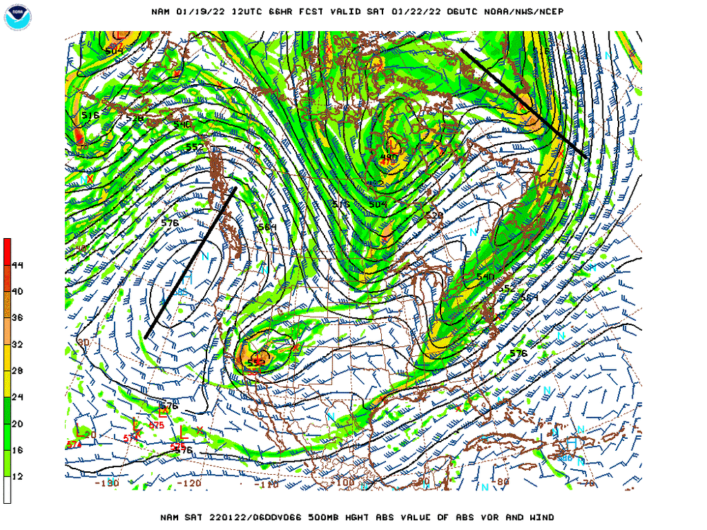
-
January Medium/Long Range Discussion
StormchaserChuck! replied to WinterWxLuvr's topic in Mid Atlantic
whatever.. I dont know what I'm talking about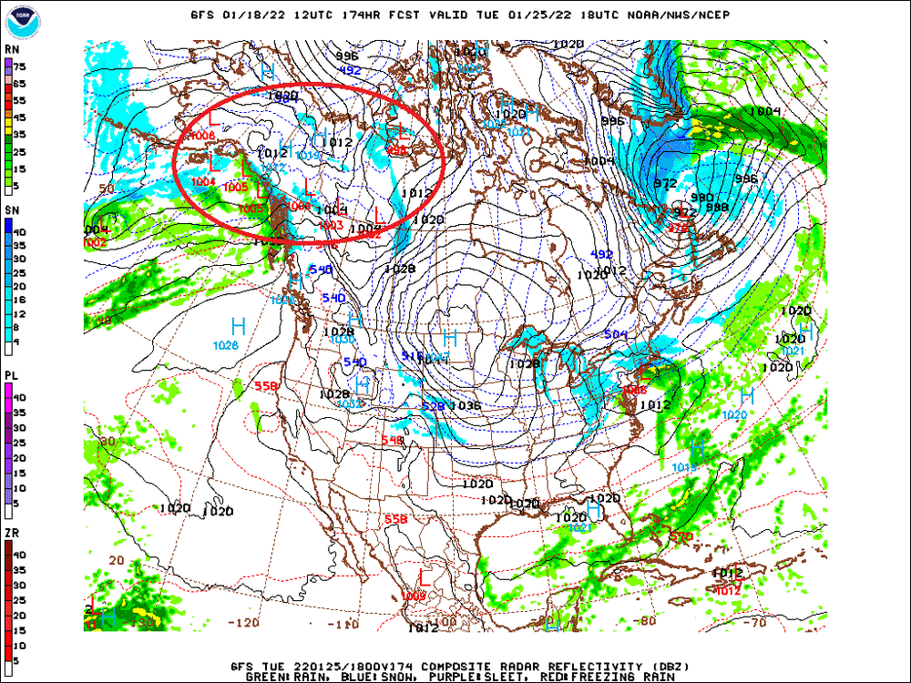
-
January Medium/Long Range Discussion
StormchaserChuck! replied to WinterWxLuvr's topic in Mid Atlantic
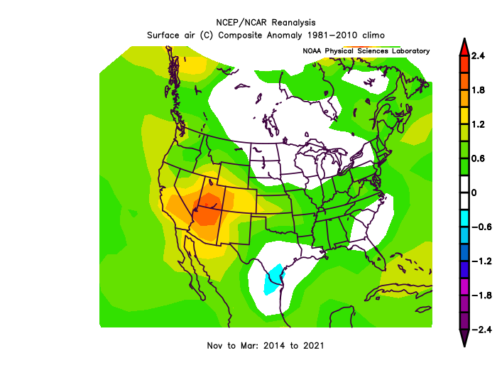
rain all the way up to land at the coldest time of the year.. we started it in 2014/2015 then there was a Strong El Nino in 2015-16, followed by 6 years of strongest -PNA on record -300 vs -220 #2. This is maybe round 2. when the rain hits land the biggest part of the trenddifference is done. -
January Medium/Long Range Discussion
StormchaserChuck! replied to WinterWxLuvr's topic in Mid Atlantic
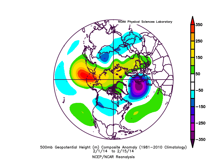
lOOK At the Pacific though Sorry guys, but warmer Winter's are coming -
Pretty good evidence that a ridge in the SW-US/West coast/western rim to Alaska, leads warmer weather here +time.
-
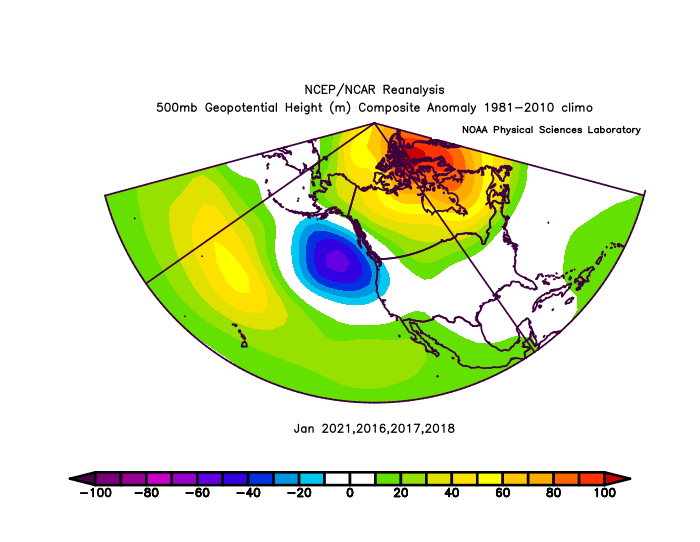
January Medium/Long Range Discussion
StormchaserChuck! replied to WinterWxLuvr's topic in Mid Atlantic
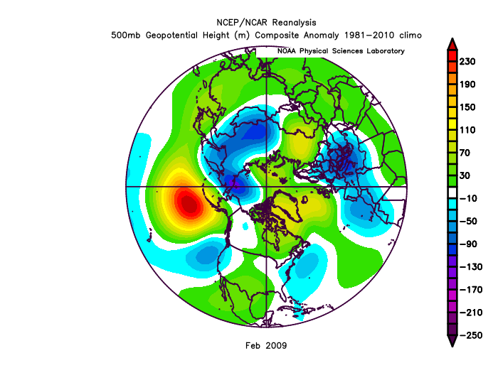
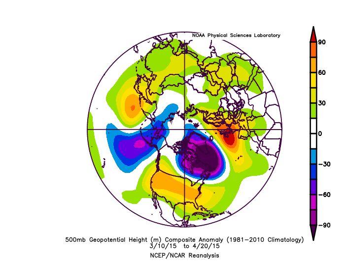
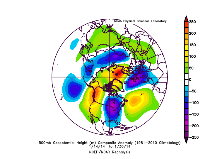
2015.. I think this is where we are heading for February (La Nina pattern) -AAM[La Nina] is +N Pacific/-N Atlantic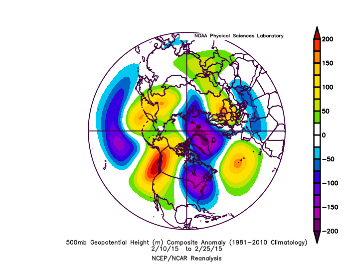
-
2021-2022 ENSO
StormchaserChuck! replied to StormchaserChuck!'s topic in Weather Forecasting and Discussion
Same thing in Feb 2015 Look at the -AAM! (Pacific +, N Atlantic -) , La Nina signal/pattern, that followed

-
2021-2022 ENSO
StormchaserChuck! replied to StormchaserChuck!'s topic in Weather Forecasting and Discussion
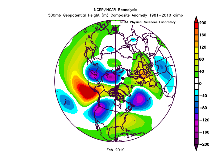
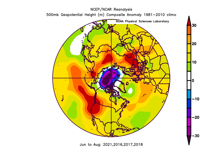
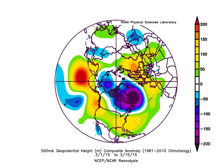
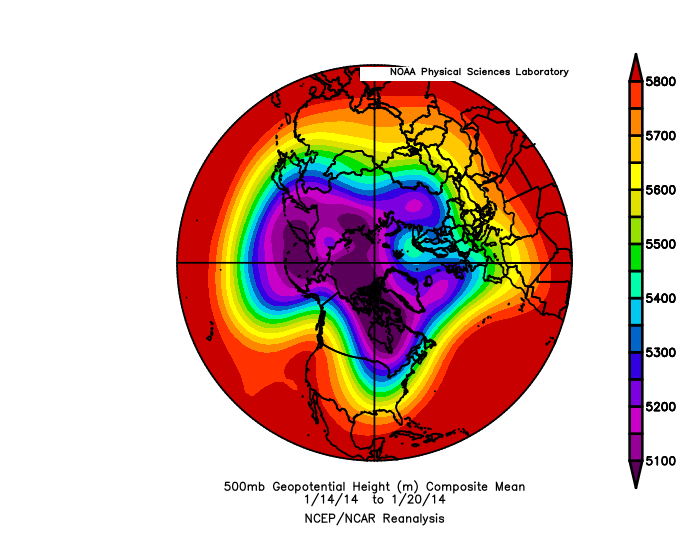
Focusing on 582dm West coast ridge, we did a similar pattern in 2014. It really went -AAM (La Nina) for February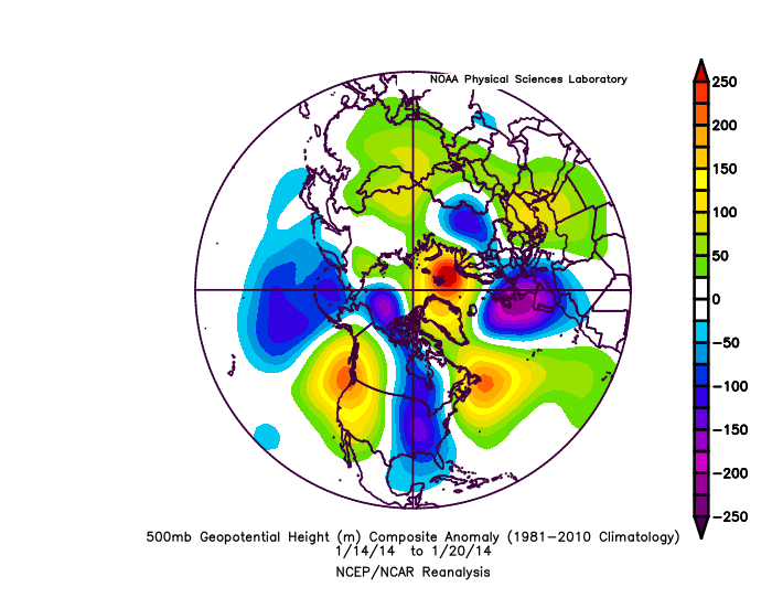

-
January Medium/Long Range Discussion
StormchaserChuck! replied to WinterWxLuvr's topic in Mid Atlantic
Focusing on 582dm West coast ridge, we did a similar pattern in 2014. It really went -AAM for February


-
2021-2022 ENSO
StormchaserChuck! replied to StormchaserChuck!'s topic in Weather Forecasting and Discussion
Snow isn't very correlated to ENSO. Although in the early 1900s Strong El Nino's were cold. -
January Medium/Long Range Discussion
StormchaserChuck! replied to WinterWxLuvr's topic in Mid Atlantic
Ooo I like this, do these setups ever work out? These things trend SW (northern energy), so it might even be the later piece that hits -
January Medium/Long Range Discussion
StormchaserChuck! replied to WinterWxLuvr's topic in Mid Atlantic
8 days of +PNA then it switches.. -
2021-2022 ENSO
StormchaserChuck! replied to StormchaserChuck!'s topic in Weather Forecasting and Discussion
-
2021-2022 ENSO
StormchaserChuck! replied to StormchaserChuck!'s topic in Weather Forecasting and Discussion
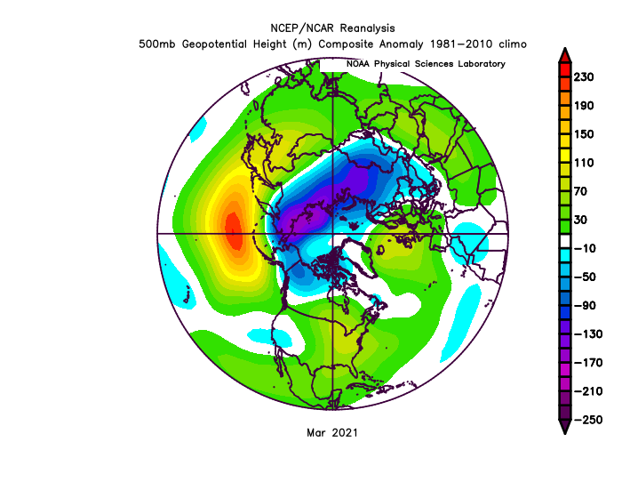
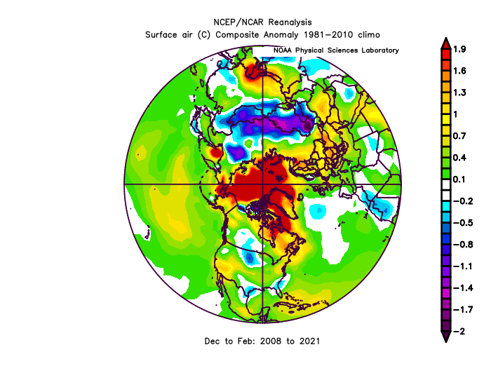
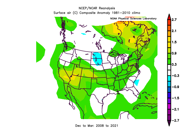
We're pretty close here to the 13-year average March.. SW-US High and -PNA are both sticking, probably ENSO related.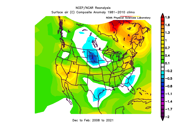
-
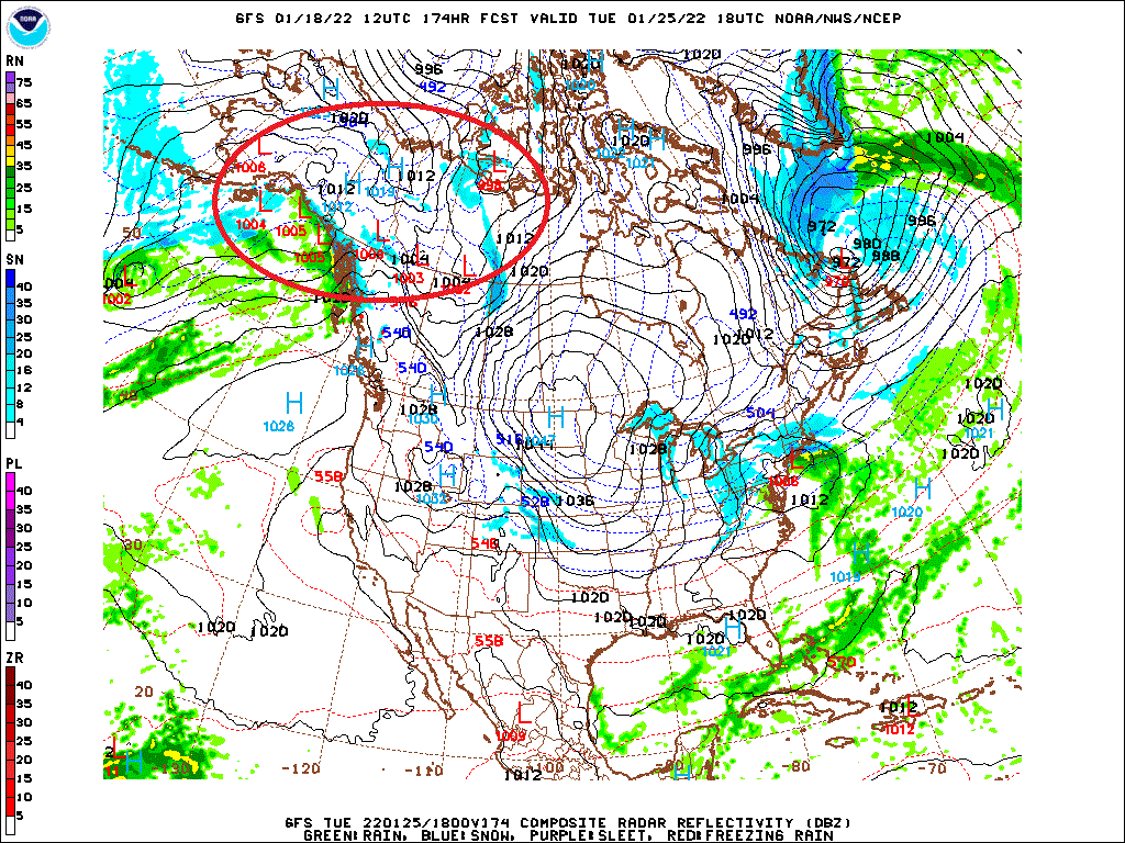
January 16-17, 2022 MLK storm obs/now cast
StormchaserChuck! replied to George BM's topic in Mid Atlantic
Actual low is off of Ocean City We had such a strong wrap around, the front end got very warm. -
January Medium/Long Range Discussion
StormchaserChuck! replied to WinterWxLuvr's topic in Mid Atlantic
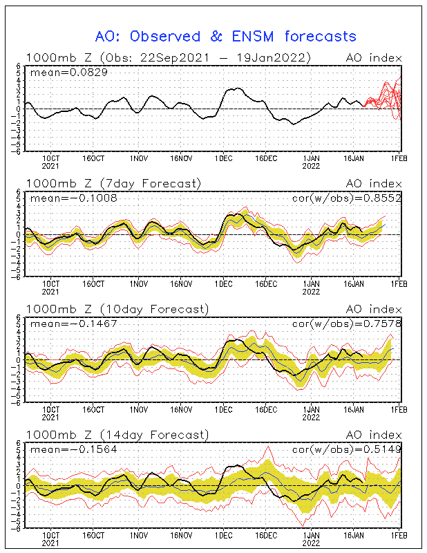
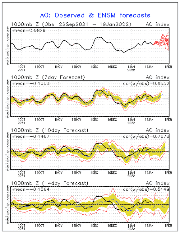
AO is positive but whew, I think these other storms are coming north.