

StormchaserChuck!
-
Posts
2,273 -
Joined
-
Last visited
Content Type
Profiles
Blogs
Forums
American Weather
Media Demo
Store
Gallery
Posts posted by StormchaserChuck!
-
-
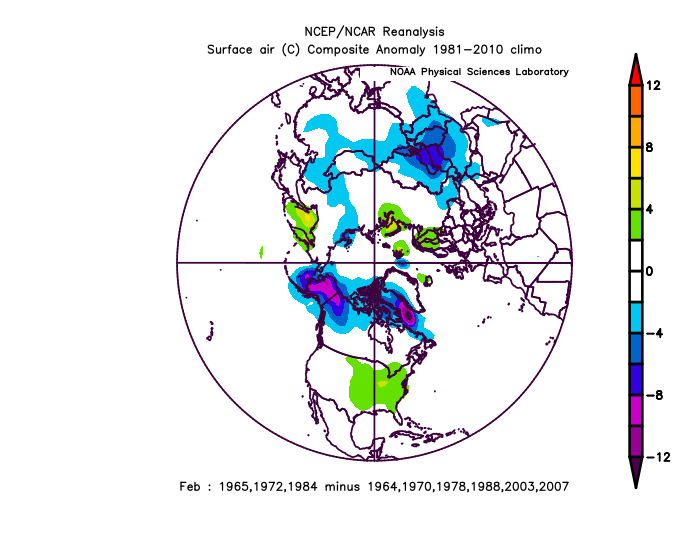
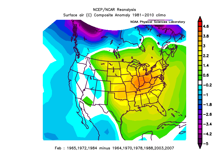
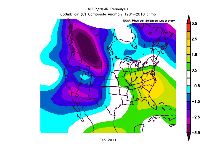
A rapidly deteriorating event at the surface for February looks like this..
to be continued..
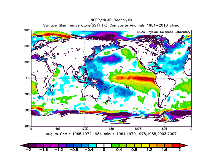
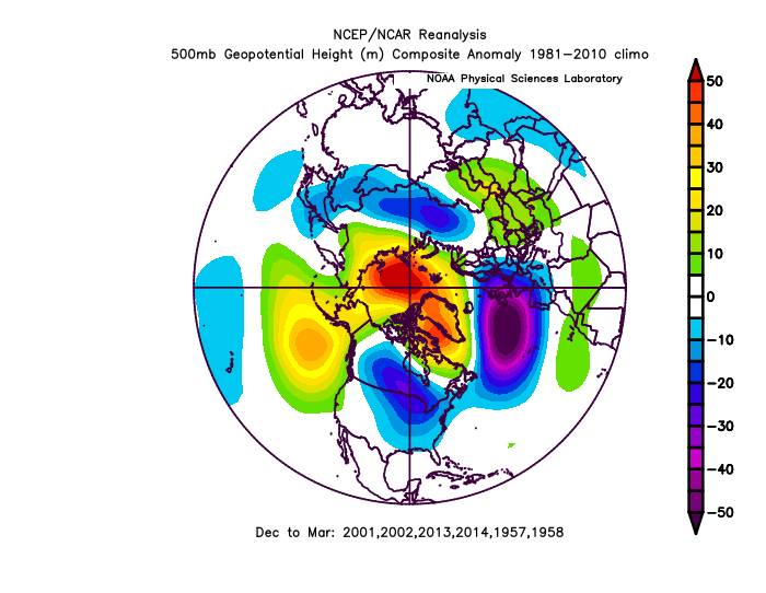
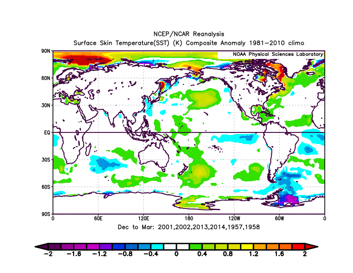
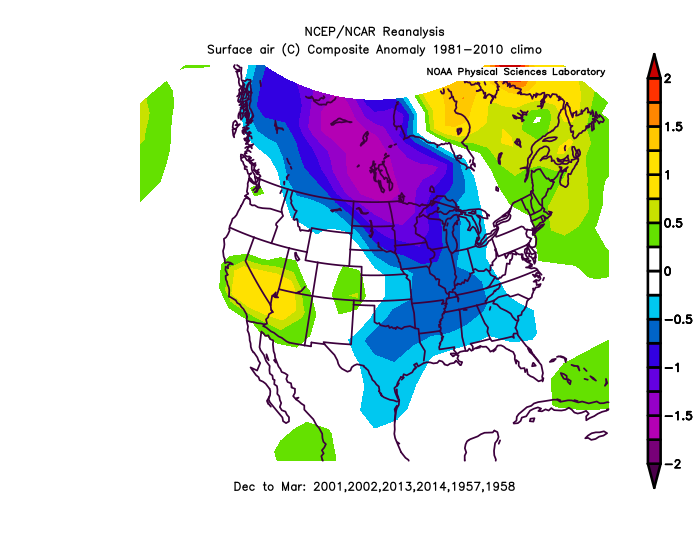
I think 4/6 analog composite researches I have done have given us a strong el nino for later in the year, but I intuitively feel that this will not be the case, but these multi-year analog composites of +1.5 and +2.0c+ are impressive.
-
 1
1
-
-
On 1/20/2022 at 6:42 AM, Holston_River_Rambler said:
here you go
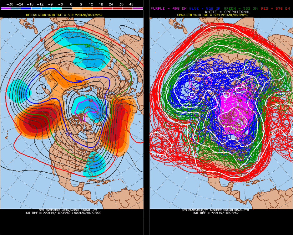
Strong -AAM signal for mid-February.. could crush the Kelvin wave a little bit.
-
 1
1
-
-
too bad.. we are doing the opposite of this as much as we can this year. La Nina's are a little dry though.
opposite of Strong La Nina's (alone)v
-
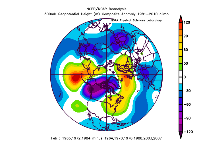
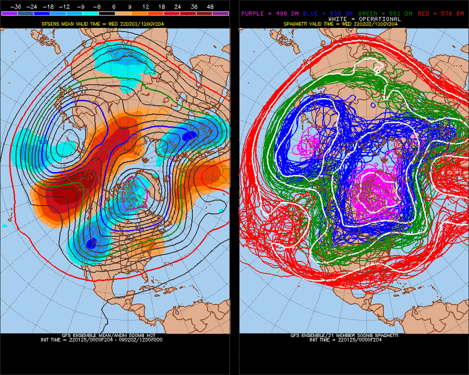
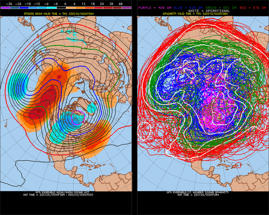
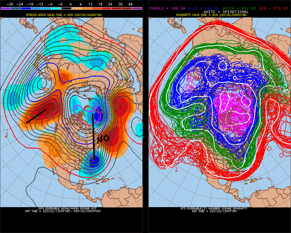
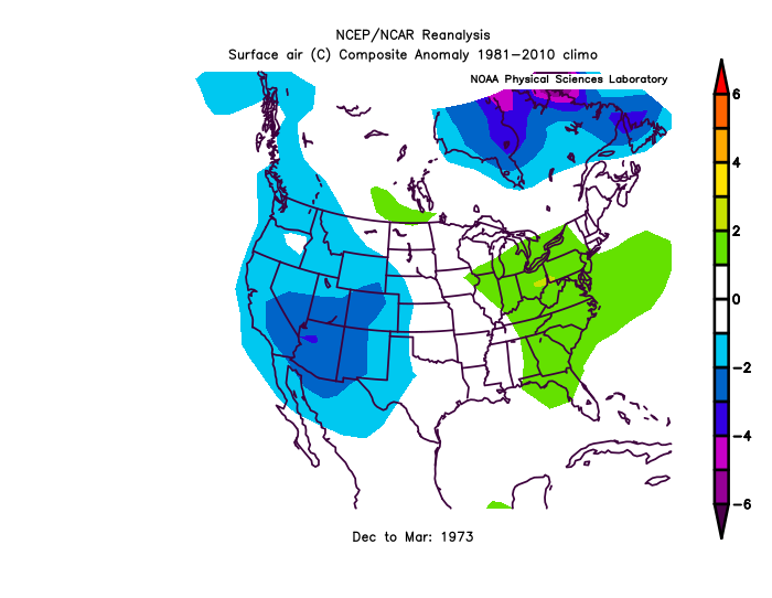
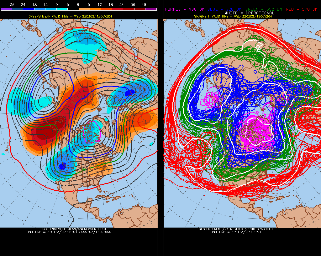
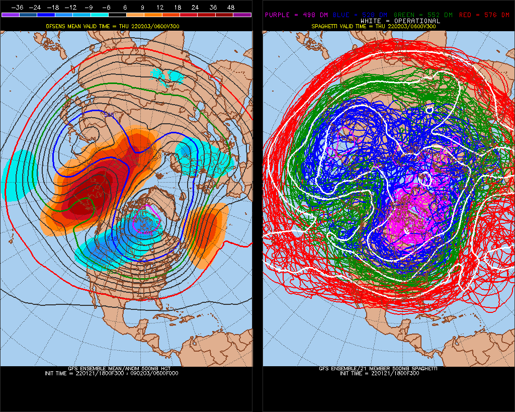
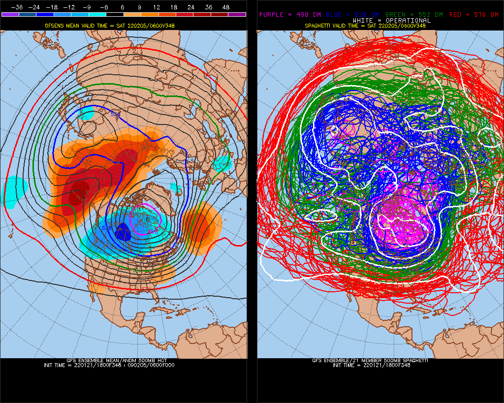
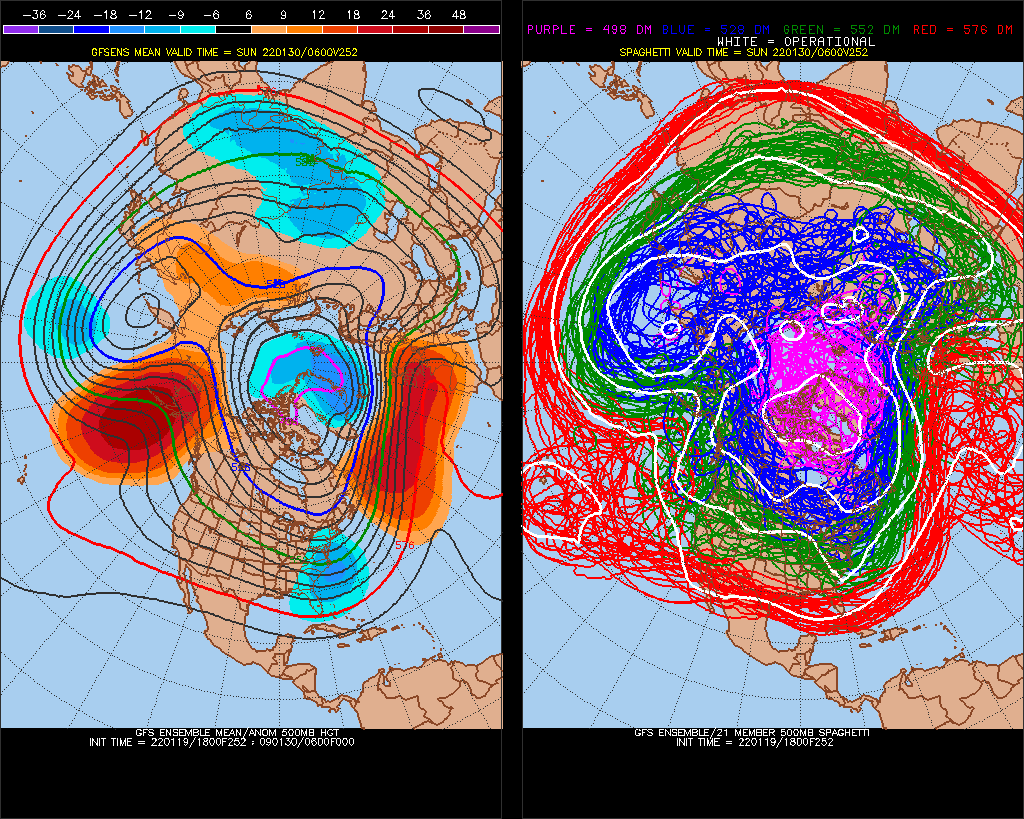
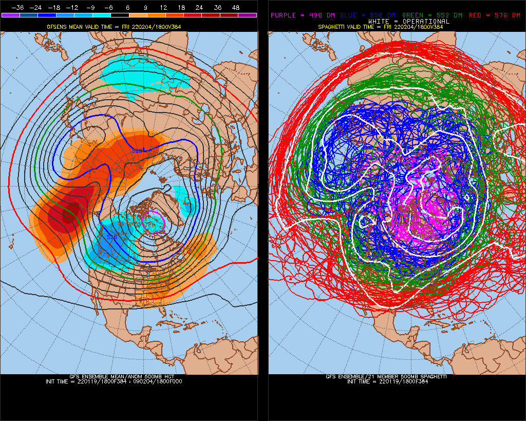
6 straight years of this Central America cold-pattern Feb 4-8 (see 2nd model image above)
I used that 6-year consistency to say we would have a -NAO Christmas this year back in November
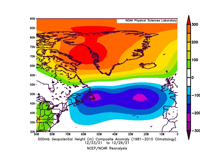
8 days later -AAM peaks, La Nina condition-pattern, (-AAM is -NAtlantic, +NPacific) +8 days is Feb 12-16, 2022
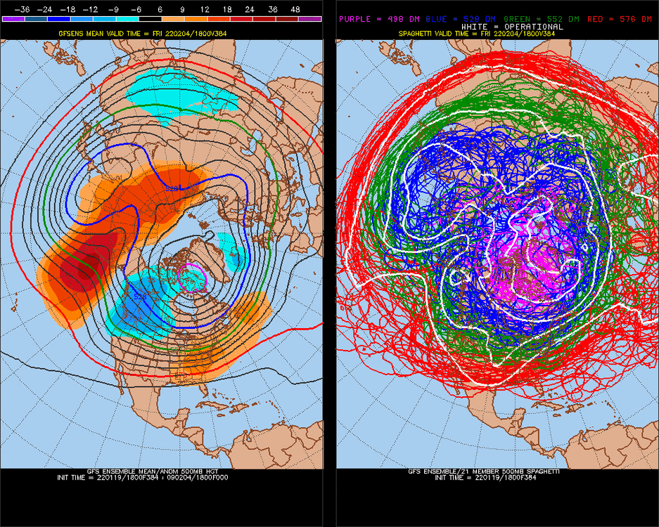
These AAM's spin and stuff to effect the pattern for a long time, this is last week of February ^+10days, Feb 22-26
-
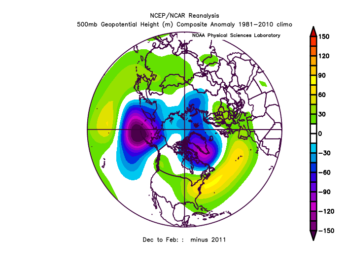
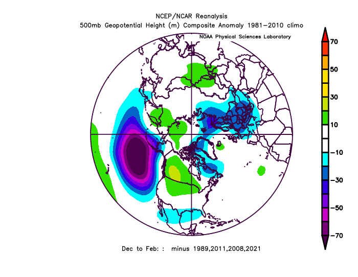
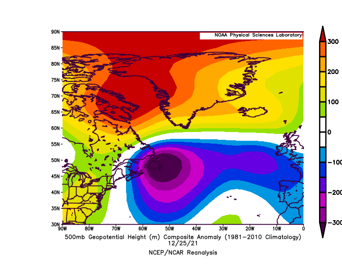
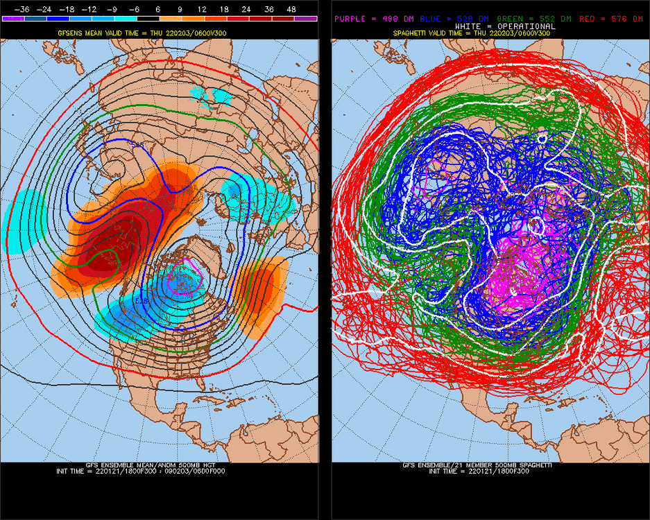
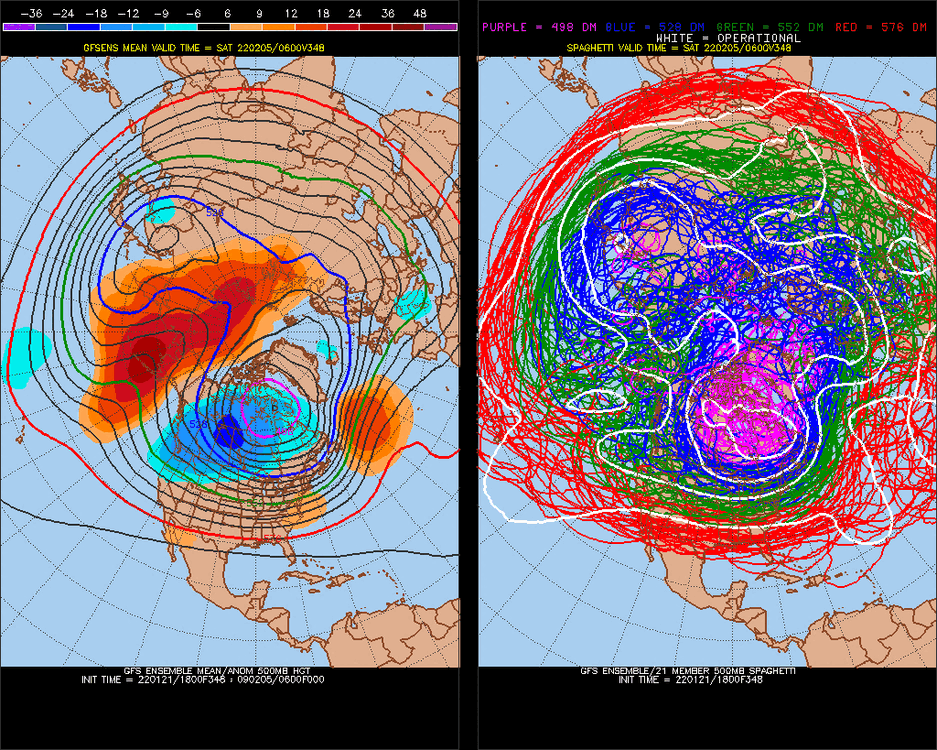
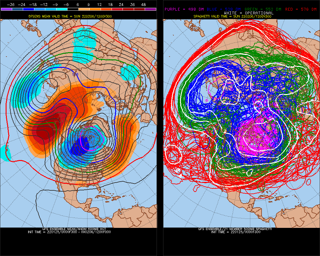
This is a massive -PNA. We'll be in the 50s higher every day after this storm threat.
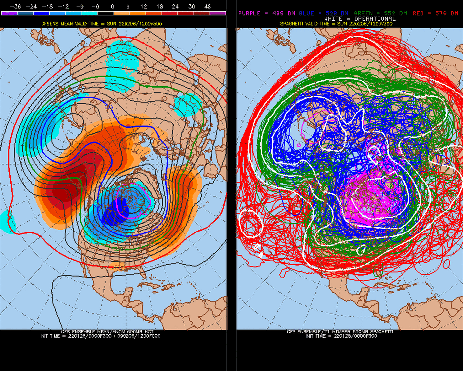
I really like the 10-11 analog, although the NAO wasn't as negative. NAO really switched in early Feb, should be interesting (I have +NAO signal Feb 7-9 core/max, but we have been veering -NAO for little reason 5/7 months.
anyway.. we saw this in March/April, we'll see
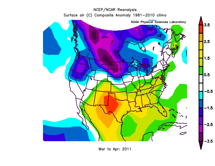
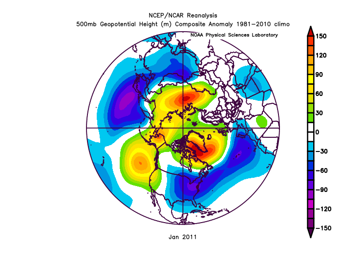
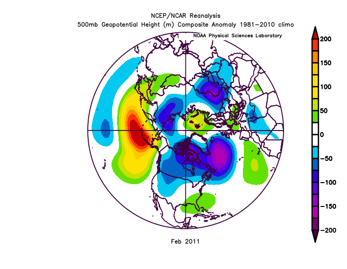
2011 was dry
2-year pattern analogs are working
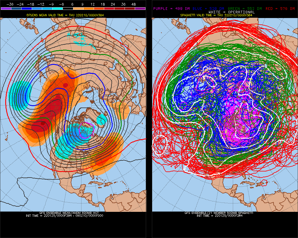
Feb 7, 2022, +15day model
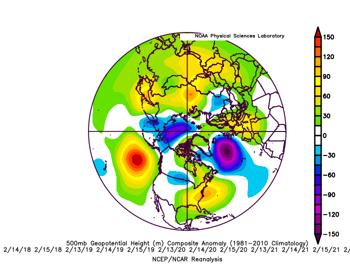
Record +350dm Pacific High in December > 20% #1
-
^ NAO has been negative alot of the time too. No +EPO's either.
-
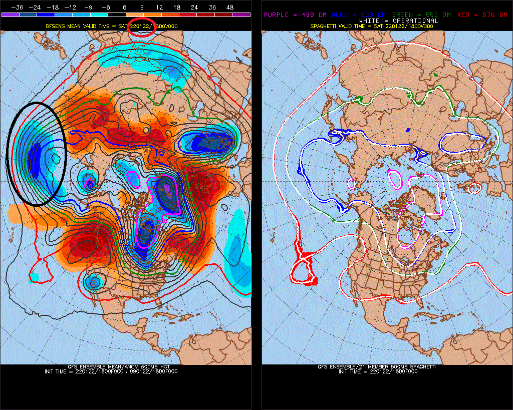
Well, we constantly have a west-N. Pacific trough through 15-day models for several runs now. You can even call it a +PNA, because I thought some of our best patterns like 76-77 and 77-78 had this west-based N. Pacific trough. We need to break this +PNA/+NAO, -NAO/-PNA though, otherwise it wont really snow.
I did research that showed after record -PDO's, (Oct-Nov-Dec was the #1 lowest -PDO on record) we actually rebounded with +PNA/GOA or Alaska high for next 2 years. The extreme PNA/PDO events seem to always even/reverse to balance. I don't think that changes our SE ridge state though, which could be present through Winter 22-23 too.
-
I think this Kelvin wave is a headfake
We'll keep doing this +/- thing for the next 1 year, I guess. I don't even know who sees this when. People play up the "help situation" until it becomes too ridiculous, all judgement- how good you are doing and stuff.
-
-PNA/+AO, just what I like for a snowstorm(not). You are riding the N. Atlantic ridge which has correlated 21 straight times to -PNA or +EPO (neutralized), and the AO is positive anyway. rainstorm.
-
2
-
 2
2
-
-
-
20 minutes ago, stormtracker said:
Brave call in an area notoriously hard to get a snowstorm . You've earned your paycheck. Take the rest of the night off.
This isn't South Carolina. I average 32" of snow per year, and the coldest day is Jan 27th.
-
1% - 5% chance of a snowstorm, realistically. give me my $$$.
-
2
-
1
-
 1
1
-
 2
2
-
-
Highest odds is probably for a rainstorm.
-
1
-
2
-
3
-
1
-
3
-
-
unless it trends toward a different H5 pattern, there will be no snowstorm, not even close
-
1
-
1
-
 1
1
-
2
-
-
32 minutes ago, Weather Will said:
WB latest Extended GEFS likes the late January/early February period.
It's like those La Nina Winter's of the 1960s, Pacific ridge cold-dry. US-Europe won after, micro-macro.
-
2
-
-
2 minutes ago, SnowLover22 said:
I understand what you are talking about since I am a met student but for people who have no knowledge on the subject saying it gets in the 460s means nothing. What does that mean? What are you trying to explain here?
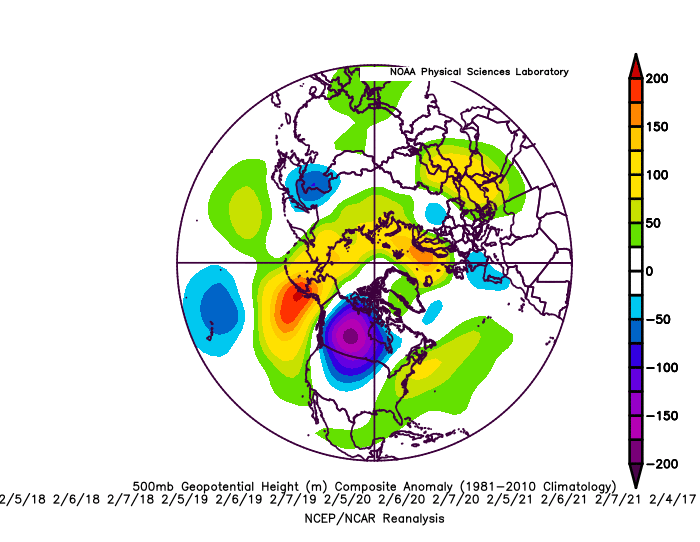
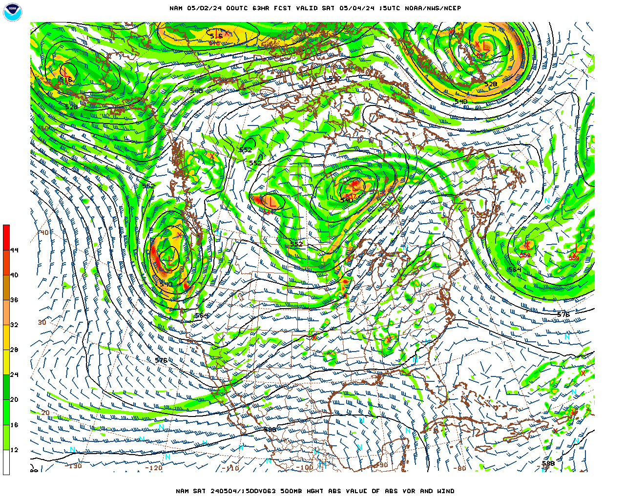
Geopotential height min. I found 477dm is the lowest recorded in the US
https://stormtrack.org/community/threads/lowest-500-mb-height-in-history.8225/
-
This might pick up.. 474 still. It will pick up if it holds/trends colder though
-
2
-
-
474.. -NAO
I've seen it get into the 460s before
-
2
-
-
https://www.ncei.noaa.gov/pub/data/cmb/ersst/v5/index/ersst.v5.pdo.dat
following 3 most neg Oct-Dec -PDO's it switches in the Pacific and Atlantic (+PDOpattern 2 years later while holding -PDO SSTs)
-
All1960s,70s El Nino's 1.0 ONI>, 4 events
We followed some pretty severe -PDO in the 1950s, followed by a positive blip ~1960, just like the 2000s have progressed
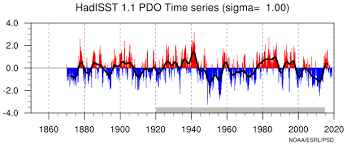
I don't think we'll get out of -PNA for the Winter, even if its El Nino next year.
Strong Nino of 72-73
-
In the global warming cycle, new high anomaly in -PNA starts cold here, and takes years to acclimate (warm), so expect the NAO to keep going negative with -PNA, -PNA/-NAO (+PNA/+NAO) correlated through February.
-
2
-
-
Big -EPO and -NAO, too. I had a reverse-negPNA signal through February anyway, so this fits. Should stay borderline cold/snow if 12z/18z GFS ensembles verify.
-
1
-
-
yikes
-
1
-
1
-
-
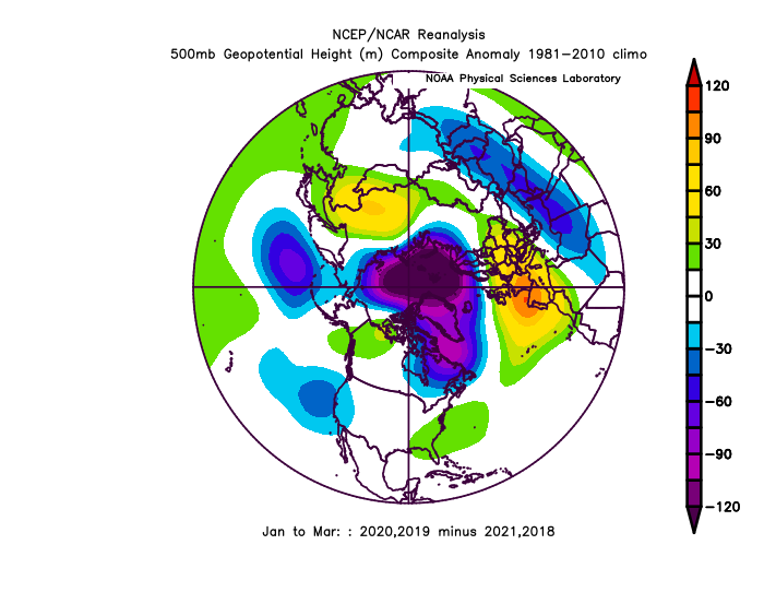
warm ENSO lately hasn't been able to conquer this N. Pacific -PNA
18-19 El Nino +0.7
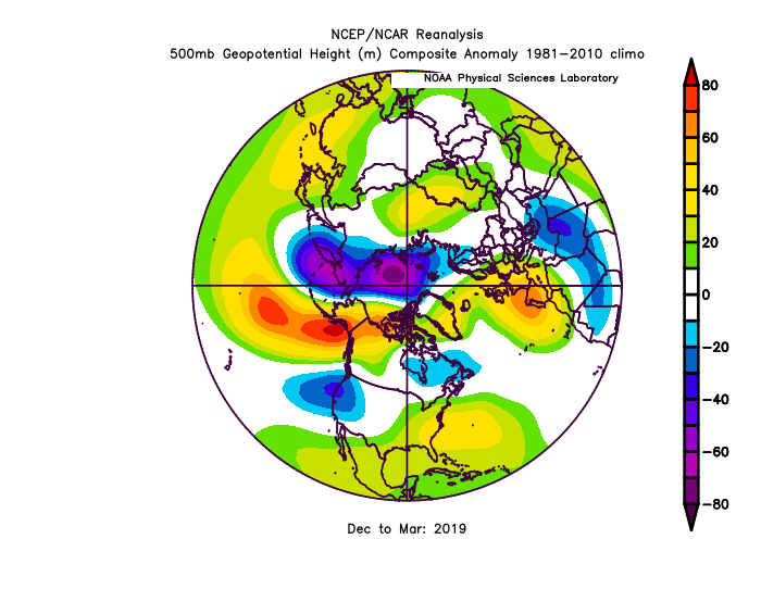
19-20 +Neutral +0.5 ONI
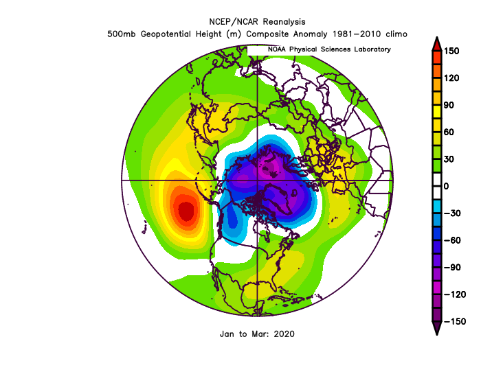
Last 2 +ENSO Jan-Mar
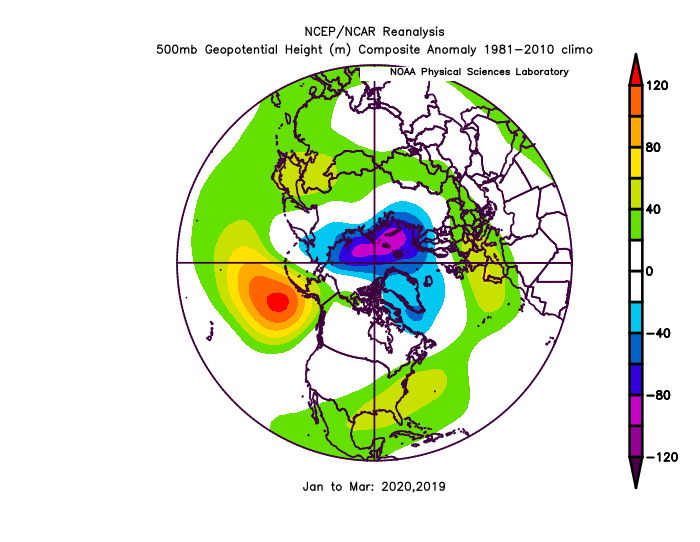
vs last 2 La Nina's (+ENSO minus Nina)

Late January and February Medium/Long Range Discussion
in Mid Atlantic
Posted
It's going to be hard for it to snow.. but it's possible.