StormchaserChuck!
-
Posts
2,274 -
Joined
-
Last visited
Content Type
Profiles
Blogs
Forums
American Weather
Media Demo
Store
Gallery
Everything posted by StormchaserChuck!
-

Late January and February Medium/Long Range Discussion
StormchaserChuck! replied to WinterWxLuvr's topic in Mid Atlantic
It's going to be hard for it to snow.. but it's possible. -
2021-2022 ENSO
StormchaserChuck! replied to StormchaserChuck!'s topic in Weather Forecasting and Discussion
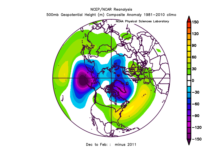
A rapidly deteriorating event at the surface for February looks like this.. to be continued.. I think 4/6 analog composite researches I have done have given us a strong el nino for later in the year, but I intuitively feel that this will not be the case, but these multi-year analog composites of +1.5 and +2.0c+ are impressive.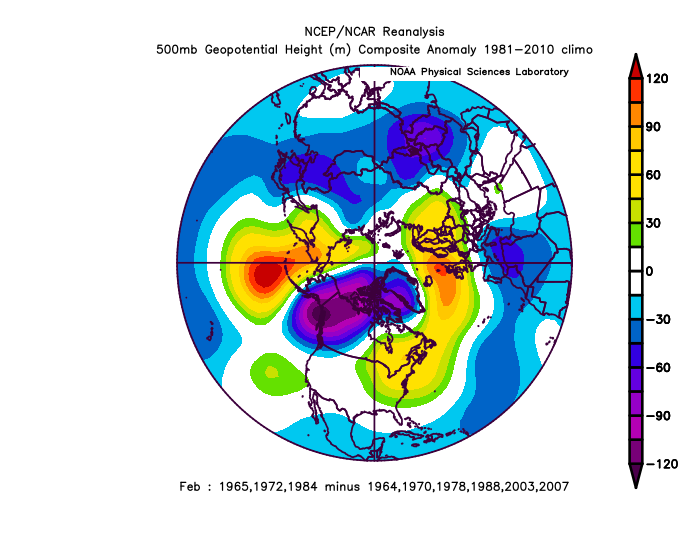
-
here you go Strong -AAM signal for mid-February.. could crush the Kelvin wave a little bit.
-
too bad.. we are doing the opposite of this as much as we can this year. La Nina's are a little dry though. opposite of Strong La Nina's (alone)v
-
Late January and February Medium/Long Range Discussion
StormchaserChuck! replied to WinterWxLuvr's topic in Mid Atlantic
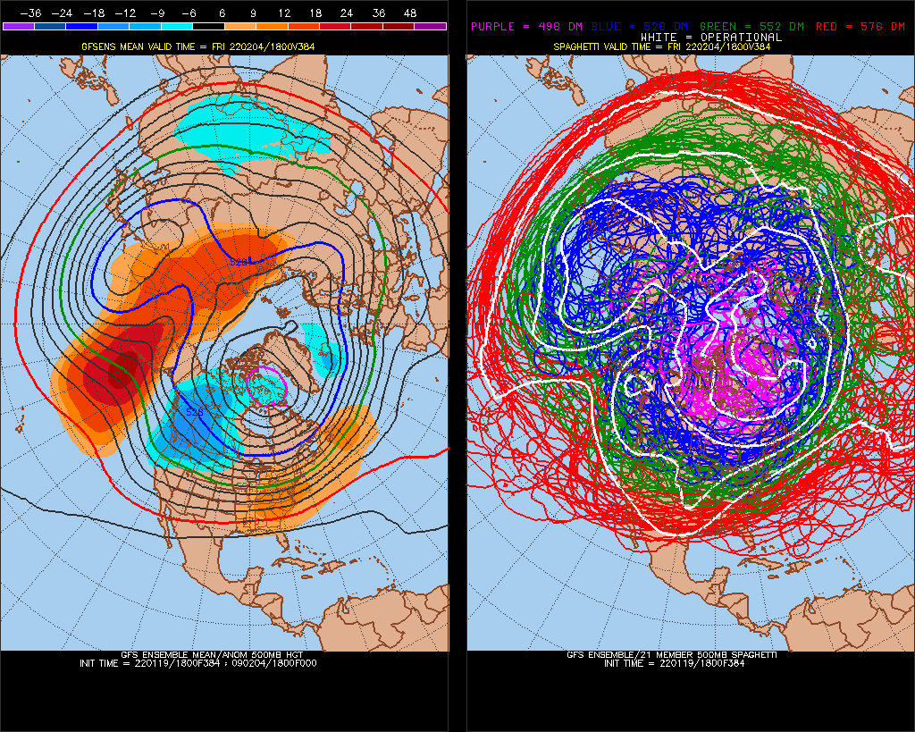
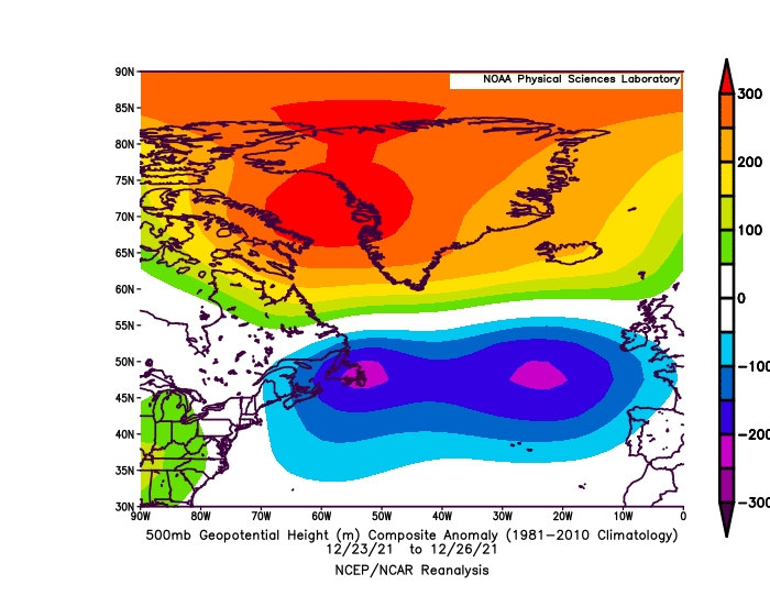
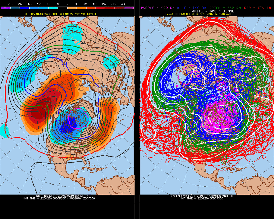
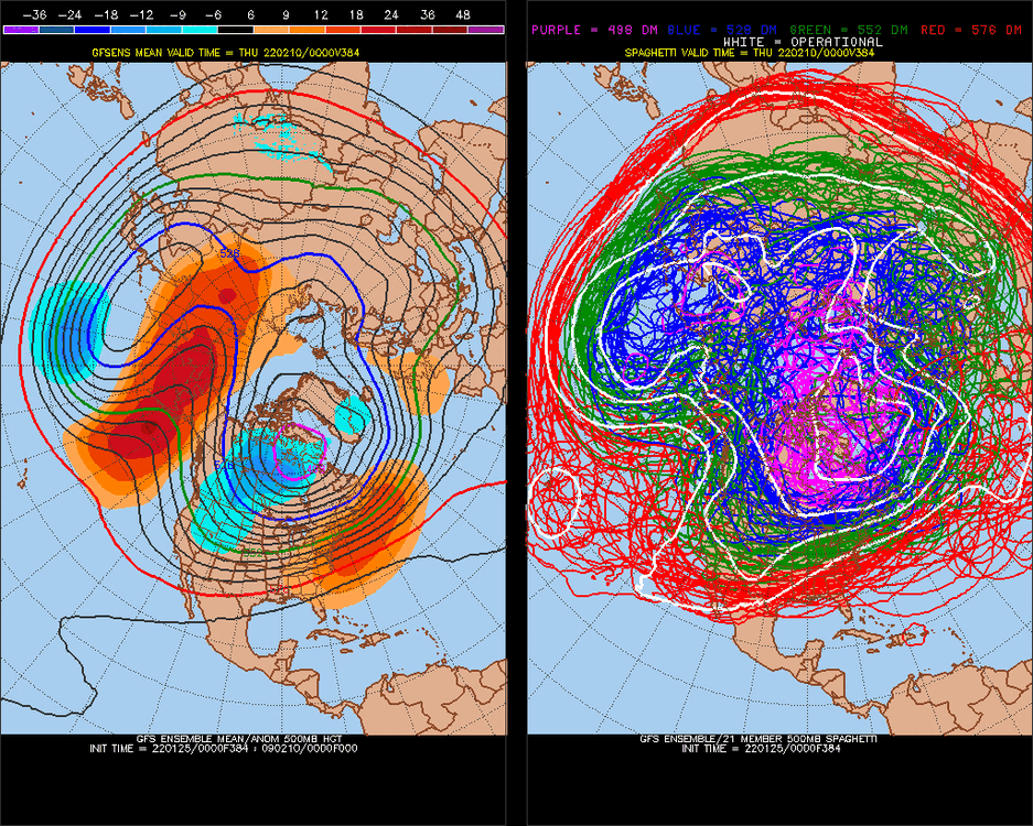
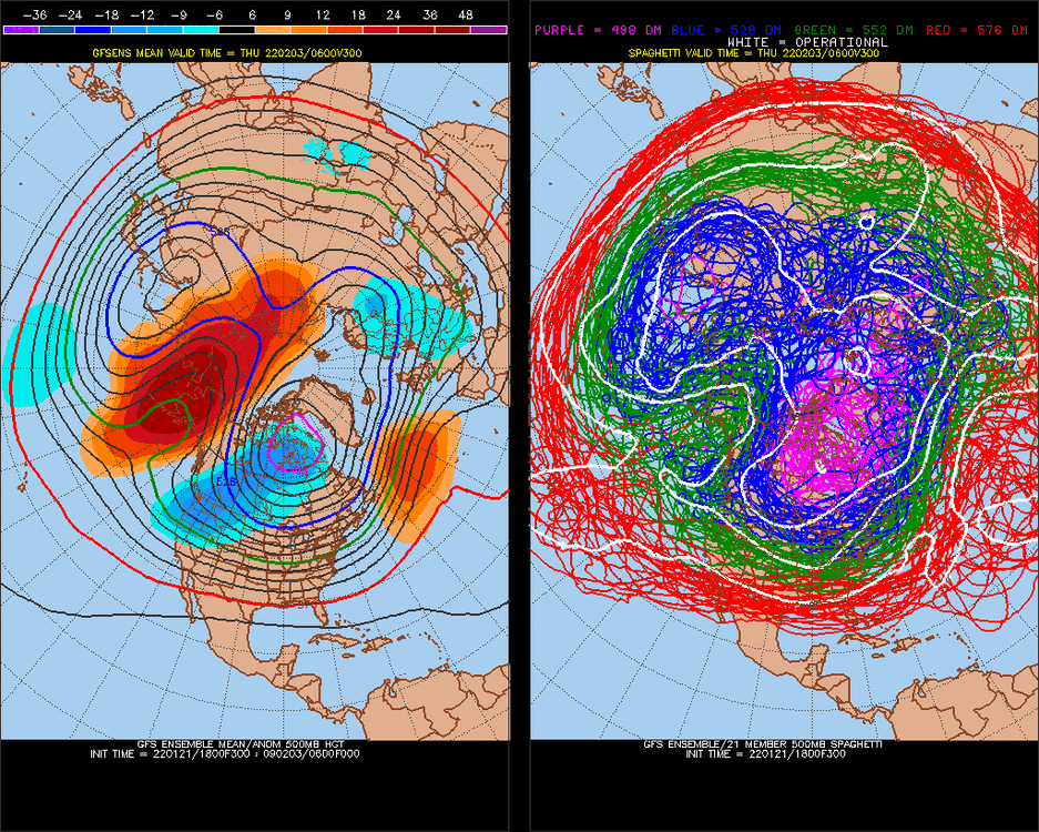
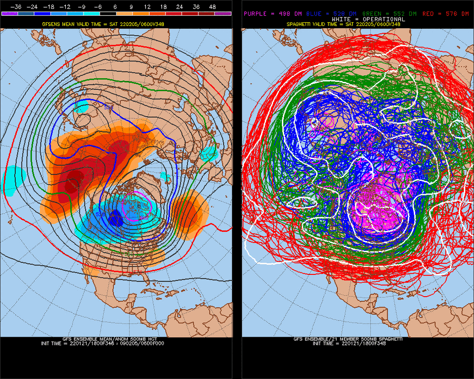
6 straight years of this Central America cold-pattern Feb 4-8 (see 2nd model image above) I used that 6-year consistency to say we would have a -NAO Christmas this year back in November 8 days later -AAM peaks, La Nina condition-pattern, (-AAM is -NAtlantic, +NPacific) +8 days is Feb 12-16, 2022 These AAM's spin and stuff to effect the pattern for a long time, this is last week of February ^+10days, Feb 22-26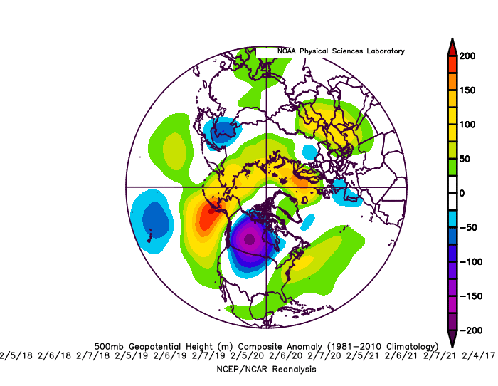
-
Late January and February Medium/Long Range Discussion
StormchaserChuck! replied to WinterWxLuvr's topic in Mid Atlantic
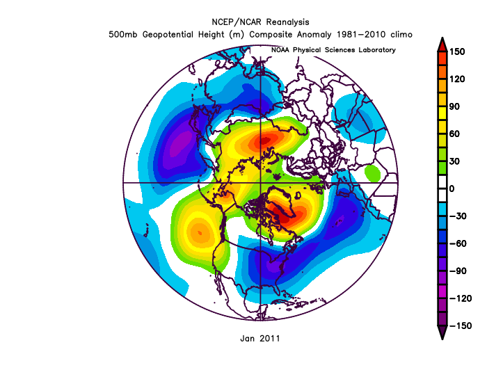
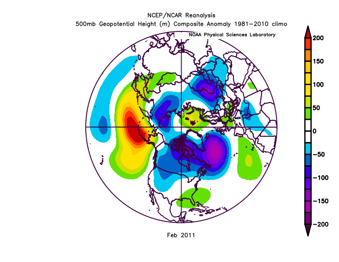
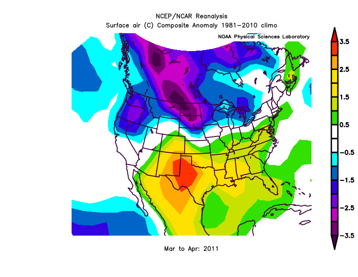
This is a massive -PNA. We'll be in the 50s higher every day after this storm threat. I really like the 10-11 analog, although the NAO wasn't as negative. NAO really switched in early Feb, should be interesting (I have +NAO signal Feb 7-9 core/max, but we have been veering -NAO for little reason 5/7 months. anyway.. we saw this in March/April, we'll see 2011 was dry 2-year pattern analogs are working Feb 7, 2022, +15day model Record +350dm Pacific High in December > 20% #1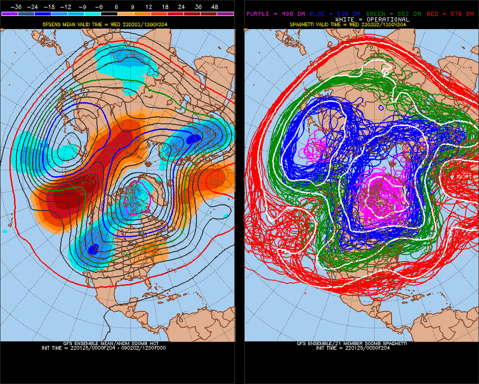
-
2021-2022 ENSO
StormchaserChuck! replied to StormchaserChuck!'s topic in Weather Forecasting and Discussion
^ NAO has been negative alot of the time too. No +EPO's either. -
Late January and February Medium/Long Range Discussion
StormchaserChuck! replied to WinterWxLuvr's topic in Mid Atlantic
Well, we constantly have a west-N. Pacific trough through 15-day models for several runs now. You can even call it a +PNA, because I thought some of our best patterns like 76-77 and 77-78 had this west-based N. Pacific trough. We need to break this +PNA/+NAO, -NAO/-PNA though, otherwise it wont really snow. I did research that showed after record -PDO's, (Oct-Nov-Dec was the #1 lowest -PDO on record) we actually rebounded with +PNA/GOA or Alaska high for next 2 years. The extreme PNA/PDO events seem to always even/reverse to balance. I don't think that changes our SE ridge state though, which could be present through Winter 22-23 too. -
2021-2022 ENSO
StormchaserChuck! replied to StormchaserChuck!'s topic in Weather Forecasting and Discussion
I think this Kelvin wave is a headfake We'll keep doing this +/- thing for the next 1 year, I guess. I don't even know who sees this when. People play up the "help situation" until it becomes too ridiculous, all judgement- how good you are doing and stuff.
-
Late January and February Medium/Long Range Discussion
StormchaserChuck! replied to WinterWxLuvr's topic in Mid Atlantic
-PNA/+AO, just what I like for a snowstorm(not). You are riding the N. Atlantic ridge which has correlated 21 straight times to -PNA or +EPO (neutralized), and the AO is positive anyway. rainstorm.- 4,130 replies
-
- 4
-

-

-
- prime climo
- cold canada
- (and 1 more)
-
-
Late January and February Medium/Long Range Discussion
StormchaserChuck! replied to WinterWxLuvr's topic in Mid Atlantic
This isn't South Carolina. I average 32" of snow per year, and the coldest day is Jan 27th. -
Late January and February Medium/Long Range Discussion
StormchaserChuck! replied to WinterWxLuvr's topic in Mid Atlantic
1% - 5% chance of a snowstorm, realistically. give me my $$$.- 4,130 replies
-
- 6
-

-
-

-
-
- prime climo
- cold canada
- (and 1 more)
-
Late January and February Medium/Long Range Discussion
StormchaserChuck! replied to WinterWxLuvr's topic in Mid Atlantic
Highest odds is probably for a rainstorm.- 4,130 replies
-
- 10
-
-
-

-
-
-
- prime climo
- cold canada
- (and 1 more)
-
Late January and February Medium/Long Range Discussion
StormchaserChuck! replied to WinterWxLuvr's topic in Mid Atlantic
unless it trends toward a different H5 pattern, there will be no snowstorm, not even close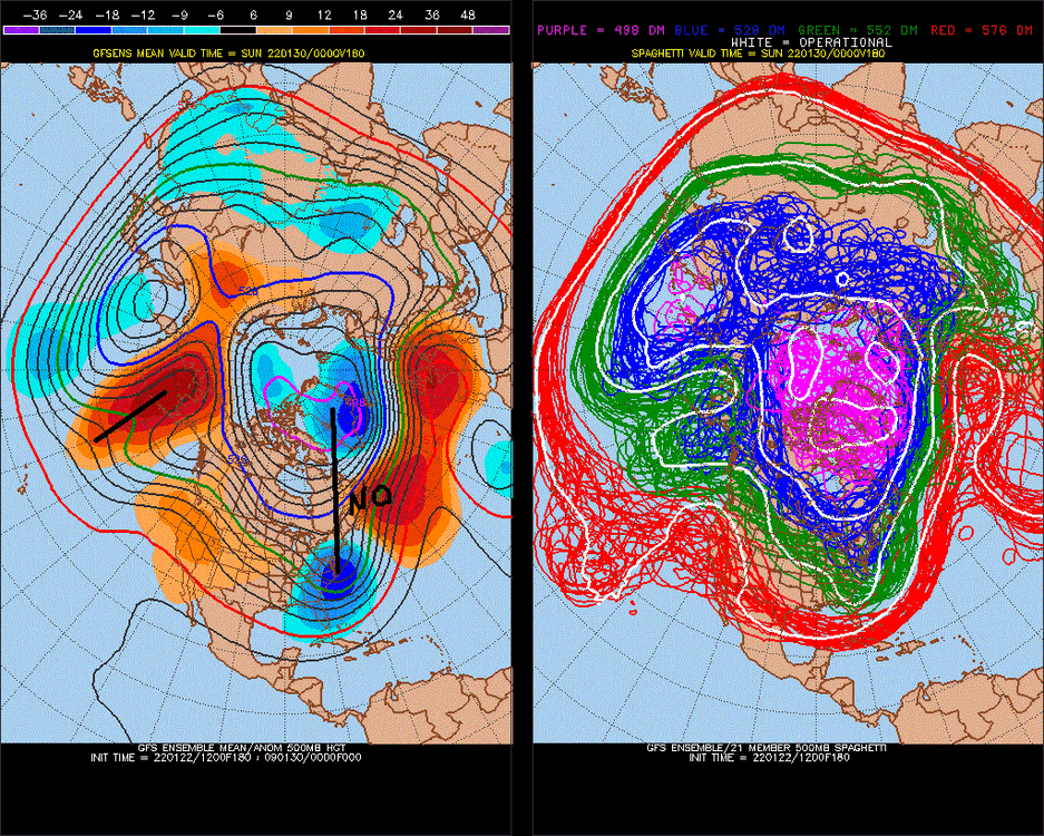
- 4,130 replies
-
- 5
-
-
-
-

-
- prime climo
- cold canada
- (and 1 more)
-
Late January and February Medium/Long Range Discussion
StormchaserChuck! replied to WinterWxLuvr's topic in Mid Atlantic
It's like those La Nina Winter's of the 1960s, Pacific ridge cold-dry. US-Europe won after, micro-macro.
- 4,130 replies
-
- 2
-
-
- prime climo
- cold canada
- (and 1 more)
-
Late January and February Medium/Long Range Discussion
StormchaserChuck! replied to WinterWxLuvr's topic in Mid Atlantic
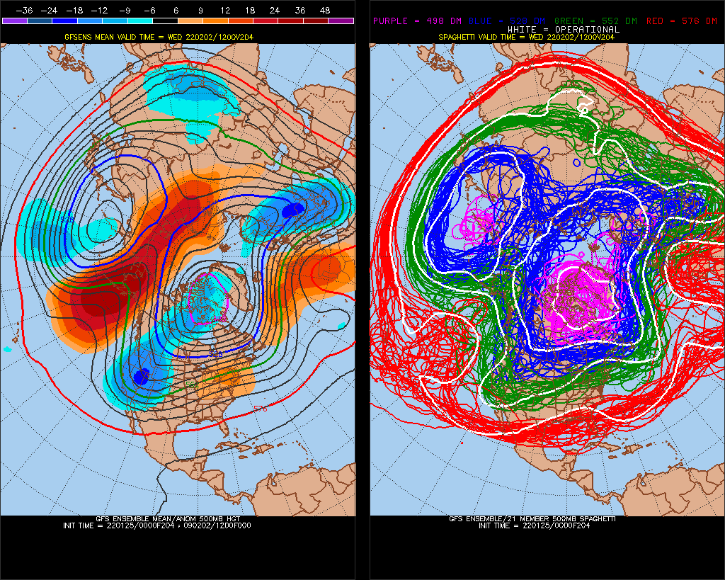
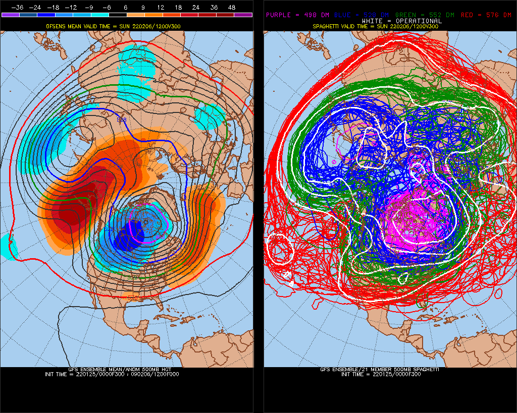
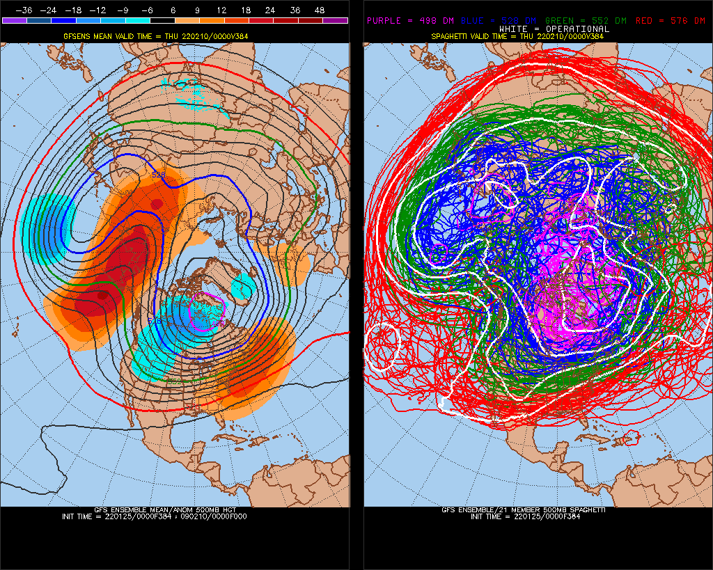
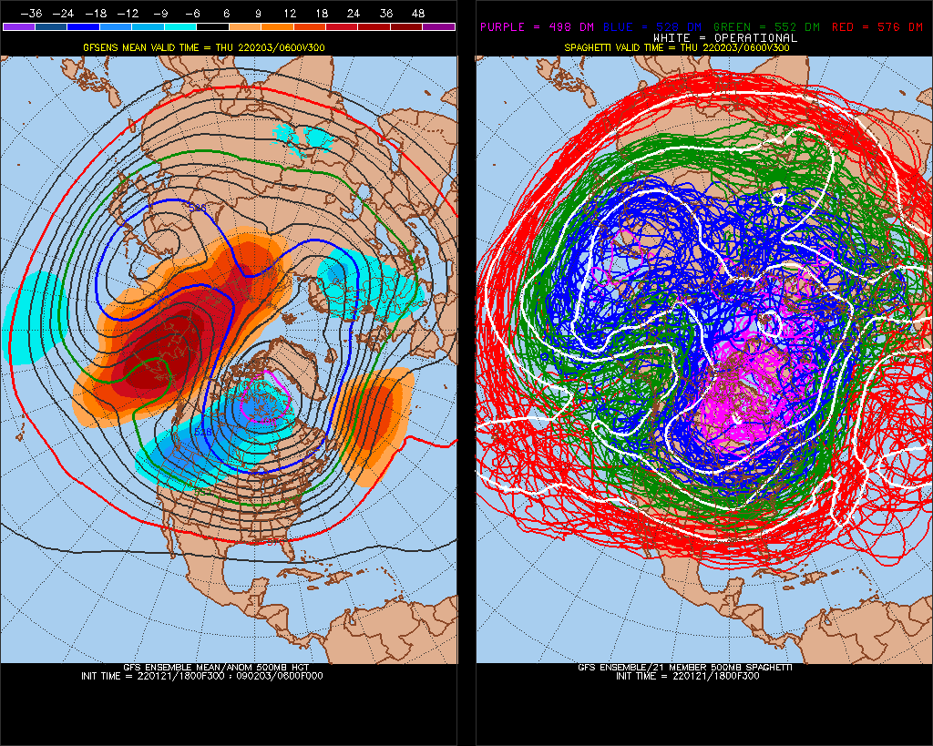
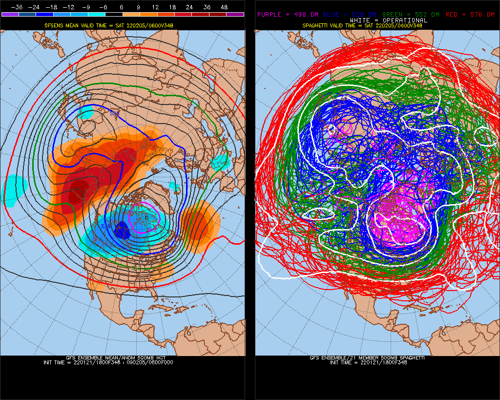
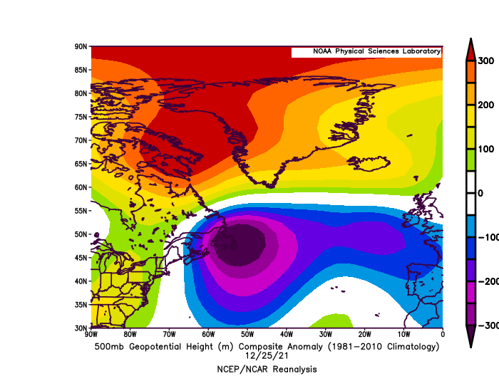
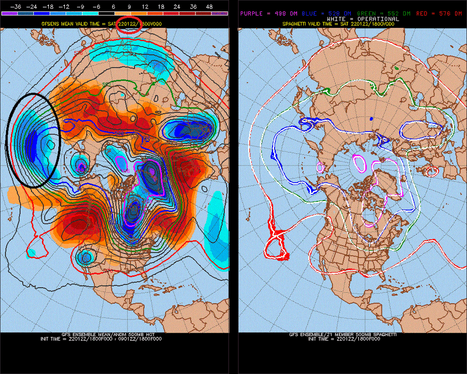
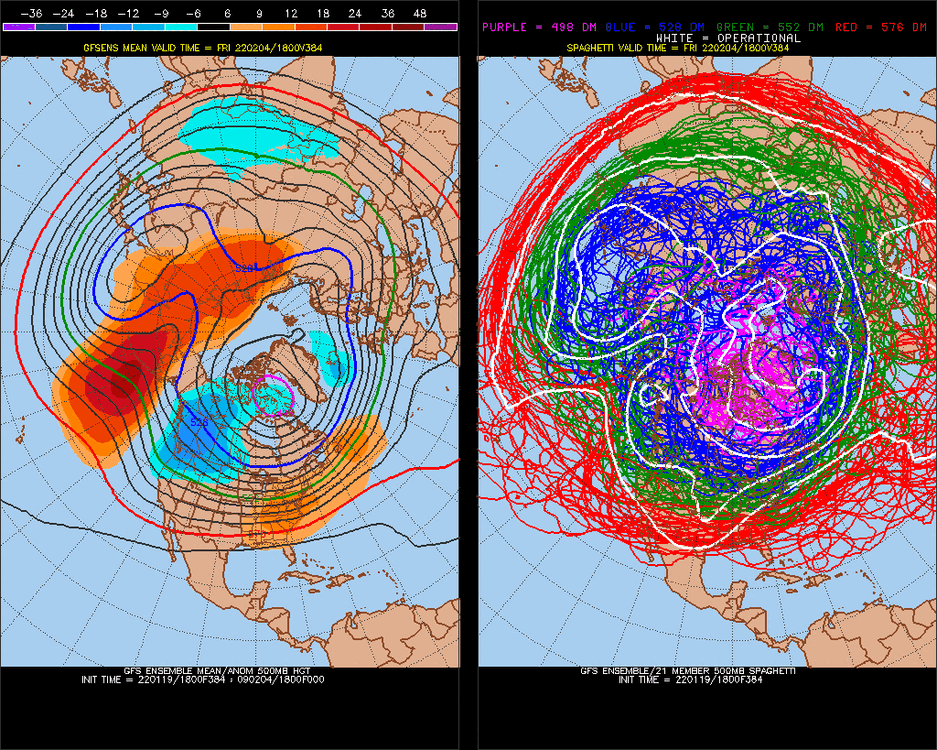
Geopotential height min. I found 477dm is the lowest recorded in the US https://stormtrack.org/community/threads/lowest-500-mb-height-in-history.8225/ -
Late January and February Medium/Long Range Discussion
StormchaserChuck! replied to WinterWxLuvr's topic in Mid Atlantic
This might pick up.. 474 still. It will pick up if it holds/trends colder though- 4,130 replies
-
- 2
-
-
- prime climo
- cold canada
- (and 1 more)
-
Late January and February Medium/Long Range Discussion
StormchaserChuck! replied to WinterWxLuvr's topic in Mid Atlantic
474.. -NAO I've seen it get into the 460s before- 4,130 replies
-
- 2
-
-
- prime climo
- cold canada
- (and 1 more)
-
2021-2022 ENSO
StormchaserChuck! replied to StormchaserChuck!'s topic in Weather Forecasting and Discussion
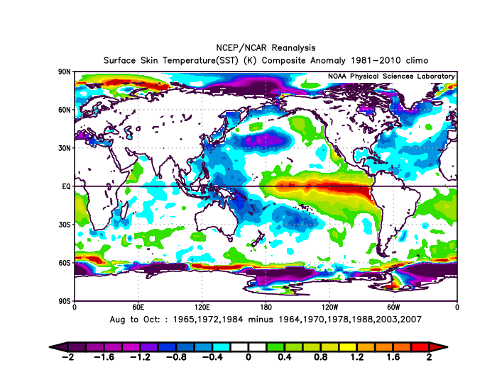
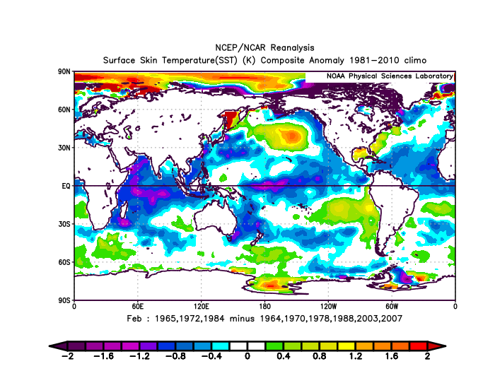
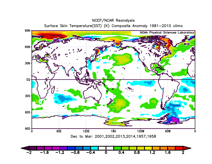
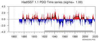
https://www.ncei.noaa.gov/pub/data/cmb/ersst/v5/index/ersst.v5.pdo.dat following 3 most neg Oct-Dec -PDO's it switches in the Pacific and Atlantic (+PDOpattern 2 years later while holding -PDO SSTs)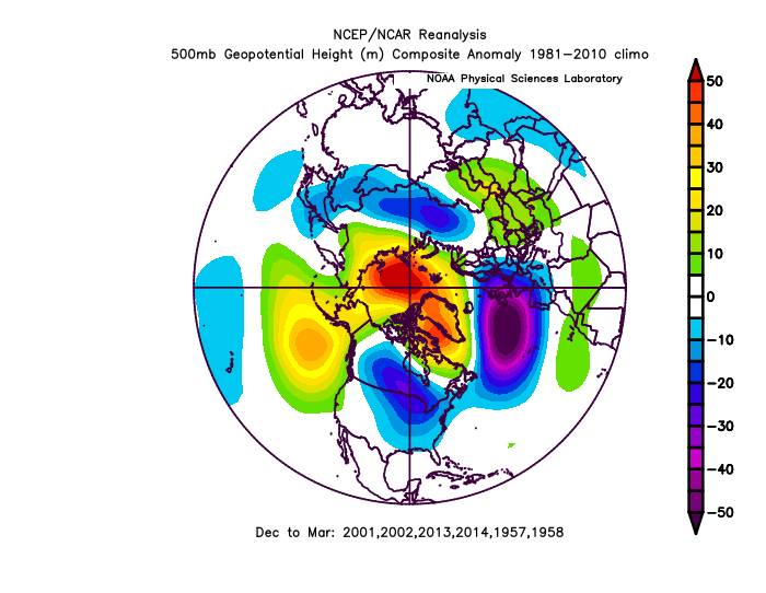
-
2021-2022 ENSO
StormchaserChuck! replied to StormchaserChuck!'s topic in Weather Forecasting and Discussion
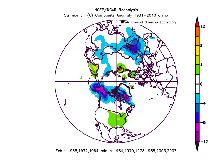
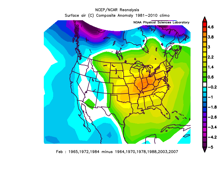
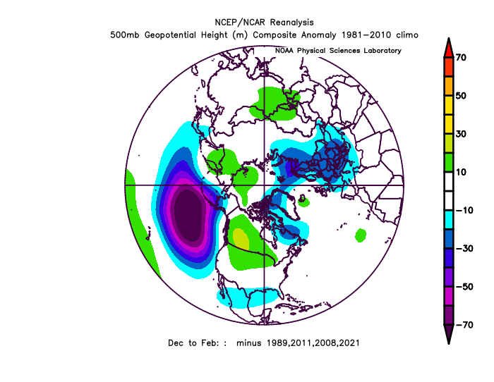
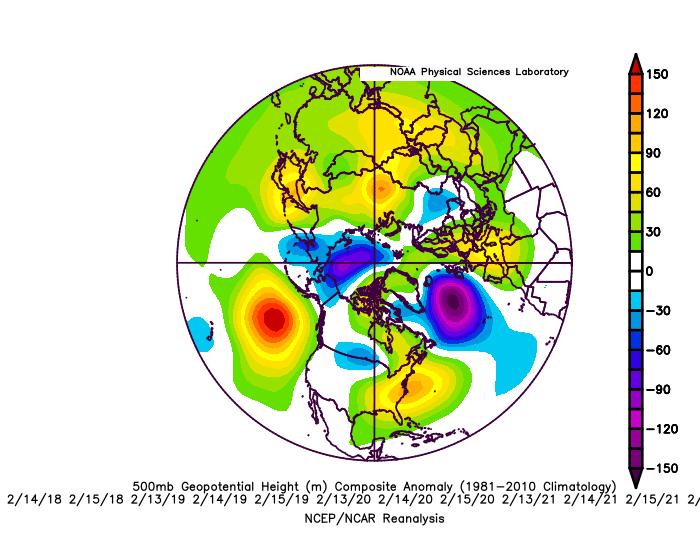
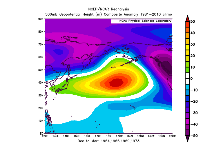
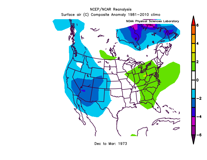
All1960s,70s El Nino's 1.0 ONI>, 4 events We followed some pretty severe -PDO in the 1950s, followed by a positive blip ~1960, just like the 2000s have progressed I don't think we'll get out of -PNA for the Winter, even if its El Nino next year. Strong Nino of 72-73
-
Late January and February Medium/Long Range Discussion
StormchaserChuck! replied to WinterWxLuvr's topic in Mid Atlantic
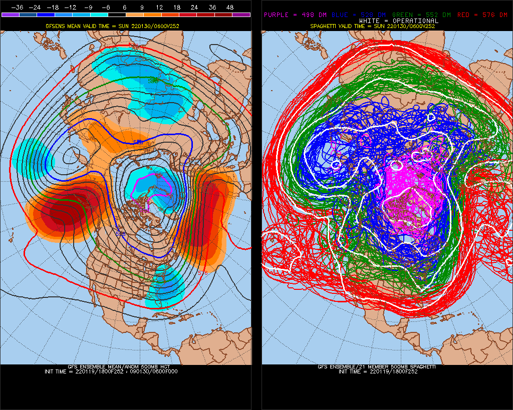
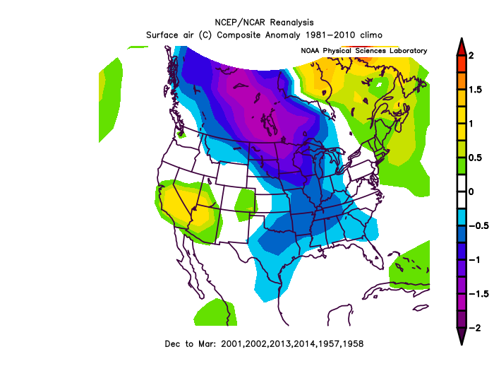
In the global warming cycle, new high anomaly in -PNA starts cold here, and takes years to acclimate (warm), so expect the NAO to keep going negative with -PNA, -PNA/-NAO (+PNA/+NAO) correlated through February.- 4,130 replies
-
- 2
-
-
- prime climo
- cold canada
- (and 1 more)
-
Late January and February Medium/Long Range Discussion
StormchaserChuck! replied to WinterWxLuvr's topic in Mid Atlantic
Big -EPO and -NAO, too. I had a reverse-negPNA signal through February anyway, so this fits. Should stay borderline cold/snow if 12z/18z GFS ensembles verify.- 4,130 replies
-
- 1
-
-
- prime climo
- cold canada
- (and 1 more)
-
January Medium/Long Range Discussion
StormchaserChuck! replied to WinterWxLuvr's topic in Mid Atlantic
yikes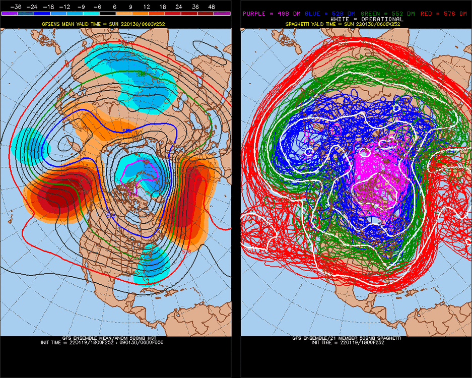
-
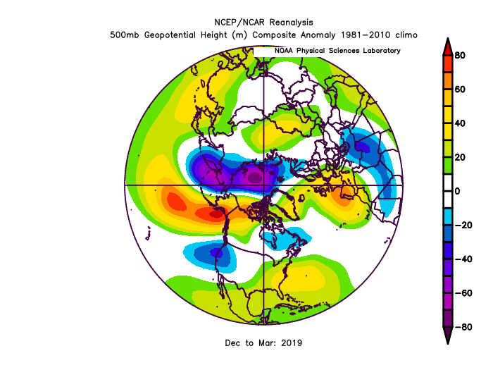
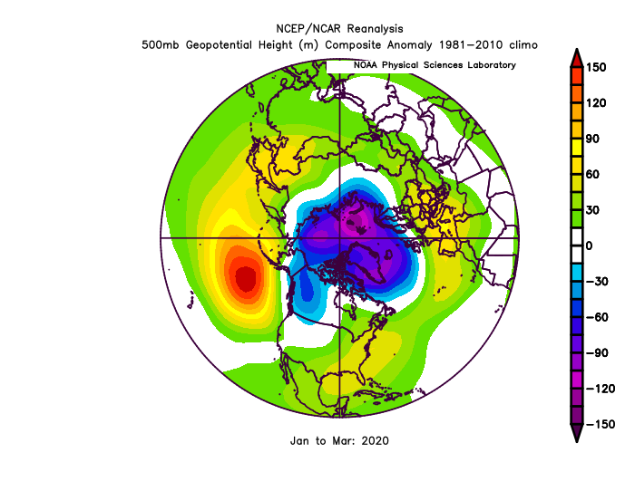
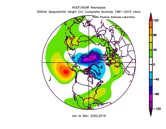
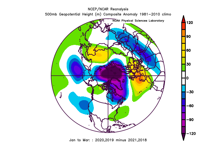
2021-2022 ENSO
StormchaserChuck! replied to StormchaserChuck!'s topic in Weather Forecasting and Discussion
warm ENSO lately hasn't been able to conquer this N. Pacific -PNA 18-19 El Nino +0.7 19-20 +Neutral +0.5 ONI Last 2 +ENSO Jan-Mar vs last 2 La Nina's (+ENSO minus Nina)