

StormchaserChuck!
-
Posts
2,273 -
Joined
-
Last visited
Content Type
Profiles
Blogs
Forums
American Weather
Media Demo
Store
Gallery
Posts posted by StormchaserChuck!
-
-
I think Nino1+2 will go positive by June or July.
-
73-74, 74-75, 75-76, Strong on the backend. 74-75 was big +PNA in that 3-year cycle, and 00-01 was big +PNA In that 3-year cycle. 2/2 had a strong +PNA Winter in 1 of the 3 years.
-
Today's storm is just EPO, -EPO with a slight trough over water south of it, it's not even NAO.. NAO is + actually with ridge over northern Europe. I keep saying this. We are getting our best winter storms in +NAO. (I think the issue is a normal -NAO goes +600dm-900dm, to extreme for average kind of a thing). Or it could be the 50/50 low theorem, where you have a low pressure parked to the north
-
4 hours ago, donsutherland1 said:
The ENSO Region 1+2 anomaly was -1.7C for the week centered around April 13th. That is the coldest anomaly for that timeframe since weekly records were kept beginning in 1982. The prior mark was -1.4C in 1994.
I feel like we are going strongly toward El Nino (climo stats), this is a pretty strong opposite push, --/+
-
On 4/12/2022 at 7:39 AM, WinterWxLuvr said:
I think you’re grasping here
The pattern is so stable., Give it 10 years, or 7to10 years, and I bet any amount of money the eastern 2/3 of US are warmer than average>climotrends, SW->2-3xeast
-
-NAO Apr28-May 3
*Then, no real analogs until before 2010
-
 2
2
-
-
-
Yeah, that's a pretty good +PNA
-
On 2/19/2021 at 10:58 AM, StormchaserChuck! said:
Powerful, Nina's going to even out though.
El Nino push.. +3, probably +4 soon in the western subsurface. Will probably go/turn positive at the surface by late May/June.
-
Kind of had a return of the cold snow/blowing snow, it was 13F a few mornings with light snow. C-/D+.
-
2 hours ago, Amped said:
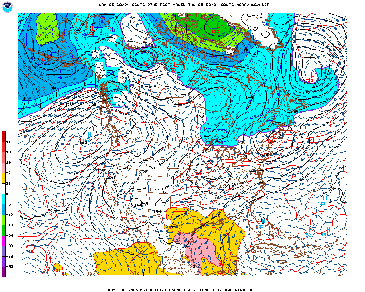
They look to be within 500 miles or so with the 850 line, which is about all you can tell from those maps.
Actually, it's snow for northern Va
-
3 hours ago, WinterWxLuvr said:
You promised a -PNA all winter and we had Z near continuous +PNA from Jan 1 through March.
But …. -PNA all the way!!! Next 27 winters!!!
How much snow? I said the Pacific 1/3 would even out +650dm December..no alarms. 2010 did the same thing, for the Winter it was very RNA.
-
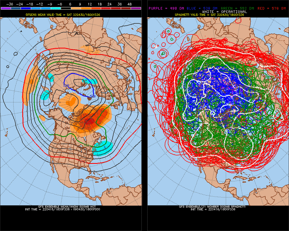
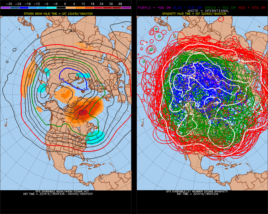
A few of the GFS ensembles looks close
-
Nice little -NAO here .. we are going to carry this strong-NAO/-PNA/+EPO Pacific thing into next Winter
.thumb.gif.fd5b67b99e5ca0013f02393f52ad4bb0.gif)
-
 1
1
-
-
I think it will be a -AO Summer(+500mb).
-
On 4/13/2022 at 10:39 AM, 40/70 Benchmark said:
Hopefully we can get a modoki of modest intensity...muster up some blocking and negative PDO is fine with me.
Here you go
.thumb.gif.9b06163391c50aa3c3506e1152395e9e.gif)
-
*years
It's probably a higher probability for the Winter though.
It's not going to chagne the 5-year weather
-
Just now, bluewave said:
Record -PNA trough out West is taking a bunch of trees down in Portland with the historic late season snowfall.
1948/9-1951, great analog for -PNA evolution right now (ENSO-PNA). Yesterday's 12z GFS had 5-7 straight days of snowfall in Seattle, I checked the forecast though and it was Upper40s/low50s, rain throughout.
-
-
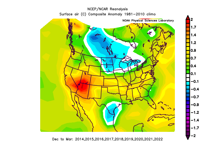
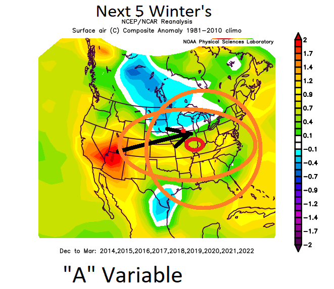
I love it. No Low pressures in the SW on an exponential logarithmic scale, +, 1995 0.20, 2000 0.40, 2010 0.50, 2013 0.65, 2015 0.75, 2017 0.78, 2018 0.80, 2019 0.82, 2021-2, 0.90. Something to watch out for in the next few Winter's. I think it's correlation is strong.
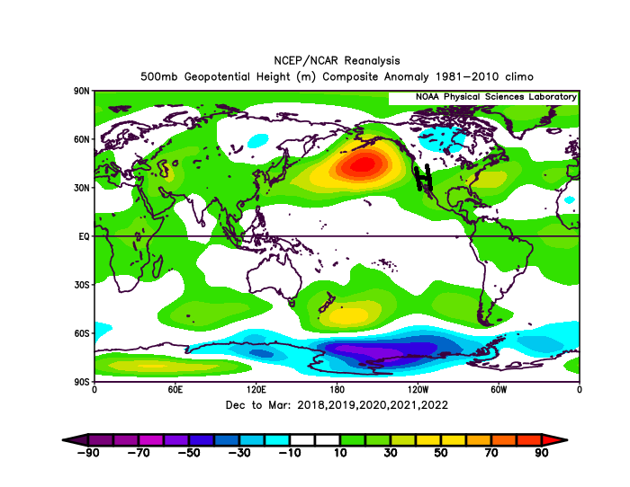
9 straight Winter's above normal in the SW.
-
1
-
-
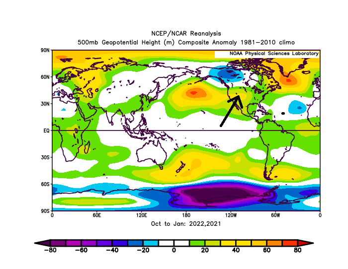
The Hadley Cell really flexed this Winter, we had a +180dm N. Pacific anomaly, when the average for a Weak-Nina is +60dm+60dm 30% error. I think that general energy potential should extend into the Atlantic Hurricane season, keeping warm SSTs/calmer conditions generally farther north through the season. ENSO state is the wild card.
vland/ocean
-
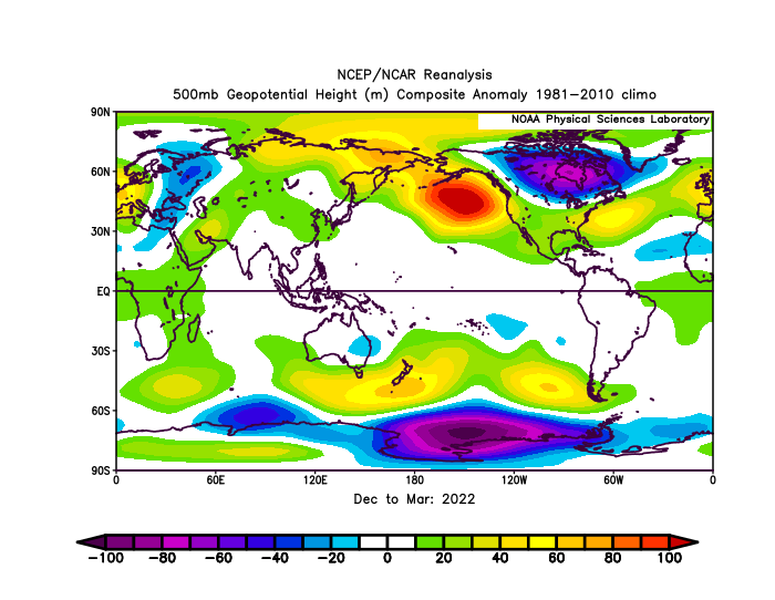
SW, US High pressure/temps severely lead us here, relative to time,(warm 2 months = warm +2-4months later here, 2 years = 3rd year, etc, it's like ~68%/50). This warm SW has established since 2000, but really picked up in the last 1.5 years, dominate High pressure despite -PNA, other drivers. I think we will see a streak of warm Winter's, El Nino is the only thing that can save us.
-
 1
1
-
-
I still think we'll see a El Nino/solar action push, but it's relative to a dominant -PDO state.
-
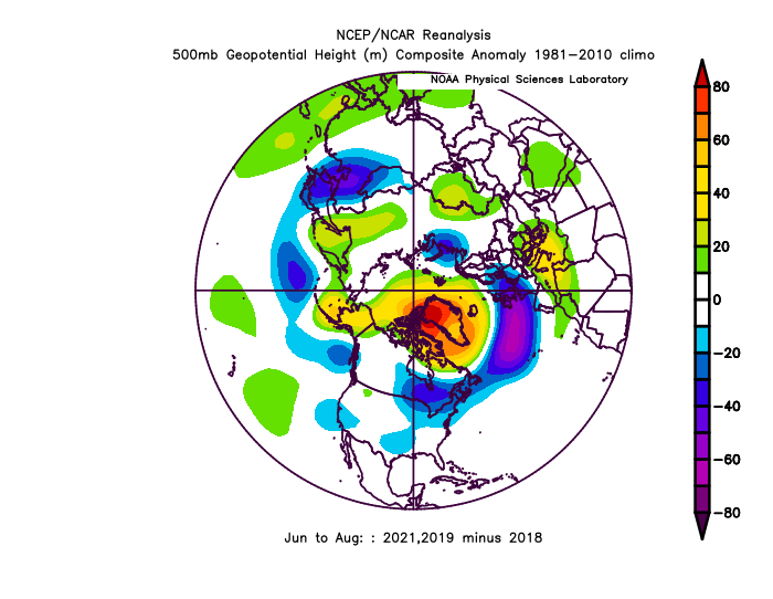
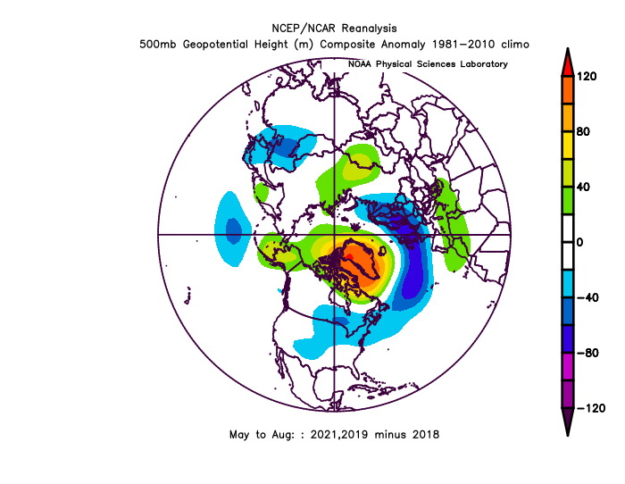
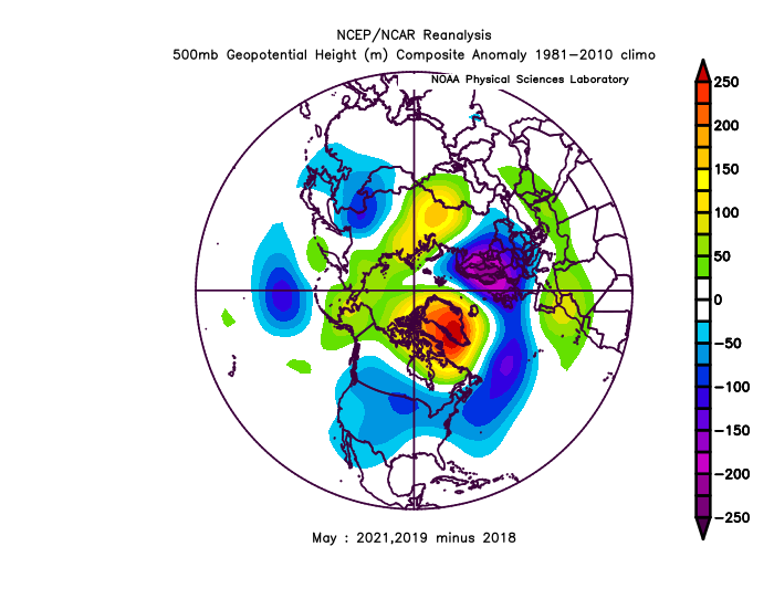
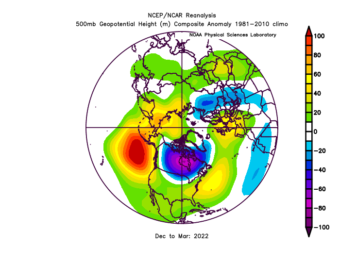
SW ridge has been extremely anomalous in the last few years. Biggest consistency in the globe (anomalies) right now.
.gif.87afda3319e07a133562aeac96882fc2.gif)
.gif.161cd1b1e026702d82514ab74d615516.gif)
April 18 Nor’easter
in Mid Atlantic
Posted
It's pouring now, gets dark at like 6:30pm today