dWave
-
Posts
1,864 -
Joined
-
Last visited
Content Type
Profiles
Blogs
Forums
American Weather
Media Demo
Store
Gallery
Everything posted by dWave
-
34 here which is the low, coldest May temp of my life by far
-
Ha yup..In NYC our most exciting events were a trace of snow Feb 29 to avoid first snowless Feb, and trace of snow in May.
-
38 light rain here. Rain snow line looks to be approaching upper manhattan
-
Temps falling more rapidly now, down to 42, w/rain
-
TWC has the coldest forecasts I've seen. We'll how close it gets. I believe it hasnt been below 40 in May in NYC in over 40 yrs or so, or ever in my life. Ill be checking for a snowflake..
-
May 2020 General Discussions & Observations Thread
dWave replied to Rtd208's topic in New York City Metro
Yeah expected temps to stay steady, maybe fall but it's up to 73 instead -
May 2020 General Discussions & Observations Thread
dWave replied to Rtd208's topic in New York City Metro
Im at 80 now. Today was suppose to be the 5 boro bike tour. Last year was pouring rain and cool. Today would of been great..maybe even too warm for some. -
May 2020 General Discussions & Observations Thread
dWave replied to Rtd208's topic in New York City Metro
NYC 78, LGA 77, EWR 80 -
May 2020 General Discussions & Observations Thread
dWave replied to Rtd208's topic in New York City Metro
Mostly sunny 77 -
I've noticed on some pages NWS shows traces of snow in the closing days of May at LGA and JFK. I always assumed it was some clerical error or hail. Record lows range from 41 to 50 on the dubious dates.
-
Don't know if it'd make it down there but If JFK reports a trace of snow that would be a record for the date (and latest in April). LGA and NYC had a trace this date in 1986.
-
yup! snow shower in the Bx. 41. Can't remember seeing snow flakes this late within NYC before.
-
Meanwhile, Florida and the Gulf smashing records https://www.washingtonpost.com/weather/2020/04/22/record-april-heat-miami-florida-gulf-coast/
-
I think JFK set a record low of 36, old record was 37. Central Park and LGA's record low of 33 survives another year
-
Had some gusty winds and hail. Still some thunder. Not damaging but enough to lose some garbage cans and a chair
-
City in it too. Tornado warning here..Manhattan, Bronx, Southern Westchester, NW Nassau Phone went off as soon as it got dark, windy and rain right now.
-
Suns out, 66 dewpt 65
-
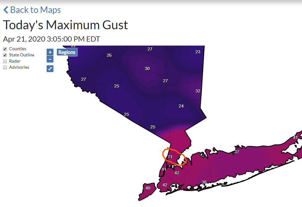
I agree, pretty good for wind like anywhere else, it just could vary considerably. If you're facing a solid row of buildings it could seem bad, until you go around the corner and its howling. SI, Qns, and Bx mesonets are all 50+ mph today so far. As for offical readings, Central Park is usually bad for winds, some directions worse than others.
-
just under 11,000 Con Ed customers without service https://apps.coned.com/stormcenter/external/default.html
-
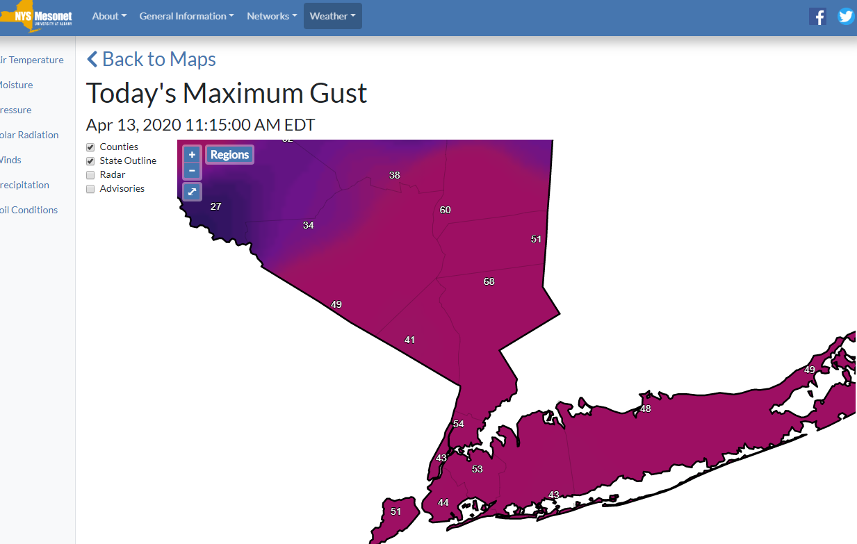
frequest gusts into the 40s here and occsaional 50+ so far. impressive 68mph, Somers in northern westchester

-
Thats a problem for the field hospitals, like in Central Park. NWS implies concern over this 947 PM EDT Sat Apr 11 2020 ... HIGH WIND WATCH REMAINS IN EFFECT FROM MONDAY MORNING THROUGH MONDAY AFTERNOON... * WHAT, South winds 30 to 40 mph with gusts up to 70 mph possible. * WHERE, Portions of northeastern New Jersey, southern Connecticut and southeastern New York, including New York City. * WHEN, From Monday morning through Monday afternoon. * IMPACTS, Damaging winds could blow down trees and power lines. Even sturdy and well secured tent structures could be damaged. Widespread power outages are possible. Travel could be difficult, especially for high profile vehicles. PRECAUTIONARY/PREPAREDNESS ACTIONS... Monitor the latest forecasts and warnings for updates on this situation. Fasten loose objects or shelter objects in a safe location prior to the onset of winds.
-
at first I thought I was looking at pollen or blossoms but it is in fact snow. flurries..occasionally enough to call it a snow shower, 44
-
partly sunny..68
-
59, sun feel great. 60s just a little further from the Sound
-
The flowering trees are really ahead of schedule. Alot of Cherry blossoms have peaked and many have already tranistioned to (small) green leaves. Last freeze here was Mar 1, which is kinda crazy. The freezes even during the winter were sporadic anyway.