MattPetrulli
-
Posts
1,728 -
Joined
-
Last visited
Content Type
Profiles
Blogs
Forums
American Weather
Media Demo
Store
Gallery
Everything posted by MattPetrulli
-

2023 Atlantic Hurricane season
MattPetrulli replied to Stormchaserchuck1's topic in Tropical Headquarters
-
...ELEVATED FIRE RISK WEDNESDAY DUE TO BREEZY CONDITIONS AND LOW RELATIVE HUMIDITY... Ongoing drought conditions, combined with breezy southerly winds and low relative humidity values will lead to an elevated fire risk on Wednesday, especially in the afternoon and evening hours. Relative humidity values will drop into the mid 30s to lower 40s, but the bigger concern will be with respect to winds. By the afternoon, winds will be sustained at 10 to 20 mph at a minimum with gusts of 25 to 30 mph possible. Winds will be strongest in the higher elevations. A bit nervous about tomorrow in my area. Hopefully won't have a fire pop up, but tomorrow is probably the most favorable fire day since the Wears Valley fires.
-
Disturbance in Caribbean 30/70 chance of development
-
A nightmare scenario is unfolding for southern Mexico this evening with rapidly intensifying Otis approaching the coastline. Satellite images show that Otis has continued to intensify, with Dvorak Data-T estimates between 130-145 kt during the past few hours. The initial wind speed is set to 140 kt as a blend of these values, making Otis a Category 5 hurricane. Otis has explosively intensified 95 kt during the past 24 hours, a mark only exceeded in modern times by Patricia in 2015. Otis should maintain category 5 status before the hurricane makes landfall near the Acapulco area overnight or early on Wednesday. The only significant change to mention to the track forecast is that it has been shifted to the right due to a recent wobble to the east and the latest model trends, and a general north-northwest motion at about 8 kt is anticipated through landfall. Rapid weakening is anticipated after landfall, and Otis should dissipate tomorrow night over the higher terrain of Mexico. This is an extremely serious situation for the Acapulco metropolitan area with the core of the destructive hurricane likely to come near or over that large city early on Wednesday. There are no hurricanes on record even close to this intensity for this part of Mexico.
-
Lol
-
-
Here's what makes me a little more concerned. While we were in an exceptional drought in 2016, we were not experiencing drought conditions when the Wears Valley fires occurred. Shows that wind is truly the biggest factor, but drought beginning at this time is just fuel to the fire no pun intended. Glad I moved out of Pigeon Forge into an area of Sevierville that isn't near the main mountains.
-
Really am not a fan of entering a drought at the beginning of Fall. If drought continues to increase, gonna become more and more increasingly concerned when we start getting mountain wave events for fires.
-
2023 Atlantic Hurricane season
MattPetrulli replied to Stormchaserchuck1's topic in Tropical Headquarters
-
2023 Atlantic Hurricane season
MattPetrulli replied to Stormchaserchuck1's topic in Tropical Headquarters
-
NYC break probably gonna be short lived, band from NJ building back up into the city. 14z HRRR shows this nicely.
- 886 replies
-
- 1
-

-
- heavy rain
- flooding potential
- (and 2 more)
-
At what point does a FFE get issued? At least from HRRR and radar, probably another 2-4" to go at the least with many many reports of flash flooding on social media.
- 886 replies
-
- 1
-
-
- heavy rain
- flooding potential
- (and 2 more)
-
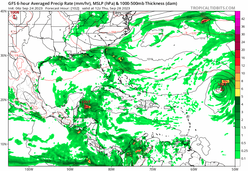
00z Euro brings it pretty far west and redevelops it a little. It's the vorticity over the Bahamas, the other concentrated vorticity is 91L. GFS kinda does this too. Something to watch over the next few days.
-
2023 Atlantic Hurricane season
MattPetrulli replied to Stormchaserchuck1's topic in Tropical Headquarters
We participate in a little of GFS trolling (just a tiny bit difference between runs)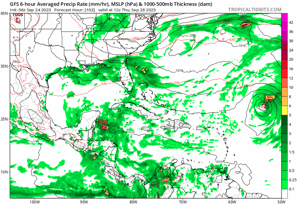
-
2023 Atlantic Hurricane season
MattPetrulli replied to Stormchaserchuck1's topic in Tropical Headquarters
Hmmmm -
Oh no we're posting meteorological observations on a meteorological website! Seriously your trolling is old and annoying. You're getting as bad as Idubb23. Please stop posting.
-
Looks like Washington may be ground zero
-
Wonder how bad the flooding is right now. This is what the criteria says, and it isn't far off from it at all. 7 Widespread and significant flooding of the town of Washington (including the Washington Park and River Road areas), as well as the community of Whichards Beach. Many homes and businesses will flood in Washington.Many roads will be impassable, especially those adjacent to the Pamlico River and adjacent creeks.
-
Frictional convergence making an organized structure at the last moment.
-
As expected, this was temporary and the eyewall feature collapsed. However, it made the storm slightly more symmetrical as a whole while doing so. This is important to note for surge and potential frictional convergence enhancers.
-
Kind of a skeletal look due to the dry air, and I think this is temporary, but this is the most organized we've seen the COC. I think it's temporary organization but it's reasonable, for the moment, it's at 75 MPH.
-
Norfolk Airport, over 250 miles+ away, is sustained at 40 MPH gusting to 53 MPH. Impressive wind field and on ground verification. Even Wallops Island, Delaware is sustained at 36 gusting to 51.
-
All in MPH Piney Island, NC 33/55 Chery Point, NC 29/47 Beaufort 23/41 Cape Hatteras 22/43 Pretty good gusts considering COC is still 12 hours out from LF.